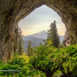
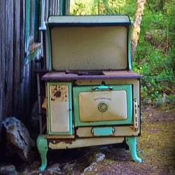
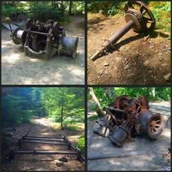
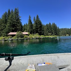
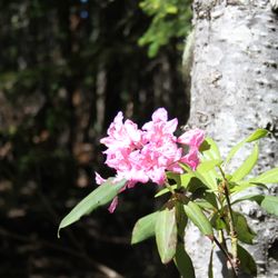
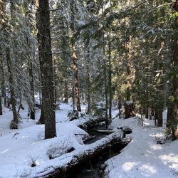
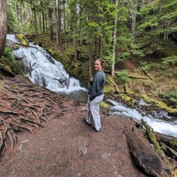
Cancel

    Open app

    Search

    Mt Jefferson

    5.0 (1 review)

    Mt Jefferson Photos

    Recommended Reviews - Mt Jefferson

    Your trust is our priority, so businesses can't pay to alter or remove their reviews. Learn more about reviews.
    Yelp app icon
    Browse more easily on the app
    Review Feed Illustration

    9 years ago

    Helpful 2
    Thanks 0
    Love this 2
    Oh no 0

    Verify this business for free

    Get access to customer & competitor insights.

    Verify this business

    Stahlman Point Trail

    Stahlman Point Trail

    5.0(1 review)
    28.9 km

    I've done this hike several times over the decades. It used to be a very well kept secret and I…read moreonly found out about it by talking to a Ranger at the Ranger station in Detroit. Seems like the word has gotten out in recent years so the chances of you being alone on the trail or at the summit are now pretty slim. This is not a difficult hike but you do need to be in shape to do it. Pretty much impossible to get lost as you are always hiking on a ridge line but it's always wise to carry a map and compass (or GPS) all the same. It's a somewhat steep, 3 mile, several thousand feet of elevation gain stroll and no drinkable water along the trail most of the year. So bring sufficient water and also a headlamp if you're starting out late in the day. Figure three hours to do the round trip and you will be under a thick forest canopy so it does get dark on the trail early. The trail is narrow and you are on a ridge so there is some exposure. Poles can be helpful although I've never needed them here. This trail is not ADA accessible. The final 100' scramble to the summit reveals a concrete slab where a fire watch station once sat. Great views of Mount Jefferson and Detroit. There has always been a few big downed trees blocking the narrow trail. But since the fire you'll start seeing felled trees about a mile up the trail. In one location you'll have to bushwhack around a half dozen or so massive fallen trees. The trailhead is easy enough to find although there are several roads to the the left before you get there that are NOT trailheads. The true trailhead parking area is marked and has space for about four cars. The left turn into the parking area is about 5+ miles from Highway 22. Turn right at the Pacific Pride filling station and follow the road for about 5 miles. Maybe a bit more.

    Photos
    Stahlman Point Trail

    See all

    Clear Lake - Drinks and fishing stuff

    Clear Lake

    4.5(12 reviews)
    47.9 km

    Here is my review of clear lake for row boat use!…read more We got here at 930 am. Found the pay box at the entrance $9, no cash. There is an option to pay at the bottom which we should have done because they take the national park passes there (see picture). We were able to find parking in the main lot and there were a few people there. We weren't sure how the process of renting the boats or availability of life jackets. There is a shop that sells food, snacks, drinks, ice cream , and desserts. They also have a selection of fishing items, shirts, jackets. We paid for the boat - $60 for the large boat all day. The life jackets were plentiful and available. My husband rowed most of the time because I am not a good rower. We made it from the dock to the start of the river that you can't go past which is good since you could hear the rapids. The way to the left was a lot calmer and clear. We had a blast out on the lake. You could see down near the shallows but not in the middle of the lake. Make sure to bring sunscreen because there isn't much shade. The facilities are great!! Two bathrooms in the shop. Large tables to sit and enjoy a hot cooked meal or ice cream. I am so glad we were able to make a morning on the lake super easy and stress free! Next time I'm thinking of renting a kayak or a stand up paddle board. That would be fun! If you are in the area make sure to stop by early. As we were leaving, the parking lot was filled up so make sure to get there early! I hope my review and pictures help you plan for a successful visit to Clear Lake!

    A beautiful setting for the perfect romantic getaway or family weekend escape. The cabins are…read morecozy with gas stoves and heaters and the boat rentals are very affordable is you want to connect with the water. We enjoyed a wonderful hike around the lake which took us through forests, lava fields, and springs with wooden bridges. The views were amazing!

    Photos
    Clear Lake - Coffee and tea bar

    Coffee and tea bar

    Clear Lake - Bathroom

    Bathroom

    Clear Lake - View of the boat dock

    See all

    View of the boat dock

    Abiqua Falls Trailhead - The ropes section of the hike wasn't as daunting as initially feared.

    Abiqua Falls Trailhead

    4.5(11 reviews)
    66.6 km

    Awesome spot, but you need a good car! Drove a RAV4 to the…read moregate, then walked a short distance. You definitely need a capable car because some uphill parts are rough and slippery (almost lost traction). The hike down is a bit steep and slippery but there are ropes to help. Tip: Bring gloves! After reaching the bottom, just follow the stream to the beautiful waterfall. We had a picnic there and it was so chill. There are no trash cans here,please take your trash with you. I felt like being at a childhood summer camp with the hiking and climbing. The water was too cold to swim this time, but I'll definitely be back during the summer!

    Abiqua Falls! I just visited this beautiful 92-foot waterfall sort of in the middle of nowhere in…read moreOregon but located about 50 miles south of Portland. I have a lot to relay about the experience. This review could take the maximum 5000 words, lol, but I'll try my best to keep things as concise as possible... There are many questions about what to expect from Abiqua Falls. Even myself, I had concerns and doubts. But...I survived and it's an easy adventure to a very secluded waterfall. I'll try and answer the following questions... - Can you drive to the trailhead? From my POV, it's a VERY ROUGH ROAD down to the bottom. There's one specific section (and you'll recognize it immediately) where the road is practically cracked in half with divots and potholes. I actually witnessed a Ford Explorer trying to drive over it on the way back up and it was a big struggle for them! They eventually got past it, but I thought they were stuck. You absolutely need a high clearance 4x4 vehicle to make it down to the base to access the trailhead to Abiqua Falls. For me...I have a Suburu and I parked 2 miles away at the Abiqua Falls "Parking Lot" (according to Google) and then walked 2 miles down to the bottom and 2 miles back up. There was no way I was risking a flat tire, especially with not knowing how to change a tire and there barely being cell phone reception in the area. Btw...just to arrive at the Abiqua Falls parking lot, you must first drive 1.5 miles on a dirt road. For me, dirt and gravel roads are like nails on a chalkboard. I cringe driving over them. - Where is the trailhead located? This is a good question because there's no specific sign for Abiqua Falls, but it's easy to discover. Here's how...the road down to the bottom only goes so far. Eventually, you'll confront a white fence where you can leave your car (if you drove). But...there's a clear opening to the forest on the left-hand side of the road as you're going down. People say it's hard to find, but truly...you can't miss it. If you're any sort of outdoors enthusiast, it's simple. The hike is 7/10ths of a mile out and back. That's it! Again...there's barely any hiking involved, especially if you drive down to the base. - What is the ropes section like on the trail? I must be transparent. I read other people's AllTrails and Google reviews, and this can be deceiving. Let me explain... There were many reviews saying how the ropes section is intense and you're practically repelling down the cliff side. WRONG! WRONG! WRONG! It's an easy pathway. The ropes are no big deal. I have a serious fear of heights, and I casually made my down to the creek. Using the ropes was necessary for the most part, but it wasn't scary. It didn't strain my hands. IT IS NOT STRESSFUL! I'd rate the trail as easy - moderate. Do not fear the incline/decline slope. There's nothing of that sort. It is 100% safe to get up and down the trail. Once down at the bottom of the creek, hang on the left hand side. You'll notice the trail continuing around the bend that leads straight to Abiqua Falls. It's easy. I had no problems at any point in time. I've been on much, much rougher trails during my explorations. I visited on a random Thursday morning at the end of August and pretty much had the falls to myself. There were a few people that came along towards the middle of the day. I believe if you're coming to Abiqua Falls, you must bring a bathing suit and towel. I think it's a right of passage. The waterfall is scenic and the setting is charming, but other than admiring the views and maybe having a picnic, you must take the plunge in the pool of water that Abiqua Falls splashes down into. - Was the water cold? Absolutely! Lol, I was dreading the cold water but made the premeditated decision that I was swimming to have a fun memory. It wasn't even hot outside as well, but I forced myself in and I'm glad I just did it. Obviously, your body adjusts to the cold and it's not too extreme. Overall, the ambiance at Abiqua Falls was liberating. The canyon walls sort of engulf you from high above. You're standing at this dramatic waterfall and when the sun reaches above the tree line, you can notice some slight coloring in the waters which can make for a magical moment. In all, maybe you need a few hours to hang out at the falls before returning to the ropes section and heading back up to the trailhead and road. Again, the hike back up to the top is barely strenuous. It's a slight workout. Most folks can handle it. Lastly, if you're someone who left their car all the way at the top of the road (like I did), it is possible that you may get offered a lift from those hikers who took a chance driving their cars down to the base. If so, hop in, lol. It'll save time not having to trek back uphill. In the end, I enjoyed getting to witness Abiqua Falls. The journey to arrive here was not as daunting as I initially anticipated. And again, from my POV, be kind to your car tires. Don't risk the drive.

    Photos
    Abiqua Falls Trailhead - The trailhead to Abiqua Falls. It's located on the left hand side of the road.

    The trailhead to Abiqua Falls. It's located on the left hand side of the road.

    Abiqua Falls Trailhead
    Abiqua Falls Trailhead - This is Abiqua Falls, a fantastic under the radar  Oregon waterfall.

    See all

    This is Abiqua Falls, a fantastic under the radar Oregon waterfall.

    Koosah Falls

    Koosah Falls

    4.7(11 reviews)
    39.5 km

    I recommend parking at the Koosah Falls parking lot- there is ample parking available there…read more Parking at Sahalie Falls is overcrowded and some folks had to park across the highway. There is a dig out restroom available in the parking lot. The trails are very well maintained and the overlooks offer excellent views of the falls. The path between the falls offers views of the BLUE McKenzie River. Across the river you will see the McKenzie River Trail with runners and hikers. There are several unmaintained paths going from the trail to the river- wander down at your own risk! Definitely a low effort high reward hike! Do not miss this one!

    Koosah Falls sits right along Waterfalls Trail beside the McKenzie River. It's not difficult to…read morereach and there are a bunch of overlook viewpoints with benches offering different perspectives. The first few lookouts are partially obstructed by trees and branches, but eventually as you keep walking, you're afforded undisturbed panoramas which are special, imo. And before walking over to this Koosah Falls (since it's barely strenuous, I wouldn't even consider it hiking), you'll immediately confront another terrific looking waterfall, and that's Sahalie Falls. You get two scenic waterfalls by simply stopping here for an hour or so. That's pretty efficient in my opinion, lol. I showed up in late July around 3:30pm and although the small parking lot was mainly full, I was still able to nab a spot. It's free to visit at your own accord. This Highway 126 situated next to the McKenzie River is the epitome of exploring around nature and is "one of Oregon's most famous recreation areas". Just 3.5 miles up the road from here at Koosah and Sahalie Falls is the iconic Tamolitch Falls - Blue Pool. That should not be missed as well. Including hiking to the colorful Blue Pool, it takes about half the day to visit. Back to this Koosah Falls...while walking along Waterfalls Trail, you'll have opportunities to relax at any point and soak up the McKenzie River forest surroundings. It's a pleasant setting. Extra notes... - Koosah Falls is 64 feet tall but appears more grand in real time. Sahalie Falls is about the same length. - Although you can't reach down to the base of Koosah Falls, Sahalie Falls is accessible and I suggest climbing over the railing for closeup views. It's not hard to do. Last thing I can say, I discovered Koosah and Sahalie Falls through TikTok mentions. TikTok is a great source of information for adventurers looking to find hidden gems among the great outdoors. Thank you to TikTok.

    Photos
    Koosah Falls - Taking a moment to appreciate the Koosah Falls views.

    Taking a moment to appreciate the Koosah Falls views.

    Koosah Falls - Koosah Falls

    Koosah Falls

    Koosah Falls

    See all

    Little Zigzag Falls - Fast moving Zigzag River. Sept 2024.

    Little Zigzag Falls

    4.7(19 reviews)
    71.2 km

    Little Zigzag Falls, Welches, Oregon. Sept, 2024…read more What a great little hike! Located in the Mt. Hood National Forest, this is an easy-to-access trail a few paved miles off OR-26. The parking area, with space for maybe 20 or so cars, is at the end of the road. There are trail signs, as well as a porta-potty. You need a Northwest Forest Pass, or NPS pass, to park here but they are not sold on-site. (You can purchase at the Zigzag Ranger District @ 70220 E. Highway 26 in Zigzag). The Forest Service (FS) describes the trail as a "gentle uphill trail located in a narrow canyon next to the Little Zigzag River." The shaded and mostly smooth trail ends at the falls. There are some rocks and roots but overall it's quite smooth. Also, per the Forest Service, it's a great hike for kids, but supervision along the riverside is a must. We note that the stream was exceptionally fast-moving and the falls he a lot of water in mid-September The FS describes the trail as having a distance of 0.5 miles (one way), but All Trails lists it as 0.6 for BOTH ways and my watch recorded 0.7 for both. The trail is at an elevation of around 3,250 feet, and is snow-free from June to November. There's a nice shaded picnic table near the start of the trail. There's also a wooden bench near the falls. The trail is not wheelchair accessible.

    Nice, easy hike with an awesome payoff at the end. The parking lot is pretty spacious. The hike is…read morevery short itself so perfect for families. Great views at the end.

    Photos
    Little Zigzag Falls - Me at the falls!

    Me at the falls!

    Little Zigzag Falls - Zigzag Falls.

    Zigzag Falls.

    Little Zigzag Falls - Top of the falls

    See all

    Top of the falls

    Mt Jefferson - hiking - Updated June 2026

    Loading...
    Loading...
    Loading...