Mount Bierstadt Photos


You might also consider

More like Mount Bierstadt
Recommended Reviews - Mount Bierstadt
Start your review...


Reviews With Photos


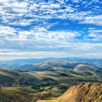
They say you never forget your first, right? Well, like many Coloradans, Mount Bierstadt goes down as my first 14er. I've been gearing up this summer with longer hikes. 11, 12, 13+ miles, in hopes of building up my endurance. Without this "training" I would've been ill-prepared for Bierstadt. Bierstadt is known as a beginner 14er, and one of the more popular ones with its close proximity to Denver. My buddy and I got to the trailhead at 6:30 am on a Monday morning and the parking lot was nearly full. You've been warned. As far as the hike goes, I'm not going to lie, it was more difficult than I anticipated. Eight miles round trip, just under 3,000 ft. elevation gain, five hours in total. I've never seen the destination from the parking lot before, which gives a unique perspective to the hike. Once you get into the thick of the trail, you feel it. The combination of the thin air paired with the strain on my quads and hamstrings was more intense than I expected. Am I doing a poor job of selling the hike? Probably. But you know what? Pain is weakness leaving the body. No pain yields no gain. And when you complete the final rocky climb (not as technical as it's made out to be), 360 degree views of Colorado glory await you. It's magical. I haven't cracked open a beer at 9:30 am since college. This one was well-earned if you ask me. Bring some snacks, take photos, and soak in the views that so many people will never see. A hike I will never forget. Not for the faint of heart, but doable with determination. Bierstadt, you magnificent bastard. Until we meet again!


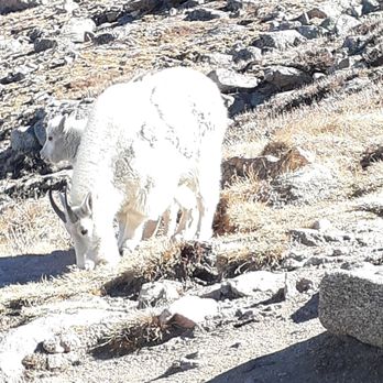
I have done this peak around 10 times now in the last 3 years. Went up again today. This is later in the season than I would normally like to go for a 14er but the weather looked promising with 41 degrees as a high at the top. I have taken many folks up on this peak for their first 14er from teenage girl scouts to friends. It is always a pleasure and a new experience each and every time. Currently have also done Mount Sherman and Quandary Peak and this one is my favorite to take folks up on their first 14er. This one is absolutely beautiful in the summer with all of the wild flowers. Every time i have been up have seen several mountain goats. Have also seen marmots, pica, white tail ptarmigan and hawks. If you are bringing your dog be sure to have them on a leash or they have very good voice recall! Dogs chasing the mountain goats is not cool and can cause harm to the goats. Generally on the weekdays in the summer it is good to arrive by 630. if you are going on a weekend i have heard even earlier though I have not done this peak on a weekend. The parking lot is small and can hold around 30 cars, there is another small lot across the road for cars and cars do tend to park on the roadside. There are pit toilet bathrooms at the trailhead. There is no hand sanitizer so you will want to bring your own. There is also NO TRASH CANS! so plan on packing out what you pack in! People frequently are leaving their garbage on the trail and it makes it not pleasant for everyone else coming up there to enjoy. If you can feel free to bring a trash bag with you to pick up garbage on your way down. There are no other trash cans along the trail, nor bathrooms. (please do bring a plastic bag with toilet paper in it for if you need to go to bathroom along the trail and put the tp in your plastic bag and haul it down with you!) The first 3/4 mile or so is down hill and flat. There are lovely bridges to walk across and there is a stream to cross over that you will need to walk on the rocks. It then starts to climb. There are many stunning views along the way, be sure to pace yourself and enjoy the hike. The views at the top are stunning and the feeling of summiting a 14er is pretty dang amazing. There is not a lot that can compare to that. It may be one of the easier 14ers in the state but it is by no means easy. Please be sure to properly prepare and also bring electrolytes with you. Also be sure to check the weather forecasts at mountain-forecasts.com. Thunderstorms in the afternoon are common in the summer. You dont want to be on the peak during a thunderstorm so be sure to summit by 11 am especially through the summer.


Great 14er! The hike was pretty challenging and the parking lot does fill up like any other 14er parking area, but still worth doing. The scramble at the end is also challenging but worth doing to get the views at the end. As you go down it does get extremely hot and there isn't any shade. Make sure to bring lots of extra water and sunscreen.


Well, I had to get at least one 14'er under my belt. I checked with a veteran 14'er climber and he said Bierstadt was a good one to start with. It took us most of the day but we were so glad we did it! It was by no means easy but we took our time with many, many stops. Once we got over 13,000 feet it seemed to get a lot more fun. I loved the scramble up the rocks at the top! All of us that climbed it are over 60 years old so it really felt like an accomplishment!


Second 14er for me - first since living in Colorado. The trail was extremely moderate in regards to 14ers, but still a challenge. Started around 7:30ish, plenty of parking. Trail was broken out, but on the way down, the sun really warmed up the snow and mad for slushy, loose snow. I highly recommend spikes, I think you can get away not wearing snowshoes. Barely any wind at the top, beautiful views all around as you start above tree line.


The high trailhead and relatively short hiking distance make this one of the easier fourteeners to hike. This is the prettiest 14er in my eyes. One of my first 6 ( six) 14'ers I climbed after moving to Colorado. I hiked and climbed everything that I can the entire 2015 starting in May. "Easy" is a word I know means relative to who's saying it. If you hike a lot this is easy. If you don't it won't be, period. I would say you need a moderate skill level to hike this beauty. You will start at a high altitude of 11,669. You end up at 14,060. A gain of 2,861 ft. Total miles is 8.2. Out and back. If you've hiked Ansel Adams in Ca. the gain when you hike that trail is about 861 ft shy of this climb. Originally called the "Chicago Mountains" by early miners, today's Mount Evans massif contains a kind of "romantic triangle" of peaks. German painter Albert Bierstadt, who was more interested in mining romantic scenery than in mining gold, arrived in the 1860s and soon began producing the stunning canvases of western scenes that made him famous. One of these was of the "Chicago Mountains;" and Bierstadt, in a telling gesture, bestowed his wife's name, Rosalie, on the highest peak. The Colorado Territorial Legislature, decided to move the wife's name to a rounded, unimpressive summit to the southeast and honor colorless Governor Evans on the highest summit instead. Later on, Bierstadt himself received his due on a peak to the southwest, perhaps out of some topographer's guilty feelings. Bierstadt, the hopeless romantic, would surely be disappointed for he and his beloved are now separated by the great gulf called "The Abyss." I've done this twice. I'm itching to go back. Let's go! #2000threview.


This was also my first 14er and I couldn't have been happier with the hike. There were amazing views throughout but it was the summit that blew me away. Not literally, either, as there was very little wind at the top and the temperature was comfortable. I just never imagine the spectacular views I would have once I finished! What an award! As for the hike, you should expect about 5 hours round trip. I would say you probably want to start hiking by 8AM. Make sure you bring warm clothes as it gets cold as you ascend. I have a little problem with altitude so I bring lots of GU (or Gel Bloks) and water. Any time I feel any lightness in my head or weirdness in my stomach I just pop one of these and drink tons of water. Also, remember to bring snacks and a lunch for the summit! Some people brought beer but I couldn't imagine once I was up there! And as someone else mentioned, you should be on your way down well before noon! This was one of the best hikes I have ever done! I would definitely recommend it to anyone!
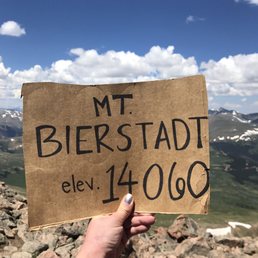

All I can say is "wow"... certainly a challenge. 14,000 feet is no joke but the reward is so great! Stay hydrated and wear the right shoes and know you can make it!!! The path is very pleasant going up. Seems very popular, but not so many people that the hike gets overwhelmed. Saw some moose in the lake on the way coming down which was rad. Georgetown nearby is a cute little town! Nice hike, scenery, and overall an enjoyable experience (even the sore thighs the following day!)


This is the best 14er to do for your first one, especially if your entire group is inexperienced. Show up at 5:30 or else the parking lot will be full, but street parking is popular and ticketing is uncommon. I suggest you don't use the disgusting compost toilets at the trailhead. There are plenty of boulders/bushes for semi-private restroom stops PLEASE REMEMBER TO PACK OUT TOILET PAPER. There is a scramble at the top that requires balance and using your hands. We took our time, and it took 3.5 hours up and about 2 hours down. Don't bring your dog if it is not an experienced hiker. Do bring your hard-core hiking kid.


Its five star and some more all they way.. all the way from the parking lot to the summit. very well maintained despite the tsunami of people and pets swarming all over. my very 1st trip and soon to be more than that started with wonderful view of the ridge covered with cloud (fog) at 7 am and few minutes later, all cleared up except the band of cloud stretching from northwest all the way to the southwest. how can one not fall in love in such precious mother nature has to offer to the hiker who left his house 5 am in the morning and only drove 1.5a hours to meet such grandeurs of what mother nature offered to such insignificant being. Some of you reading this and thinking of coming up here, please do and experience what Colorado outdoor is all about. I have seen infant on parents back, toddlers touting worn out camelback to well aged people all encouraging others with common goal of reaching the peak and celebrating the magnificent Bierstadt. Pros: Its class one trail almost all the way to the top. It does not mean easy.. it means trails are well maintained and you don't have to be on your fours to climb unless you are four legged. The swampy Willows are all super well maintained with wooden boardwalk that will take you to the small creak. Jump over or step on small stones laid by other thoughtful hikers and you are on the way up winding through the trails. On my visit, I was rewarded with countless wild flowers of all sorts and alpine landscapes all the way up. When you get to about 13000 feet, you have a place to rest and view the mount Evans and also the lake Abyss. Its short distance from here that you might need to use the hands to make it easier to reach the summit. Instead of going back to the TH, we went across the Sawtooth Ridge to reach the summit of Mt Evans. This was very doable for most of us. I would definitely discourage for people with fear of heights including I. However, when you are up at this high altitude, we are all loaded with adrenaline and in a super good mood to help others and that's what we got crossing over for the very first time. Cons: not much. I love dogs but I don't like people who doesn't follow the posted rules. Its already bad enough that humans track all over the place damaging fragile alpine eco system but here they are off leash running around pooping everywhere and chasing wild life. Do I blame the dogs or dog owners? Friends.. get off your couch and drive the short distance to enjoy this wonderful place before the cold weather hits.


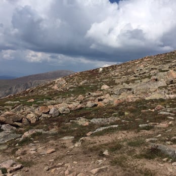
If you read reviews on this that say its easier and not to have a concern, you're mistaken. This may be a "novice" 14'er, it still packs a punch. This was my first 14'er (14,000 elevation hike). I went in December on a beautiful day. There was barely anybody on the trail. I had to park at the bottom and walk the mile and half or so up before I was even able to start the initial hike. The first mile or so is deceptive because its pretty easy going. After that, it gets real. I am an average guy in okay shape. I had to stop multiple times during the hike up. I contemplated quitting a couple times because I was just flat exhausted. However, I didn't quit and it was completely worth it. The summit is very incredible and is worth your time and effort. It took me about 3:20 minutes to hike up from the parking lot to the summit (I was also dealing with snow and trouble finding the trail). It took another 2:20 from the summit down to the lower parking lot. In the snow, it was almost impossible to stick to a trail when you are near the summit. Its much easier once you get off the rockier part. I'm glad I did this one instead of the other novice 14'er Mt. Gray that would take 8 HOURS! This being my first 14'er, I had a great time all things considered. The views are incredible and worth it. Extra bonus, I had 4 F-16's fly over me as I was coming down.


Bierstadt is always a great time if you keep in mind there will be at least 30 other people you see even during the week. That being said its a quick drive up from Denver. Over the past few years much work has gone into maintaining and improving Guanella Pass, making it even easier to visit. There is a great trail that brings you to the last rock pile before the top. We saw about 15 workers this last Tuesday improving the trail and adding great staircases to offset the damage accrued by such a popular route. If you see them, be sure to thank them! We saw two mountain goats hanging out on the saddle before the last climb. I've hiked this route at least 5 times and have never saw one here but rather in the distance over on Mt Evans, so it was quite the treat. All in all its a reasonably quick hike, a good place to start if you want to reach 14k feet, and pretty straightforward. Recommended.


My first CO 14'er peak and it was an awesome hike. I learned a lot about altitude and breathing and pacing. The summit was stunning and I like taking summit pictures. We also saw a male and female moose in the distance along with mountain goat. Easy parking at the trailhead and there is a restroom. Please come and create your own adventure. read more


10 months ago

Bierstadt is one of the 14ers you should do...it is very accessible and minimal exposure to drop-offs.....unlike Longs or Capital (where death is a slight possibility). Done this hike many times and have actually had to administer First aid to either drunk or unprepared tourists ( like the amount of people with flip flops and shoes not for hiking is pretty amazing). So what I'm saying is it gets hella busy on the weekends. I suggest Mondays or Wednesdays and parking in the upper lot. Gorgeous views. Take at least a liter of water, sunscreen, and a snack. read more


They say you never forget your first, right? Well, like many Coloradans, Mount Bierstadt goes down as my first 14er. I've been gearing up this summer with longer hikes. 11, 12, 13+ miles, in hopes of building up my endurance. Without this "training" I would've been ill-prepared for Bierstadt. Bierstadt is known as a beginner 14er, and one of the more popular ones with its close proximity to Denver. My buddy and I got to the trailhead at 6:30 am on a Monday morning and the parking lot was nearly full. You've been warned. As far as the hike goes, I'm not going to lie, it was more difficult than I anticipated. Eight miles round trip, just under 3,000 ft. elevation gain, five hours in total. I've never seen the destination from the parking lot before, which gives a unique perspective to the hike. Once you get into the thick of the trail, you feel it. The combination of the thin air paired with the strain on my quads and hamstrings was more intense than I expected. Am I doing a poor job of selling the hike? Probably. But you know what? Pain is weakness leaving the body. No pain yields no gain. And when you complete the final rocky climb (not as technical as it's made out to be), 360 degree views of Colorado glory await you. It's magical. I haven't cracked open a beer at 9:30 am since college. This one was well-earned if you ask me. Bring some snacks, take photos, and soak in the views that so many people will never see. A hike I will never forget. Not for the faint of heart, but doable with determination. Bierstadt, you magnificent bastard. Until we meet again! read more




6 years ago
I have done this peak around 10 times now in the last 3 years. Went up again today. This is later in the season than I would normally like to go for a 14er but the weather looked promising with 41 degrees as a high at the top. I have taken many folks up on this peak for their first 14er from teenage girl scouts to friends. It is always a pleasure and a new experience each and every time. Currently have also done Mount Sherman and Quandary Peak and this one is my favorite to take folks up on their first 14er. This one is absolutely beautiful in the summer with all of the wild flowers. Every time i have been up have seen several mountain goats. Have also seen marmots, pica, white tail ptarmigan and hawks. If you are bringing your dog be sure to have them on a leash or they have very good voice recall! Dogs chasing the mountain goats is not cool and can cause harm to the goats. Generally on the weekdays in the summer it is good to arrive by 630. if you are going on a weekend i have heard even earlier though I have not done this peak on a weekend. The parking lot is small and can hold around 30 cars, there is another small lot across the road for cars and cars do tend to park on the roadside. There are pit toilet bathrooms at the trailhead. There is no hand sanitizer so you will want to bring your own. There is also NO TRASH CANS! so plan on packing out what you pack in! People frequently are leaving their garbage on the trail and it makes it not pleasant for everyone else coming up there to enjoy. If you can feel free to bring a trash bag with you to pick up garbage on your way down. There are no other trash cans along the trail, nor bathrooms. (please do bring a plastic bag with toilet paper in it for if you need to go to bathroom along the trail and put the tp in your plastic bag and haul it down with you!) The first 3/4 mile or so is down hill and flat. There are lovely bridges to walk across and there is a stream to cross over that you will need to walk on the rocks. It then starts to climb. There are many stunning views along the way, be sure to pace yourself and enjoy the hike. The views at the top are stunning and the feeling of summiting a 14er is pretty dang amazing. There is not a lot that can compare to that. It may be one of the easier 14ers in the state but it is by no means easy. Please be sure to properly prepare and also bring electrolytes with you. Also be sure to check the weather forecasts at mountain-forecasts.com. Thunderstorms in the afternoon are common in the summer. You dont want to be on the peak during a thunderstorm so be sure to summit by 11 am especially through the summer. read more




Great 14er! The hike was pretty challenging and the parking lot does fill up like any other 14er parking area, but still worth doing. The scramble at the end is also challenging but worth doing to get the views at the end. As you go down it does get extremely hot and there isn't any shade. Make sure to bring lots of extra water and sunscreen. read more

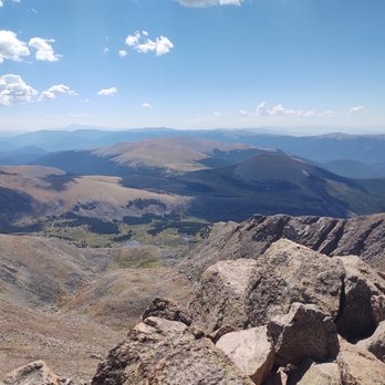


Well, I had to get at least one 14'er under my belt. I checked with a veteran 14'er climber and he said Bierstadt was a good one to start with. It took us most of the day but we were so glad we did it! It was by no means easy but we took our time with many, many stops. Once we got over 13,000 feet it seemed to get a lot more fun. I loved the scramble up the rocks at the top! All of us that climbed it are over 60 years old so it really felt like an accomplishment! read more


Second 14er for me - first since living in Colorado. The trail was extremely moderate in regards to 14ers, but still a challenge. Started around 7:30ish, plenty of parking. Trail was broken out, but on the way down, the sun really warmed up the snow and mad for slushy, loose snow. I highly recommend spikes, I think you can get away not wearing snowshoes. Barely any wind at the top, beautiful views all around as you start above tree line. read more


The high trailhead and relatively short hiking distance make this one of the easier fourteeners to hike. This is the prettiest 14er in my eyes. One of my first 6 ( six) 14'ers I climbed after moving to Colorado. I hiked and climbed everything that I can the entire 2015 starting in May. "Easy" is a word I know means relative to who's saying it. If you hike a lot this is easy. If you don't it won't be, period. I would say you need a moderate skill level to hike this beauty. You will start at a high altitude of 11,669. You end up at 14,060. A gain of 2,861 ft. Total miles is 8.2. Out and back. If you've hiked Ansel Adams in Ca. the gain when you hike that trail is about 861 ft shy of this climb. Originally called the "Chicago Mountains" by early miners, today's Mount Evans massif contains a kind of "romantic triangle" of peaks. German painter Albert Bierstadt, who was more interested in mining romantic scenery than in mining gold, arrived in the 1860s and soon began producing the stunning canvases of western scenes that made him famous. One of these was of the "Chicago Mountains;" and Bierstadt, in a telling gesture, bestowed his wife's name, Rosalie, on the highest peak. The Colorado Territorial Legislature, decided to move the wife's name to a rounded, unimpressive summit to the southeast and honor colorless Governor Evans on the highest summit instead. Later on, Bierstadt himself received his due on a peak to the southwest, perhaps out of some topographer's guilty feelings. Bierstadt, the hopeless romantic, would surely be disappointed for he and his beloved are now separated by the great gulf called "The Abyss." I've done this twice. I'm itching to go back. Let's go! #2000threview. read more




13 years ago
This was also my first 14er and I couldn't have been happier with the hike. There were amazing views throughout but it was the summit that blew me away. Not literally, either, as there was very little wind at the top and the temperature was comfortable. I just never imagine the spectacular views I would have once I finished! What an award! As for the hike, you should expect about 5 hours round trip. I would say you probably want to start hiking by 8AM. Make sure you bring warm clothes as it gets cold as you ascend. I have a little problem with altitude so I bring lots of GU (or Gel Bloks) and water. Any time I feel any lightness in my head or weirdness in my stomach I just pop one of these and drink tons of water. Also, remember to bring snacks and a lunch for the summit! Some people brought beer but I couldn't imagine once I was up there! And as someone else mentioned, you should be on your way down well before noon! This was one of the best hikes I have ever done! I would definitely recommend it to anyone! read more


9 years ago
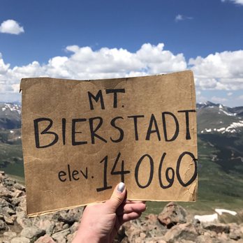
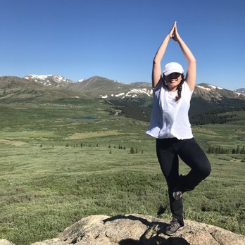
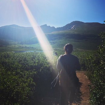
All I can say is "wow"... certainly a challenge. 14,000 feet is no joke but the reward is so great! Stay hydrated and wear the right shoes and know you can make it!!! The path is very pleasant going up. Seems very popular, but not so many people that the hike gets overwhelmed. Saw some moose in the lake on the way coming down which was rad. Georgetown nearby is a cute little town! Nice hike, scenery, and overall an enjoyable experience (even the sore thighs the following day!) read more



9 years ago
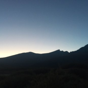
This is the best 14er to do for your first one, especially if your entire group is inexperienced. Show up at 5:30 or else the parking lot will be full, but street parking is popular and ticketing is uncommon. I suggest you don't use the disgusting compost toilets at the trailhead. There are plenty of boulders/bushes for semi-private restroom stops PLEASE REMEMBER TO PACK OUT TOILET PAPER. There is a scramble at the top that requires balance and using your hands. We took our time, and it took 3.5 hours up and about 2 hours down. Don't bring your dog if it is not an experienced hiker. Do bring your hard-core hiking kid. read more



10 years ago
Its five star and some more all they way.. all the way from the parking lot to the summit. very well maintained despite the tsunami of people and pets swarming all over. my very 1st trip and soon to be more than that started with wonderful view of the ridge covered with cloud (fog) at 7 am and few minutes later, all cleared up except the band of cloud stretching from northwest all the way to the southwest. how can one not fall in love in such precious mother nature has to offer to the hiker who left his house 5 am in the morning and only drove 1.5a hours to meet such grandeurs of what mother nature offered to such insignificant being. Some of you reading this and thinking of coming up here, please do and experience what Colorado outdoor is all about. I have seen infant on parents back, toddlers touting worn out camelback to well aged people all encouraging others with common goal of reaching the peak and celebrating the magnificent Bierstadt. Pros: Its class one trail almost all the way to the top. It does not mean easy.. it means trails are well maintained and you don't have to be on your fours to climb unless you are four legged. The swampy Willows are all super well maintained with wooden boardwalk that will take you to the small creak. Jump over or step on small stones laid by other thoughtful hikers and you are on the way up winding through the trails. On my visit, I was rewarded with countless wild flowers of all sorts and alpine landscapes all the way up. When you get to about 13000 feet, you have a place to rest and view the mount Evans and also the lake Abyss. Its short distance from here that you might need to use the hands to make it easier to reach the summit. Instead of going back to the TH, we went across the Sawtooth Ridge to reach the summit of Mt Evans. This was very doable for most of us. I would definitely discourage for people with fear of heights including I. However, when you are up at this high altitude, we are all loaded with adrenaline and in a super good mood to help others and that's what we got crossing over for the very first time. Cons: not much. I love dogs but I don't like people who doesn't follow the posted rules. Its already bad enough that humans track all over the place damaging fragile alpine eco system but here they are off leash running around pooping everywhere and chasing wild life. Do I blame the dogs or dog owners? Friends.. get off your couch and drive the short distance to enjoy this wonderful place before the cold weather hits. read more


11 years ago
If you read reviews on this that say its easier and not to have a concern, you're mistaken. This may be a "novice" 14'er, it still packs a punch. This was my first 14'er (14,000 elevation hike). I went in December on a beautiful day. There was barely anybody on the trail. I had to park at the bottom and walk the mile and half or so up before I was even able to start the initial hike. The first mile or so is deceptive because its pretty easy going. After that, it gets real. I am an average guy in okay shape. I had to stop multiple times during the hike up. I contemplated quitting a couple times because I was just flat exhausted. However, I didn't quit and it was completely worth it. The summit is very incredible and is worth your time and effort. It took me about 3:20 minutes to hike up from the parking lot to the summit (I was also dealing with snow and trouble finding the trail). It took another 2:20 from the summit down to the lower parking lot. In the snow, it was almost impossible to stick to a trail when you are near the summit. Its much easier once you get off the rockier part. I'm glad I did this one instead of the other novice 14'er Mt. Gray that would take 8 HOURS! This being my first 14'er, I had a great time all things considered. The views are incredible and worth it. Extra bonus, I had 4 F-16's fly over me as I was coming down. read more


5 years ago

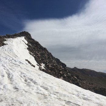
Great hike, easy parking and super accessible. Be sure to get there early, parking lot was full as was road parking in June on a Saturday morning by 6am. If you can do this during the week it will most definitely be less crowded and a lot more enjoyable! read more



11 years ago
Bierstadt is always a great time if you keep in mind there will be at least 30 other people you see even during the week. That being said its a quick drive up from Denver. Over the past few years much work has gone into maintaining and improving Guanella Pass, making it even easier to visit. There is a great trail that brings you to the last rock pile before the top. We saw about 15 workers this last Tuesday improving the trail and adding great staircases to offset the damage accrued by such a popular route. If you see them, be sure to thank them! We saw two mountain goats hanging out on the saddle before the last climb. I've hiked this route at least 5 times and have never saw one here but rather in the distance over on Mt Evans, so it was quite the treat. All in all its a reasonably quick hike, a good place to start if you want to reach 14k feet, and pretty straightforward. Recommended. read more


Wonderful experience. I am from Texas (flat land, nothing but highways and skyscrapers) so walking through this scenery & trail was unreal. I felt like I was going in Narnia. Or in the 1800s fighting in a war, haven't seen my family in 10 years and little bit of oxygen and energy left, waiting for my last seconds of breath. That's actually what I was thinking the entire time. But it was only because I ate 3 weed brownies last night and I woke up high as fuudddge. Why did I do that on my first night in Colorado?! The altitude wasn't helping either. But like I said... WONDERFUL EXPERIENCE. I saw 6 year olds and dogs hiking and hitting summit, jeez I felt so weak. I was halfway there but had to turn back. Next time I hike this mountain I'm not going to get high prior and mission to complete the hike!!! read more


11 years ago


13 years ago
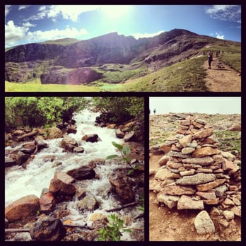
Astronomical! My first 14er! I loved every minute and fell in love with colorado even more! I am a beginner and not in the best shape and got to the the top with several breaks in 2 hours. Took about an hour to get back to the car. Spectacular view and surrounded by nature. The drive up/down there is amazing as well. Stopped in multiple place to take some great photos! There was even kids on this hike who we saw at the top. Anyone can do this and you definitely should add it to your bucket list! Can't wait to conquer my next 14er!!! read more


13 years ago

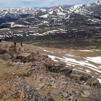
I've hiked Bierstadt several times and the views have always been drop dead gorgeous! I hiked last weekend,June 21st and started at 6am and the parking lot was completely full. I don't think I've ever seen that many people on a mountain before. There is still snow as you reach the last leg of the summit and I was glad to have my spikes, however, I saw several people do just fine without. read more



9 years ago
Beautiful. The first part of hike is more like a stroll. It's great for a romantic walk, older people, or physically impaired. read more


9 years ago

11 years ago

12 years ago

10 years ago
13 years ago
More info about Mount Bierstadt
Mount Evans Wilderness
Idaho Springs, CO 80452
Directions
(303) 567-3000
Call Now
Hours
Indoor Amenities
Outdoor Amenities
Ask the Community - Mount Bierstadt
Review Highlights - Mount Bierstadt


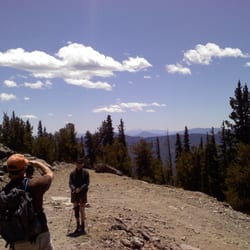




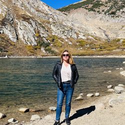

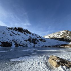


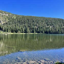










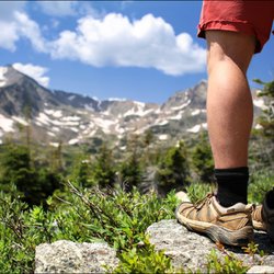
Mount Bierstadt - hiking - Updated May 2026
Best of Idaho Springs
People found Mount Bierstadt by searching for…
Hiking Trails With Waterfalls in Idaho Springs, CO
Things to Do in Idaho Springs, CO
Natural Hot Springs in Idaho Springs, CO
Sunrise View in Idaho Springs, CO
Star Gazing in Idaho Springs, CO
Photo Spots in Idaho Springs, CO
Off Leash Dog Hikes in Idaho Springs, CO
Scenic Views in Idaho Springs, CO
Waterfalls in Idaho Springs, CO
Dog Friendly Parks in Idaho Springs, CO
Scenic Overlook in Idaho Springs, CO
Snow Play in Idaho Springs, CO
Off Road Trails in Idaho Springs, CO
Night Hike in Idaho Springs, CO
Easy Hikes in Idaho Springs, CO
Boardwalk in Idaho Springs, CO
Places to Take Pictures in Idaho Springs, CO
Running Trails in Idaho Springs, CO
Dog Friendly Trails in Idaho Springs, CO
Hiking Trails Kid Friendly in Idaho Springs, CO
Trending Searches in Idaho Springs, CO
Boat Rental near Mount Bierstadt
Botanical Gardens near Mount Bierstadt
Bounce House Rentals near Mount Bierstadt
Campgrounds near Mount Bierstadt
Cliff Jumping near Mount Bierstadt
Dog Friendly Things To Do near Mount Bierstadt
Flower Fields near Mount Bierstadt
Flower Shop near Mount Bierstadt
Lakes & Ponds near Mount Bierstadt
Movie Theatre near Mount Bierstadt
Nurseries & Gardening near Mount Bierstadt
Outdoor Activities near Mount Bierstadt
Outdoor Furniture Stores near Mount Bierstadt
Party Equipment Rentals near Mount Bierstadt
Pick Your Own Farms near Mount Bierstadt
Picnic Areas near Mount Bierstadt
Places To Walk Around near Mount Bierstadt
Rainy Day Activities near Mount Bierstadt
Rock Quarry near Mount Bierstadt
Running Trails near Mount Bierstadt
Scenic Drive near Mount Bierstadt
Secret Spots near Mount Bierstadt
Strawberry Picking near Mount Bierstadt
Sunrise View near Mount Bierstadt
Swimming Holes near Mount Bierstadt
Things To Do On A Rainy Day near Mount Bierstadt
Browse Brands
Related Searches in Idaho Springs, CO
Affordable Kayak Rental Services in Idaho Springs, Colorado
Best Fishing Locations and Guides in Idaho Springs, Colorado
Best Places for Horseback Riding in Idaho Springs, Colorado
Best Sledding Spots and Fun in Idaho Springs, Colorado
Check Out Off Road Trails in Idaho Springs, Colorado
Discover Dog Friendly Trails to Explore in Idaho Springs, Colorado
Discover Kid Friendly Hiking Trails in Idaho Springs, Colorado
Discover Scenic Waterfall Spots in Idaho Springs, Colorado
Discover Top Scenic Spots to Visit in Idaho Springs, Colorado
Discover a Hiking Trail in Idaho Springs, Colorado
Discover the Best Night Hike Trails in Idaho Springs, Colorado
Dog-Friendly Hikes With Dogs in Idaho Springs, Colorado
Enjoy Camping Adventures Around Idaho Springs, Colorado
Enjoy Exciting Mountain Biking Adventures in Idaho Springs, Colorado
Enjoy Kayaking Adventures in Idaho Springs, Colorado
Enjoy River Tubing Adventures in Idaho Springs, Colorado
Enjoy Tent Camping Spots Around Idaho Springs, Colorado
Enjoy Water Activities and Fun in Idaho Springs, Colorado
Enjoy a Beautiful Waterfall Hike in Idaho Springs, Colorado
Enjoy the Best Tubing Experiences in Idaho Springs, Colorado
Enjoy the Best Walking Trails in Idaho Springs, Colorado
Exciting Cliff Jumping Spots in Idaho Springs, Colorado
Experience Thrilling White Water Rafting in Idaho Springs, Colorado
Explore Beautiful Parks and Green Spaces in Idaho Springs, Colorado
Explore Easy Hikes Perfect for All in Idaho Springs, Colorado
Explore Fun Activities to Do in Idaho Springs, Colorado
Explore Popular Campgrounds Near Idaho Springs, Colorado
Explore Scenic Lakes to Visit in Idaho Springs, Colorado
Explore the Best Beach Spots in Idaho Springs, Colorado
Explore the Best Boating Spots in Idaho Springs, Colorado
Explore the Best Swimming Holes Around Idaho Springs, Colorado
Family Friendly Hiking With Kids in Idaho Springs, Colorado
Find Popular Ziplining Spots Around Idaho Springs, Colorado
Find the Best Playgrounds to Visit in Idaho Springs, Colorado
Find the Best Scenic View Locations in Idaho Springs, Colorado
Hiking Trails With Waterfalls in Idaho Springs, Colorado
Off Leash Dog Hiking Trails in Idaho Springs, Colorado
Plan a Scenic Drive Route Near Idaho Springs, Colorado
Popular Fishing Spots to Explore in Idaho Springs, Colorado
Popular Outdoor Activities to Try in Idaho Springs, Colorado
Popular Picnic Spots to Visit in Idaho Springs, Colorado
Popular Things to Do in Idaho Springs, Colorado
Safe River Swimming Areas in Idaho Springs, Colorado
Safe and Fun Parks for Kids in Idaho Springs, Colorado
Top Climbing Spots and Gyms in Idaho Springs, Colorado
Top Playgrounds for Kids to Enjoy in Idaho Springs, Colorado
Top Running Trails to Explore in Idaho Springs, Colorado
Top Swimming Lakes to Enjoy in Idaho Springs, Colorado
Browse Articles
People who viewed Mount Bierstadt also viewed

Gray’s And Torrey’s Trailhead
1 review

Centennial Cone Park
2 reviews

Corwina Park
4 reviews

Threemile Creek Trail
1 review

Bear Creek Canyon Park
2 reviews

William F. Hayden Park on Green Mountain
22 reviews

Meyer Ranch Park
11 reviews

South Table Mountain Trail
8 reviews

Flying J Ranch Park
6 reviews

Bear Mountain Stables
30 reviews