Mora Trail Photos


You might also consider
More like Mora Trail
Recommended Reviews - Mora Trail
Start your review...

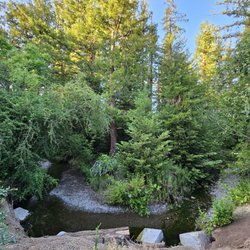
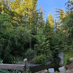
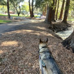
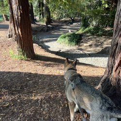
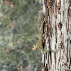
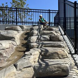
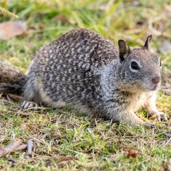
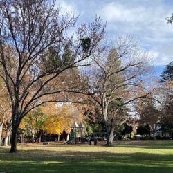
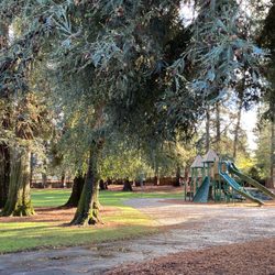
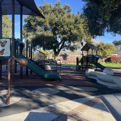
Big smiles, everybody --Jonathan Mora (Earth-31916) Jim Mora's playoff rant did not seem appropriate here as the lead quote. But as the days shorten, when you get a chance to hit a mid week trail head you take it! DEfinite big smiles! After Glenn G's Bohemian Rhapsody of a review, when we got together for some more Bro time, this was an easy trail to hit. Like Glenn wrote, parking is difficult to find thanks to street signs prohibiting daytime parking but there are a few good spots. This is the back ways trail into the Rancho San Antonio Open Preserve and County Park but I'd like to clear up some confusion you see on the web. A lot of people list the the Open Preserve, including my very intelligent friend, as 165 acres. When I read that number it just seemed instinctively wrong. It seems the Preserve is 3,988-acres but it is the adjoining County Park that is 165 acres. However a lot of people on the Web list the whole Preserve at 165 acres. So correct those links people so that Yelpers can provide the correct info!!! ;) The trails here are quite lovely and except on the return loop we were thankfully devoid of seeing too many humans. Except one douchebag with a pony tail who ran up behind Glenn and I, went fast in the middle between us and then yelled back as the entitled hipster he lives his life as with a :"Hey, the trails are for sharing!". I think I yelled something back like: "Yeah, I'll remember that the next time I grow eyes in the back of my f#^%&ing head you pony haired moron!" I so wanted to run that guy down and headbutt him a few times to show him how I share a trail but Glenn being the cool mediator counseled it wasn't worth it and to let it go. Other than that few minutes of ridiculousness, it was a lovely hike with beautiful views and the requisite deer and wild turkeys. When in the area, I would definitely seek this out as it is far less crowded than the main Rancho San Antonio entrances. Just watch out for the entitled pony haired freaks who think the people ahead of them read minds or have multiple eye sockets. Highly recommended (except for pony haired douches. You types stay away). read more


9 years ago
11 years ago
10 years ago
6 years ago
11 years ago
More info about Mora Trail
10600 Mora Dr
Los Altos, CA 94024
Directions
Hours
Outdoor Amenities
Ask the Community - Mora Trail
You might also consider


Mora Trail - hiking - Updated July 2026
Best of Los Altos
People found Mora Trail by searching for…
Hiking Trails in Los Altos, California
Easy Hikes in Los Altos, California
Scenic View in Los Altos, California
Running Trails in Los Altos, California
View Points in Los Altos, California
Walking Trails in Los Altos, California
Shaded Hike in Los Altos, California
Photo Spots in Los Altos, California
Scenic Drive in Los Altos, California
Scenic Spots in Los Altos, California
Scenic Overlook in Los Altos, California
Stroller Friendly Hikes in Los Altos, California
Trails in Los Altos, California
Skyline View in Los Altos, California
Hiking With Kids in Los Altos, California
Nature Preserve in Los Altos, California
Night View in Los Altos, California
Lookout Points in Los Altos, California
Wildlife Park in Los Altos, California
Hiking Trails Kid Friendly in Los Altos, California
Nice Places to Take Pictures in Los Altos, California
Waterfall in Los Altos, California
Trending Searches in Los Altos, CA
Black Owned Nail Salons in Los Altos, CA
Cliff Jumping in Los Altos, CA
Dog Friendly Beaches in Los Altos, CA
Dog Friendly Trails in Los Altos, CA
Fishing Spots in Los Altos, CA
Jet Ski Rental in Los Altos, CA
Kids Activities Outdoor in Los Altos, CA
Lakes & Ponds in Los Altos, CA
Lookout Points in Los Altos, CA
Off Road Trails in Los Altos, CA
Outdoor Activities in Los Altos, CA
Outdoor Basketball Courts in Los Altos, CA
Places To Walk Around in Los Altos, CA
Pool Day Pass in Los Altos, CA
Public Beaches in Los Altos, CA
Public Shower in Los Altos, CA
River Swimming in Los Altos, CA
Scenic Night View in Los Altos, CA
Scenic Overlook in Los Altos, CA
Secluded Spots in Los Altos, CA
Strawberry Picking in Los Altos, CA
Swimming Holes in Los Altos, CA
Swimming Lakes in Los Altos, CA
Browse Nearby
BEST of Los Altos, California Coffee near Mora Trail
BEST of Los Altos, California Things to Do near Mora Trail
BEST of Los Altos, California Restaurants near Mora Trail
BEST of Los Altos, California Walking Trails near Mora Trail
BEST of Los Altos, California Parks near Mora Trail
BEST of Los Altos, California Breakfast near Mora Trail
Browse Brands
Related Searches in Los Altos, CA
Affordable Kayak Rental Services in Los Altos, California
Best Fishing Locations and Guides in Los Altos, California
Best Nature Trails for Hiking in Los Altos, California
Best Off Leash Dog Parks in Los Altos, California
Best Parks for Parties and Events in Los Altos, California
Best Places for Horseback Riding in Los Altos, California
Best Water Parks for Kids in Los Altos, California
Best Waterfalls and Swimming Holes in Los Altos, California
Check Out Great Playgrounds in Los Altos, California
Check Out Off Road Trails in Los Altos, California
Discover Baseball Fields Around Los Altos, California
Discover Beautiful Garden Spots in Los Altos, California
Discover Dog Friendly Trails to Explore in Los Altos, California
Discover Fun Toddler Parks in Los Altos, California for Your Little One
Discover Kid Friendly Hiking Trails in Los Altos, California
Discover Lakes & Ponds to Explore in Los Altos, California
Discover Popular Photo Spots in Los Altos, California
Discover Scenic Hiking Trails in Los Altos, California
Discover Scenic Mountain Bike Trails Near Los Altos, California
Discover Scenic Waterfall Spots in Los Altos, California
Discover Soccer Fields in Los Altos, California Near You
Discover Top Nature Parks to Visit in Los Altos, California
Discover Top State Parks to Visit in Los Altos, California
Discover Walking Parks in Los Altos, California Near You
Discover a Hiking Trail in Los Altos, California
Discover the Best Beaches in Los Altos, California
Discover the Best Kids Park Spots in Los Altos, California
Discover the Best Night Hike Trails in Los Altos, California
Dog-Friendly Hikes With Dogs in Los Altos, California
Enjoy Camping Adventures Around Los Altos, California
Enjoy Exciting Mountain Biking Adventures in Los Altos, California
Enjoy Kayaking Adventures in Los Altos, California
Enjoy Tent Camping Spots Around Los Altos, California
Enjoy a Beautiful Waterfall Hike in Los Altos, California
Enjoy a Peaceful Nature Walk in Los Altos, California
Enjoy the Best Picnic Spots and Ideas in Los Altos, California
Enjoy the Best Walking Path in Los Altos, California
Enjoy the Best Walking Trails in Los Altos, California
Exciting Cliff Jumping Spots in Los Altos, California
Experience Thrilling White Water Rafting in Los Altos, California
Explore Beautiful Parks and Green Spaces in Los Altos, California
Explore Easy Hikes Perfect for All in Los Altos, California
Explore Family-Friendly Zoos and Wildlife in Los Altos, California
Explore Free Picnic Areas Around Los Altos, California
Explore Fun Activities to Do in Los Altos, California
Explore Parks With Pull Up Bars in Los Altos, California
Explore Popular Campgrounds Near Los Altos, California
Explore Popular Picnic Areas Around Los Altos, California
Explore Popular RV Parks Around Los Altos, California
Explore Popular Recreation Centers Around Los Altos, California
Browse Articles
People who viewed Mora Trail also viewed
Foothill Fitness Trail
2 reviews
Permanente Creek Trail
8 reviews
Matadero Creek Trail
1 review
Adobe Creek Loop Trail
11 reviews
Moffett Bay Trail
5 reviews
Critenden Trail
1 review
San Vicente Redwoods
2 reviews
Redwood Creek Trail
2 reviews
Palo Alto Playing Fields - Stanford
1 review
Máyyan 'Ooyákma - Coyote Ridge Open Space Preserve
5 reviews