
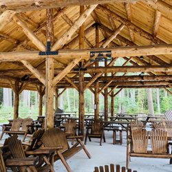
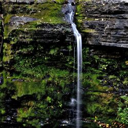
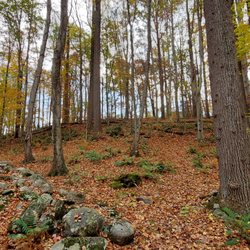
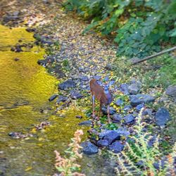
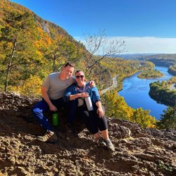
Millbrook Village Photos


You might also consider
More like Millbrook Village
Recommended Reviews - Millbrook Village
Start your review...

1 year ago
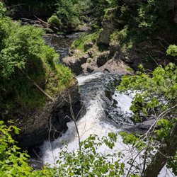
The ORCHARD (orange) Trailhead is across the road fro the driveway to the parking lot and is a little hard to spot...it's across the road from the restrooms (which were clean and well kept). We initially tried to park at Van Campens Glen but all the parking locations were closed with no access allowed. We took the Orchard trail to take a left onto the Hamilton Ridge "Road" (more like a Parks Road that's covered in moss with remnants of asphalt). Hamilton is supposed to the be the blue trail, but we didn't see a single trail marker. Off Hamilton we turned right onto Pioneer (also the orange trail). We covered about 2.5 miles from the parking lot, trails were well marked, while some steep hills (up and down)...there wasn't much to see except forest. We only ran into 2 people during our 3 hour excursion. We caught a glimpse of the Delaware River before turning around, but it wasn't a close/good view. read more


More info about Millbrook Village
Old Mine Rd
Hardwick Township, NJ 07825
Directions
Hours
Outdoor Amenities
You might also consider


Millbrook Village - hiking - Updated July 2026
Best of Hardwick Township
People found Millbrook Village by searching for…
Parks in Hardwick Township, NJ
Things to Do in Hardwick Township, NJ
Hiking Trails in Hardwick Township, NJ
Off Road Trails in Hardwick Township, NJ
Walking Trails in Hardwick Township, NJ
Stroller Friendly Hikes in Hardwick Township, NJ
Waterfalls and Swimming Holes in Hardwick Township, NJ
Running Trails in Hardwick Township, NJ
Waterfalls in Hardwick Township, NJ
Dog Friendly Beaches in Hardwick Township, NJ
Picnic Areas in Hardwick Township, NJ
Cliff Diving in Hardwick Township, NJ
Sunrise View in Hardwick Township, NJ
Things to Do on a Rainy Day in Hardwick Township, NJ
Abandoned Places in Hardwick Township, NJ
Scenic Night View in Hardwick Township, NJ
Group Fitness Classes in Hardwick Township, NJ
Off Leash Dog Hikes in Hardwick Township, NJ
Tourist Attractions in Hardwick Township, NJ
Trails in Hardwick Township, NJ
Secluded Spots in Hardwick Township, NJ
Browse Nearby
BEST of Hardwick Township, New Jersey Restaurants near Millbrook Village
BEST of Hardwick Township, New Jersey Things to Do near Millbrook Village
BEST of Hardwick Township, New Jersey Shopping near Millbrook Village
BEST of Hardwick Township, New Jersey Lunch near Millbrook Village
BEST of Hardwick Township, New Jersey Pizza near Millbrook Village
BEST of Hardwick Township, New Jersey Attractions near Millbrook Village
Browse Brands
Browse Articles
People who viewed Millbrook Village also viewed
Worthington State Forest
50 reviews
High Point State Park
67 reviews
High Point Monuments of Sussex County
5 reviews
Wallkill River National Wildlife Refuge
4 reviews
Rail Gap Pocono Creek Nature Preserve
2 reviews
Dingmans Campground
62 reviews
Delaware Water Gap Nra
10 reviews
Mount Tammany
8 reviews
Jacobsburg Environmental Education Center
15 reviews
Franklin Pond
5 reviews