Cancel

    Open app

    Search

    Midpeninsula Regional Open Space District

    3.7 (23 reviews)
    Closed 8:30 am - 5:00 pm

    Midpeninsula Regional Open Space District Photos

    You might also consider

    More like Midpeninsula Regional Open Space District

    Recommended Reviews - Midpeninsula Regional Open Space District

    Your trust is our priority, so businesses can't pay to alter or remove their reviews. Learn more about reviews.
    Yelp app icon
    Browse more easily on the app
    Review Feed Illustration

    Reviews With Photos

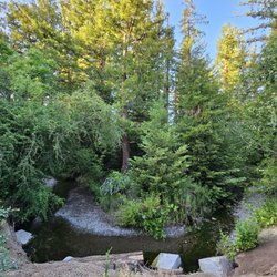
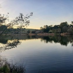
    Pond
    Lacey C.

    Super close to town, easy access parking but limited, and about a 5 mile hike. Lots of hills and a breeze back downhill. It is not to large but a great spot to go for a quick walk and breathe in those redwoods.

    Menlo K.

    While it deserves 5-stars for simply existing, that would not allow a good comparison with other Mid Peninsula Open Space Preserves that are much nicer and more enjoyable. This is a quiet preserve with low use, probably because parking requires a (free) permit. It is pretty dull compared to other local preserves, but I am grateful that it exists.

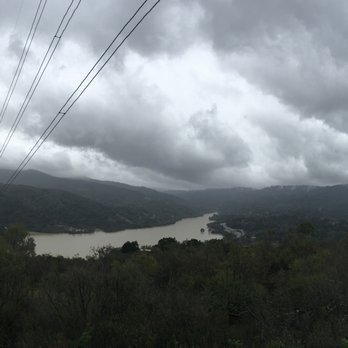
    Looking down Trout Canyon to Lexington Reservoir
    Wes M.

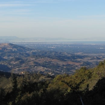
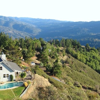
    While Rancho San Antonio is easily the best-known MROSD preserve, El Sereno is certainly a contender for the least-known. First, you have to know how to find this place; I didn't see a single sign. From the 17 it's 3 miles up the steep and narrow Montevina Road (and PS: who lives up here? Cuz damn). At the end, you won't find any constellation of parking lots, just a rough dirt pullout with space for 3-4 cars. Not counting a few random spurs, you have your choice of a whopping 1 trail, which is actually a dirt road. And aside from one all-too-brief stretch, there's not a sliver of shade to be found. So, why hike it? Because it's there, of course! Oh yeah, and the phenomenal views stretching from the city and Mt Tam to Monterey, with a commanding view of the entire South Bay as well. Some say this trail is best in the spring when there's wildflowers, but then, so are most Bay Area trails, and there are only so many spring weekends to go around. Personally I recommend a clear, cold winter's day instead, when smog is at a minimum and the ever-present sun is actually welcome. So, El Sereno is certainly underappreciated, but then, it's a little underdeveloped too. How about adding a foot trail somewhere, maybe as a loop, or a way to get down to Villa Montalvo or the 17?

    Start of the Aquinas Trail

    See all

    1 year ago

    Helpful 0
    Thanks 0
    Love this 0
    Oh no 0

    9 months ago

    Helpful 0
    Thanks 0
    Love this 0
    Oh no 0

    5 years ago

    Helpful 6
    Thanks 0
    Love this 4
    Oh no 0

    6 years ago

    Helpful 1
    Thanks 0
    Love this 1
    Oh no 0
    Photo of Menlo K.
    27
    239
    440

    9 years ago

    Helpful 1
    Thanks 0
    Love this 1
    Oh no 0
    Photo of Wes M.
    370
    1188
    402

    19 years ago

    Helpful 3
    Thanks 0
    Love this 3
    Oh no 0

    8 years ago

    Helpful 3
    Thanks 0
    Love this 1
    Oh no 0
    Photo of Mike G.
    132
    1485
    2896

    10 years ago

    Helpful 1
    Thanks 0
    Love this 0
    Oh no 0
    Photo of Luz D.
    55
    86
    82

    18 years ago

    Helpful 10
    Thanks 0
    Love this 1
    Oh no 0
    Photo of J A.
    344
    325
    32

    20 years ago

    Helpful 3
    Thanks 0
    Love this 7
    Oh no 0

    15 years ago

    Helpful 6
    Thanks 0
    Love this 0
    Oh no 0

    16 years ago

    Helpful 0
    Thanks 0
    Love this 2
    Oh no 0

    8 years ago

    Helpful 1
    Thanks 0
    Love this 0
    Oh no 0
    Photo of Colin G.
    51
    78
    53

    8 years ago

    Helpful 0
    Thanks 0
    Love this 0
    Oh no 0

    6 years ago

    Helpful 0
    Thanks 0
    Love this 0
    Oh no 0
    Photo of Alex R.
    396
    4
    0

    10 years ago

    Helpful 3
    Thanks 0
    Love this 0
    Oh no 0

    15 years ago

    Helpful 2
    Thanks 0
    Love this 1
    Oh no 0
    Photo of Kaori M.
    269
    1741
    1486

    10 years ago

    Helpful 0
    Thanks 0
    Love this 0
    Oh no 0

    17 years ago

    Helpful 0
    Thanks 0
    Love this 0
    Oh no 0
    Photo of Sami M.
    1
    148
    0

    8 years ago

    Helpful 0
    Thanks 0
    Love this 0
    Oh no 0

    15 years ago

    Helpful 0
    Thanks 0
    Love this 0
    Oh no 0
    Photo of Kevin S.
    397
    1596
    278

    21 years ago

    Helpful 5
    Thanks 0
    Love this 4
    Oh no 0

    13 years ago

    Helpful 0
    Thanks 0
    Love this 0
    Oh no 0

    Ask the Community - Midpeninsula Regional Open Space District

    Review Highlights - Midpeninsula Regional Open Space District

    We started at the end of Montevina Road and went to all the way to the boundary of other side.

    Mentioned in 3 reviews

    Read more highlights

    You might also consider

    Verify this business for free

    People searched for Parks 20,458 times last month within 15 miles of this business.

    Verify this business

    Rancho San Antonio Preserve

    Rancho San Antonio Preserve

    4.5
    (778 reviews)
    4.5 mi

    I've done over half a dozen hikes here, including the treacherous black mountain trail, and I think…read morethis is one of the best hiking areas near Cupertino! Rancho San Antonio offers hikes for just about every level, and all of the trails are well maintained. Some of the higher elevation trails like the PG&E trail offer great views of Silicon Valley. Wildlife like turkeys can be seen along the trails.
    First things first, if you don't come here early, expect to circle the numerous parking lots many,…read moremany times. The first time I came here years ago, couldn't find a spot so we left, then came back another time and lucked out. Most recently we spent about 30 minutes circling and going back and forth between all the lots before we finally got a spot. We considered leaving, but every time we tried to sit and look at a map to find somewhere else to go, a car would come up behind us and we'd have to move. So if you aren't a patient person, come early, or don't come. After our parking search nightmare was over, we were finally able to enjoy the beautiful trails and lovely farm. It was truly amazing how empty the trails felt with how many people and cars were there. We did the deer hollow loop trail which included the coyote trail, and we only came across a handful of other groups until we got to the farm. They have maps at the trial head, and many trails to choose from, so grab a map if you haven't been. The maps are small so it's kind of hard to tell where you are, but luckily the trail posts are numbered, so you can reference them on the map as your winding your way on the trails. We were pleasantly surprised by how many animals there were on the farm! There were goats, pigs, sheep, cows, ducks, geese, and chickens. It was fun to explore and watch all the animals grazing and roaming their pens. The farm is a decent trek from the parking lot, even though it is flat and there are paved areas you can walk, it does take some time to get back out from it.

    Photos
    Rancho San Antonio County Park and Open Space Preserve
    Rancho San Antonio County Park and Open Space Preserve
    Rancho San Antonio County Park & Open Space Preserve
    Rancho San Antonio County Park & Open Space Preserve
    Rancho San Antonio County Park and Open Space Preserve

    See all

    Rancho San Antonio County Park and Open Space Preserve
    Monte Bello Open Space Preserve

    Monte Bello Open Space Preserve

    4.4
    (56 reviews)
    4.1 mi

    "Beautiful Mountain" Yes, indeed!…read more PSA: No dogs allowed - I had to leave mine at home. It's ok, you can enjoy this one alone! Take the drive! Yes, the road is windy and please slow for cyclists on your way up. Come along, sing a song. Dancing feet, magical retreat. Bring a friend or brave alone, it'll be worthwhile - 2, 4, or 7 miles! Our small group hiked the 7 mile loop, and had many photos stops along the way. Our leisure hike took approximately 4.5 hours. We spotted a tarantula early on the trail, other hiking groups, a backpacking group, bikers in groups and a few solo peeps. Shaded Hike & Open Space Sunny Hike: If you're wanting a shaded hike, start on the White Oak Trail located to the right of the Monte Bello parking. If you begin your hike on Bella Vista Trail, it's more of an open space with direct sunlight. Start early and enjoy! =)

    Monte Bello is a hidden treasure for the Mid-Peninsula area…read more Funny thing, though. For being hidden, it's sure well known. To get there, you drive seven miles up a narrow, windy road. You're wondering if there's anything here besides big houses on tree-filled hills. Make a sharp left at Foothills Park - oops, never mind, you don't live in PA, you can't drive in here. More driving, more driving . . . and you finally get there, only to find a spacious parking lot crammed with cars. Here's why I gave it five stars: At first, it looks like typical landscape on this part of the Peninsula. But then I went down the narrow Stevens Creek Nature Trail. And ended up in a deep, dark forest with a babbling brook, pretty wildflowers, romantic bridges, and interpretive signs to explain what you're gazing at. If you felt like you got away from it all by driving up Page Mill Road, now you *really* feel like you're away from it all. Monte Bello also has a few peaks to climb up, and a backpacking camp. I'm itching to come back to try these out. I was not here long enough to really appreciate Monte Bello, but I saw enough to appreciate it a LOT. I had written about Russian Ridge that it's part of a conglomerate of Mid-Peninsula Open Space Preserves that gives you a few days of outback hiking. Monte Bello is part of that conglomerate, which combines with Los Trancos (and Foothills Park, but don't tell anyone, shhhh) to give you even more wandering. And bring a lunch, because you'll be so mesmerized that you may forget to leave and get food.

    Photos
    Monte Bello Open Space Preserve
    Ahhhhh, sweet tranquility
    Ahhhhh, sweet tranquility
    Come along

    See all

    Come along
    Castle Rock State Park

    Castle Rock State Park

    4.6
    (430 reviews)
    11.6 mi

    Have long eyed the Castle Rock State Park and glad we finally went! The park charges a nominal…read moreparking fee ($10 at time of writing); the parking fee is waived if you have one of the supported passes. Check their site for more info: https://www.parks.ca.gov/?page_id=538# We really enjoyed our hike here. The space is beautiful, and the trails are well-maintained. The trailhead had plenty restrooms as well. We made it up to Goat Rock Lookout, back down, then detour to the waterfall. It took ~1.5 hours in total, which was perfect for a end-of-day hike before the park closes at sunset. The view up at Goat Rock Lookout was breathtaking!

    If you're looking for another place that has breathtaking views surrounding the whole Santa Cruz…read moreMountains (but don't want to go all the way to Portola Valley), Castle Rock State Park is the place for you. This place is usually my go to when the weather is just perfect and you want good views of the mountains viewing the Monterey Bay and the Santa Clara Valley. In addition, the park is even open during the cold winter season, where it occasionally will snow (because of how high the elevation is, the main base is situated at about 3,200 feet above sea level). This place has been my go-to park for hiking for a while, because of its terrain. At the same time, it's also been because of how much snow they get when cold fronts come into effect. They are also open year-round, so definitely swing by this state park when you do get the chance to! It's a decision you'll never regret.

    Photos
    Castle Rock State Park
    Castle Rock State Park
    Castle Rock State Park

    See all

    Byrne Preserve

    Byrne Preserve

    4.9
    (7 reviews)
    3.7 mi

    Fun spot to come for a hike if you want to see some horses and experience a variety of scenery…read more You start in a pretty big open hilly field, this area is mostly brush, though there is a clear trail. There's a tree at the top of the hill, though no shade other than that. This is the area where we saw the horses. We tried following along with All Trails, but the route on there did a lot of figure 8's and was hard to really comprehend. Luckily with the guidance from other hikers we were able to extend our hike out of this immediate area and make it back to the car. The trail continues out of this fenced in area with multiple different ways to go. There is some signage, though it's rather old and you can tell that some of the directional signs have fallen off. We headed down the hill, out of the gate, next to a house with a vineyard, then down into a tree covered path that went next to the mostly dried up creek. This area was nice and shaded, a little steep in some areas, but not too bad. I liked that you had a number of different routes you could take to make this hike longer or shorter depending on your adventure, but more and better signage would be a welcome addition. We parked at the trail head, it was a pretty big lot with a lot of spots. By the time we got back, it was pretty packed, but there was another area before you enter with some extra parking if this area is full. We were pretty surprised to see so many cars, as the trail didn't feel crowded and we often went long stretches without seeing anyone.

    This is a great hidden spot for hiking. It's a 55-acre nature preserve in Los Altos Hills. It's…read morequiet and peaceful with a great change of scenery. If you park in the parking lot on Altamont, you see rolling hills and pasture. Once you walk into the preserve it becomes more of a wooded and shaded area. The paths are well worn and well marked. Please be careful when it rains. The path looks like mostly clay and is really slippery. Look out for horses because it's a horse path. Dogs need to be on leashes for this park.

    Photos
    Byrne Preserve
    Byrne Preserve
    Byrne Preserve

    See all

    Midpeninsula Regional Open Space District - parks - Updated August 2026

    Loading...
    Loading...
    Loading...