Mary Jane Falls Photos


You might also consider


More like Mary Jane Falls
Recommended Reviews - Mary Jane Falls
Start your review...


Reviews With Photos


Came up here July 26th (a Sunday) arrived at about 9:30am and got lucky with somebody pulling out so we got a spot however all parking was full and cars were parked on the street and even in the truck/horse trailer spots. It was about 80 degrees and the hike up was a continuous up. My calves, hammies and booty were on fire but the view was totally worth it. I definitely worked up a sweat. There were several people on the trail, a decent amount of dogs as well however, there wasn't ever a "crowd" on the trail at any time. If you have a chance to get away and come up here, I highly recommend it! Its gorgeous and the weather is perfect this time of year. There wasn't any water on the falls but the hike was worth it anyway. Excited to explore another hike around the area!!


This hike was not an easy one, but it was a great way to challenge yourself of your a intermediate hiker. It has a lot of switchbacks that are not wide at all. Your feet will slip but you won't fall. Make sure to take plenty of water a snack for when you get to the top. At the time of our visit, April 25, 2021, the waterfall was small but flowing. Was it worth it? Yes it is. Not only the view but to push yourself and be able to say "I DID IT!"


Moderate incline hike all the way up to the falls. Almost 3 miles from parking lot to falls. There were many kids completing the hike, so it's not difficult at all. Plus, the views are truly amazing! There is plenty of parking but even with 2 lots, it is not enough. We arrived around 10 a.m so we were lucky that people were coming back down from their early hike and spots were opening up. If possible, I suggest using hiking sticks, just because there were several areas with loose gravel so the sticks can help prevent any slipping. Fyi, there is cell phone service throughout the entire hike, in case you were wondering.


Despite a birthday on a 3 day weekend, I just couldn't swing a trip out of town this year. Instead, we went up to Mt Charleston and did this hike as a way of getting a change of scenery and some cooler temperatures. Drive all the way up to the upper lot at the trail head then start your hike- lots of reviews say to go super early in the morning to avoid crowds, but we went 3-5PM and only passed one group going up and a few couples as we left, with families lingering up at the top of the falls for quite a while. Even at the end of August, there was a pretty good trickle at the 2 falls. Hike itself is probably "intermediate" level, not super difficult but you'll have to go slow with kids/dogs and take breaks. We were up and down in under an hour, not including our break up top. We're both pretty active and were surprised to wake up with sore quads and hamstrings the next day. It's a nice workout with some great views! TIP: Several reviews suggest hiking boots. I wore sneakers and saw a few others in sandals or slip-on shoes. Sneakers were fine most of the time but there were a few parts that I had to be more cautious of sliding.


Decent hike up to these beautiful falls. You can go under them which is cool but you need to climb a bit. Going up is easier than coming back down. Very touristy spot, know that you won't be alone and it can get quite busy in the weekends! That's the only down side to this location.


I have hiked this trail many times but I especially wanted to get up there early this summer to witness the falls. Traditionally, these falls are generally pretty lifeless due to lack of winter snowfall, but since we had such a wet and snowy winter I knew they were going to be amazing! Always best to go in the early morning if possible to avoid the crowds and obtain a parking spot near the trailhead. I went up on a Tuesday morning and was greeted by a beautiful deer as I entered the parking lot. When I arrived there was plenty of parking but by the time I left, it was filled and overflowing along the side of the road. Per the AllTrails app, it states the hike is 3.1 miles round trip. My watch logged additional distance. As you ascend the mountain, you begin a slow up hill climb nothing too difficult. Lots of gravel to maneuver through and then eventually the path becomes a single track and all dirt, rocks and tree roots to walk over. Once you hit the switchbacks, this hike hits a whole new level. I wouldn't categorize it as difficult, but you will get winded as you climb. Lots of steps to climb on the switchbacks and it can get tricky towards the top, so be sure to watch your footing. I would definitely recommend wearing hiking boots or trail shoes with a grip. It is recommended to be in decent physical shape for this trail as I saw many people struggling to breathe and looking peaked as they made their way up. Take this trail at your own pace and take frequent breaks if you need to. Once I arrived at the falls, there were three falls flowing big time! It was so breathtaking and the mist from the falls was refreshing to feel. I was able to grab some great pics and video. I sat up there for a good hour or two. I sat down and just took in all that nature had to offer and it was a perfect way to spend my morning. As I looked towards the Charleston Peak, the last remaining snow is trying to hang on but very little left. We had one heck of a year and to see snow this late in the season is pretty unusual. The only negative about this hike or any other hike I have done lately is some people feel they have to bring music and blast it while they are hiking. WHY??? This is so irritating!! Can't these people enjoy the sounds of nature?? UGH! As always take plenty of water with you, wear good shoes, and most of all Leave No Trace.


About 4 miles round trip (or 5 if you get lost looking for the entrance like me) and over 1000ft in elevation gain with a starting elevation of 7650ft! The first half mile or so is fairly easy and everything else is uphill from there. The trail is easy to follow and there are a few shortcuts that require rock scrambling but it's not much of a shortcut, I realized on the way back that those "shortcuts" probably only shave a minute or so from the hike. The views are amazing throughout the whole hike and definitely worth it at the end! You get an awesome view of Mount Charleston and whatever is left of the waterfalls there. The waterfalls were still frozen in April and ice was falling off so just watch out for that. Pretty packed trail so if you want to avoid the crowd, it's better to go early. Definitely one to check out!
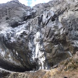

Beautiful hiking area. Hard at times with the steep climb and the high elevation but once you make it to the Spring it's worth it. I don't know if there is a larger fall/water Speing but I will post a picture of the area we got to. We went off course a little so can't tell you exactly how much time it takes to get there. It's a nice get away from the city. It's a lot cooler in Mt. Charleston. There are most of trees and a lot of good views. It's very dry so you will need lots of water. A lot! Please don't get stuck up here without water and do bring snacks but take your trash with you, please. Let's keep our trails clean from trash. There are bathrooms and a map at the beginning of the hike. There are two parking areas close to this trail. People parked on the road leading to the trail and if I can remember correctly, there was a smaller parking area right before the trail begins. It's very rocky and at time tough, especially with kids. I liked this one better than Kyle Canyon (I think that's the name) Trail. But then again, I didn't make it to the top of that trail so I can't really compare the two. That one was way harder for me to accomplish with my toddlers. I also found it more confusing. Had I been alone I would have probably gotten most. It was also hotter with less shade.


This hike gave me all the autumn feels! My friends and I picked the perfect day where it wasn't too cold, not too hot for this hike! First off, now is the perfect time to go because the leaves are changing so you will capture so much fall vibes. Also, this hike is just right for the novice hikers - yes there are some steep spots but with some sturdy hiking shoes and a hiking stick you can conquer anything! Another huge plus about this hike is that it has many shaded areas. The trails itself are very clear and you can't get lost. At the end of this hike you'll find a waterfall and a cave-like area with absolutely stunning views. I would totally do this hike again; it's about 3-4 miles round trip with free parking.


We've done this trail a few times, even though it's not long it does go up, up, up...so be ready for that and bring water to stay hydrated no matter what the season. This particular Saturday was blistering hot in town, the dog needed to get his crazy out and we needed exercise. We got to the parking lot around 1130 and were back to the car at 1430. The trail was busy and there were tons of dogs. Some parts of the trail are not very wide making passing by other hikers a bit difficult but doable. The falls were flowing when we got to the top. The dog had a blast running through water and digging in mud. We relaxed, had a snack, snapped some pictures then down, down, down we go. The trees make for nice shade on sunny days. I love me some time with wilderness.


This is a classic hike. Lots of switchbacks with a fair amount of elevation gain. The elevation is the hardest part of this hike- it makes it hard to breathe if you're not used to it. It is a good hike if you want to get out of the vegas heat. There is actually some water in the waterfall right now. NOTE: the switchbacks are very eroded right now. In some areas it is very narrow and/or unstable. You should be fine as long as you keep an eye where you are walking. I would be a little hesitant to take kids on this trail atm. Beautiful view at the top.
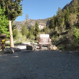

Mary Jane Falls is a hike in the Mount Charleston area. The area is about 20 degrees cooler on average than Las Vegas, so it's a great place to hike in the summer when Red Rock Canyon is too hot for many people. The hike is 3 miles round trip and the elevation gain is about 1,000 feet. In the spring, after some good winter snow on the mountain, Mary Jane will have some nice water falling down its steep cliffs. That's the case now in June, 2010. The falls are never a gusher, but they are pretty. The trail starts out rising gently as you hike about 1/2 mile to get to the first switchback. From there, it's a series of switchbacks to the edge of the cliffs. The going is steeper. Please don't cut the switchbacks. There has been some damage done to the trail because of people taking a shorter route. On the way up the switchbacks, you'll see a cave off to the left. When you get to the falls, you can take the trail to the cave. It's a nice place to have a snack as you take in the beautiful vista. Walk back to the falls to get the trail back to your car. To get to the trailhead, drive up Kyle Canyon Road, State Route 157. After passing the elementary school, there is a side road that goes off to the right to the Echo subdivision. This is Echo Road. Follow this road about 1/3 of a mile, and you will see a sign to turn left on a dirt, graded road to reach the trailhead. This area is very crowded on weekends so an early start is best.


Mary Jane Falls is considered one of the more challenging hikes at Mt. Charleston. I wouldn't consider it particularly difficult. We were working, but it wasn't difficult for us. The trail is also easy to follow and doesn't have any obstacles. There aren't any narrow areas or anything I'd consider dangerous either. It's a great trail for someone that wants a bit of a workout, but nothing scary. Keep in mind that depending on rain levels that the "falls" may not be falls as much as a trickle. It was more of a trickle when we visited. The falls area still offers a nice view of the surrounding area even if the falls aren't plentiful. Mt. Charleston is a great place to visit during the summer since it will be considerably cooler up here. The parking was plentiful and the lot to start the trail was easy to find using maps online. I like that they had a bathroom at the start/end of the trail as well.


3 years ago
It's always been one of my favorite trails in Mt Charleston. Mary Jane's is listed as moderate hike and while it's true, it has some pretty steep hills, but the switchbacks are amazingly helpful. Definitely recommend going early in the morning so you can enjoy the cooler temperatures, instead of the hot sun later on. Make sure to bring plenty of drinking water and sunscreen! There is no drinking fountain anywhere on the trail. Also keep in mind, there isn't any restrooms on the hiking trails beside the very bottom at the beginning. The trail is very walkable but definitely no wheelchair accessible! We enjoyed the hike earlier this summer. There was still snow on the ground right across from us on the hillside. While we were hiking, there were beautiful wildflowers present on the ground. After the switchbacks, we had reached the waterfalls and immediately felt the refreshing smell in the air. The water was amazingly pleasant, washed our hands and enjoyed the beautiful views around us. Can't wait to go back again! read more


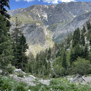


One of my favorite hikes in the Mt Charleston area. Mary Jane Falls is the ultimate desert escape. Just 45 minutes from Las Vegas, this hike trades heat and neon for cool mountain air, towering pines, and a steady uphill challenge. The switchbacks make you work for it, but the payoff is worth it -- a peaceful alpine waterfall that feels wildly out of place in the Mojave. Go early, bring water, and be ready to earn your views. Short, steep, and totally worth it. read more



***WINTER*** So on the way here if you are on the US 95N you will see a electronic sign telling you if the mountain is safe to go to. It's around the Elkhorn exit. The parking lot gets closed off and you have to park on the road and it's a long walk to the trailhead since you see no parking signs everywhere. The trailhead itself is amazing I didn't know Las Vegas could get so beautiful . My friend's and I couldn't make it to the top. The snow was thick and this is about 2 miles up. You will need snow shoes, proper clothing etc. One of my reasons for wanting to go up the trailhead in the winter is because my friend told me the waterfall is actually frozen over and it's an amazing sight to see! ***SUMMER*** If you come here during the summer it is an amazing easy hike. The only part that gets difficult is when you start to do the stairway towards the last three quarters of a mile. The parking lot is open during the summer and it's easy to find parking there is plenty of spaces. There is a Metro Police station about 3/4 of the way once you make that turn to get to Mount Charleston that's pretty much a straight away so I wouldn't go over 65 mph and actually pay attention because they are out there. Definitely check out both summer and winter Mary Jane falls even though I didn't make it all the way in the snow the views are just breathtaking. read more


6 years ago
Came up here July 26th (a Sunday) arrived at about 9:30am and got lucky with somebody pulling out so we got a spot however all parking was full and cars were parked on the street and even in the truck/horse trailer spots. It was about 80 degrees and the hike up was a continuous up. My calves, hammies and booty were on fire but the view was totally worth it. I definitely worked up a sweat. There were several people on the trail, a decent amount of dogs as well however, there wasn't ever a "crowd" on the trail at any time. If you have a chance to get away and come up here, I highly recommend it! Its gorgeous and the weather is perfect this time of year. There wasn't any water on the falls but the hike was worth it anyway. Excited to explore another hike around the area!! read more


This hike was not an easy one, but it was a great way to challenge yourself of your a intermediate hiker. It has a lot of switchbacks that are not wide at all. Your feet will slip but you won't fall. Make sure to take plenty of water a snack for when you get to the top. At the time of our visit, April 25, 2021, the waterfall was small but flowing. Was it worth it? Yes it is. Not only the view but to push yourself and be able to say "I DID IT!" read more


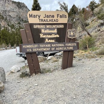


Moderate incline hike all the way up to the falls. Almost 3 miles from parking lot to falls. There were many kids completing the hike, so it's not difficult at all. Plus, the views are truly amazing! There is plenty of parking but even with 2 lots, it is not enough. We arrived around 10 a.m so we were lucky that people were coming back down from their early hike and spots were opening up. If possible, I suggest using hiking sticks, just because there were several areas with loose gravel so the sticks can help prevent any slipping. Fyi, there is cell phone service throughout the entire hike, in case you were wondering. read more
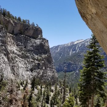


7 years ago
Despite a birthday on a 3 day weekend, I just couldn't swing a trip out of town this year. Instead, we went up to Mt Charleston and did this hike as a way of getting a change of scenery and some cooler temperatures. Drive all the way up to the upper lot at the trail head then start your hike- lots of reviews say to go super early in the morning to avoid crowds, but we went 3-5PM and only passed one group going up and a few couples as we left, with families lingering up at the top of the falls for quite a while. Even at the end of August, there was a pretty good trickle at the 2 falls. Hike itself is probably "intermediate" level, not super difficult but you'll have to go slow with kids/dogs and take breaks. We were up and down in under an hour, not including our break up top. We're both pretty active and were surprised to wake up with sore quads and hamstrings the next day. It's a nice workout with some great views! TIP: Several reviews suggest hiking boots. I wore sneakers and saw a few others in sandals or slip-on shoes. Sneakers were fine most of the time but there were a few parts that I had to be more cautious of sliding. read more


Decent hike up to these beautiful falls. You can go under them which is cool but you need to climb a bit. Going up is easier than coming back down. Very touristy spot, know that you won't be alone and it can get quite busy in the weekends! That's the only down side to this location. read more


I have hiked this trail many times but I especially wanted to get up there early this summer to witness the falls. Traditionally, these falls are generally pretty lifeless due to lack of winter snowfall, but since we had such a wet and snowy winter I knew they were going to be amazing! Always best to go in the early morning if possible to avoid the crowds and obtain a parking spot near the trailhead. I went up on a Tuesday morning and was greeted by a beautiful deer as I entered the parking lot. When I arrived there was plenty of parking but by the time I left, it was filled and overflowing along the side of the road. Per the AllTrails app, it states the hike is 3.1 miles round trip. My watch logged additional distance. As you ascend the mountain, you begin a slow up hill climb nothing too difficult. Lots of gravel to maneuver through and then eventually the path becomes a single track and all dirt, rocks and tree roots to walk over. Once you hit the switchbacks, this hike hits a whole new level. I wouldn't categorize it as difficult, but you will get winded as you climb. Lots of steps to climb on the switchbacks and it can get tricky towards the top, so be sure to watch your footing. I would definitely recommend wearing hiking boots or trail shoes with a grip. It is recommended to be in decent physical shape for this trail as I saw many people struggling to breathe and looking peaked as they made their way up. Take this trail at your own pace and take frequent breaks if you need to. Once I arrived at the falls, there were three falls flowing big time! It was so breathtaking and the mist from the falls was refreshing to feel. I was able to grab some great pics and video. I sat up there for a good hour or two. I sat down and just took in all that nature had to offer and it was a perfect way to spend my morning. As I looked towards the Charleston Peak, the last remaining snow is trying to hang on but very little left. We had one heck of a year and to see snow this late in the season is pretty unusual. The only negative about this hike or any other hike I have done lately is some people feel they have to bring music and blast it while they are hiking. WHY??? This is so irritating!! Can't these people enjoy the sounds of nature?? UGH! As always take plenty of water with you, wear good shoes, and most of all Leave No Trace. read more


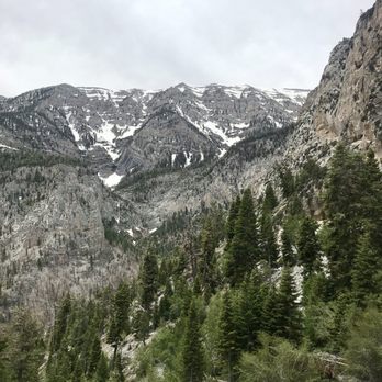


5 years ago
About 4 miles round trip (or 5 if you get lost looking for the entrance like me) and over 1000ft in elevation gain with a starting elevation of 7650ft! The first half mile or so is fairly easy and everything else is uphill from there. The trail is easy to follow and there are a few shortcuts that require rock scrambling but it's not much of a shortcut, I realized on the way back that those "shortcuts" probably only shave a minute or so from the hike. The views are amazing throughout the whole hike and definitely worth it at the end! You get an awesome view of Mount Charleston and whatever is left of the waterfalls there. The waterfalls were still frozen in April and ice was falling off so just watch out for that. Pretty packed trail so if you want to avoid the crowd, it's better to go early. Definitely one to check out! read more


Beautiful hiking area. Hard at times with the steep climb and the high elevation but once you make it to the Spring it's worth it. I don't know if there is a larger fall/water Speing but I will post a picture of the area we got to. We went off course a little so can't tell you exactly how much time it takes to get there. It's a nice get away from the city. It's a lot cooler in Mt. Charleston. There are most of trees and a lot of good views. It's very dry so you will need lots of water. A lot! Please don't get stuck up here without water and do bring snacks but take your trash with you, please. Let's keep our trails clean from trash. There are bathrooms and a map at the beginning of the hike. There are two parking areas close to this trail. People parked on the road leading to the trail and if I can remember correctly, there was a smaller parking area right before the trail begins. It's very rocky and at time tough, especially with kids. I liked this one better than Kyle Canyon (I think that's the name) Trail. But then again, I didn't make it to the top of that trail so I can't really compare the two. That one was way harder for me to accomplish with my toddlers. I also found it more confusing. Had I been alone I would have probably gotten most. It was also hotter with less shade. read more
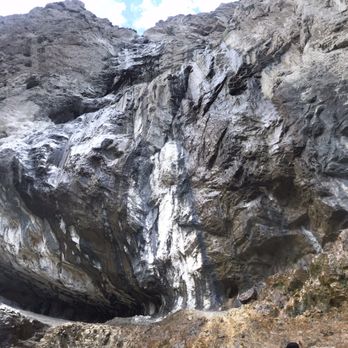

7 years ago
This hike gave me all the autumn feels! My friends and I picked the perfect day where it wasn't too cold, not too hot for this hike! First off, now is the perfect time to go because the leaves are changing so you will capture so much fall vibes. Also, this hike is just right for the novice hikers - yes there are some steep spots but with some sturdy hiking shoes and a hiking stick you can conquer anything! Another huge plus about this hike is that it has many shaded areas. The trails itself are very clear and you can't get lost. At the end of this hike you'll find a waterfall and a cave-like area with absolutely stunning views. I would totally do this hike again; it's about 3-4 miles round trip with free parking. read more


We've done this trail a few times, even though it's not long it does go up, up, up...so be ready for that and bring water to stay hydrated no matter what the season. This particular Saturday was blistering hot in town, the dog needed to get his crazy out and we needed exercise. We got to the parking lot around 1130 and were back to the car at 1430. The trail was busy and there were tons of dogs. Some parts of the trail are not very wide making passing by other hikers a bit difficult but doable. The falls were flowing when we got to the top. The dog had a blast running through water and digging in mud. We relaxed, had a snack, snapped some pictures then down, down, down we go. The trees make for nice shade on sunny days. I love me some time with wilderness. read more


8 years ago
This is a classic hike. Lots of switchbacks with a fair amount of elevation gain. The elevation is the hardest part of this hike- it makes it hard to breathe if you're not used to it. It is a good hike if you want to get out of the vegas heat. There is actually some water in the waterfall right now. NOTE: the switchbacks are very eroded right now. In some areas it is very narrow and/or unstable. You should be fine as long as you keep an eye where you are walking. I would be a little hesitant to take kids on this trail atm. Beautiful view at the top. read more


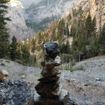


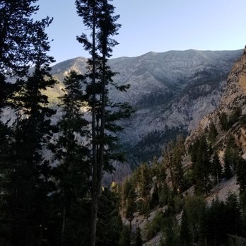


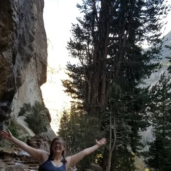

Mary Jane Falls is a hike in the Mount Charleston area. The area is about 20 degrees cooler on average than Las Vegas, so it's a great place to hike in the summer when Red Rock Canyon is too hot for many people. The hike is 3 miles round trip and the elevation gain is about 1,000 feet. In the spring, after some good winter snow on the mountain, Mary Jane will have some nice water falling down its steep cliffs. That's the case now in June, 2010. The falls are never a gusher, but they are pretty. The trail starts out rising gently as you hike about 1/2 mile to get to the first switchback. From there, it's a series of switchbacks to the edge of the cliffs. The going is steeper. Please don't cut the switchbacks. There has been some damage done to the trail because of people taking a shorter route. On the way up the switchbacks, you'll see a cave off to the left. When you get to the falls, you can take the trail to the cave. It's a nice place to have a snack as you take in the beautiful vista. Walk back to the falls to get the trail back to your car. To get to the trailhead, drive up Kyle Canyon Road, State Route 157. After passing the elementary school, there is a side road that goes off to the right to the Echo subdivision. This is Echo Road. Follow this road about 1/3 of a mile, and you will see a sign to turn left on a dirt, graded road to reach the trailhead. This area is very crowded on weekends so an early start is best. read more
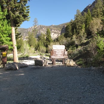


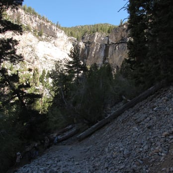


Mary Jane Falls is considered one of the more challenging hikes at Mt. Charleston. I wouldn't consider it particularly difficult. We were working, but it wasn't difficult for us. The trail is also easy to follow and doesn't have any obstacles. There aren't any narrow areas or anything I'd consider dangerous either. It's a great trail for someone that wants a bit of a workout, but nothing scary. Keep in mind that depending on rain levels that the "falls" may not be falls as much as a trickle. It was more of a trickle when we visited. The falls area still offers a nice view of the surrounding area even if the falls aren't plentiful. Mt. Charleston is a great place to visit during the summer since it will be considerably cooler up here. The parking was plentiful and the lot to start the trail was easy to find using maps online. I like that they had a bathroom at the start/end of the trail as well. read more


6 years ago

7 years ago
I'm only giving it 4 stars because I didn't make it all the way up, otherwise it would have been 5. I got altitude sickness at the end of the switch backs. I pushed myself way too much and almost continued but I had to realize it was time to stop. Altitude sickness is real! I began to feel dizzy, nauseous and at one point I almost passed out. Thankfully I remembered to put my head between my knees. I want to say I even felt my blood pressure drop. Do some easy hikes if you're not used to hiking. You're going from 7,000 something to 8,000 something of elevation. I got sick at like 8,400. I had not hiked in like 2 years...so I was not completely shocked. I'm not out of shape but, altitude can still affect anyone. We did not get to see the falls but we still saw some spectacular views. The good thing is that we live in Las Vegas and we are gonna try again in 2 weeks. Hopefully I make it to the top then. read more


6 years ago

I did this hike on a Thursday afternoon, and was able to find parking, and while the trail was definitely popular, I luckily wasn't sandwiched too closely between groups. It was a bit confusing finding each switchback, and I definitely had to be sure of my footing around some of the washed out sections of the path due to erosion and wear and tear from people making their own shortcuts... but overall, it was a nice hike and I really enjoyed the views from high up. The falls themselves weren't flowing super hard, but this was in mid-June, so that was expected. I found a little boulder overlook sort of away from others and enjoyed some time just taking in the views. The only downsides were people not obeying the dogs on leash rule, which could be dangerous for others like myself if I had brought my dog who does not like stranger dogs approaching him on his leash. I wish people could be a little more respectful of others in that way. Also, there were tons of empty water bottles thrown around the trail which is annoying, but I picked up as many as I could on the way down to recycle them at home. If you enjoy more secluded trails, I would suggest the Big Falls Trail which splits off from this one. I took my dog on that one and we had tons of space and privacy. I would do MJF again if I went super duper early before others were crowding the trail. read more


9 years ago
Excellent easy hike! Even with snow and ice on several areas of trail, provided you're wearing proper hiking boots, this is a nice family stroll. While immediately feeling the difference in altitude, I really didn't think I would do much more than the designated blocked off parking lot for MJF. Maybe take a few pictures of snow at trailhead and leave..? Well maybe just a little further up..? These switchbacks are pretty easy and better photos with some height... Aside from watching my steps, my mind was clear and not serenaded with headphones. Listened to wind in trees, watched thin clouds pass overhead and the crunch of every footstep. I looked upwards for once and realized the falls were within reach. Other hikers on way down said "only about 15mins more... don't turn back now." Might as well finish it. I got no plans. Slow and go, 15mins and around the corner, there they were. Two defrosting waterfalls, melting in a hurry. Warned by an experienced hiker, I didn't dare get too close. Snow and bits of ice had been falling from above since rounding the last corner. The dumb tourist in me did get a little closer and caught a dart of ice with my unguarded ear. Backing off, I did the "running man" on the slick ice runoff leading down into the gulley below, before catching a secured rock. That slide would have been long, fast and stopped by rocks to knees and shins. No thanks. Not Monkey anymore, but still clumsy. A large lower section of ice did fall before I arrived. BOOMFF!!! echoed. Lucky to have seen it mostly intact, it may not be here after today. I do recommend this trail to all. Slow and go, pay attention and dress accordingly. Clip, zip, hang those car keys around your neck. Bring water. If not for you, maybe for that gorgeous young lady in need, whose lips wrapped around my mouthpiece and sucked huge gulps of water from my camelback. Yeah, my pleasure, indeed. "Thanks, you're the best." Yeah, tell your friends... read more


9 years ago
Extremely steep hike, loose rocks & slippery in some areas due to snow. Bring extra water, take lots of brakes if out of shape. There were some older and bigger people who made it to the top. Just takes patience! Beautiful waterfall. Everyone we encountered was very friendly read more

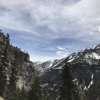


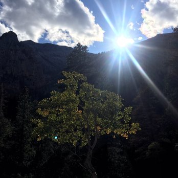
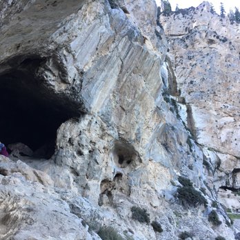
Timing is what should be considered for this hike. Come after a significant storm and the water should be coming down hard but we came after a very mild storm and the falls were still going and it was incredibly peaceful and beautiful. Visiting this place as Fall begins you can also expect to see the colors changing and that never gets old for me. This hike is about 1.5 miles and it's all up, up, up. Pet friendly as well! Incredible workout for that booty and I love a natural stair-master! Once you reach the falls, you'll notice there are a few caves to climb into and keep going a little further down the trail from the falls and you'll reach a fairly large cave. It's perfect for whatever you want it to be. Keep in mind this is a popular spot for getting high (not just on nature) so you may get a contact high, just putting it out there for those that plan to visit with their family. Great workout! Gorgeous foliage! Falls! Caves! Much cooler weather when you're coming over from Vegas! Tip: Be extra careful as some of the switchbacks get extremely narrow. Wear shoes that won't allow you to slip! read more






7 years ago
This is a beautiful trail. Very easy to find and ample parking right in front of the trail head if you go early. Trail starts out fairly easy and flat then around a mile in you have a half a mile of switch backs going straight up. There are great views all through out and ends with a waterfall and cave. One of the best hikes I've enjoyed here. So worth the muscle soreness read more


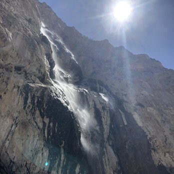


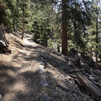


Mary Jane Falls took my breath away. No really, the incline was no joke! It took me and two teenage boys about an hour and a half to get all the way in by the water fall and view of the canyon. I took plenty of much needed breaks for what felt like every 10 feet. Make sure to wear shoes with lots of traction because it does get slippery. For the Vegas locals out there, this was great way to escape the heat. While Vegas was about 100 degrees, MJ falls was shaded and around 85 degrees. Also the water is gloriously cold once you finally make it! Loved this hike, even though it kicked my butt. The drive was lovely and it was free! Always a plus! ;) read more


9 years ago
Very beautiful place and the hike isn't too bad. I will warn you though that it is moderate and is uphill the whole way for about 1.5-1.75 miles. There are a few switch backs at a certain point, but not too many. While you hike up make sure to take some short breaks even if you don't need them physically. Why? Because behind you is some of the best views of nature in Southern Nevada. Don't rush to the falls and skip the scenery! Once you are at the top the falls won't be "huge", but regardless it's a waterfall and it's very serene. Ahead about 3 minutes is a nice size cave with a great place to sit and snack while taking in your surroundings. I'd easily recommend the hike for anyone who wants to get away from the city and enjoy nature for the day. I'd suggest bringing plenty of water and a couple snacks so you can enjoy them at the top. read more
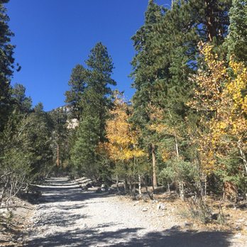
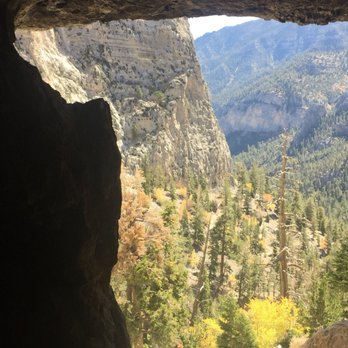
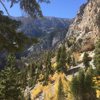


9 years ago
Its not so hot out perfect time to adventure new trails! Went to Mt Charleston for hiking for the first time and i loved it. Definitely will be back to try other trails ,this trail is nice its pretty flat not to crazy for thoses who don't want to do all the rock climbing. Make sure to take a light jackets its a little chilly up there. They also have restrooms at the start of the trail . read more


10 years ago
5 stars because I found this to be a really great family friendly hike! Incline, incline...yes! My 3 year old hiked it with no problem. When he did need some uplifting, I would distract his mind by telling him about the blue butterflies we are on a hunt for. That hunt kept him going. If your toddlers aren't used to hiking or don't like using their legs, they will definitely whine and even get lazy on you. Make sure you hike after or way before their nap time. Once you get to the top it truly is rewarding! I'd say it's actually alot more rewarding for the kids because kids get excited about water especially when they can play in it. But the sound and feel of any kind of water after a climb up is exciting in itself. I hiked with my 1 year old on my back with a carrier. Squeeze those glutes because if you're an active person...this hike may not be enough to satisfy your active spirit. Surely, someone is thinking I'm nuts after reading that. Hey, might as well knock it down while you're at it. The trees along your path make it enough for you to catch a sun break! This is great especially when you do bring the kiddos. Hold on to those kids, too! Don't want them slipping off the edges. As always, bring plenty of water to drink, a snack, or even some sandwiches for when you finally reach the top! Maybe even a small towel and extra clothes if you plan on letting yourself or the kids stand under/play in whatever trickle or pour the falls has to offer. It was a busy day and parking was certainly reaching slim. Come early to beat the heat and to avoid circling for parking. The trail is pretty obvious. You wont need a map or a tour guide. Leave the strollers at home, but definitely kid and family friendly! Enjoy! read more
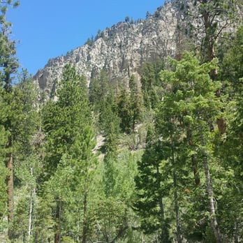
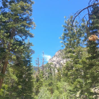

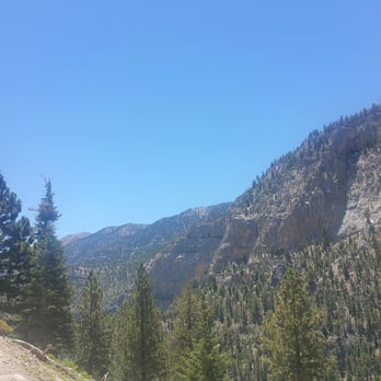


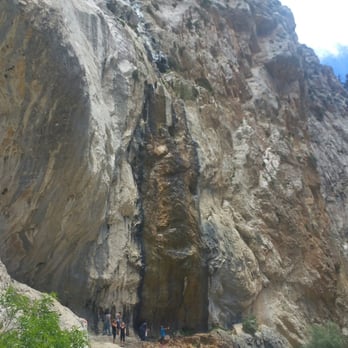


7 years ago
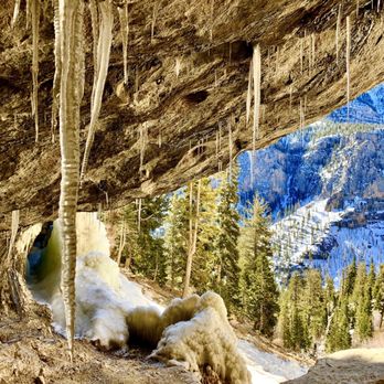
Trail is clearly defined and full of switchbacks. Must go during the winter when the waterfall is frozen. A walking stick helped us with the icy patches. The ice formations are amazing so explore up close, but beware when it's melting. Climb up and see icicles and venture behind the waterfall read more


11 years ago
Another great trail on Mt. Charleston! We come up here to get out of the heat in the summer. It's so beautiful and peaceful. The parking isn't paved so bring the car that already needs washed. There are restrooms available at the beginning of the trail as well. This trail is easy and simple. Just over 2 miles, it took us about 45 minutes to reach the falls. I'm sure many people who are actually in better shape than me could do it in less time. We saw kids and dogs reach the top so it's a fairly easy climb. The first part of this trail is open with a wide path. The second half zig zags up the mountain. The nice part is this is shaded during the morning hours. At the end there was a small trickle of falls. You get a better view from the Cathedral Rock hike but this was still great. So come here to get out of the city and enjoy nature. read more


9 years ago
Hiking near Las Vegas there are so many options!! Anything near Mount Charleston is absolutely beautiful as you drive toward the mountain and the vastness just consumes you. During the winter months the snow caps draw you in and leave you breathless. Sometimes quite literally with the altitude change! We arrived mid day and began our hike. Our first time to the mountain we were a little taken aback by the beauty and began following he foot prints in the snow. The problem was someone was not truly on the right path. Midway up the trail there is a cut off which leads to a switchback. We kept looking for it but never saw it as we followed the prints through a much more "scenic" pass toward the falls. Snow deepened and made this path difficult to navigate eventually forcing us to turn back. Midway back down we noticed hikers on the correct path and spoke to them only to realize we basically were taking the more advanced route. We will go back to take the normal path on another day. It was beautiful and so different than any other hikes we had been on. Can't wait to see the Falls themselves. read more


This is an amazing trail to Mary Jane Falls! We started from the lower parking lot right off the main road. The round trip from there was 3.6 miles with 1440 feet of elevation gain. Who knew...there was a closer parking lot 1/4 of a mile up the hill? The elevation at the upper parking lot is 7827 feet, and 9200 feet at the Mary Jane Falls. It's a short trail with many switchbacks that help you climb up the elevation. The trail starts off wide, but as you ascend up the mountain it narrows and at times gets a little difficult to follow. At one point, I seemed to loose the trail...with no Falls in sight. Knowing it was up there somewhere, I just made my own trail. Once you get a little higher and look back, it is a lot easier to see the trail and get back on track. On the trail, there are many fallen trees and small cave-like indentations. Once you get to the Falls, the view is exceptional, with the snow capped mountain! Without rushing, it took us 2 hours for the round trip (not including the 15 minutes of admiring the small Mary Jane Falls and the view). I really enjoyed this great challenging nature walk! read more


Another trail in Mount Charleston that we frequent in the summer-summer- summertime. Actually, we go there more than in the summer time, but the last time we went was in January and the falls were frozen. Today was our first hike back and the temps were a cool 57 degrees when we started up at around 7:00am. National Donut Day? How about We Need to Escape the Three-Digit Temps Day? It takes about 45 minutes to get to the falls from the parking lot if you don't dilly dally and about the same on the descent because you need to be cautious on the narrow parts of the trail so you don't slide off the sides. I was especially cautious today, paranoid about falling because of the recent tragic deaths of experienced hikers at Red Rock. Just be careful! It only takes one wrong step for things to take a bad turn. You will definitely get a good cardio workout because of the higher elevation up on the mountain, but the lush greenery and silence of the woods are so worth it. This is not a difficult hike; we always see families and dogs on the trail, and there are several stone steps along the route to help you along. Just be sure to keep an eye on the kids because, again, it's easy to slip and fall in some places. The "falls" were back to their normal state, with water falling in several points. Please don't expect Niagara Falls here, though. The water that's falling is more like a stream, but you still get the soothing sounds of a rainfall. Take a break and enjoy the scenery and sounds at the falls before you begin the trek back. Bring snacks and hydration and you're set. If you come to get away from the desert heat, I recommend getting up early and starting at the very least by 8:00am. Wear layers because we were cold at the start, but then it gets warm. When we were done, it was in the high 70s and heating up quickly. Maybe we'll see you there! read more


Page 1 of 3
More info about Mary Jane Falls
Las Vegas, NV 89044
Directions
Hours
Indoor Amenities
Outdoor Amenities