Lakeview Gusher Photos


More like Lakeview Gusher
Recommended Reviews - Lakeview Gusher
Start your review...

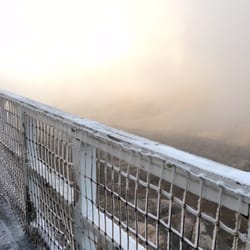
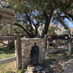
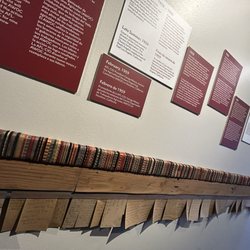
This historical landmark records one of the worst oil blows in American history. The impact of the blowout (not the kind you get at the salon) can be seen in the landscape and is described on the info board. This blowout created a lake; there are pictures of folks canoeing through oil, about 9 million barrels of it when all was said and done. The remnants of the oil released over 100 years ago can still be seen. An important California historical monument. Free admission and parking. read more


More info about Lakeview Gusher


Lakeview Gusher - landmarks - Updated July 2026
Best of Maricopa
People found Lakeview Gusher by searching for…
Fun Things to Do in Maricopa, California
Night View in Maricopa, California
Free Parking in Maricopa, California
Field Trips in Maricopa, California
Scenic Overlook in Maricopa, California
Parking in Maricopa, California
Places to Take Pictures in Maricopa, California
Tourist Attractions in Maricopa, California
Sightseeing in Maricopa, California
Attractions in Maricopa, California
Photo Spots in Maricopa, California
Public Services & Government in Maricopa, California
Landmarks in Maricopa, California
Abandoned Buildings in Maricopa, California
Historical Sites in Maricopa, California
Records in Maricopa, California
Scenic Views in Maricopa, California
Free Things to Do in Maricopa, California
Museums in Maricopa, California
Things to Do With Kids in Maricopa, California
Chapel in Maricopa, California
Browse Nearby
BEST of Maricopa, California Things to Do near Lakeview Gusher
BEST of Maricopa, California Restaurants near Lakeview Gusher
BEST of Maricopa, California Coffee near Lakeview Gusher
BEST of Maricopa, California Museums near Lakeview Gusher
BEST of Maricopa, California Hotels near Lakeview Gusher
BEST of Maricopa, California Photo Spots near Lakeview Gusher
BEST of Maricopa, California Breakfast near Lakeview Gusher
BEST of Maricopa, California Campgrounds near Lakeview Gusher
Browse Brands
Trending Searches in Maricopa, CA
Browse Articles
People who viewed Lakeview Gusher also viewed
Wilson branch Kern County Library
5 reviews
Taft Branch Kern County Library
3 reviews
Kern County Library - Lamont Branch
1 review
Pine Mountain Club
22 reviews
CHP Office
4 reviews
U.S. Army Bakersfield West Recruiting Station
1 review
Carrizo Plain National Monument
76 reviews
Mount Pinos Nordic Base
4 reviews
United States Government
2 reviews
Maricopa Police Department
5 reviews