Lakes Trail To Watchtower Photos


You might also consider
More like Lakes Trail To Watchtower
Recommended Reviews - Lakes Trail To Watchtower
Start your review...

11 years ago
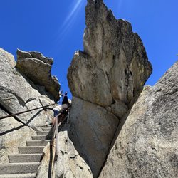
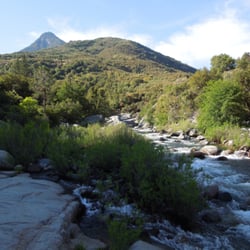
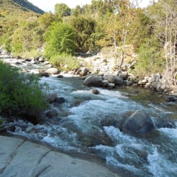
This hike is stunning. We started off from Lodgepole campground spent a few miles climbing through the forest. It is a strenuous hike but when you get to the treeline you are at the Watchtower which is a massive rock face above a sheer drop into a valley. You then can take a trail along the edge of the cliff to several alpine lakes. We went to heather lake - you can swim and chill out there or hike on to two more lakes. We only went to the first one and then headed back- we were pretty wiped. It's a long day but so worth it. read more


More info about Lakes Trail To Watchtower
Sequoia National Park
CA, CA
Directions
Hours
Outdoor Amenities


Lakes Trail To Watchtower - hiking - Updated May 2026
Best of CA
People found Lakes Trail To Watchtower by searching for…
Browse Nearby
BEST of CA, California Restaurants near Lakes Trail To Watchtower
BEST of CA, California Coffee near Lakes Trail To Watchtower
BEST of CA, California Parks near Lakes Trail To Watchtower
BEST of CA, California Campgrounds near Lakes Trail To Watchtower
BEST of CA, California Breakfast near Lakes Trail To Watchtower
BEST of CA, California Hotels near Lakes Trail To Watchtower