Cancel

    Open app

    Search

    Lake Hartwell State Park

    4.1 (8 reviews)
    Closed 9:00 am - 5:00 pm

    Lake Hartwell State Park Photos

    More like Lake Hartwell State Park

    Recommended Reviews - Lake Hartwell State Park

    Your trust is our priority, so businesses can't pay to alter or remove their reviews. Learn more about reviews.
    Yelp app icon
    Browse more easily on the app
    Review Feed Illustration

    Reviews With Photos

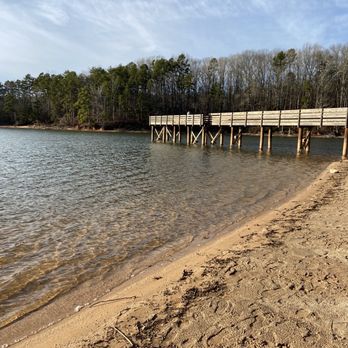
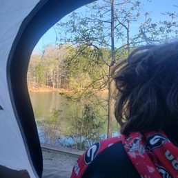
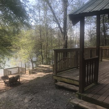
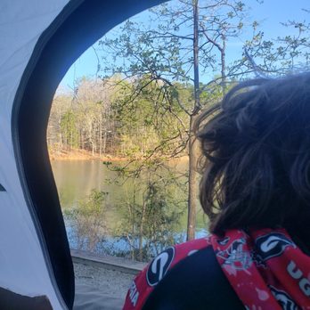
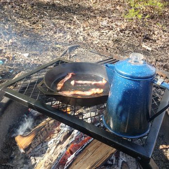
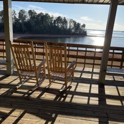
    1st time tent camping at Lake Hartwell- campsite T13. Love the raised platform for your tent overlooking the lake. Can literally walk out of your tent and fish. However, the rest of the campsite is rough- terrible incline. Everything slides off the picnic table, fire pit too far from the fire, pans placed on the grill are not flat/even due to incline, can easily fall over in your chair. The other 4 sites there are not much better. Beautiful views and location, just needs to be more even. Next time we will try the very first tent site in that row or T9.

    Ashton M.

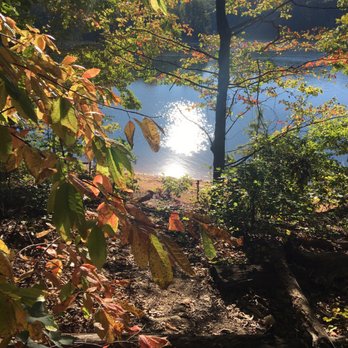
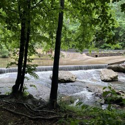
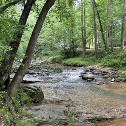
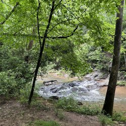
    Beautiful park with clean bathrooms. I came here for a little bit of day hiking. The park and lakes were beautiful, but next time I will bring a boat! My dog enjoyed the trails and lake scenery.

    See all

    5 years ago

    Helpful 1
    Thanks 0
    Love this 0
    Oh no 0

    4 years ago

    Helpful 0
    Thanks 0
    Love this 0
    Oh no 0
    Photo of Ann H.
    1
    26
    6

    3 years ago

    Helpful 1
    Thanks 0
    Love this 1
    Oh no 0

    4 years ago

    Helpful 0
    Thanks 0
    Love this 0
    Oh no 0

    7 years ago

    Helpful 1
    Thanks 0
    Love this 0
    Oh no 0

    14 years ago

    Helpful 1
    Thanks 0
    Love this 0
    Oh no 0

    10 years ago

    Helpful 1
    Thanks 0
    Love this 1
    Oh no 0

    10 years ago

    Helpful 1
    Thanks 0
    Love this 1
    Oh no 0

    Ask the Community - Lake Hartwell State Park

    Verify this business for free

    People searched for Parks 172 times last month within 15 miles of this business.

    Verify this business

    Tugaloo State Park - Rocks on the trail

    Tugaloo State Park

    4.6(26 reviews)
    1.8 mi

    Great State Park campground! Georgia has yet to disappoint on the state campground front. Enjoyed…read morethe camp site we selected, great view of the river and South Carolina shoreline. The main hiking trail, Sassafras Loop, is a good hike. The trail is well marked and has some nice variations in elevation. The park staff was super friendly and very knowledgeable.

    Tugaloo State Park-Georgia…read more A large state park near Lavonia and Toccoa, Georgia off of I-85. Pronounced "Two-ga-low" according to locals we asked. Located on Lake Hartwell, this state park features 105 campsites and 4 bath houses. Cottages and yurts are also available to rent. All rv sites are well shaded and many have nice lake views. Each site has water, electric and cable tv hookups(although our cable hookup did not work). No sewer hookups but there is a double lane dump station near the campground entrance. The park staff we met were friendly and helpful. The park has a rec area with a swimming beach, a mini-golf course, tennis courts and several picnic shelters. There are two boat ramps in the park but we saw many people just beaching their canoes and kayaks on the shore behind their campsites. We also saw people fishing from the shore and from boats. We were in site 7, a lakeside pull through. The gravel drive was sloped some but relatively level midway in where we set up. The pad area with the fire pit and grill and large table was somewhat smaller than we have found in other Georgia state parks, but it was just a few steps down an incline from our back door to the lakeshore. This was a pretty quiet park but the low rumble from I-85 could be heard from across the lake from where we were. There were a few hiking trails but bikes were not permitted on the ones we saw. However, the paved roads inside the park made for nice e-biking. Toccoa is about a 20 minute drive. It is a nice small town and has just about anything you might need(groceries, pharmacies, restaurants, a WalMart, etc.). Lavonia is a bit smaller town but its also a bit nearer to the park. went into Toccoa and toured the Currahee WWII Museum downtown. Toccoa and nearby Mount Currahee were the home of the 101st Airborne Division's training operations during WWII. There are also some waterfalls in that area but we did not get to visit those. Should you go into Toccoa, if you enjoy country cooking, don't miss the M&J Home Cooking Country Buffet for tasty lunch or dinner. The weather was great when we were there in mid-October and the public areas in the park were not crowded at all.

    Photos
    Tugaloo State Park
    Tugaloo State Park
    Tugaloo State Park

    See all

    Riley Moore Falls

    Riley Moore Falls

    5.0(4 reviews)
    19.0 mi

    This is the best waterfall we got to visit in SC this far. After we left Reedy Branch Falls we…read moredrove here. Well, as close as we could get. I didn't realize that we couldn't drive all the way to the trailhead so we had a long hike in store due to me having to carry my toddler most of the time. I should have re-read the previous reviews before coming. My friend did help me carry her as well and for that I was very thankful. So definitely don't recommend this hike with a little one unless strapped in a carrier. Also, I don't recommend it for the elderly either. It's definitely a wilderness hike deal with roots and elevation change. In fact, it's mostly downhill on the way to the falls, but on the way back it's pretty much all uphill, which was not fun with aforementioned young child. It's about a half mile to the actual trailhead and then another 0.7 mile to the falls. That's about 2.4 miles round trip. The reason of course that my boys absolutely became enamored with this place is the large swimming hole. It is wonderful and has plenty of space. The waterfall itself is beautiful and although it's not as tall as others, its width is quite impressive. I was trying to get as close as I could and even noticed a hidden part of the falls inside of the rock structure. That was so cool!! The sand at the base and shore give it a beachy vibe. We definitely packed it in and out making sure not to leave anything behind as to preserve the area as best as possible. Needless to say we were wiped by the time we made it back to our vehicles, but we're still glad we decided to venture here. Coming back with my hubby and boys in the very near future. Happy yelping!

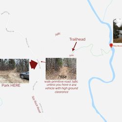
    I just wanted to update my 3/15/20 review below to add I've now done this hike several times, but…read moreTHIS time I had the chance to hike it with a friend who is directly related to the namesake of the waterfall... Riley Moore. Sandie is a church friend of mine and Riley Moore was her Great Great Uncle (I believe that's right). He once upon a time operated a grist mill here at the top of the falls. She's been trying to get here to see the waterfall, but couldn't find it and wanted to join us (along with her family) since I knew the way. Upon further research I discovered there are actually still remnants of the mill including visible drill holes, spikes and bolts. Thought that was pretty cool info to share! [ [ [ PREVIOUS REVIEW ] ] ] Riley Moore Falls is small in height but HUGE in personality. It's located off State Road S37-748, which is a nicely maintained gravel road where cars and trucks alike can comfortably traverse. ~~~ DIRECTIONS From Westminster, SC - DO NOT turn onto Cobb Bridge Road from Long Creek Hwy (Hwy 76) where you will see the brown & white sign pointing you in the direction of Riley Moore Falls. Our GPS had us go this way, then left onto State Road S37-748, but the road was CLOSED during our visit! INSTEAD, turn onto PU-32 also known as Rocky Fork Road. Turn left onto a gravel road near Rocky Fork Baptist Church and follow that until it dead ends @ State Road S37-748 (also known as Spy Rock Road). Turn right and drive approx. 1.4 miles (4 minutes) to 748c (aka Riley Moore Shoals Road). Park at the intersection of State Road S37-748 and 748c. DO NOT ATTEMPT TO DRIVE 748c in a car or minivan. Low clearance vehicles will find the terrain on this road to be VERY difficult to navigate without bottoming out or getting stuck. I'd also recommend 4x4 capability on wet days! There can be several deep-pocketed muddy areas after heavy rains. ~~~ THE TRAIL Once you reach the intersection of Spy Rock Rd (S37-748) and 748c, park roadside on Spy Rock, secure your vehicle and begin your hike approx. 1/2 mile down the "primitive road." IF you have a high ground clearance SUV or truck, you can drive the primitive road another half mile or so to a second parking area near the trailhead. The primitive road is VERY BUMPY  and can be muddy in spots after heavy rains, so a 4x4 is best. After reaching the second parking area, follow the marked trail on the left!!! The trail is a little over a 1/2 mile to the falls from here. The trail is fairly straightforward and easy to follow. ~~~ THE FALLS Once you reach the Chauga River, you will notice a large sandy area with plenty of room for an entire horde of hikers!!! Riley Moore Falls is not very tall (only about 12 feet), but it is very wide and has a deep base pool. PRO TIP - Bring swimwear, towels and a picnic, but be sure to pack it in and pack it out. ~~~ THINGS TO KNOW Hiking Distance: 2 miles (round trip to falls from S37-748) Difficulty of hiking 748c: All downhill to trailhead (moderate return) Difficulty of hiking trail to falls: EASY Creek Crossings: NO Elevation Gain: 357 feet Waterfall Height: Approx 12 feet Access to top of falls: NO - not without getting wet Access to base of falls: YES Pool of water @ base of Falls: YES Sitting areas @ base: YES + sandy beach RESTROOMS: NO PARKING: YES (along road) + secondary parking area closer to trailhead for trucks and high ground clearance vehicles with room for about 6 cars. ~~~ [ FINAL THOUGHTS ] A lovely waterfall in any season, but also a great spot for a summer swim. While we had the waterfall practically to ourselves during our Mid-March expedition, be advised other trail website reviews say it gets trashy & crowded in summer months. What a shame if that is true because it truly is a treasure. ENJOY! 2022 / 74 #UPDATE 178

    Photos
    Riley Moore Falls
    Riley Moore Falls - CREATED FROM GOOGLE MAPS

    CREATED FROM GOOGLE MAPS

    Riley Moore Falls

    See all

    Tallulah Gorge State Park

    Tallulah Gorge State Park

    4.5(209 reviews)
    26.9 mi

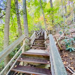
    Tallulah Gorge State Park is a 2,689-acre Georgia state park adjacent to Tallulah Falls, Georgia,…read morealong the county line between Rabun and Habersham Counties. The park surrounds Tallulah Gorge, a 1,000-foot deep gorge formed by the action of the Tallulah River, which runs along the floor of the gorge. Service options here are picnic tables available, has barbecue grill and it's dogs friendly. One of the most spectacular canyons in the eastern U.S., Tallulah Gorge is two miles long and nearly 1,000 feet deep. Visitors can hike rim trails to several overlooks, or they can obtain a permit to hike to the gorge floor (100 per day, not available during water releases). A suspension bridge sways 80 feet above the rocky bottom, providing spectacular views of the river and waterfalls. $5 parking fee or an Annual ParkPass is required for each vehicle. The park offers a range of trails, from easy rim walks to the more challenging trek down into the gorge floor. Permits are required for gorge floor access, but the effort is well worth it as you can get up close to the waterfalls, including the famous Hurricane Falls. Approximately 2 miles, round-trip Mulched with metal stairs, Rated difficult. This trail has a total of 1,099 stairs (including staircase to gorge floor). Please do not attempt this trail if you have any known health condition. The North and South Rim Trails consist of 3 miles round- trip which will take approximately 2 hours to hike. It is a mulched trail with exposed roots that is a leisurely walk. From the Interpretive Center there is a recycled rubber tire trail that accesses Overlooks 2 and 3. Overall had a great experience.

    The visitor center is phenomenal! Movie was down for some reason. The gift shop has loads to choose…read morefrom and the rest rooms were clean and there were many stalls available. There is almost a museum quality to the taxidermy animal scene they have in the middle of the room and along the walls. Truly a special visit! The hike to see the inspirational point and the swinging bridge wasn't too strenuous for my 4 or 5 year old for people's reference when considering it. We are an active family who hikes etc. There were a lot of warnings but we found it wasn't as bad as it seemed.

    Photos
    Tallulah Gorge State Park
    Tallulah Gorge State Park - 10.22 towards the S Rim 568 stairs up

    10.22 towards the S Rim 568 stairs up

    Tallulah Gorge State Park

    See all

    Brasstown Falls

    Brasstown Falls

    4.8(4 reviews)
    21.8 mi

    Beautiful waterfalls for just a short hike** from the parking lot. Has 3 sections,…read moreCascades/Veil/Sluice, the Cascades is the first one to get to and the easiest. The Veil section is probably my favorite part, it's a picture I see when someone mentions "waterfalls". I didn't hike down to the Sluice section as it didn't seem worth the effort after seeing the Cascades and Veil sections. ** excerpt from Richard R's amazingly detailed review and great tips "The hike is short to the first section of the falls known as "The Cascades." This is a highly appropriate name since this section really is more of a series of cascades than a waterfall. On the day of my visit, there had been several days of rain making the trail extremely muddy, but also making the falls extremely full! The flow was so strong that it was hard to see where the Cascades separated from the second section known as The Veil. You reach 'The Cascades' by following the trail on the right after the information board. You will go uphill slightly before making your descent down to the cascades. You will hear the falls long before you reach them. The downhill trail to the cascades is relatively easy, but it gets far more difficult when you continue downhill to see the two lower sections. NOTES: This is a class three hike, meaning you will need both hands to navigate the steepness of the trail. I HIGHLY RECOMMEND good hiking boots and a backpack for any camera, phone or other items you might carry in your hand. You will definitely need both hands to hold on to branches, tree roots or whatever you can find. * SCOUTING TIP - It is better to take the higher routes as you navigate your way to the lower falls. * SCOUTING TIP 2 - This trail IS NOT suitable for young children or anyone who doesn't have sure balance. Your legs, knees and upper body will be heavily used! * SCOUTING TIP 3 - DO NOT bring a walking stick. Again, you will need both hands to navigate this trail safely. I personally did not see the advantage to hiking down to the base of the second section known as 'The Veil'. However, if you are feeling adventurous, you can actually walk behind this section of the falls on low flow days. The trickiest part of the trail is finding your way to the base of 'The Sluice' section. At first I considered forgoing the hike since it was rather steep, but another hiker on his way up showed me pics on his camera that convinced me to continue. There is also a downed log you can use as a bridge to balance across to the other side for an even closer view of this third section of the falls, which looks a lot like a powerful water slide." https://www.yelp.com/biz/brasstown-falls-long-creek?hrid=Weq_6ZUYbqLd0Ao6QafbDg&utm_campaign=www_review_share_popup&utm_medium=copy_link&utm_source=(direct)

    This was well-worth the drive from Columbia, SC. The hike wasn't that long. There were some stairs…read morethat were pretty steep but hand rails were available. Absolutely Stunning views.

    Photos
    Brasstown Falls
    Brasstown Falls - Waterfalls

    Waterfalls

    Brasstown Falls

    See all

    Falls Park

    Falls Park

    4.8(277 reviews)
    43.3 mi

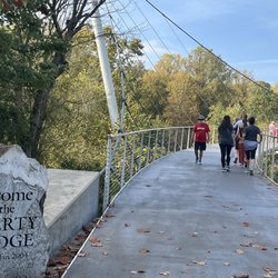
    Spending time along the Reedy River in Greenville is such a special experience. There are several…read morebeautiful spots to sit and relax, especially near the Grand Bohemian Lodge Greenville, and the bridge is a wonderful place to stroll while enjoying the soothing sound of the river and waterfall. What makes it even more meaningful is the history behind it. Beginning in the late 1700s, water-powered industries clustered along the Reedy River, including trading posts, grist and corn mills, a sawmill, an ironworks, the Gower, Cox and Markley Coach Factory, a paper-making factory, and an armory. A century later, textile and apparel mills were established along its banks. Unfortunately, the mills discharged waste and excess dyes into the river, and the Reedy began to suffer from the spoils of progress. By the mid-20th century, downtown Greenville's stretch of the river was so severely polluted by upstream textile mills that the once pristine and popular falls became desolate and unsafe. Seeing how beautiful and vibrant the area is today makes you truly appreciate the restoration and revitalization efforts. It's peaceful, scenic, and rich with history -- definitely a must-visit when you're in Greenville. Cheers!

    Walking through Falls Park was an amazing experience. The sweet sounds of the waterfalls was very…read morenice especially right in the heart down town Greenville. I enjoyed walking on the suspension bridge overlooking sites.

    Photos
    Falls Park
    Falls Park
    Falls Park

    See all

    South Carolina Botanical Garden

    South Carolina Botanical Garden

    4.5(36 reviews)
    17.2 mi

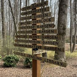
    Tucked away off the campus of Clemson on a vast plot of land is the South Carolina Botanical…read moreGardens. Like some other college-affiliated gardens, this one is free of charge to all visitors. It's a bit tough to get your bearings at first since the property is really spread out, and requires quite a bit of driving to get from place to place, where first time visitors (like me) are sure to get lost along the way, even with a map of the property. I recommend starting your visit with the visitors center, carriage house, and geology museum, which are adjacent to the desert and Jurassic gardens. I tried to get intel on best places to see blooms at the visitors center, but staff weren't overly helpful in assisting where to explore, so I basically grabbed the map and drove off meandering around the back roads, winding up at the Hanover House (super friendly staff here) and the Caboose and President's gardens (some blooms in this area). Despite feeling a bit lost while exploring and encountering very few blooms, I did overall enjoy my visit to the South Carolina Botanical Gardens. I would rate it as a 3.5 out of 5 experience overall, as much of the land on property seemed not to serve much of a purpose, and you really have to spend time exploring (and getting lost) to find interesting blooms.

    I took my 88 yr old neighbor with me. We walked around the circle near the bell. Just so special…read moreand peaceful.

    Photos
    South Carolina Botanical Garden
    South Carolina Botanical Garden - Side

    Side

    South Carolina Botanical Garden

    See all

    Lake Hartwell State Park - parks - Updated May 2026
    Loading...
    Loading...
    Loading...