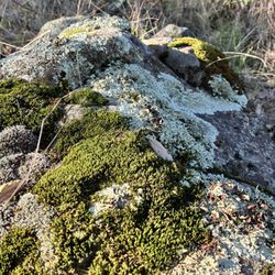
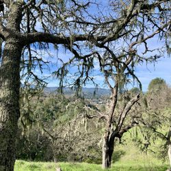
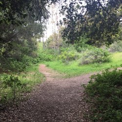
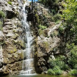
Jim Green Trail Photos

 - Hiking Near Me")


You might also consider
More like Jim Green Trail
Recommended Reviews - Jim Green Trail
Start your review...

4 years ago
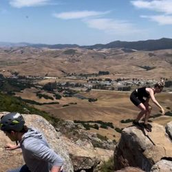
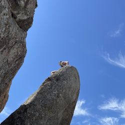
We liked it well enough! Friendly people along the way, great view at the top, steeper hills to hike up...super cute kid tree that Invites children to exchange toys and gifts during their visit. Different than that of 3 bridges in North County, we find that decent hiking trails don't really exist unless you're willing to drive more toward the coast. This happens to fall very conveniently in the backside of Atascadero. One of our fellow hikers mentioned the morning time is a lot more "crisp" and I could see that... ...It's Shaded very nicely amongst the trees which, it did happen to be a triple digit day in the area so we didn't overheat. Rattlesnakes tend to freak me out... We were told there hasn't been a spotting but there is a warning amongst the entry of the path by the train tracks. I always say continue to be aware in the dry grassy plains next to the wood piles. It is rather annoying to run into dog dumpings as you hike, especially when you're not a dog owner but if you are a dog owner, then taking your doggo is a great idea! read more


3 years ago
8 years ago
5 years ago
A good trail for exercise minded old folks like me. I take a snack and stop at the bench near the top to bask in the view for a few minutes. Trail is well kept and easy. Stay to the right at the beginning of the loop for a gentler assent. Take some pictures. read more

More info about Jim Green Trail
Atascadero, CA 93422
Directions
Hours
Outdoor Amenities


Jim Green Trail - hiking - Updated May 2026
Best of Atascadero
People found Jim Green Trail by searching for…
Things to Do in Atascadero, CA
Hiking Trails in Atascadero, CA
Places to Take Pictures in Atascadero, CA
Running Trails in Atascadero, CA
Walking Trails in Atascadero, CA
Dog Friendly Hiking Trails in Atascadero, CA
Waterfall Hike in Atascadero, CA
Stroller Friendly Hikes in Atascadero, CA
Tourist Attractions in Atascadero, CA
Restaurants With a View in Atascadero, CA
Hiking With Kids in Atascadero, CA
Things to Do at Night in Atascadero, CA
Fun Things to Do With Kids in Atascadero, CA
Scenic Overlook in Atascadero, CA
Romantic Views in Atascadero, CA
Trending Searches in Atascadero, CA
Boat Rental near Jim Green Trail
Botanical Gardens near Jim Green Trail
Bounce House Rentals near Jim Green Trail
Campgrounds near Jim Green Trail
Cherry Picking near Jim Green Trail
Cliff Jumping near Jim Green Trail
Dog Friendly Things To Do near Jim Green Trail
Flower Fields near Jim Green Trail
Flower Shop near Jim Green Trail
Garage Sales near Jim Green Trail
Nurseries & Gardening near Jim Green Trail
Outdoor Activities near Jim Green Trail
Outdoor Furniture Stores near Jim Green Trail
Party Equipment Rentals near Jim Green Trail
Pick Your Own Farms near Jim Green Trail
Picnic Areas near Jim Green Trail
Places To Take Pictures near Jim Green Trail
Rock Quarry near Jim Green Trail
Running Trails near Jim Green Trail
Scenic Drive near Jim Green Trail
Secret Spots near Jim Green Trail
Strawberry Picking near Jim Green Trail
Sunrise View near Jim Green Trail
Swimming Holes near Jim Green Trail
Table And Chair Rentals near Jim Green Trail
Browse Articles
Browse Nearby
BEST of Atascadero, California Coffee near Jim Green Trail
BEST of Atascadero, California Restaurants near Jim Green Trail
BEST of Atascadero, California Things to Do near Jim Green Trail
BEST of Atascadero, California Walking Trails near Jim Green Trail
BEST of Atascadero, California Breakfast near Jim Green Trail
BEST of Atascadero, California Parks near Jim Green Trail
BEST of Atascadero, California Campgrounds near Jim Green Trail
BEST of Atascadero, California Hotels near Jim Green Trail
BEST of Atascadero, California Day Trips near Jim Green Trail
Browse Brands
Related Searches in Atascadero, CA
Affordable Kayak Rental Services in Atascadero, California
Best Fishing Locations and Guides in Atascadero, California
Best Places for Horseback Riding in Atascadero, California
Best Places for Stunning Views in Atascadero, California
Check Out Off Road Trails in Atascadero, California
Discover Scenic Mountain Bike Trails Near Atascadero, California
Discover Scenic Waterfall Spots in Atascadero, California
Discover Top State Parks to Visit in Atascadero, California
Discover a Hiking Trail in Atascadero, California
Discover the Best Night Hike Trails in Atascadero, California
Dog-Friendly Hikes With Dogs in Atascadero, California
Enjoy Camping Adventures Around Atascadero, California
Enjoy Exciting Mountain Biking Adventures in Atascadero, California
Enjoy Kayaking Adventures in Atascadero, California
Enjoy Tent Camping Spots Around Atascadero, California
Enjoy a Beautiful Waterfall Hike in Atascadero, California
Enjoy the Best Picnic Spots and Ideas in Atascadero, California
Enjoy the Best Walking Trails in Atascadero, California
Explore Beautiful Parks and Green Spaces in Atascadero, California
Explore Easy Hikes Perfect for All in Atascadero, California
Explore Fun Activities to Do in Atascadero, California
Explore Popular Campgrounds Near Atascadero, California
Explore Top Dog Parks in Atascadero, California Near You
Explore the Best Beach Spots in Atascadero, California
Explore the Best Boating Spots in Atascadero, California
Explore the Best Trail Options in Atascadero, California
Family Friendly Hiking With Kids in Atascadero, California
Find Beautiful Views in Atascadero, California
Find Fun Kids Activities Outdoor in Atascadero, California
Find Parks and Recreation Activities in Atascadero, California
Find Popular Ziplining Spots Around Atascadero, California
Find the Best Parks for Picnics in Atascadero, California
Find the Best Playgrounds to Visit in Atascadero, California
Find the Best Scenic View Locations in Atascadero, California
Great Places to Walk in Atascadero, California
Hiking Trails With Waterfalls in Atascadero, California
Off Leash Dog Hiking Trails in Atascadero, California
Plan a Scenic Drive Route Near Atascadero, California
Popular Outdoor Activities to Try in Atascadero, California
Popular Picnic Spots to Visit in Atascadero, California
Popular Things to Do in Atascadero, California
Safe River Swimming Areas in Atascadero, California
Safe and Fun Parks for Kids in Atascadero, California
Top Places for Snorkeling in Atascadero, California
Top Playgrounds for Kids to Enjoy in Atascadero, California
Top Running Trails to Explore in Atascadero, California
Top Swimming Lakes to Enjoy in Atascadero, California
Top Swimming Spots and Pools in Atascadero, California