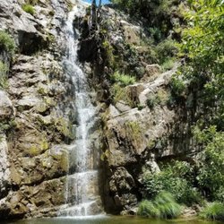
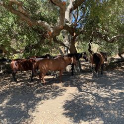
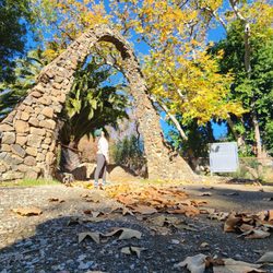
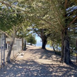
Bishop Peak Photos


You might also consider
More like Bishop Peak
Recommended Reviews - Bishop Peak
Start your review...

Reviews With Photos

This was a tough but rewarding hike. I went with a group of friends and it was so much fun. I was able to climb to the peak of the rock. It was a little over 4 miles round trip and we started from the trailhead at Patricia Dr. Bring good grip shoes,their is lots of rocks and borders especially of you plan to climb to the peak.

Great autumn hike with family and our dog. We parked on Patricia and it was about 4 miles total with over 1,000 feet of climbing. It was harder than I thought based on the reviews here but we had no issues - but we hike a lot. Lot of rock hopping at the top but nothing too tricky. Our medium dog needed a hand on a few of them. I would've worn hiking shoes instead of trail runners because a little stiffer shoe would've been nice on all those rocks. It's mostly exposed with little shade through most of the climb. We went through plenty of water even though it was only in the 70s and we started around 8 am. Lots of dogs on the trail, mostly unleashed but well behaved.

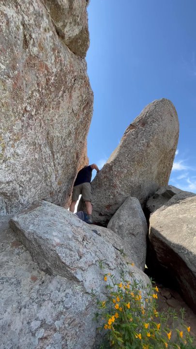
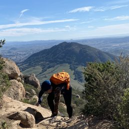
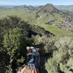
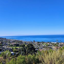
Bishop Peak is the tallest of the Nine Sisters. Once you reach to the top, a 360-degree view of the area is amazing from the summit. There is a vast view from Islay Hill in Edna Valley to Morro Rock. It's a moderate hike- easy to a bit difficult. The steep climb from the Foothill trailhead to the main trail will last for about a mile at the beginning. It's about 4 miles round trip. Once on the main trail, it levels off a bit, but it's still a serious climb to the top. There's one bench near the top and gathering area just below the summit. If you are up for an adventure, you must have the best views, then climb like a spider over a handful of large boulders to reach the summit. The spectacular view is totally worth all the hard work so bring some treats to reward yourself. I enjoyed the hike and love the view. Highly recommend it!

This review is for Bishop Peak Trail from Highland Drive Trailhead which was a ~3.3 miles round trip that took ~2 hour to complete. Steady inclines to the peak with nice views of the surroundings of San Luis Obispo. Trail becomes narrow as you climb towards the peak. Some parts of the trail were rocky. Limited parking spots on the side of the street. Short video of the hike for those interested! https://youtu.be/L80lgBfb584

I have hiked Bishop peak 10+ times throughout my time attending Cal Poly and my yearly visits to relive the great times in SLO. If you are in the area and are thinking of hiking or just trying to find something to pass the time, then look no further, hiking Bishop Peak is the answer! Difficulty - The hike isn't too long (around 3.5 miles out and back), but get ready to hike at a decent elevation. I would rate this as a moderate-level hike. Expectations: -Great Views at the top -A lot of sun on the side of the mountain -A cool rock climbing-esque section at the top to get on top of the peak Watching the sunrise while at the top is a great experience!

Have hiked this peak 2x and both times it's probably one of the best views, best workouts, and best hikes out there in SLO. Pros: - Great view at the top - especially if you're ok with climbing rocks a little more risky. Actually great view throughout the hike even - KILLER workout - you will be sore the next day! - Lots of green along the way - Clear trail, nothing ambiguous - Close to downtown - Easy parking in the residential area at the trailhead - Much of the trail is shaded! Still besti n the early morning though Cons: - gets super crowded at the top, so not as romantic as you would hope haha. Also just be safe and careful! There is a very sad sign along the trail about a college student who passed away after falling from the mountain a decade or so ago.

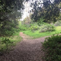
We really enjoy the central coast of California. One of our favorite get aways is the town of San Luis Obispo. We visited this summer and this time we made sure to complete a couple of hike's in the area. We got up fairly early for this hike and found our way to it's beginning point at Highland Drive. This is a residential area but there is plenty of parking along the street. Be sure to not park/ block people's driveways. Bishop Peak is the tallest peak of the nine sisters. It gets its name from the summit looking like a bishops miter. The summit is 1,559 feet and the views at the top are panoramic. Total mileage for the hike is 3.5 miles and elevation gain is 950 feet. We headed up the trail and passed through an oak forrest and a cattle pond. Once you are past this point, the climb continues through another forrest filled with more bay and oak trees giving you a nice break from the sun. The hike wraps around the mountain which provides you better and better views as you climb. Be aware that you are completely exposed to the sun for the remainder of the hike. Before you know it, you have made it to the top, but not without some hard work and effort. We were definitely sweating since it was August and the hike is challenging at the end. At the top, everywhere you looks is a gorgeous sight and we were able to see all over SLO, Cal Poly campus, Lake Laguna, and the Santa Lucia mountains. There are a couple of benches to sit at or you can continue to scramble around the rocks for better views. This was definitely one of the best hikes I completed in 2019 and I would say do it and enjoy! I would recommend completing on a weekday for less crowds.


This hike was more of spontaneous decision! We weren't so sure how this hike was going to be and I definitely enjoyed it! On the California hiking list it's deemed as moderate and it sure is! If you have a bad knee it's a lot of stepping up going up and then a lot of impact on the knee going down. So just be careful! We definitely enjoyed the bottom part where the trees are located it was such a nice area to walk at. When you get to the top there's a lot of area where you need to climb or shimmying yourself to climb. Be careful if you're afraid of heights. Unfortunately we did not get far along as my other half has a fear of heights. Next time! Would definitely recommend this for visitors who are avid hikers!

Came here for the first time and was amazed by the surrounding beauty of SLO! Bishop Peak has always been on my bucket list of hikes, especially after having lived in the Central Coast. Finally got to do it and it was well worth the 2 or so hours back and forth. My friend and I took the Highland Drive trail entrance, which was a good starting point as it wasn't too steep. Also, parking can be found in the nearby neighborhood, albeit somewhat limited closer to the trailhead. My friend and I had to park quite a way's away from the trailhead, which was quite a steep incline -- more steep than the actual trail in my opinion! As you ascend Bishop Peak, you'll be simply amazed the the lush greenness and rolling fields that surrounds the peak. For us, the greenness was more apparent at the bottom of the peak as it was a cloudy day. Higher up, we couldn't see much of the landscape. It took my friend and a little over an hour to get to the summit. The trail up to the summit in general is relatively flat between switchbacks, although parts are rocky. On a wet day, the rocks could be slippery! At the summit, you'll be greeted by a bench that says it's the end of the trail. But as we humans are curious, most folk went beyond the bench to explore the awesome rocks and boulders. It can be a little precarious navigating the rocks and boulders. I had a hard time figuring out the best path to traverse, but eventually I found a safe way up and down some of the boulders. It was scarier coming down from the rocks than going up. I'd say it's relatively safe up on top given that many Cal Poly students hang out up on the uppermost rocks/boulders. My best advice? Be careful (and have fun!). While the weather wasn't the best (it was cloudy) on my hike up Bishop Peak, I still got some glimpses of some amazing views from time to time. It was probably a blessing in disguise as it wasn't too hot with the sun's heat being shielded by the clouds. I would like to come back on a sunny day and enjoy some of those beautiful views up on top. 5 stars!

This place provides the best views of the SLO landscape and is probably mentioned on every single SLO blog out there. We followed the map on AllTrails and were able to complete the hike within 2 hours..It's worth calling out that the hike gains an elevation of 1100 ft over 2 miles but is entirely doable with a good pair of hiking shoes.. The latter part of the hike needs you to go through a paved path on boulders

Fantastic hike! Parked by the Highland entrance, took the Summit Trail. Started the incline in the shade but eventually broke away to open sunlight so might want to bring the sunscreen. The trail was great, big rocks making it fun to hop from and narrow pathways at times. Wasn't too crowded, got passed by some joggers. Loved the end where you had to actually climb the rocks to make it to the very top but definitely not for everyone (sorry to my gf, had to leave her behind at tht point). What an amazing 360 view of SLO. Little tricky climbing down back to the benches so to take your time/recommend shoes with good traction. Overall, great hike, will do again.

2 years ago
We parked on a residental street on cul-de-sac off of Highland. Trail started off nice flat for maybe 10 minutes then it splits. Their are signs posted throughout the trail. This trail was at an incline. Small pockets of flat trail and backup climbing. I asked another hiker if trails meet together, and yes. However, they do, but their are several areas to enter/exist out of the trail. We learned that we existed out of the wrong area and asked these group of high schoolers how to get to Highland. They all said they were not from the area. We asked handful of other hikers & same not from the area. So we ended up going back up the trail, and once on top of the trail, we turned Left. 30 minutes and we were at the area we started off. Trail is mod to difficult. Beautiful scenery. Highly recommend early in AM hrs.. Just know 1st time read the signs on the trail because if you dont you will end up like us existing on the wrong street. read more


10 months ago
Beautiful hike. The trail is steep but that affords you the opportunity to get over 1,000 in a short amount of time, for amazing views of SLO. This is a challenging but very doable hike. Highly recommend. read more


The hike for Bishop Peak came up on a lot of list I saw for things to do in SLO. It's a good mix of a scenic hike, that also has some challenging parts along the way so you're actually getting a good workout in for the day. The out and back trail we took got us around the 3.7 miles that the All Trails app list. , elevation gain was over 1,000 feet so there's a good amount of climbing. The closer you get to the peak there are a lot of rocks so bring good hiking shoes. A lot of this hike isn't covered so make sure to bring a hat and sunblock, especially the summers months like when I went in mid June. read more


This was a tough but rewarding hike. I went with a group of friends and it was so much fun. I was able to climb to the peak of the rock. It was a little over 4 miles round trip and we started from the trailhead at Patricia Dr. Bring good grip shoes,their is lots of rocks and borders especially of you plan to climb to the peak. read more


2 years ago
Great autumn hike with family and our dog. We parked on Patricia and it was about 4 miles total with over 1,000 feet of climbing. It was harder than I thought based on the reviews here but we had no issues - but we hike a lot. Lot of rock hopping at the top but nothing too tricky. Our medium dog needed a hand on a few of them. I would've worn hiking shoes instead of trail runners because a little stiffer shoe would've been nice on all those rocks. It's mostly exposed with little shade through most of the climb. We went through plenty of water even though it was only in the 70s and we started around 8 am. Lots of dogs on the trail, mostly unleashed but well behaved. read more


2 years ago
Bishop Peak is the tallest of the Nine Sisters. Once you reach to the top, a 360-degree view of the area is amazing from the summit. There is a vast view from Islay Hill in Edna Valley to Morro Rock. It's a moderate hike- easy to a bit difficult. The steep climb from the Foothill trailhead to the main trail will last for about a mile at the beginning. It's about 4 miles round trip. Once on the main trail, it levels off a bit, but it's still a serious climb to the top. There's one bench near the top and gathering area just below the summit. If you are up for an adventure, you must have the best views, then climb like a spider over a handful of large boulders to reach the summit. The spectacular view is totally worth all the hard work so bring some treats to reward yourself. I enjoyed the hike and love the view. Highly recommend it! read more


This review is for Bishop Peak Trail from Highland Drive Trailhead which was a ~3.3 miles round trip that took ~2 hour to complete. Steady inclines to the peak with nice views of the surroundings of San Luis Obispo. Trail becomes narrow as you climb towards the peak. Some parts of the trail were rocky. Limited parking spots on the side of the street. Short video of the hike for those interested! https://youtu.be/L80lgBfb584 read more


1 year ago
Great Rocky trail hike. Take plenty of water. 80% of the trail is in the sun. Great activity for the fam to do. read more


I have hiked Bishop peak 10+ times throughout my time attending Cal Poly and my yearly visits to relive the great times in SLO. If you are in the area and are thinking of hiking or just trying to find something to pass the time, then look no further, hiking Bishop Peak is the answer! Difficulty - The hike isn't too long (around 3.5 miles out and back), but get ready to hike at a decent elevation. I would rate this as a moderate-level hike. Expectations: -Great Views at the top -A lot of sun on the side of the mountain -A cool rock climbing-esque section at the top to get on top of the peak Watching the sunrise while at the top is a great experience! read more

Have hiked this peak 2x and both times it's probably one of the best views, best workouts, and best hikes out there in SLO. Pros: - Great view at the top - especially if you're ok with climbing rocks a little more risky. Actually great view throughout the hike even - KILLER workout - you will be sore the next day! - Lots of green along the way - Clear trail, nothing ambiguous - Close to downtown - Easy parking in the residential area at the trailhead - Much of the trail is shaded! Still besti n the early morning though Cons: - gets super crowded at the top, so not as romantic as you would hope haha. Also just be safe and careful! There is a very sad sign along the trail about a college student who passed away after falling from the mountain a decade or so ago. read more


We really enjoy the central coast of California. One of our favorite get aways is the town of San Luis Obispo. We visited this summer and this time we made sure to complete a couple of hike's in the area. We got up fairly early for this hike and found our way to it's beginning point at Highland Drive. This is a residential area but there is plenty of parking along the street. Be sure to not park/ block people's driveways. Bishop Peak is the tallest peak of the nine sisters. It gets its name from the summit looking like a bishops miter. The summit is 1,559 feet and the views at the top are panoramic. Total mileage for the hike is 3.5 miles and elevation gain is 950 feet. We headed up the trail and passed through an oak forrest and a cattle pond. Once you are past this point, the climb continues through another forrest filled with more bay and oak trees giving you a nice break from the sun. The hike wraps around the mountain which provides you better and better views as you climb. Be aware that you are completely exposed to the sun for the remainder of the hike. Before you know it, you have made it to the top, but not without some hard work and effort. We were definitely sweating since it was August and the hike is challenging at the end. At the top, everywhere you looks is a gorgeous sight and we were able to see all over SLO, Cal Poly campus, Lake Laguna, and the Santa Lucia mountains. There are a couple of benches to sit at or you can continue to scramble around the rocks for better views. This was definitely one of the best hikes I completed in 2019 and I would say do it and enjoy! I would recommend completing on a weekday for less crowds. read more


4 years ago
This was the second place I hiked in the area. A nice hike up with some spectacular views from the top. read more


This hike was more of spontaneous decision! We weren't so sure how this hike was going to be and I definitely enjoyed it! On the California hiking list it's deemed as moderate and it sure is! If you have a bad knee it's a lot of stepping up going up and then a lot of impact on the knee going down. So just be careful! We definitely enjoyed the bottom part where the trees are located it was such a nice area to walk at. When you get to the top there's a lot of area where you need to climb or shimmying yourself to climb. Be careful if you're afraid of heights. Unfortunately we did not get far along as my other half has a fear of heights. Next time! Would definitely recommend this for visitors who are avid hikers! read more


7 years ago
Came here for the first time and was amazed by the surrounding beauty of SLO! Bishop Peak has always been on my bucket list of hikes, especially after having lived in the Central Coast. Finally got to do it and it was well worth the 2 or so hours back and forth. My friend and I took the Highland Drive trail entrance, which was a good starting point as it wasn't too steep. Also, parking can be found in the nearby neighborhood, albeit somewhat limited closer to the trailhead. My friend and I had to park quite a way's away from the trailhead, which was quite a steep incline -- more steep than the actual trail in my opinion! As you ascend Bishop Peak, you'll be simply amazed the the lush greenness and rolling fields that surrounds the peak. For us, the greenness was more apparent at the bottom of the peak as it was a cloudy day. Higher up, we couldn't see much of the landscape. It took my friend and a little over an hour to get to the summit. The trail up to the summit in general is relatively flat between switchbacks, although parts are rocky. On a wet day, the rocks could be slippery! At the summit, you'll be greeted by a bench that says it's the end of the trail. But as we humans are curious, most folk went beyond the bench to explore the awesome rocks and boulders. It can be a little precarious navigating the rocks and boulders. I had a hard time figuring out the best path to traverse, but eventually I found a safe way up and down some of the boulders. It was scarier coming down from the rocks than going up. I'd say it's relatively safe up on top given that many Cal Poly students hang out up on the uppermost rocks/boulders. My best advice? Be careful (and have fun!). While the weather wasn't the best (it was cloudy) on my hike up Bishop Peak, I still got some glimpses of some amazing views from time to time. It was probably a blessing in disguise as it wasn't too hot with the sun's heat being shielded by the clouds. I would like to come back on a sunny day and enjoy some of those beautiful views up on top. 5 stars! read more


5 years ago
This place provides the best views of the SLO landscape and is probably mentioned on every single SLO blog out there. We followed the map on AllTrails and were able to complete the hike within 2 hours..It's worth calling out that the hike gains an elevation of 1100 ft over 2 miles but is entirely doable with a good pair of hiking shoes.. The latter part of the hike needs you to go through a paved path on boulders read more


Fantastic hike! Parked by the Highland entrance, took the Summit Trail. Started the incline in the shade but eventually broke away to open sunlight so might want to bring the sunscreen. The trail was great, big rocks making it fun to hop from and narrow pathways at times. Wasn't too crowded, got passed by some joggers. Loved the end where you had to actually climb the rocks to make it to the very top but definitely not for everyone (sorry to my gf, had to leave her behind at tht point). What an amazing 360 view of SLO. Little tricky climbing down back to the benches so to take your time/recommend shoes with good traction. Overall, great hike, will do again. read more

A must hike if you're in the SLO area! I've hiked it in all seasons of the year and I must say that the spring time is the best time to go. Besides the obvious that the weather is cooler, the rain really does it magic across all of SLO and you get this beautiful view of rolling green hills and wildflowers on the trail! There are two entrances, but I've only gone from Foothill. It's pretty steep in the beginning and then you sort of go on a rock climbing uphill trail, but when you submerge from that rocky trail, it's straight forward and sandy trails. There are a couple long switchbacks to this trail, but nothing that can't be hiked. At the top, there is a bench that says 'end of trail' but if you want to get the iconic view of looking down upon SLO, keep going up. There's a little bit of bouldering that you'll have to do to get up to the top. If you're afraid of heights, I would recommend that you take your time and have someone help pull you up to the top. The viewpoint is amazing, unlike anywhere else I've hiked and for only 4 miles, count me in! You can see from the north the Men's Colony to Cal Poly SLO to Madonna Peak across the street. The sights of the small town are endless. On the way back down, just follow the path you took to get up. Be careful of missing the turn back down because you may want to continue hiking down the sandy path, but to get back to Foothill, you have to turn and go down the steep rocks. Happy hiking! read more


6 years ago
Loved this hike! It had great views, lots of rocks/flowers/things to see such as people rock climbing and it surely gives you a workout. I'd say it's an intermediate hike. I saw a lot of kids and dogs but hard enough I wouldn't bring my mom or someone who does not hike. There's a bench at the top that says it's the end of the trail, best feeling! As other yelpers indicate, stay to the LEFT of the trail. We turned right at some point and hit an intersection towards the top that felt like a dead end and backed up a bit to stay to the left which was the right path. Took us about 3 hours roundtrip including a few stops to rest and take pics. It started as a chilly morning but I got so sunburned so make sure to bring water and sunblock! read more


4 years ago
9 years ago
I came here today for some much needed trail therapy. Going through some stressful times, and I needed a hike to clear my mind. I am very happy I chose to give Bishops peak a try. It was an excellent stress relief. To back track for a moment, I did a bit of research before I set out, and although the information I gathered said it would take 3 hrs, 2.5hrs up, and 0.5 hr down. This was not the case for my hike. It only took me 2 hrs with a 20 min stop at the top. The information I gathered also said it was a moderate challenge, and I would agree with that. I was very lucky to have come at this time of year (spring) as there was an amazing array of wild flowers that lined the trail. The trail and all around the property of this open space are very well taken care of! I couldn't have asked for a more perfect day! read more


9 years ago
I absolutely love this hiking trail. There area couple entrances to begin at but I would rate this hiking trail as a moderate hiking level. In the beginning the trail is pretty wide and not very steep with a few rocks to step over. However, as you hike up switch backs become present to help with the steepness. A large amount of rocks appear so be careful where you step if you have any lower extremity joint problems. In addition, the path narrows so be courteous to others and remember to step to the aside to allow others through the path when possible. I love this trail because of its location in San Luis Obispo. The air is always so clean and crisp and the people you meet along the way are always friendly. If you hike early enough (sunrise), you may find yourself above all the clouds which is an absolutely beautiful thing to experience. During the summer season, I recommend hiking earlier in the day since most of the trail does not offer much shade. If you enjoy rock climbing, there are a lot of opportunities to boulder or top rope towards the beginning of the hike. I have never tried it before but look forward to climbing sometime in the near future. Also, the trail is dog friendly as many people bring their pets up. :) read more


7 years ago
We tried this trail today and really enjoyed it! Apparently there are two sides to the peak, but we just followed the directions on yelp and it took us to the foothill side. I think this is a fairly challenging hike if you're not active. The climb up to the actual trail is very steep. You can do it! You might just have to take several breaks. The trail is steep and rocky going up, but the view is absolutely worth it! Coming down, it's also very slippery with a lot of loose gravel and rocks. I actually slipped and took a pretty hard fall, but that was me being careless and not taking my time. I would recommend wearing good hiking shoes or shoes with good traction. Pack a little bag with some water and light snacks to enjoy at the top! Beware: there aren't any restrooms so if you have to go, go before you get there! Other than that, enjoy! It took us about 2 hours to go up and come back. read more


7 years ago
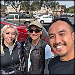
I was on the fence about whether or not I'd enjoy this hike and ended up being pleasantly surprised! Based on the sheer number of reviews and proximity to Cal Poly I thought it would be overcrowded and overrated. On the Sunday following Thanksgiving, it had a good number of trail goers but never felt too jam packed with people and the scenery, views at the top and the varying terrain make this an excellent moderate hike that you can bang out early in the day before other local adventures. Based on a few hiking blogs and other Yelpers, I opted to park at the Patricia Drive trailhead, which is easy to find on Google Maps. Plenty of parking and easy locate trail head. From here you will have a map (which shows other trails connected to the open space,) and well signed directions to the peak. It's a moderate climb to the first junction (which connects with the trail that starts on Highland,) then flattens out as you wind your way through a wooded area. After that you start what seems like an endless series of switchbacks up to the peak. It's not too difficult to climb and the trails are well kept and wide enough so you're not feeling like you'll tumble down the side. Still, be careful with your footing and wear sturdy shoes with a good grip. Plenty of people were running it and I saw folks of varying fitness levels giving it a go. It's about 4 miles round trip and the total hike took about 2 hours including a stop at the top. There's a Trails End sign with a bench but I opted to scramble around a few boulders for better views. Here's where you really need to take extra care and have a buddy to hoist you up in areas. With the views alone, this hike is a must do, at least once if you're in the area. Glad I checked it out and if I lived closed by, I could see this being part of my regular hike rotation. read more


5 years ago
Nice uphill hike close to town. The street parking was a little limited in a residential neighborhood but enough for my mid-week hike. The views of SLO as you hike up are enjoyable. read more

Review #800! Loved this hike. There are 2 routes - 1 route veers to the right side of the mountain when you're headed towards the main trailhead... this one is a shorter distance but considerably more challenging since it's extremely steep. If you choose this route, expect to climb and use all four limbs for stability. The 2nd route is the main route with all the switchbacks. It takes longer but it's a pretty enjoyable hike. The hike will take approximately 2 hours. At the end of the switchbacks, you're at the top of Bishop's Peak. To get to the very top of the peak you'll have go bouldering and climb up there. Just go slow. If you have a fear of heights, you'll probably be nervous on the very top. We brought our GoPro and got some awesome pictures. There were a ton of SLO students hiking + families and doggies. It's uncovered so wear a hat and bring sunscreen and water. read more

When my son was five his father took him to the top of Bishop Peak. That hike preceded the cell phone era and they were gone so long that I began fearing that something had happened to his dad. Briefly, I harbored dark visions of my five year old wandering the mountain, lost and alone. It took me fifteen years and ten minutes on the mountain to dispel that image completely for Bishop Peak is probably the most frequented hiking trail in all of San Luis Obispo County. It's like everyone in town looks at each other sometime over the weekend and declares "Let's go hike Bishop Peak". Even if my son had been lost and wandering he would've been found within 5 minutes tops. It's a busy trail. Bishop Peak is the highest in a chain of morros (extinct volcanoes) and has an easy to follow single-track trail up to the top. The trail is anywhere from 3.5 - 4.5 miles round trip (depending on which publication you consult) with an elevation of 950 feet. The whole hike (in and out) will take you about 2 hours. Despite being the highest of the peaks on view I had little appreciation for the intensity of this hike, and found it to be much more demanding than I'd anticipated. I attribute my experience to hiking in the heat of the day and hiking with a dog who kept getting too hot and tired out to continue. In addition, the rocky terrain on the upper half adds a lot of impact to your feet and knees. Near the top you'll see a bench etched with the words "end of trail". They're just kidding. Almost everyone goes past that point, scaling the giant boulders to reach what is truly the peak. If your dog is with you though, you might just have to stop at the bench. I couldn't discern a way to get her safely up and down those rocks and she wanted no part of me trying. Even if you can't get much beyond the bench though, the views are great. Bishop Peak is a very good, not too difficult hike, best tackled during the still cool, early morning hours. There are several entrance points but the one I took began at the top of Highland Drive, where hikers can park on the street. If you want to see what everyone else in town is doing for exercise head on over to Bishop Peak. Great views, great workout, and bears the stamp of approval from my former five year old who, yes, made it to the top. read more
? We were both surprised she made it up to the top. If she can, you can. - Hiking Near Me - San Luis Obispo, California")
We spent 30 minutes trying to find the "start" position for this hike. Being from Norcal, none of us had any familiarity with Bishop's Peak. We've hiked Mt. Tam together as well as Mission Peak (the Norcal version of Bishop's Peak) before, so we are not hiking amateurs. Bishop's Peak does not have clear-cut directions, so that was a bummer. We started out parking in a residential area called "Brittany's Circle." The directions via Google Maps told us that that was the starting position for the hike. Just so y'all know, Brittany's Circle is the back-end of Bishop's Peak...and most people truly BEGIN the hike on the "front side" of the mountain. Anyhoo, after struggling for tens of minutes to find the starting point (along with two other parties of lost first-timer Bishop hikers), we finally got to the start. We saw some families with smaller kids (don't know how they did), lots of people bouldering, and mainly locals or big groups of people--probably students? We started the hike around 11AM, so it was pretty hot by the time we got to the top. It takes 2 hours to get to the top if you haven't done this hike before. It wasn't as strenuous as hikes like Mission Peak or Mt. Tam, but the "hardest" parts about this hike are the lack of shade. There's lots of dust/sand along the hike so bring sunnies and a hat! We also enjoyed preparing our lunch beforehand (got wraps and salads from Trader Joe's) so we could sit on the peak and relax on the rocks. That was a plus. In all, we loved this hike and it is definitely a must when you get to SLO. The only downside to this hike was the unclear start point. There aren't enough signs...how are out of towners supposed to know where to begin?! read more

Bishop's is great! I try to run the hound up the hill at least once a week. The trail is amazing if you have an active dog who has some extra energy that needs to get burned off! My fox hound loves charging up the hill. There's a dog bowl up at the top that's changed to a bench. Bring some fresh water for your pup and stay a while so they'll calm down and actually drink some of it. There isn't too much shade near the best seating, unless you decide to sit in the way of those trying to climb the last few rock to get to the tippy top. We always encounter about half a dozen other dogs in the trail and most of them are off leash. 95%of the time that's fine, but here's a tip: don't cop an attitude when your little puff ball starts crap with a dog 5x times its size . . . when it's 20 get away from you. You're the one breaking the rules by having it off leash and out of control. There are 3 trailheads: Foothill Blvd, Highland Dr, and Patricia Dr. I usually stage from Highland Dr, mostly out of habit, but also there's a good shady part at the end so the dog can cool off before jumping back in the truck. The southeast side of the hill has a couple switch backs that radiate a damp heat while running up through them. This stretch also has the best views of SLO of you don't climb the boulders at the top. The south west switch backs can have some cooler breezes near the top. Lots of cool air comes through that corridor from Los Osos. The trails do get crowded at times and some people have trouble letting people pass. read more

6 years ago
This was a fun, scenic hike with shade maybe 1/5 of the route. A little crowded at the top on a Saturday but I got away from everybody by traversing to the western peak, including fun bouldering. Be careful up top, it's easy to lose your way. Deducted one star because entire loop should be one-way during pandemic, not just the Felsman connector/loop option. read more


By far my favorite hike in San Luis Obispo. If I lived here I would climb it every weekend. The hike is short, but its very steep and strenuous which makes it longer. You are climbing on rocks for the last 1/3 of it, so beware and make sure you have proper foot gear. I brought lunch up here and had it on the rocks while the sun was setting. What a lovely view and perfect hike. Views are fantastic Parking can be hard around the area, just a little heads up. read more


Mental note to self: Keep handy/accessible a trail map on your phone or in your pocket. For those with smart phones, this became our savior for myself and friends while hiking to Bishops Peak when we realized we're on the Felsman Loop trail. Not very bring on our ourselves to keep a note of the small signs that actually tell you what trail you're on. http://santalucia.sierraclub.org/BishopPeak.pdf Nonetheless, we made our way onto the Bishop Peak Trail and I enjoyed telling my group we're almost there when we still about 400 feet UP still left to hike. If you start the hike mid-morning, say 9 or 10, don't mind the bees and they won't mind you walking through their territory. Once at the top, those daring to do a "small" rock climbing to the top of the peak, it will be well worth the 360 panoramic view of San Luis Obispo and the ocean. Definitely a hike not for the weak at heart but not too difficult for the hiker enthusiast. Very novice/intermediate trail for all levels to appreciate and get a bit of exercise as well. I would suggest bring a bottle or two of water and a snack for those who are hypo or I.C.E. of sugar levels. Follows the signs and avoid the horse/animal droppings prior to the split between Felsmans Loop/Bishop Peak trails, you'll be good! Definitely worth visiting again for the workout. read more

 - Hiking Near Me - San Luis Obispo, California")
5 years ago
My daughter lives in SLO now and this is an absolute favorite to go hike for a couple of hours. read more

6 years ago
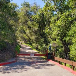
Discovered this hike through Yelp. First of all, this is a strenuous hike for those who are not active since it will require climbing up steep, narrow paths. 1. First, lets talk about how you will get to the trail entrance. As you approach the location of the hike, you will notice a wide, metal gate which i suspect is used as an entrance for horses/cows to enter for feeding purposes. You will have to drive down a bit further until you see a line of cars parked on a dirt patch, this is your parking spot!! Now, there is no "official" entrance and you are required to climb over the metal bar to enter the trail. 2. There are no shades throughout the hike so bring a hat and do your hike either early morning or late afternoon so the scorching sun doesnt get to you. 3. The first 15-30 mins of the hike (if you are strolling) is pretty flat and relaxing. But as you get higher, the path gets more narrow and you will be required to do some serious climbing. Because of this, I highly recommend bringing a water backpage so your hands are free to grab onto branches/small boulders for support (now, do this with cautions and only pull on strong branches only. Please don't fall). Be aware that there will be people coming down the same narrow path you are on so please be kind and courteous and yield as needed. 4. Unfortunately, we werent able to finish the hike so I wont be able to tell you what await you at the top. But do be aware that as you get higher up, the more steep and narrow the path gets. read more


4 years ago
10 years ago
First of all, I was skeptical if 1 Highland Dr was the right place to park. Yes it is. Go all the way to the top. There is about 15 spots going down the street. There are other entrances but idk where those are (yet). The trail starts with walking uphill a bumpy dirt road. Then you climb some more dirt, small rocks, then gradually larger rocks. The view is great the entire way since you walk on the side of the mountain (inner side of the valley). Luckily it's not too windy. The top: I'm sort of afraid of heights. I'm 5'4 and it took several attempts to climb certain rocks at the top. My friend helped me get to the highest Boulder. The view was soooo cool. I was half afraid of the rock rolling down the mountain and half thinking, "Yay me!" Walking back to the car and climbing down was MUCH easier and faster. I definitely recommend it! read more


10 years ago
First thing first, the address (1 Highland Dr San Luis Obispo, CA 93403) will lead you to the back entrance of the hike, the front entrance is at: 787 Patricia Dr, San Luis Obispo, CA 93405 The Highland entrance have limited parking and the Patricia entrance have street parking which is able to accommodate more cars. The hike itself isn't too bad, it took me a bit over 2 hours to get to the top and that is because when I see two paths, one path with signs and other doesn't, I go to the path with no signs first, before I realize it was the wrong path and had to turn back. If you can follow the sign, you are ok. Early or late morning is probably the best time to go because it will get hot in the early afternoon and there aren't many shade spots. If you are in SLO and into outdoors, you shouldn't miss this hike. read more


16 years ago
Bishop's peak is a pretty high hike but it's not that difficult and a lot of fun! Weird cave behind some brush that tunnels in 30 feet to end in a shrine-ish wall with candles? Check Dodge and duck poison oak? Check. Leap across rocks thousands of feet in the air? Check. Not much to say other than it's a gorgeous view at the very top. You will not be disappointed. Actually I do have one more thing to say. If you eat a sausage breakfast burrito with tons of salsa beforehand ... consider the possible ramifications over the next few hours. read more

Page 1 of 5
More info about Bishop Peak
1 Highland Dr
San Luis Obispo, CA 93403
Directions
Hours
Indoor Amenities
Outdoor Amenities
Ask the Community - Bishop Peak
Review Highlights - Bishop Peak
You might also consider


Why does Yelp recommend reviews?
12 reviews that are not currently recommended
The reviews below are not factored into the business's overall star rating.
15 years ago
14 years ago
15 years ago
11 years ago
4 years ago
2 years ago
15 years ago
10 years ago
14 years ago
12 years ago
10 years ago
13 years ago
Bishop Peak - hiking - Updated May 2026
Best of San Luis Obispo
People found Bishop Peak by searching for…
Things to Do in San Luis Obispo, CA
Beaches in San Luis Obispo, CA
Campgrounds in San Luis Obispo, CA
Hiking Trails in San Luis Obispo, CA
Rock Climbing in San Luis Obispo, CA
Flower Fields in San Luis Obispo, CA
Watch Sunset in San Luis Obispo, CA
Dog Friendly Beaches in San Luis Obispo, CA
Scenic View in San Luis Obispo, CA
Cliff Jumping in San Luis Obispo, CA
Places to Take Pictures in San Luis Obispo, CA
Off Road Trails in San Luis Obispo, CA
Dog Friendly Hiking Trails in San Luis Obispo, CA
Waterfall Hike in San Luis Obispo, CA
View Points in San Luis Obispo, CA
Sunrise Hike in San Luis Obispo, CA
Night Hike in San Luis Obispo, CA
Hiking With Kids in San Luis Obispo, CA
Fall Foliage in San Luis Obispo, CA
Hiking Club in San Luis Obispo, CA
Trending Searches in San Luis Obispo, CA
Botanical Gardens near Bishop Peak
Bounce House Rentals near Bishop Peak
Cherry Picking near Bishop Peak
Cliff Jumping near Bishop Peak
Dog Friendly Things To Do near Bishop Peak
Flower Fields near Bishop Peak
Garden Center near Bishop Peak
Lakes & Ponds near Bishop Peak
Nurseries & Gardening near Bishop Peak
Outdoor Activities near Bishop Peak
Outdoor Furniture Stores near Bishop Peak
Party Equipment Rentals near Bishop Peak
Pick Your Own Farms near Bishop Peak
Places To Take Pictures near Bishop Peak
Running Trails near Bishop Peak
Strawberry Picking near Bishop Peak
Swimming Holes near Bishop Peak
Browse Articles
Browse Nearby
BEST of San Luis Obispo, California Coffee near Bishop Peak
BEST of San Luis Obispo, California Restaurants near Bishop Peak
BEST of San Luis Obispo, California Parks near Bishop Peak
BEST of San Luis Obispo, California Things to Do near Bishop Peak
BEST of San Luis Obispo, California Breakfast near Bishop Peak
BEST of San Luis Obispo, California Botanical Gardens near Bishop Peak
BEST of San Luis Obispo, California Hotels near Bishop Peak
BEST of San Luis Obispo, California Campgrounds near Bishop Peak
Browse Brands
Related Searches in San Luis Obispo, CA
Affordable Kayak Rental Services in San Luis Obispo, California
Best Fishing Locations and Guides in San Luis Obispo, California
Best Places for Horseback Riding in San Luis Obispo, California
Best Places for Stunning Views in San Luis Obispo, California
Check Out Off Road Trails in San Luis Obispo, California
Discover Dog Friendly Trails to Explore in San Luis Obispo, California
Discover Scenic Mountain Bike Trails Near San Luis Obispo, California
Discover Scenic Waterfall Spots in San Luis Obispo, California
Discover Top State Parks to Visit in San Luis Obispo, California
Discover a Hiking Trail in San Luis Obispo, California
Discover the Best Night Hike Trails in San Luis Obispo, California
Dog-Friendly Hikes With Dogs in San Luis Obispo, California
Enjoy Camping Adventures Around San Luis Obispo, California
Enjoy Exciting Mountain Biking Adventures in San Luis Obispo, California
Enjoy Kayaking Adventures in San Luis Obispo, California
Enjoy Tent Camping Spots Around San Luis Obispo, California
Enjoy a Beautiful Waterfall Hike in San Luis Obispo, California
Enjoy the Best Picnic Spots and Ideas in San Luis Obispo, California
Enjoy the Best Walking Trails in San Luis Obispo, California
Experience Thrilling White Water Rafting in San Luis Obispo, California
Explore Beautiful Parks and Green Spaces in San Luis Obispo, California
Explore Easy Hikes Perfect for All in San Luis Obispo, California
Explore Fun Activities to Do in San Luis Obispo, California
Explore Popular Campgrounds Near San Luis Obispo, California
Explore Top Dog Parks in San Luis Obispo, California Near You
Explore the Best Beach Spots in San Luis Obispo, California
Explore the Best Boating Spots in San Luis Obispo, California
Explore the Best Trail Options in San Luis Obispo, California
Family Friendly Hiking With Kids in San Luis Obispo, California
Find Beautiful Views in San Luis Obispo, California
Find Popular Ziplining Spots Around San Luis Obispo, California
Find the Best Playgrounds to Visit in San Luis Obispo, California
Find the Best Scenic View Locations in San Luis Obispo, California
Great Places to Walk in San Luis Obispo, California
Hiking Trails With Waterfalls in San Luis Obispo, California
Off Leash Dog Hiking Trails in San Luis Obispo, California
Plan a Scenic Drive Route Near San Luis Obispo, California
Popular Outdoor Activities to Try in San Luis Obispo, California
Popular Picnic Spots to Visit in San Luis Obispo, California
Popular Things to Do in San Luis Obispo, California
Safe River Swimming Areas in San Luis Obispo, California
Safe and Fun Parks for Kids in San Luis Obispo, California
Top Paddleboarding Activities in San Luis Obispo, California
Top Places for Snorkeling in San Luis Obispo, California
Top Playgrounds for Kids to Enjoy in San Luis Obispo, California
Top Running Trails to Explore in San Luis Obispo, California
Top Swimming Lakes to Enjoy in San Luis Obispo, California
Top Swimming Spots and Pools in San Luis Obispo, California
Top Things to Do With Kids in San Luis Obispo, California
Walk Dog Friendly Hiking Trails in San Luis Obispo, California