Independence Pass Photos



More like Independence Pass
Recommended Reviews - Independence Pass
Start your review...


Reviews With Photos
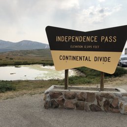

Scary Drive! Narrow lanes with one side next to mountain and the the other looking down the deep cliff. At points, two lanes becomes one, heart attack with a large SUV squeezing through. Majestic Views! Many lookout points en route: spectacular are the mountains against the blue or gray clouded sky. Wonderful trails to be taken: beauty in nature of creeks, trees, and, flowers. CHEERS!


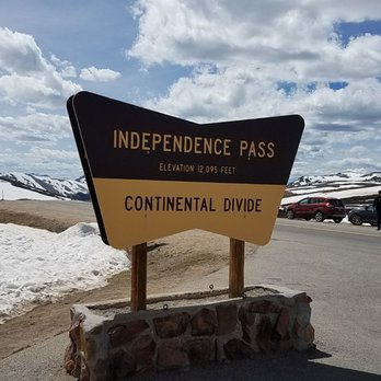
Independence Pass (from what I researched) is one of the most worthwhile road trips to embark upon within the United States. It's roughly 20 miles long and it's situated about 20 miles away from Aspen, Colorado. At the pinnacle of Independence Pass Drive, the altitude is over 12,000 feet high above sea level. And at this apex, there's a specific sign stating that you're passing over the Continental Divide. Along the road there's a parking section to pull your car over. I'd suggest stopping here for a unique picture opportunity as sort of an exclamation point that you have officially arrived at this landmark. The area around the Independence Pass Sign is fine for stretching your legs, walking around and hiking in general, just exploring the mountainous landscape. I visited back in mid-July of 2021, and I must say the conditions were pleasant. For a Sunday morning it was nice and brisk outside and not a cloud in the sky. The reason I'm mentioning the weather is because this drive can only be accomplished during summer times as there's too much snow on the road to be navigated across during winters. This climactic portion of Independence Pass had some decent views while I explored, but nothing of significance that really connected with me. There was barely much snow on the background to make for scenic pictures. I love Colorado and all...but basically the terrain is filled with a bunch of simple alpine lakes and uninspiring pale gray tones of peaks and valleys. I mean, overall, the sights weren't memorable (at least for me they weren't). Ultimately, I was making my way towards Aspen to ride the famous Silver Queen Gondola to the top of Aspen Mountain for a better chance at photogenic moments. And...along the way continuing on Independence Pass Drive, I stopped 2 - 3 more times at various roadside overlooks to try and capture the essence for what makes the drive so well known. Unfortunately, none of the pitstops had any names to them so I can't even mention what to be on the lookout for. I guess, just, go with the flow and pull over when you feel like stopping, lol. A little side note...the day prior to coming here on Independence Pass...I drove another famous road known as Mount Evans Scenic Byway. On that drive I climbed above 14,000 feet and definitely felt the effects of altitude sickness, being nauseous at times. But now here at Independence Pass it seemed like my body had properly adjusted to the elevation and I didn't mind being so high up. I guess maybe it was a temporary issue. Finally, although Independence Pass is famous for being a scenic drive in the USA...it was just okay in terms of my experience. I enjoyed Mount Evans better the day before. Overall, within Colorado...my favorite drive is still without a doubt Million Dollar Highway going from Silverton, CO to Ouray, CO (the Switzerland of America) in the southwestern portion of the state. Alright, well, this is Independence Pass near the Twin Lakes area of Colorado.


We drove through Independence Pass on our way to Aspen just to see the views. Amazing views of mountains and trees! We pulled over at one of the trails and walked a little bit. We also played in the snow (in June!) and had a snowball fight. Its cold up in the mountains; bring a jacket! Oh, and if you have never drove in the mountains before, please READ on how-to. If you don't, you could end up wearing down your brakes real bad!
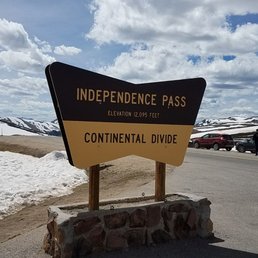

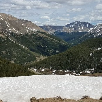
If one wants to truly see how beautiful the Colorado mountains are, just travel up Highway 82. At 12,095 feet you get to experience the majestic Sawatch mountain range. This mountain range has spectacular views as far as the eye can see. Driving west from Leadville, the road is wide and inclines gradually, but for the more adventurous thrill seeker, driving east from Aspen the road twists and turns, with steep inclines, sharp curves, and at one spot turns from a wide two lane road into a narrow one lane road. (which both directions of traffic have to take turns sharing) All in all which ever way you choose, after you get to the huge parking lot at the top of the mountain and walking along the trails youll be able to see some of the best mountain views in Colorado.


Amazing drive and views. We were right by the snow at the end of June! Scary hairpin turns so go slow! Many places to pull over. We stopped at the Continental Divide portion that explains history and provided a map of the area. Must do drive if you're in the area. If you're coming from Twin Lakes area, be sure to stop along the river to enjoy nature.


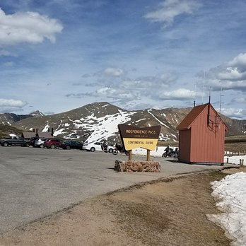
Slowly driving the winding mountain road approaching this location you can feel the anticipation built as you reach the top and see nothing but mountains going on forever in all directions. At the base of the pass are two somewhat small parking areas, that are usually full of cars and people given its popularity, but is surprisingly east to find places to park as the visitors rotate out fairly quick. At the base is a small building with restrooms that on my visit were a total mess and unclean from the overwhelming amount of visitors. Going up the hill is a paved walkway that forks to multiple sides leading to viewing areas that overlook the valley, with signs and visual references to all the peaks and to the continental divide which is just a few hundred yards from the viewing area. At the summit in the summer (mid august) the temperature was about 45 degrees and the wind was blowing a little making it a cold location, so a good jacket and cold protection is highly advised as well as sunscreen given the altitude, as you are engulfed by the majesty of the view you can sunburn quickly. The pathway is also a somewhat steep incline and some visitors might want to bring a travel oxygen breather if you have breathing difficulties. On both sides of the pass down the highway before you make the drive up there are businesses that sell the small canned tanks, or they can be purchased in Aspen or any of the ski resorts.


On our last day in Colorado, we drove from Aspen to Twin Lakes on SH 82. Midway through this stretch, we stopped at Independence Pass, a popular scenic overlook at an elevation of 12,095 feet. Wonderful views of Mount Elbert, the highest peak in the Rocky Mountains and in Colorado, La Plata Peak, the alpine tundra above the treeline, open grassy slopes with wildflowers and shrubs. It's a very short walk around this overlook, but it's also very spectacular. For us, it was one of the last views we had of the Rocky Mountains before we headed home. Driving through the pass can be somewhat challenging if you're not used to navigating sharp turns and switchbacks on a mountain road. Luckily, my parents and I are experts having driven through many difficult mountain roads while traveling so we didn't think this was too bad. However, I have read some reviews where folks found this drive to be taxing and vowed to never do it again. I'd be aware of the ever-changing weather like thunderstorms or snow and altitude changes. During the winter, SH 82 through the pass is closed. If you're driving through, Independence Pass is a great stop to stretch your legs and admire the scenery.


Such a beautiful drive from Leadville to Aspen! The road is steep, narrow, and curvy in most places. In fact, as you near Aspen, the two lane road - suddenly and without warning - turns into a one lane road in a couple of different places. So check your speed! Vehicle size and weight restrictions are enforced, which is nice because you won't ever get stuck behind a slow-moving tractor trailer or motorhome. At the top of the pass, get out of the car to stretch your legs and enjoy the breathtaking scenery of the Continental Divide (elevation 12,095 feet). Be sure to dress warmly because it can be really cold (even in the middle of summer) and super windy. Take a short walk on a paved path to check out some expansive views. On a clear day you can see all the way to Leadville (37.3 miles away), all the way to Buena Vista (41.5 miles away), and also glimpse La Plata Peak, Colorado's fifth highest mountain at 14,343 feet. Bathrooms are located at the parking area as well. The pass does close during the winter (usually between November 1 and the start of the Memorial Day weekend), so plan your trip accordingly. You won't want to miss this quintessential Colorado landmark.


2 months ago

2 years ago
Independence Pass is originally known as Hunter Pass. It is the high mountain pass in central Colorado, United States,which is at elevation 12,095 feet above the sea level on the Continental Divide in the Sawatch Range of the Rocky Mountains. The pass is midway between Aspen and Twin Lakes, on the border between Pitkin and Lake counties. It's not an easy climb during the icy snowy days but with luck, there will be a window of a perfect timing to adventure to the top during the winter like I did! When the pass is open in warmer weather, it is a popular destination. A scenic overlook near the pass allows visitors to take in the alpine tundra environment above treeline, and offers excellent views to the east of Mount Elbert, Colorado's highest peak and the second-highest mountain in the contiguous United States. This scenic road is one of the highest in North America, meandering along the Continental Divide. It's such a thrill driving along it like a daredevil. The sharp tight turns along towering cliffs and through thick forests are wild. The is a paved hiking trail (the Independence Pass Scenic Trail) which leads to a sightseeing platform where far-reaching the stunning views of the Continental Divide! Spectacular sight! Enjoy! read more


The place is good for quick stop, I waited to see vista in the sunset, not as spectacular as I thought. Also I had high hopes to find famous Continental Divide Trail around this area two days later, even to hike some of it, it seemed my mistake, there is a trail, but it's not CDT. read more


6 years ago
Scary Drive! Narrow lanes with one side next to mountain and the the other looking down the deep cliff. At points, two lanes becomes one, heart attack with a large SUV squeezing through. Majestic Views! Many lookout points en route: spectacular are the mountains against the blue or gray clouded sky. Wonderful trails to be taken: beauty in nature of creeks, trees, and, flowers. CHEERS! read more
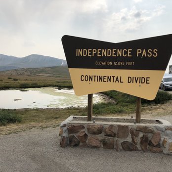


Independence Pass (from what I researched) is one of the most worthwhile road trips to embark upon within the United States. It's roughly 20 miles long and it's situated about 20 miles away from Aspen, Colorado. At the pinnacle of Independence Pass Drive, the altitude is over 12,000 feet high above sea level. And at this apex, there's a specific sign stating that you're passing over the Continental Divide. Along the road there's a parking section to pull your car over. I'd suggest stopping here for a unique picture opportunity as sort of an exclamation point that you have officially arrived at this landmark. The area around the Independence Pass Sign is fine for stretching your legs, walking around and hiking in general, just exploring the mountainous landscape. I visited back in mid-July of 2021, and I must say the conditions were pleasant. For a Sunday morning it was nice and brisk outside and not a cloud in the sky. The reason I'm mentioning the weather is because this drive can only be accomplished during summer times as there's too much snow on the road to be navigated across during winters. This climactic portion of Independence Pass had some decent views while I explored, but nothing of significance that really connected with me. There was barely much snow on the background to make for scenic pictures. I love Colorado and all...but basically the terrain is filled with a bunch of simple alpine lakes and uninspiring pale gray tones of peaks and valleys. I mean, overall, the sights weren't memorable (at least for me they weren't). Ultimately, I was making my way towards Aspen to ride the famous Silver Queen Gondola to the top of Aspen Mountain for a better chance at photogenic moments. And...along the way continuing on Independence Pass Drive, I stopped 2 - 3 more times at various roadside overlooks to try and capture the essence for what makes the drive so well known. Unfortunately, none of the pitstops had any names to them so I can't even mention what to be on the lookout for. I guess, just, go with the flow and pull over when you feel like stopping, lol. A little side note...the day prior to coming here on Independence Pass...I drove another famous road known as Mount Evans Scenic Byway. On that drive I climbed above 14,000 feet and definitely felt the effects of altitude sickness, being nauseous at times. But now here at Independence Pass it seemed like my body had properly adjusted to the elevation and I didn't mind being so high up. I guess maybe it was a temporary issue. Finally, although Independence Pass is famous for being a scenic drive in the USA...it was just okay in terms of my experience. I enjoyed Mount Evans better the day before. Overall, within Colorado...my favorite drive is still without a doubt Million Dollar Highway going from Silverton, CO to Ouray, CO (the Switzerland of America) in the southwestern portion of the state. Alright, well, this is Independence Pass near the Twin Lakes area of Colorado. read more


We drove through Independence Pass on our way to Aspen just to see the views. Amazing views of mountains and trees! We pulled over at one of the trails and walked a little bit. We also played in the snow (in June!) and had a snowball fight. Its cold up in the mountains; bring a jacket! Oh, and if you have never drove in the mountains before, please READ on how-to. If you don't, you could end up wearing down your brakes real bad! read more


9 years ago
If one wants to truly see how beautiful the Colorado mountains are, just travel up Highway 82. At 12,095 feet you get to experience the majestic Sawatch mountain range. This mountain range has spectacular views as far as the eye can see. Driving west from Leadville, the road is wide and inclines gradually, but for the more adventurous thrill seeker, driving east from Aspen the road twists and turns, with steep inclines, sharp curves, and at one spot turns from a wide two lane road into a narrow one lane road. (which both directions of traffic have to take turns sharing) All in all which ever way you choose, after you get to the huge parking lot at the top of the mountain and walking along the trails youll be able to see some of the best mountain views in Colorado. read more





6 years ago
Amazing drive and views. We were right by the snow at the end of June! Scary hairpin turns so go slow! Many places to pull over. We stopped at the Continental Divide portion that explains history and provided a map of the area. Must do drive if you're in the area. If you're coming from Twin Lakes area, be sure to stop along the river to enjoy nature. read more


9 years ago
Slowly driving the winding mountain road approaching this location you can feel the anticipation built as you reach the top and see nothing but mountains going on forever in all directions. At the base of the pass are two somewhat small parking areas, that are usually full of cars and people given its popularity, but is surprisingly east to find places to park as the visitors rotate out fairly quick. At the base is a small building with restrooms that on my visit were a total mess and unclean from the overwhelming amount of visitors. Going up the hill is a paved walkway that forks to multiple sides leading to viewing areas that overlook the valley, with signs and visual references to all the peaks and to the continental divide which is just a few hundred yards from the viewing area. At the summit in the summer (mid august) the temperature was about 45 degrees and the wind was blowing a little making it a cold location, so a good jacket and cold protection is highly advised as well as sunscreen given the altitude, as you are engulfed by the majesty of the view you can sunburn quickly. The pathway is also a somewhat steep incline and some visitors might want to bring a travel oxygen breather if you have breathing difficulties. On both sides of the pass down the highway before you make the drive up there are businesses that sell the small canned tanks, or they can be purchased in Aspen or any of the ski resorts. read more


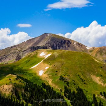

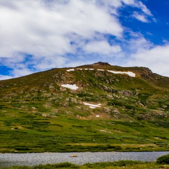


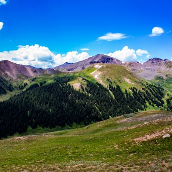

On our last day in Colorado, we drove from Aspen to Twin Lakes on SH 82. Midway through this stretch, we stopped at Independence Pass, a popular scenic overlook at an elevation of 12,095 feet. Wonderful views of Mount Elbert, the highest peak in the Rocky Mountains and in Colorado, La Plata Peak, the alpine tundra above the treeline, open grassy slopes with wildflowers and shrubs. It's a very short walk around this overlook, but it's also very spectacular. For us, it was one of the last views we had of the Rocky Mountains before we headed home. Driving through the pass can be somewhat challenging if you're not used to navigating sharp turns and switchbacks on a mountain road. Luckily, my parents and I are experts having driven through many difficult mountain roads while traveling so we didn't think this was too bad. However, I have read some reviews where folks found this drive to be taxing and vowed to never do it again. I'd be aware of the ever-changing weather like thunderstorms or snow and altitude changes. During the winter, SH 82 through the pass is closed. If you're driving through, Independence Pass is a great stop to stretch your legs and admire the scenery. read more


Such a beautiful drive from Leadville to Aspen! The road is steep, narrow, and curvy in most places. In fact, as you near Aspen, the two lane road - suddenly and without warning - turns into a one lane road in a couple of different places. So check your speed! Vehicle size and weight restrictions are enforced, which is nice because you won't ever get stuck behind a slow-moving tractor trailer or motorhome. At the top of the pass, get out of the car to stretch your legs and enjoy the breathtaking scenery of the Continental Divide (elevation 12,095 feet). Be sure to dress warmly because it can be really cold (even in the middle of summer) and super windy. Take a short walk on a paved path to check out some expansive views. On a clear day you can see all the way to Leadville (37.3 miles away), all the way to Buena Vista (41.5 miles away), and also glimpse La Plata Peak, Colorado's fifth highest mountain at 14,343 feet. Bathrooms are located at the parking area as well. The pass does close during the winter (usually between November 1 and the start of the Memorial Day weekend), so plan your trip accordingly. You won't want to miss this quintessential Colorado landmark. read more


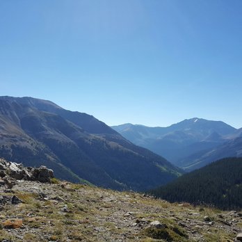


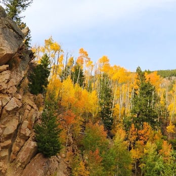
This is the absolute best place in Colorado to see the aspen trees changing colors from green to yellow in the first few weeks of Fall. There is an abundance of aspen along the drive, and many stopping points where you can safely park your car to snap some photos. I should also mention there are a few unsafe parking spots on the pass! The best views are between Aspen and Weller Campground. Best time of day to go is between 2pm and sunset for photos. Semi trucks are not allowed on this pass. Use extra precaution when driving an RV: very steep, narrow lanes, and low clearance rock overhangs. read more







10 years ago
More info about Independence Pass
Ask the Community - Independence Pass
Review Highlights - Independence Pass


















Why does Yelp recommend reviews?
2 reviews that are not currently recommended
The reviews below are not factored into the business's overall star rating.

7 years ago

8 years ago
Independence Pass - localflavor - Updated October 2026
Best of Aspen
People found Independence Pass by searching for…
Trending Searches in Aspen, CO
Archery near Independence Pass
Barbershop near Independence Pass
Blow Dry Bar near Independence Pass
Eyelash Extensions near Independence Pass
Formal Dresses near Independence Pass
Formal Wear near Independence Pass
Makeup Artists near Independence Pass
Photo Spots near Independence Pass
Places To Take Pictures near Independence Pass
Browse Articles
Browse Nearby
BEST of Aspen, Colorado Things to Do near Independence Pass
BEST of Aspen, Colorado Restaurants near Independence Pass
BEST of Aspen, Colorado Coffee near Independence Pass
BEST of Aspen, Colorado Scenic Drive near Independence Pass
BEST of Aspen, Colorado Arts & Entertainment near Independence Pass
BEST of Aspen, Colorado Hotels near Independence Pass
BEST of Aspen, Colorado Breakfast near Independence Pass
Browse Brands
Related Searches in Aspen, CO
Best Fishing Locations and Guides in Aspen, Colorado
Best Fun Things to Do in Aspen, Colorado
Best Places for Stunning Views in Aspen, Colorado
Best Things to Do on a Rainy Day in Aspen, Colorado
Best Wood Fired Pizza Available in Aspen, Colorado
Book Engaging Historical Tours in Aspen, Colorado
Discover Beautiful Garden Spots in Aspen, Colorado
Discover Farm to Table Restaurants in Aspen, Colorado
Discover Fun Things to Do Alone in Aspen, Colorado
Discover Romantic Activities to Enjoy in Aspen, Colorado
Discover Top Festivals Happening in Aspen, Colorado
Discover a Library Near You in Aspen, Colorado
Discover the Best Beaches in Aspen, Colorado
Enjoy Arts & Entertainment in Aspen, Colorado
Enjoy Authentic Oxtail Soup Near Aspen, Colorado
Enjoy Hiking Adventures in Aspen, Colorado
Experience Stunning Sunset Views in Aspen, Colorado
Explore Beautiful Botanical Gardens in Aspen, Colorado
Explore Beautiful Parks and Green Spaces in Aspen, Colorado
Explore Fun Activities to Do in Aspen, Colorado
Explore Landmarks & Historical Buildings in Aspen, Colorado
Explore Popular Craft Fairs in Aspen, Colorado
Explore Popular Scenic Overlook Points in Aspen, Colorado
Explore Popular Scenic Views Near Aspen, Colorado
Explore Scenic Lakes to Visit in Aspen, Colorado
Explore Secret Spots Worth Visiting in Aspen, Colorado
Explore the Best Swimming Holes Around Aspen, Colorado
Find Beautiful Views in Aspen, Colorado
Find Exciting Tours to Take in Aspen, Colorado
Find Top Art Museums in Aspen, Colorado
Find Top Libraries to Visit in Aspen, Colorado
Find Top-Rated Waterfalls in Aspen, Colorado Now
Find the Best Playgrounds to Visit in Aspen, Colorado
Find the Best Scenic View Locations in Aspen, Colorado
Fun Things for Kids in Aspen, Colorado
Hiking Trails With Waterfalls in Aspen, Colorado
Must-See Tourist Attractions Around Aspen, Colorado
Plan a Scenic Drive Route Near Aspen, Colorado
Popular Kids Activities in Aspen, Colorado
Popular Picnic Spots to Visit in Aspen, Colorado
Popular Places to Take Pictures in Aspen, Colorado
Popular Things to Do in Aspen, Colorado
Savor the Best Tiramisu in Aspen, Colorado
Secure Convenient Parking Options in Aspen, Colorado
Top Fun Things to Do at Night in Aspen, Colorado
Top Hiking Trails to Explore in Aspen, Colorado
Top Must See Attractions and Spots in Aspen, Colorado
Top Running Trails to Explore in Aspen, Colorado


