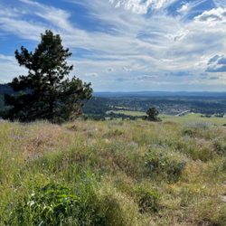
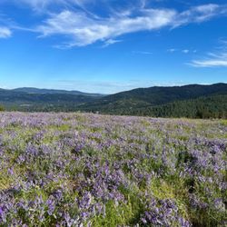
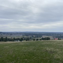
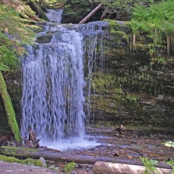
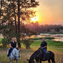
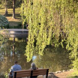
Iller Creek Conservation Area Photos


More like Iller Creek Conservation Area
Recommended Reviews - Iller Creek Conservation Area
Start your review...

4 years ago
This place is a truely hidden wonderful rocky road or wall? Lets find out #comming #soon @tiffTruth.com read more
4 years ago
8 years ago
This is a great trail. Almost 5 miles with a variety of sunny and shady areas. There were even ripe thimble berries on the trail. Quite a few wasps and yellow jackets though. read more
9 years ago
More info about Iller Creek Conservation Area
9001 E Holman
Spokane, WA 99206
Directions
Hours
Outdoor Amenities


Iller Creek Conservation Area - hiking - Updated July 2026
Best of Spokane
People found Iller Creek Conservation Area by searching for…
Trending Searches in Spokane, WA
Beautiful Views near Iller Creek Conservation Area
Blueberry Picking near Iller Creek Conservation Area
Boat Tours near Iller Creek Conservation Area
Cliff Jumping near Iller Creek Conservation Area
Day Trips near Iller Creek Conservation Area
Dog Friendly Things To Do near Iller Creek Conservation Area
Dog Friendly Trails near Iller Creek Conservation Area
Jet Ski Rental near Iller Creek Conservation Area
Kayak Rental near Iller Creek Conservation Area
Kids Activities Indoor near Iller Creek Conservation Area
Lakes near Iller Creek Conservation Area
Off Road Trails near Iller Creek Conservation Area
Outdoor Activities near Iller Creek Conservation Area
Parks near Iller Creek Conservation Area
Peach Picking near Iller Creek Conservation Area
Picnic Spots near Iller Creek Conservation Area
Places To Walk Around near Iller Creek Conservation Area
Public Shower near Iller Creek Conservation Area
River Swimming near Iller Creek Conservation Area
Rock Quarry near Iller Creek Conservation Area
Scenic Overlook near Iller Creek Conservation Area
Surf Shop near Iller Creek Conservation Area
Swimming Holes near Iller Creek Conservation Area
Swimming Lakes near Iller Creek Conservation Area
Things To Do On A Rainy Day near Iller Creek Conservation Area
Tubing near Iller Creek Conservation Area
View Points near Iller Creek Conservation Area
Watch Sunset near Iller Creek Conservation Area
Browse Articles
Browse Nearby
BEST of Spokane, Washington Coffee near Iller Creek Conservation Area
BEST of Spokane, Washington Restaurants near Iller Creek Conservation Area
BEST of Spokane, Washington Things to Do near Iller Creek Conservation Area
BEST of Spokane, Washington Breakfast near Iller Creek Conservation Area
BEST of Spokane, Washington Shopping near Iller Creek Conservation Area
BEST of Spokane, Washington Thrift Stores near Iller Creek Conservation Area
Browse Brands
Related Searches in Spokane, WA
Affordable Bike Repair Services in Spokane, Washington
Affordable Bike Tune Up Services in Spokane, Washington
Affordable Kayak Rental Services in Spokane, Washington
Best Dirt Bike Riding Spots in Spokane, Washington
Best Dog Hiking Trails Around Spokane, Washington
Best Electric Bike Rental Services in Spokane, Washington
Best Fishing Locations and Guides in Spokane, Washington
Best Gym With Sauna Amenities in Spokane, Washington
Best Gyms With Swimming Pools in Spokane, Washington
Best Places for Horseback Riding in Spokane, Washington
Best Racquetball Court Options in Spokane, Washington
Best Sightseeing Experiences Available in Spokane, Washington
Best Sledding Spots and Fun in Spokane, Washington
Best Spinning Classes Offered in Spokane, Washington
Challenge Yourself With an Obstacle Course in Spokane, Washington
Check Out Indoor Track Facilities in Spokane, Washington
Check Out Off Road Trails in Spokane, Washington
Discover Dog Friendly Trails to Explore in Spokane, Washington
Discover Easy Hiking Trails Near Spokane, Washington
Discover Fun Activities to Do in Spokane, Washington
Discover Fun Toddler Parks in Spokane, Washington for Your Little One
Discover Great Fitness Classes Available in Spokane, Washington
Discover Kid Friendly Hiking Trails in Spokane, Washington
Discover Popular Bike Tours in Spokane, Washington
Discover Popular Bike Trails in Spokane, Washington
Discover Scenic Mountain Bike Trails Near Spokane, Washington
Discover Top Yoga Options and Studios in Spokane, Washington
Discover a Hiking Trail in Spokane, Washington
Discover a Yoga Studio in Spokane, Washington
Discover the Best Night Hike Trails in Spokane, Washington
Dog-Friendly Hikes With Dogs in Spokane, Washington
Enjoy Camping Adventures Around Spokane, Washington
Enjoy Hiking Adventures in Spokane, Washington
Enjoy Kayaking Adventures in Spokane, Washington
Enjoy Off Leash Dog Hikes in Spokane, Washington
Enjoy River Tubing Adventures in Spokane, Washington
Enjoy Tent Camping Spots Around Spokane, Washington
Enjoy a Beautiful Waterfall Hike in Spokane, Washington
Enjoy the Best Bouldering Experiences in Spokane, Washington
Enjoy the Best Tubing Experiences in Spokane, Washington
Enjoy the Best Walking Trails in Spokane, Washington
Exciting Laser Tag Games and Venues in Spokane, Washington
Experience Aerial Yoga Sessions in Spokane, Washington
Explore BMX Bike Shops Near Spokane, Washington
Explore Beautiful Parks and Green Spaces in Spokane, Washington


