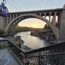
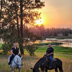
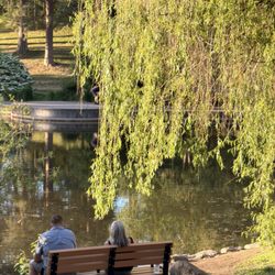
Glenrose Trailhead Photos


More like Glenrose Trailhead
Recommended Reviews - Glenrose Trailhead
Start your review...

Fun family friendly hiking, mountain biking or trail running spot off of Glenrose. Easily accessible with a good sized parking lot. Evidence of horseback riding in the area too so watch your step! Open year round and dogs are welcome as long as they are on leash. read more


More info about Glenrose Trailhead
3700 S Thierman Rd
Spokane, WA 99223
Directions
Hours
Outdoor Amenities


Glenrose Trailhead - hiking - Updated June 2026
Best of Spokane
People found Glenrose Trailhead by searching for…
Fun Things to Do With Kids in Spokane, Washington
Scenic View in Spokane, Washington
Things to Do in Spokane, Washington
Hiking Trails in Spokane, Washington
Walking Trails in Spokane, Washington
Beautiful Views in Spokane, Washington
Waterfall in Spokane, Washington
Off Leash Dog Hiking Trails in Spokane, Washington
Family Fun in Spokane, Washington
Dog Friendly Trails in Spokane, Washington
Shaded Hike in Spokane, Washington
Mountain Biking in Spokane, Washington
Running Trails in Spokane, Washington
Easy Hikes in Spokane, Washington
Hikes With Dogs in Spokane, Washington
Swimming Lakes in Spokane, Washington
Watch Sunset in Spokane, Washington
Photo Spots in Spokane, Washington
River Swimming in Spokane, Washington
Attractions in Spokane, Washington
Trending Searches in Spokane, WA
Boat Rental near Glenrose Trailhead
Cliff Jumping near Glenrose Trailhead
Day Trips near Glenrose Trailhead
Dog Friendly Trails near Glenrose Trailhead
Fireworks near Glenrose Trailhead
Fishing Spots near Glenrose Trailhead
Jet Ski Rental near Glenrose Trailhead
Kayak Rental near Glenrose Trailhead
Outdoor Activities near Glenrose Trailhead
Places To Walk Around near Glenrose Trailhead
Public Pools near Glenrose Trailhead
Public Shower near Glenrose Trailhead
River Swimming near Glenrose Trailhead
Rock Quarry near Glenrose Trailhead
Scenic Overlook near Glenrose Trailhead
Soccer Store near Glenrose Trailhead
Splash Pad near Glenrose Trailhead
Strawberry Picking near Glenrose Trailhead
Sunrise View near Glenrose Trailhead
Swimming Holes near Glenrose Trailhead
Swimming Lakes near Glenrose Trailhead
Watch Sunset near Glenrose Trailhead
Browse Articles
Browse Nearby
Browse Brands
Related Searches in Spokane, WA
Affordable Kayak Rental Services in Spokane, Washington
Best Fishing Locations and Guides in Spokane, Washington
Best Places for Horseback Riding in Spokane, Washington
Check Out Off Road Trails in Spokane, Washington
Discover Dog Friendly Trails to Explore in Spokane, Washington
Discover Kid Friendly Hiking Trails in Spokane, Washington
Discover Scenic Waterfall Spots in Spokane, Washington
Discover Top Boat Tours in Spokane, Washington for All Ages
Discover a Hiking Trail in Spokane, Washington
Dog-Friendly Hikes With Dogs in Spokane, Washington
Enjoy Camping Adventures Around Spokane, Washington
Enjoy Exciting Mountain Biking Adventures in Spokane, Washington
Enjoy Kayaking Adventures in Spokane, Washington
Enjoy River Tubing Adventures in Spokane, Washington
Enjoy Tent Camping Spots Around Spokane, Washington
Enjoy Water Activities and Fun in Spokane, Washington
Enjoy the Best Walking Trails in Spokane, Washington
Exciting Cliff Jumping Spots in Spokane, Washington
Explore Beautiful Parks and Green Spaces in Spokane, Washington
Explore Bike Rentals Throughout Spokane, Washington
Explore Fun Activities to Do in Spokane, Washington
Explore Popular Campgrounds Near Spokane, Washington
Explore Popular RV Parks Around Spokane, Washington
Explore Scenic Lakes to Visit in Spokane, Washington
Explore Top Dog Parks in Spokane, Washington Near You
Explore the Best Beach Spots in Spokane, Washington
Explore the Best Boating Spots in Spokane, Washington
Family Friendly Hiking With Kids in Spokane, Washington
Find Beautiful Views in Spokane, Washington
Find Cozy Camping Cabins in Spokane, Washington
Find the Best Parks for Picnics in Spokane, Washington
Find the Best Playgrounds to Visit in Spokane, Washington
Find the Best Scenic View Locations in Spokane, Washington
Off Leash Dog Hiking Trails in Spokane, Washington
Plan a Scenic Drive Route Near Spokane, Washington
Popular Outdoor Activities to Try in Spokane, Washington
Popular Picnic Spots to Visit in Spokane, Washington
Popular Things to Do in Spokane, Washington
Popular Things to See in Spokane, Washington
Safe River Swimming Areas in Spokane, Washington
Safe and Fun Parks for Kids in Spokane, Washington
Top Climbing Spots and Gyms in Spokane, Washington
Top Fishing Charter Experiences in Spokane, Washington
Top Paddleboarding Activities in Spokane, Washington
Top Places to Visit in Spokane, Washington for Sightseeing
Top Running Trails to Explore in Spokane, Washington
Top Swimming Lakes to Enjoy in Spokane, Washington
Top Swimming Spots and Pools in Spokane, Washington
People who viewed Glenrose Trailhead also viewed
Sunshine Meadows Park
1 review
Turnbull National Wildlife Refuge
5 reviews
Stevens Creek Trail
7 reviews
Mirabeau Meadows Park
12 reviews
Olmsted Park
2 reviews
Corbin Park
6 reviews
Little Spokane River Natural Area Indian Painted Rocks
2 reviews
North Idaho Centennial Trail
7 reviews
Deep Creek
3 reviews
The Dig
1 review