Cancel

Open app

Search

Hunter Creek Ice Climbs

5.0 (1 review)

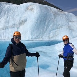
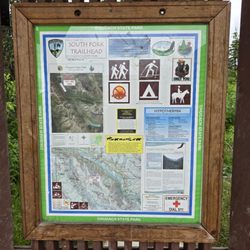
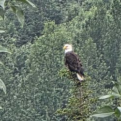
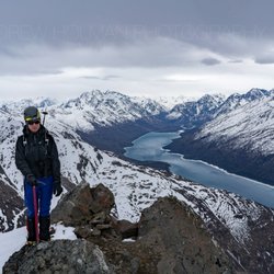
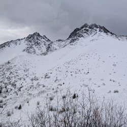
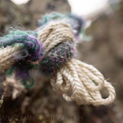
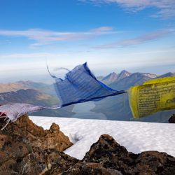
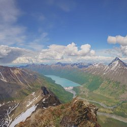
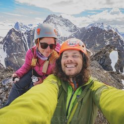
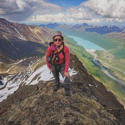
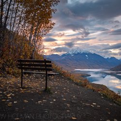
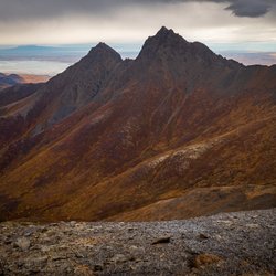
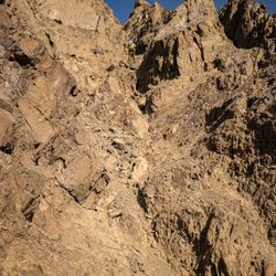
Hunter Creek Ice Climbs Photos

You might also consider
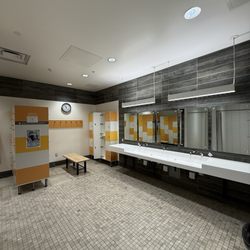
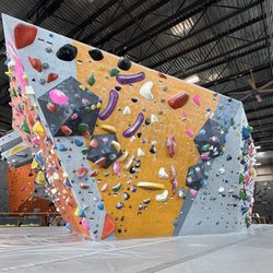
Recommended Reviews - Hunter Creek Ice Climbs

Your trust is our priority, so businesses can't pay to alter or remove their reviews. Learn more about reviews.
Yelp app icon
Browse more easily on the app
Review Feed Illustration

8 years ago

Helpful 5
Thanks 0
Love this 4
Oh no 0

Verify this business for free

Get access to customer & competitor insights.

Verify this business

Ascending Path - Ice cave

Ascending Path

4.8(16 reviews)
34.0 mi

Take the helicopter glacier hike tour! You will not regret it!! My husband and I were second…read moreguessing such a big ticket item for our Alaska trip but we agree it was worth it! Our trip would not have been the same had we skipped this standout experience! Our guides Andy and Matt were amazing! We had a lot of fun with them and learned a lot too. Thank you guys for the memories! Until you see and walk on a glacier, you cannot understand the scale and size of one! There are hidden worlds when you get on the ice! Waterfalls into the abyss, hidden ice caves, lakes of deep aqua blue... and it goes on and on in every direction. Completely insane! Do yourself a favor and book this trip. The views from the helicopter alone are worth it, but exploring a glacier is priceless!

Did the spencer glacier kayak and hike, starting from the Alyeska Resort. $379pp (occasional…read morecoupons on their Facebook). This took about 9 hours, with about 5 hours being kayak + hike. The rest was transportation/waiting for train/etc. Prices are high, but the experience is pretty amazing. It's hard to do activities or get up close to glaciers without assistance/guides. The group to guide ratio is low so you're definitely safe. I love the energy from the guides. They know what they're doing and they are so enthusiastic about it. They definitely take care of you if you're a newb to all this. Amazing views. Amazing pictures. Would recommend!

Photos
Ascending Path - Blue water lake

Blue water lake

Ascending Path - Best guides ever! Andy and Matt, you guys rocked.

Best guides ever! Andy and Matt, you guys rocked.

Ascending Path

See all

East Twin Peak - going downi

East Twin Peak

5.0(1 review)
10.9 mi

You've probably seen this peak a million times if you've ever driven up to Palmer…read more It's the second most-notable peak in the area, behind Pioneer (which is sits right next to). The twin peaks vaguely resememble a pint-sized version of the Tetons if you squint your eyes just right. To get to the tops of them, you need to start at Eklutna Lake: https://www.yelp.com/biz/eklutna-lakeside-trail-eklutna Take the trail that goes *away* from the lake, you'll quickly start gaining some elevation. Eventually you'll come to one of the most scenic trail benches in Alaska. Keep going up! The trail will end and you'll see an expanse of tundra in front of the craggy Twin Peaks. You want to go for the one on your right. (if you continue up the "hill" behind you, you'll summit pepper peak, which is a walk-up) You've got two options for summitting East Twin: East Ridge: this is on your (climber's) right. It's got some pretty exposed 4th class terrain and maybe one or two 5th-class moves. The climbing is easy but the consequences of a fall could be dire. (there are a couple spots where a fall might be fatal) Just keep making your way up the ridge, scrambling through the path of least resistance, until you can't anymore. If there is still snow on the ridge, you may need crampons. Main South Gully: this is a garbage chute of loose rock located roughly in the middle of the Twin Peaks massif. It's the descent route for the East Ridge route as well. This is the most common way people take to access the summit. While the movement isn't anywhere near as exposed as the East Ridge, rock fall can be a serious issue. The scree/talus here is very loose. If there are people ahead of you, they could easily knock stuff down on you. In winter/early spring, this gully is filled with snow and is probably more pleasant, however, avalanches would be a very real concern. It took us about 9 hours roundtrip, going up the East Ridge and down the Main South Gully. The views from the summit are incredible. Eklutna Lake and Bold Peak dominate the area and there is also a backside view of Pioneer Peak. On clear days, Denali can easily be seen. You'll also probably see lots of Dall Sheep on the way up/down. Summit post is a great resource for topping out on East Twin: http://www.summitpost.org/east-twin-peak/753392

Photos
East Twin Peak - Summit, Eklutna Lake, Bold Peak

Summit, Eklutna Lake, Bold Peak

East Twin Peak
East Twin Peak - Approaching the ridge

See all

Approaching the ridge

Bold Peak - rope has seen better days

Bold Peak

5.0(1 review)
7.8 mi

What a great hike/climb!…read more Depending on who you ask, this is either an extremely difficult hike or a non-technical climb. There is one section where, if you don't have experience rock climbing, you might be pretty sketched out. But, fear not, there are fixed ropes! I'd just caution on not relying on them 100%. I might also recommend wearing a helmet. This climb starts at Eklutna Lake: https://www.yelp.com/biz/eklutna-lakeside-trail-eklutna From there you travel 10.5 miles along the lake to the trailhead. I'd HIGHLY recommend doing this with a mountain bike. I rented one from here (they are open till 10pm!): https://www.yelp.com/biz/downtown-bicycle-rental-sales-and-repair-anchorage?osq=mountain+bike I'm not a good cyclist and it took me about 90 minutes to get to the trailhead. Once there, you go up a densely vegetated trail for about 1.6 miles. It's not quite bush whacking but...in a month or two it probably will be. Eventually you find a creek, take this up into a large, scree-riddled gully. You then ride this gully up to the summit. And it's gorgeous. As you undulate up and down the gully, the canyon narrows and widens, the vegetation changes, creeks wind through it, it's incredible. Eventually you're on the SE face which is a pretty easy scree-scramble to the summit. Views from the summit are incredible. The main thing that makes this hard is the gain: 7,000 ft of it. That's a lot for a Chugach hike. (For comparison, Flattop is about 1,300 ft)

Photos
Bold Peak
Bold Peak
Bold Peak

See all

The Watchman - Summit panoramic

The Watchman

5.0(1 review)
12.5 mi

The crux for me on these Eklutna Glacier summits is that I don't have a mountain bike, but Abbey…read morehelped me out by renting one for me downtown ahead of time, so we could go right to the trailhead after work on Friday. We cycled in and setup our tent. There was a man and his dog plane-camping there, something I've heard happens at the Bold airstrip, but that I've never witnessed. We decided to get an early start and wakeup around 4:30am. At around 5:30 we were crossing the braids of the Eklutna river. I learned my mountaineering skills in the Pacific NW where you walk across bridges, so every time I cross these in Alaska... it kind of feels like the first time. It was extremely cold and unpleasant. Lucky for us, we had some uphill bushwhacking just ahead to clear our minds and warm us up. I've heard there might be some sort of "trail" up to the ridge of The Watchman, but we didn't find one. I was in front, following weaknesses in the trees. Initially it wasn't that bad, but, before I knew it we were hopping over rubbery tree branches stabbing at us from the slopes. In maybe 3-4 hours (it felt much longer) we were gaining the summit ridge. (Beta note: while I can't vouch for our bushwhacking route-finding, I can vouch for our ridge top-out. Once you can start to see up towards the ridge again, aim for ~61.3160, -149.0299. There is a big grass bench there, great for napping. The slope leading to it is quite moderate.) Once on the ridge, it's straight forward class 2 hiking. At about 61.3126, -149.0290 we left the ridge and started side-hilling to the climber's right (West). The side-hilling eventually turns to a wide grass bench with very comfortable hiking. This would be an amazing spot to make a high camp. (if you enjoy crossing rivers and bushwhacking with overnight gear, that is. There were ample streams for water here, but they seemed like they might be seasonal only.) Eventually the grassy bench ended (~61.3002, -149.0275) and we had to start picking our way up a series of choss gullies and rotting snow tongues. From here, the summit of The Watchman looks close (spoiler: it ain't) and there are great views of Peak 6530 (which I stupidly thought was Benign when I first saw it). The creatively-named peak (there's another peak with the same name, less than a dozen miles from this one) looks like it has some great couloir routes on its north-aspect. After ~1,000 feet of gain we were on the ridge proper. From here, it's mainly 3rd class ridge scrambling. You just have to be mindful of the runouts and not climb up anything that feels harder than that. (unless you want to) After a few false-summit top-outs, we eventually reached the summit proper. The summit area is how we all imagined the tops of mountains were before we actually started climbing them: it's the narrowest, steepest part of the climb with the scariest runout. We stayed on a ridge of increasing narrowness. Finally, we were looking at the last ~80ft. It was a slabby-looking slope off to our right with a thin (maybe 3-5 inches) layer of snow. In front of us, there was gravelly rock spine snaking up to the summit. Abbey mentioned that she didn't feel like going all the way to the summit, and, even though I'm the one with the higher risk tolerance...I definitely agreed with her on this one. It seemed like there wasn't a non-slippery way to the top. Either you go on ball-bearing gravel on top of rock or you go on a thin layer of snow of dubious quality. Abbey mentioned she read some people had gone "around" at this point. I started looking for another way. I found a sensible, short down-climb off of the ridge (climber's left/North). And then we side-hilled around looking for a less-terrible way up. I spotted some tat (the "summit anchor") around a horn and thought that was probably the summit. In front of us was something halfway between a shallow chimney and a narrow gully. After testing holds repeatedly, and breaking many, we were back on the summit ridge about 10ft from the summit. From there it was an easy crawl-scramble to the summit. Apart from an ominous storm cloud forming near Thunderbird Peak, the views were sunny and incredible! Abbey signed us into the summit register, and then we started picking our way down. In a surprise twist that rarely happens in the hills, down-climbing from the summit area was actually easier than going up! However, the dread of the bushwhack and the river re-crossing hung over our descent the entire time. We weren't precious about the creek crossing on the way out, we just marched straight through with our boots on this time. The rigidity of the mountaineering boots made It much easier, despite the flow coming up maybe a foot higher (mid-thigh now, instead of knee-high earlier). We got back to the Bold Airstrip and hydrated meals at Eklutna Lake. In our tent, we watched TV on a phone, and Abbey fell asleep with a nine-tenths of a beer in her hand.

Photos
The Watchman - Summit self portrait!

Summit self portrait!

The Watchman - Final stretch to the summit

Final stretch to the summit

The Watchman - Abbey almost at the summit

See all

Abbey almost at the summit

Twin Peaks Trail - The First Bench

Twin Peaks Trail

5.0(1 review)
10.6 mi

This trail shoots off from the Eklutna Lakeside Trail:…read more https://www.yelp.com/biz/eklutna-lakeside-trail-eklutna To access it, park at the Eklutna Lake parking lot. Get on the Eklutna Lakesde trail, but instead of heading towards the lake, go the opposite direction. In about 500 ft, you should see the trial marker for Twin Peaks. The official trail is about 5 miles round trip. If you're not an avid hiker (or are feeling lazy, or are short on time) a good benchmark is, well, "the first bench". It's about 1.6 miles one-way and offers one of the best places in the Chugach to sit on a bench and take in views. (the "second bench" is another mile up trail, and where the official trail ends) If you are an avid hiker, you have a ton of options: East Twin Peak: this is more of a scramble that a hike, if you're not sure what that means, it's best to attempt it when you do! https://www.yelp.com/biz/east-twin-peak-palmer West Twin Peak: a much easier climb than East Tiwn, but the approach is pretty long and obnoxious. https://www.yelp.com/biz/west-twin-peak-anchorage Pepper Peak: if you leave the second bench and keep going uphill (or, take a "secret trail" that starts at the first bench and goes straight up, with no switch backs), You'll eventually summit this peak. It's only a hike, nothing technical about it. Eklutna High Traverse: This starts at Twin Peaks trail and ends at Bold Ridge trail, hitting a half-dozen peaks along the way. It's over 27 miles long! Protip: This trail is an outstanding place to catch fall colors!

Photos
Twin Peaks Trail - Twin Peaks

Twin Peaks

Twin Peaks Trail - Dall Sheep

Dall Sheep

Twin Peaks Trail - Dall Sheep

See all

Dall Sheep

Bashful Peak - the famous chickensh!t gulley

Bashful Peak

5.0(1 review)
9.5 mi

This peak's main claim to fame is that it's the "tallest peak in Chugach....State Park"…read more Only in Alaska do we have state parks massive enough to include dozens of prominent mountains! The elevation is 8,005 ft, which might not sound like much if you're a Colorado-Bro. However, you have to earn most of it. The trailhead (https://www.yelp.com/biz/eklutna-lakeside-trail-eklutna) starts at only about 900 ft. You'll be grabbing about 7,100 ft of gain to summit this shy mountain. Speaking of shy: Bashful gets its name because it's often hidden: behind other mountains and/or clouds. The Mountaineering Club of Alaska named most of the peaks in this area. They must've had an alliteration fetish back in those days, as they when on a B-spree: Bold Peak (https://www.yelp.com/biz/bold-peak-anchorage), Baleful Peak, Baneful Peak, Benign Peak, Bellicose Peak, Mount Beelzebub, etc. I used the GPS track here as a rough guide: https://www.peakbagger.com/climber/ascent.aspx?aid=704662 The approach begins the same as Bold Peak: mountain bike all the way around Eklutna Lake on the Eklutna Lake trail. Eventually you'll hit a bridge, right before this bridge is the East Fork trail. Ditch your bike here, and hike about 2 miles to a (probably dried out) creek bed with a cairn. Make your way up this (minor bush whacking in spots) till you hit Stivers' Gully: a large scree-filled gully with steep walls on either side. If you go up this gully, you'll eventually summit Bold Peak. But we're bumbling our way up Bashful, bro, so we're not barging up towards Bold. Instead: Just as you enter the gully, you're looking for a cairn (there was also a machete when we were there) that signals a faint trail leading climber's right of the gully. Depending where you enter the gulley, you may have to look back (downhill) to locate the cairn. This will wind you up and around alder-choked slopes. You're looking to enter multiple "alder tunnels". If you take it slow and follow the GPS track, you should be able to easily located them, even as the sun sets (speaking for a friend ;) I saw a black bear in this area (he quickly ran into the bushes when he saw me), so be bear-aware: carry spray and make noise. There are tons of bear-ries (ugh) on these slopes, so it makes sense why Baloo would be here. You'll eventually exit the alder tunnels and cross a rock glacier, then go up a screen gulley and onto a grass ramp. Now you're on the West Ridge, which you more or less ride all the way to the summit. There is one major cruz though: about around 7,000 ft the ridge will get too steep to climb and you'll be forced to side-hill onto screen and enter into a slightly-wider than-body-width gully which has been dubbed: Chickenshit Gully. This is what separates the sodas from the beers! I found the climbing to not be terribly difficult, but it is very loose. You need to test (by tugging and by slapping) most holds before committing to them. I recommend going up ONE AT A TIME if you're climbing with friends. It is way too easy to accidentally knock rocks down. (you should have a helmet for this hike/climb as well) It's probably not necessary to use a rope to go up this (will do more harm than good, pulling loose rock and scree down), but you will want one to go down this. There used to be fixed ropes here but some local climbers, obsessed with weird mountain purity, have recently removed them. (they left the summit register though...along with tons of signage, benches...and they probably drove a car to the trail-head, and used a bike to do the first part...) I see the point of not leaving damaged gear behind but, a severely damaged rope is probably just as strong, if not stronger, than some of these horrible rock holds. Ropes are rated for thousands of pounds, even a damaged rope is still good for hundreds of pounds. But, I digress. The climb up Chicken is straight-forward, but feels longer than you'd expect it to. AKMountain (business link above) is bang-on about it being 200ft long. To rappel it you will need TWO 60m ropes, or a 60m rope and a tag-line. If you've never used a tagline before, this would not be a good place to learn, practice ahead of time! We took two 60's up here because we like to suffer. After Chicken, it's a pretty straight-forward ridge-ride followed by steep scree to the summit. The summit has a nice, new summit register put there by Team FILGO (www.filgo.org). I'll let you go there to see what it stands for ;) Views from the summit are easily the best I've seen in Alaska: full-stop. You can really see the wall of intense glaciation begin from this point. We also saw Denali and Sultana faintly in the distance. We rappelled down Chicken, which was eventful. Lots of rockfall. One of my ropes to multiple direct-hits and was visibly damaged :-/ From there, we reversed course and narrowly had enough light to make it down the alder tunnels. We were back at camp by 1am (having left at 5:30am).

Photos
Bashful Peak - Bros on a summit

Bros on a summit

Bashful Peak
Bashful Peak

See all

Hunter Creek Ice Climbs - climbing - Updated May 2026

Loading...
Loading...
Loading...