Cancel

Open app

Search

Hilton-Winn Preserve

3.0 (1 review)

Hilton-Winn Preserve Photos
You might also consider

Recommended Reviews - Hilton-Winn Preserve

Your trust is our priority, so businesses can't pay to alter or remove their reviews. Learn more about reviews.
Yelp app icon
Browse more easily on the app
Review Feed Illustration
Photo of Steff D.
4990
1260
20038

6 years ago

Helpful 13
Thanks 0
Love this 10
Oh no 0

Verify this business for free

People searched for Hiking 858 times last month within 15 miles of this business.

Verify this business

Vaughan Woods Memorial State Park - Every sort of mushroom grew this wet summer

Vaughan Woods Memorial State Park

4.6(9 reviews)
8.9 mi

We revisited Vaughan Woods at a different time of the year, and it's still such a cool spot (though…read morefar busier than it was when we came in autumn a few years ago). It's a state park that's open year long -- during the shoulder season, you can park outside the closed gates and walk in. This time we came when the gates were open; but, there was no attendant to check our state parks pass. It looks like payment is on the honor system (please pay so we can preserve beautiful trails like this!). I'll reiterate what I said in my previous review: It's located along Salmon Falls River (which separates Maine and New Hampshire). And with 3+ miles of hiking trails, it's easy to choose-your-own-adventure. So, whether you're looking to walk a lot or little, spend the day here or just a quick half hour, or if you're a local looking for a new running trail, be sure to explore the "old growth forest" (I saw this used elsewhere and looked into it: did you know this is a term that essentially means it's an ancient woodland, or a natural place that has aged without disruption?)! And it's accessible too: the extremely well groomed, well marked, mostly widened walking paths are easy to navigate (there are some hilly areas; and if it's not winter you're DEFINITELY going to want to bring bug spray). Also, from here you can access the grounds of the restored Hamilton House (built by merchant Jonathan Hamilton in the late eighteenth century) which sits on a stunning grassy knoll among cleared open green space overlooking the river (we actually saw a beaver this most recent time!) on one side and a beautifully maintained garden on the other side.

Want to get away from the sweating masses over-crowding the beach? Not up for sitting on your buns,…read morebaking in the summer sun? Want some peace & quiet instead of screaming tots and squeaky playground swings? I did. Not that there's anything wrong with the typical midsummer Maine beach experience. It just was NOT my vibe for this getaway. And so we sought out land trusts and mountains and parks, including one of our favorite spots to hit some pretty trails: Vaughan Woods. First, even in the middle of the summer and several cars in the lots, we barely saw another person. On the river trail--which I particularly love for all the scenic views of the river and benches to sit and rest--we had two couples cross our path. Very quick, smiley "hellos" and off they went. So peaceful! I'm mobility-challenged but I had a recent treatment and felt a little more mobile and stable. I took my time and my husband was a great helper. I'd say the river trail can get a bit challenging for anyone with a knee/ankle/foot/balance issue. But if conditions aren't wet, you go slow, and rest at the benches, you might be able to do it! The toilet stall is a wooden structure that is open to the air at the top of the walls before the roof begins. It's a toilet set over a pit, and you could definitely get a wheelchair in, but I don't recall seeing any grab bars. There was plenty of toilet paper and hand sanitizer. Like other places (parks, beach), we noticed it was "carry in, carry out." There are several picnic tables surrounding the parking lot, and we enjoyed a post-hike snack. This place is worth the drive out to South Berwick. Give it a go!

Photos
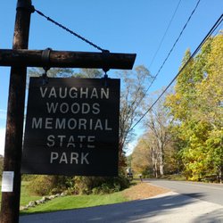
Vaughan Woods Memorial State Park - The Vaughan Woods sign!

The Vaughan Woods sign!

Vaughan Woods Memorial State Park - Perfect late summer Saturday

Perfect late summer Saturday

Vaughan Woods Memorial State Park

See all

Fort McClary - RV/Bus turn around

Fort McClary

4.5(22 reviews)
12.4 mi

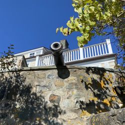
During our visit in early May there were few people here making for a quiet visit. There are…read moreseveral picnic tables and a few benches scattered around the property with beautiful views of the water. This fort was active through many wars and then decommissioned while building a protective wall around the property. Huge slabs of quarried stone, partually carved blocks and lots of stone 'chips' are scattered about. There are a few information signs detailing the history of Fort McClary and some buildings have signs that state the building purpose. Foundations of some buildings is all that remains. They have a few cannons on display. Check out their website for information on events and when the fort is manned. There is a seperate picnic grove up the road about 50 yards across the street. A dirt parking lot holds around a dozen vehicles or so and there is an 'RV turn around' area, but no parking for RV's or busses here. One outhouse is located past the end of the parking lot. There is a wooded trail at the back corner.

A nice outing. The structures are still in good shape, lots of history here…read more Especially loved the map that shows where things are in front of you. Views of Constitution Light (NH) and Whaleback Light, which is actually just a short 10 minute drive away and we went to visit that after! Sign said they officially open Memorial day but the picnic area across the street was open.

Photos
Fort McClary - Views

Views

Fort McClary - History

History

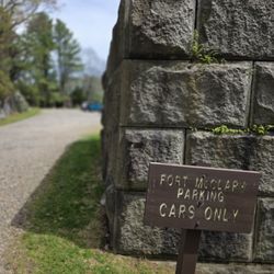
Fort McClary - Car parking

See all

Car parking

Fort McClary Picnic Area - water views

Fort McClary Picnic Area

4.3(3 reviews)
12.3 mi

If you're in southern Maine in the summer or fall and want to get away from the heavily trafficked…read morebeach hotspots, then grab your picnic stuff and come here. There's decent parking, and a handicapped spot nearest the picnic pavilion (this covered structure can be rented for large groups). And rest rooms. Speaking of potties--because Ms. Tiny Bladder knows there are people who care about this info--there's one typical park open-air bathroom. It's large and you could fit a wheelchair in, but there are no grab bars. There's a small building, closer to the woods, with a handicapped sign, so there is a designated bathroom for those of us with mobility issues. (I wasn't needing my cane nor wheelchair on this occasion.) There are picnic tables grouped to the right side of the grassy area, and a covered pavilion that can be rented for groups (though we ate in there one cloudy day & the whole place was empty). There are more picnic tables scattered about the other sides of the property, and a playground to the far left. Back at the entrance/exit, there is a small pond covered in water lilies and cattails. There's a little deck/overlook (seems a little sloped and close to the water, but it felt solid) and there's a bench nearby. No sitting on the bench or standing around this summer ('21), as there were fire ants living somewhere near the bench. A sign warned visitors ahead of time. Back on the picnic area side, there are many trails leading to Barters Creek, a picturesque spot with several places to stop and enjoy the water scene. There's one spot that's almost a little island (except it's probably by definition a peninsula? Maybe?). I've seen people swimming around there--teens to grammas--and it's just nice to also sit there and look out at the flora and fauna. We love this picnic area and always return every trip to York. Go check it out!
this is a nice spot overall. some water views down a short trail. would recommend stopping by…read moreespecially if at the fort across the street.

Photos
Fort McClary Picnic Area
Fort McClary Picnic Area - Barter's Creek

Barter's Creek

Fort McClary Picnic Area - I actually don't recall of this is at this Fort or Vaughan woods. Hmmm

See all

I actually don't recall of this is at this Fort or Vaughan woods. Hmmm

Barters Creek Trail - Looking through the trees.

Barters Creek Trail

4.0(1 review)
12.1 mi

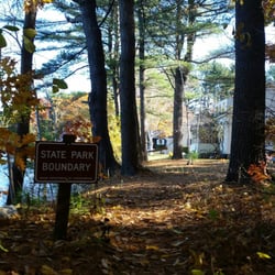
Across the street from Fort McClary State Park is a picnic area near Barters Creek. There are also…read moresome bathrooms and the Barters Creek Trail. While it isn't very long or difficult to navigate, it was absolutely lovely to walk around on - especially on a Sunday morning in late autumn. There was no one there but us! The trail is mostly a straight line with two tiny loops at each end (where it does branch off, you'll be met with big "State Boundary" signs as you're approaching someone's back yard) - so you can either choose to walk left or right first. If you initially go left on the trail, it's a small walk down to the Crockett Neck Rd bridge area. Loop around and go back to the right and you'll be brought to a mini island (we were there during low tide so it was easy to get to - only six or so steps over rocks to reach it). It's fun to hang out on it - there was a lobster trap washed up, a row boat flipped upside down, and the water was a sparkly greenish-blue. I know it sounds silly, but there really was something charming about Mini Island. Like you would expect to see fairies houses or gnomes gardens there! If you're visiting Fort McClary, it would be worth it to meander across the street (be sure to take a moment to sit and enjoy the pond - cattails, lily pads, and some amphibian friends) to this little area for some quiet time (especially during the shoulder seasons), some photos, and for some fresh air!

Photos
Barters Creek Trail - Foliage and low tide.

Foliage and low tide.

Barters Creek Trail - Don't go past here!

Don't go past here!

Barters Creek Trail - The little island near Barter's Creek Trail.

See all

The little island near Barter's Creek Trail.

Orris Falls Conservation Area

Orris Falls Conservation Area

1.0(1 review)
3.5 mi

I feel the need to preface all of my nature reviews with this: being 90% forested and having around…read more3500 miles of coastline, Maine has a tremendous amount of natural spaces, walkways, paths, and trails of all kinds and of all levels. There's something for everyone. What I'm reviewing is how a spot compares to similar outdoor spots in my personal opinion. Being in nature - and remembering to carry in, carry out - is always five stars! :) *** Parking? Kind of. Loop trail? No. Well marked signs? No. When you arrive you'll notice there's maybe three or four off-street parking spots. I don't know where you'd park if these were all taken, because the entire street is lined with No Parking signs. But that's okay, because I don't think this is necessarily a "must" as far as Maine's trails go so if you don't make it here, no big deal. The path is NOT marked well, let's just put that out there right away. I take a lot of nature walks/hike a lot of trails and this one was a little infuriating. I think it has to do with both the lack of signage and desire lines/social trails (those paths made by people cutting through an area and not sticking to the trail itself). I wandered around a lot. Yes, I saw the Foundation (the stone wall remainders of the Littlefield Homestead), Big Bump (exactly what it sounds like: a bigger bump in the ground that puts you nearly at the tree line itself), and Orris Falls (a 90 ft gorge, but there was no running water of any kind in it), but never saw the Balancing Rock. Or maybe I did and didn't process it since the falls themselves were non-existent (unless they weren't referring to water, but to the possibility of plummeting down yourself). I did see some wetlands, though and the amount of dragonflies, bird song, and bullfrog sounds was very cool. I got a heckuva workout in, but mostly was left underwhelmed. There's a lot of really cool places in Maine to take in waterfalls, gorges, funky rock formations, scenic vistas... this is not one of them.

Photos
Orris Falls Conservation Area

See all

Great Bay National Wildlife Refuge - Black Capped Chickadees all along the trail

Great Bay National Wildlife Refuge

4.0(5 reviews)
14.5 mi

Awesome little hidden gem of a wildlife refuge!! There are two hiking trails here - I did the…read morelonger of the two - the William Furber Ferry Way Trail. It has a very unique starting point - next to an abandoned weapons storage facility for an old military base!! But once you get past this, you find yourself wandering through lovely, peaceful New Hampshire woodland with a huge meadow along the way to the Great Bay viewing area! The trail is very well maintained but can definitely get muddy. We had storms the night before my hike and there were some very muddy spots that got a tad slippery - even with my excellent hiking shoes - but there were enough fallen leaves on the ground to provide plenty of pathways to avoid the super muddy and wet areas. And while this trail is wide and well maintained, it's not paved and I wouldn't consider it handicap accessible- although it might be doable if you have some pretty serious trail tires on a wheelchair! Because the trail is mostly flat and not rocky at all. One thing I really enjoyed on this trail were all the adorable American Red Squirrels, the Black Capped Chickadees, and all the fall colors - even in November! The forest was also just full of these absolutely beautiful, ghostly white and pink trees too that were very dramatic! I have no idea what they are, but they are just gorgeous!! I actually came here in search of Wild Turkeys but had no luck this day. It's a very peaceful trail - it was a weekday and I pretty much had it to myself - I only saw two other hikers pass by. The trail maps say it's 2 miles but I ended up with 2.5 miles on my AllTrails tracker for this trail. There's very minimal elevation gain. The halfway point on this loop takes you to a viewing platform of Great Bay with those binoculars on a stand that let you see across the water! There's benches there to rest, as well as benches spaced out along the trail too - just lovely! Another thing that makes this trail fun is that is has "numbered stops" along the way - and the FWS has an info pdf you can view on their website that gives you history and cool info about each stop. The guide to these numbered stops can be found here: https://www.fws.gov/uploadedFiles/Furber_Trail_Guide_FINAL_Aug2014(1).pdf The smaller trail is called the Peverly Pond Trail and is about 1/2 mile long with the trailhead right off the parking lot- but I didn't do this one so can't speak to it. There's plenty of parking in a paved lot and there are decent bathrooms at the parking lot as well - very clean and well stocked! No pets are allowed on these trails - but they do provide an extensive list of pet friendly trails nearby at the information kiosk in the parking lot.

I enjoyed my walk around the lake. There are 2 hiking trails. One is very short but well maintained…read moreand picturesque. The other one is about 2 miles. We saw wild turkey and muskrat. It was mostly in the shade.

Photos
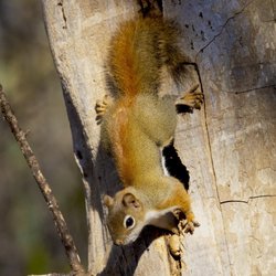
Great Bay National Wildlife Refuge - Feisty American Red Squirrels all along the trail

Feisty American Red Squirrels all along the trail

Great Bay National Wildlife Refuge - Black Capped Chickadee along the trail

Black Capped Chickadee along the trail

Great Bay National Wildlife Refuge - The longer trail starting point is across the street from the parking lot (the William Furber Ferry Way Trail)

See all

The longer trail starting point is across the street from the parking lot (the William Furber Ferry Way Trail)

Hilton-Winn Preserve - hiking - Updated May 2026

Loading...
Loading...
Loading...