Douglas Memorial Woods Photos


You might also consider
More like Douglas Memorial Woods
Recommended Reviews - Douglas Memorial Woods
Start your review...

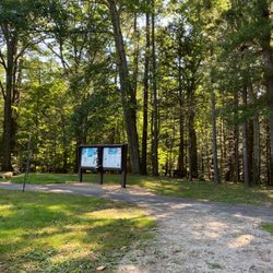
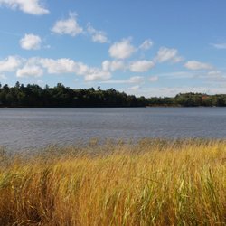
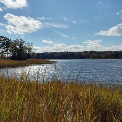
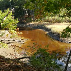
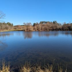
This is just a patch of woods behind the John F Hill Grange Hall. Just a patch of woods that somehow feels like the ever so charming, whimsical, and enchanting Hundred Acre Wood AND a creepy horror film set where some ominous presence looms just beyond (beyond what? you're imagination? an actual tree? you'll never know until it's too late) at the same time! In all seriousness this is a fantastic quick walk (less than a mile and almost entirely flat) in a patch of forest and wetland that has very, very, very tall trees (when its overcast, it feels like they're looming; but when sun streams through them it feels almost fairytale like). In sections, the trees are also PERFECTLY in a row with each other. Was this extreme linear placement intentional? I don't know but it's fascinating. The trail features a variety of habitats, streams, and wooden planks/bog bridges. If you're passing through the area, and wanna stretch your legs and get some fresh air I'd highly encourage you check this spot out. I know it sounds like just another stroll through the woods, but honestly there's just something different happening here. Something palpable in the atmosphere, some secret the trees themselves only know, but I'll be making this a regular haunt during late October. read more


More info about Douglas Memorial Woods
Old Rd
State Road
Eliot, ME 03903
Directions
(207) 646-3604
Call Now
Hours
Outdoor Amenities


Douglas Memorial Woods - hiking - Updated July 2026
Best of Eliot
People found Douglas Memorial Woods by searching for…
Walking Trails in Eliot, Maine
Waterfall Hike in Eliot, Maine
Running Trails in Eliot, Maine
Off Leash Dog Hikes in Eliot, Maine
Secluded Spots in Eliot, Maine
Swimming Lakes in Eliot, Maine
Swimming Holes in Eliot, Maine
Things to Do at Night in Eliot, Maine
Abandoned Places in Eliot, Maine
Browse Nearby
BEST of Eliot, Maine Restaurants near Douglas Memorial Woods
BEST of Eliot, Maine Coffee near Douglas Memorial Woods
BEST of Eliot, Maine Things to Do near Douglas Memorial Woods
BEST of Eliot, Maine Breakfast near Douglas Memorial Woods
BEST of Eliot, Maine Botanical Gardens near Douglas Memorial Woods
BEST of Eliot, Maine Horseback Riding near Douglas Memorial Woods
Browse Brands
Browse Articles
People who viewed Douglas Memorial Woods also viewed
Great Bay National Wildlife Refuge
5 reviews
Bauneg Beg Mountain Conservation Area
2 reviews
Josias River Public Park
3 reviews
Barters Creek Trail
1 review
Old Boston Preserve
2 reviews
Steedman Woods
5 reviews
Newington Town Forest
1 review
York Harbor Beach
3 reviews
Hilton-Winn Preserve
1 review
Rye Harbor State Park
2 reviews