Cancel

    Open app

    Search

    Newington Town Forest

    4.0 (1 review)

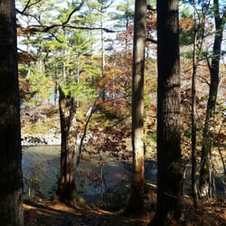
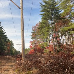
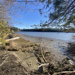
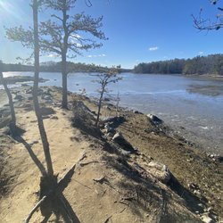
    Newington Town Forest Photos

    You might also consider

    Recommended Reviews - Newington Town Forest

    Your trust is our priority, so businesses can't pay to alter or remove their reviews. Learn more about reviews.
    Yelp app icon
    Browse more easily on the app
    Review Feed Illustration

    6 years ago

    Helpful 0
    Thanks 0
    Love this 0
    Oh no 0

    Verify this business for free

    People searched for Hiking 959 times last month within 15 miles of this business.

    Verify this business

    Great Bay National Wildlife Refuge - Black Capped Chickadees all along the trail

    Great Bay National Wildlife Refuge

    4.0(5 reviews)
    0.9 km

    Awesome little hidden gem of a wildlife refuge!! There are two hiking trails here - I did the…read morelonger of the two - the William Furber Ferry Way Trail. It has a very unique starting point - next to an abandoned weapons storage facility for an old military base!! But once you get past this, you find yourself wandering through lovely, peaceful New Hampshire woodland with a huge meadow along the way to the Great Bay viewing area! The trail is very well maintained but can definitely get muddy. We had storms the night before my hike and there were some very muddy spots that got a tad slippery - even with my excellent hiking shoes - but there were enough fallen leaves on the ground to provide plenty of pathways to avoid the super muddy and wet areas. And while this trail is wide and well maintained, it's not paved and I wouldn't consider it handicap accessible- although it might be doable if you have some pretty serious trail tires on a wheelchair! Because the trail is mostly flat and not rocky at all. One thing I really enjoyed on this trail were all the adorable American Red Squirrels, the Black Capped Chickadees, and all the fall colors - even in November! The forest was also just full of these absolutely beautiful, ghostly white and pink trees too that were very dramatic! I have no idea what they are, but they are just gorgeous!! I actually came here in search of Wild Turkeys but had no luck this day. It's a very peaceful trail - it was a weekday and I pretty much had it to myself - I only saw two other hikers pass by. The trail maps say it's 2 miles but I ended up with 2.5 miles on my AllTrails tracker for this trail. There's very minimal elevation gain. The halfway point on this loop takes you to a viewing platform of Great Bay with those binoculars on a stand that let you see across the water! There's benches there to rest, as well as benches spaced out along the trail too - just lovely! Another thing that makes this trail fun is that is has "numbered stops" along the way - and the FWS has an info pdf you can view on their website that gives you history and cool info about each stop. The guide to these numbered stops can be found here: https://www.fws.gov/uploadedFiles/Furber_Trail_Guide_FINAL_Aug2014(1).pdf The smaller trail is called the Peverly Pond Trail and is about 1/2 mile long with the trailhead right off the parking lot- but I didn't do this one so can't speak to it. There's plenty of parking in a paved lot and there are decent bathrooms at the parking lot as well - very clean and well stocked! No pets are allowed on these trails - but they do provide an extensive list of pet friendly trails nearby at the information kiosk in the parking lot.

    I enjoyed my walk around the lake. There are 2 hiking trails. One is very short but well maintained…read moreand picturesque. The other one is about 2 miles. We saw wild turkey and muskrat. It was mostly in the shade.

    Photos
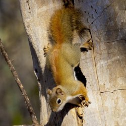
    Great Bay National Wildlife Refuge - Feisty American Red Squirrels all along the trail

    Feisty American Red Squirrels all along the trail

    Great Bay National Wildlife Refuge - Black Capped Chickadee along the trail

    Black Capped Chickadee along the trail

    Great Bay National Wildlife Refuge - The longer trail starting point is across the street from the parking lot (the William Furber Ferry Way Trail)

    See all

    The longer trail starting point is across the street from the parking lot (the William Furber Ferry Way Trail)

    Barters Creek Trail - Looking through the trees.

    Barters Creek Trail

    4.0(1 review)
    11.9 km

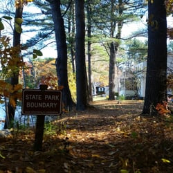
    Across the street from Fort McClary State Park is a picnic area near Barters Creek. There are also…read moresome bathrooms and the Barters Creek Trail. While it isn't very long or difficult to navigate, it was absolutely lovely to walk around on - especially on a Sunday morning in late autumn. There was no one there but us! The trail is mostly a straight line with two tiny loops at each end (where it does branch off, you'll be met with big "State Boundary" signs as you're approaching someone's back yard) - so you can either choose to walk left or right first. If you initially go left on the trail, it's a small walk down to the Crockett Neck Rd bridge area. Loop around and go back to the right and you'll be brought to a mini island (we were there during low tide so it was easy to get to - only six or so steps over rocks to reach it). It's fun to hang out on it - there was a lobster trap washed up, a row boat flipped upside down, and the water was a sparkly greenish-blue. I know it sounds silly, but there really was something charming about Mini Island. Like you would expect to see fairies houses or gnomes gardens there! If you're visiting Fort McClary, it would be worth it to meander across the street (be sure to take a moment to sit and enjoy the pond - cattails, lily pads, and some amphibian friends) to this little area for some quiet time (especially during the shoulder seasons), some photos, and for some fresh air!

    Photos
    Barters Creek Trail - Foliage and low tide.

    Foliage and low tide.

    Barters Creek Trail - Don't go past here!

    Don't go past here!

    Barters Creek Trail - The little island near Barter's Creek Trail.

    See all

    The little island near Barter's Creek Trail.

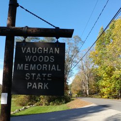
    Vaughan Woods Memorial State Park - Every sort of mushroom grew this wet summer

    Vaughan Woods Memorial State Park

    4.6(9 reviews)
    11.4 km

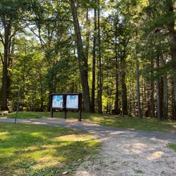
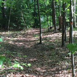
    We revisited Vaughan Woods at a different time of the year, and it's still such a cool spot (though…read morefar busier than it was when we came in autumn a few years ago). It's a state park that's open year long -- during the shoulder season, you can park outside the closed gates and walk in. This time we came when the gates were open; but, there was no attendant to check our state parks pass. It looks like payment is on the honor system (please pay so we can preserve beautiful trails like this!). I'll reiterate what I said in my previous review: It's located along Salmon Falls River (which separates Maine and New Hampshire). And with 3+ miles of hiking trails, it's easy to choose-your-own-adventure. So, whether you're looking to walk a lot or little, spend the day here or just a quick half hour, or if you're a local looking for a new running trail, be sure to explore the "old growth forest" (I saw this used elsewhere and looked into it: did you know this is a term that essentially means it's an ancient woodland, or a natural place that has aged without disruption?)! And it's accessible too: the extremely well groomed, well marked, mostly widened walking paths are easy to navigate (there are some hilly areas; and if it's not winter you're DEFINITELY going to want to bring bug spray). Also, from here you can access the grounds of the restored Hamilton House (built by merchant Jonathan Hamilton in the late eighteenth century) which sits on a stunning grassy knoll among cleared open green space overlooking the river (we actually saw a beaver this most recent time!) on one side and a beautifully maintained garden on the other side.

    Want to get away from the sweating masses over-crowding the beach? Not up for sitting on your buns,…read morebaking in the summer sun? Want some peace & quiet instead of screaming tots and squeaky playground swings? I did. Not that there's anything wrong with the typical midsummer Maine beach experience. It just was NOT my vibe for this getaway. And so we sought out land trusts and mountains and parks, including one of our favorite spots to hit some pretty trails: Vaughan Woods. First, even in the middle of the summer and several cars in the lots, we barely saw another person. On the river trail--which I particularly love for all the scenic views of the river and benches to sit and rest--we had two couples cross our path. Very quick, smiley "hellos" and off they went. So peaceful! I'm mobility-challenged but I had a recent treatment and felt a little more mobile and stable. I took my time and my husband was a great helper. I'd say the river trail can get a bit challenging for anyone with a knee/ankle/foot/balance issue. But if conditions aren't wet, you go slow, and rest at the benches, you might be able to do it! The toilet stall is a wooden structure that is open to the air at the top of the walls before the roof begins. It's a toilet set over a pit, and you could definitely get a wheelchair in, but I don't recall seeing any grab bars. There was plenty of toilet paper and hand sanitizer. Like other places (parks, beach), we noticed it was "carry in, carry out." There are several picnic tables surrounding the parking lot, and we enjoyed a post-hike snack. This place is worth the drive out to South Berwick. Give it a go!

    Photos
    Vaughan Woods Memorial State Park - The Vaughan Woods sign!

    The Vaughan Woods sign!

    Vaughan Woods Memorial State Park - Perfect late summer Saturday

    Perfect late summer Saturday

    Vaughan Woods Memorial State Park

    See all

    Fort McClary - RV/Bus turn around

    Fort McClary

    4.5(22 reviews)
    11.1 km

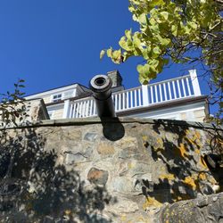
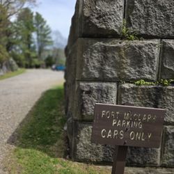
    During our visit in early May there were few people here making for a quiet visit. There are…read moreseveral picnic tables and a few benches scattered around the property with beautiful views of the water. This fort was active through many wars and then decommissioned while building a protective wall around the property. Huge slabs of quarried stone, partually carved blocks and lots of stone 'chips' are scattered about. There are a few information signs detailing the history of Fort McClary and some buildings have signs that state the building purpose. Foundations of some buildings is all that remains. They have a few cannons on display. Check out their website for information on events and when the fort is manned. There is a seperate picnic grove up the road about 50 yards across the street. A dirt parking lot holds around a dozen vehicles or so and there is an 'RV turn around' area, but no parking for RV's or busses here. One outhouse is located past the end of the parking lot. There is a wooded trail at the back corner.

    A nice outing. The structures are still in good shape, lots of history here…read more Especially loved the map that shows where things are in front of you. Views of Constitution Light (NH) and Whaleback Light, which is actually just a short 10 minute drive away and we went to visit that after! Sign said they officially open Memorial day but the picnic area across the street was open.

    Photos
    Fort McClary - Views

    Views

    Fort McClary - History

    History

    Fort McClary - Car parking

    See all

    Car parking

    Beehive Hut

    Beehive Hut

    5.0(1 review)
    30.2 km

    This is one of several mysterious stone chambers in New England, whose provenance and purpose is…read moreunknown. Usually they are square or rectangular in shape, with stone slabbed roofs and soil floors. Archaeologists usually try to claim that they were built by early colonists as 'root cellars' yet they are ill-suited to that task as the floors are soil, which is hardly conducive to dry storage. There is also some documentary evidence from early colonists saying that the chambers were there when they arrived. Other chambers have had very old trees growing out of their walls, evidence that the chamber must be older than the tree. Another theory is that they were sweat lodges used by native Americans, but there is no evidence to show that any native groups built stone sweat lodges. So who did build these things? The closest equivalent in Britain is the souterrains of Scotland or fogous of Cornwall, but these tend to be larger and have curved layouts. The corbelled roof construction is similar to the beehive cells constructed by early monks like the Culdees, but there the similarity ends. Maybe it was early Viking explorers? An earlier megalithic culture that we don't know about? It's a fascinating enigma. Research by antiquarians and earth mystery researchers has shown that many chambers have precise geometric ratios in their construction, and that they are aligned to significant solar events like midwinter solstice, and this Beehive Hut seems no exception. The proportions are almost exactly 2:1 - it is just short of being twice as long as it is wide, and the width and height are the same. The entrance (by my estimation) seems to be aligned to midwinter sunrise (it's hard to be precise because of the tree cover), and is situated part-way up a hillside, which would allow the rising sun to enter the chamber. There are an interesting couple of white quartz stones, one in the back wall and one in the left-hand side wall, which may mark the extremes of the sunrise positions between equinox and winter solstice. But as I'm not resident here I am unable to do the long-term observations that this theory would require to confirm it. Interested locals should get in touch with the New England Antiquities Research Association (NEARA), who will know more about these things.

    Photos
    Beehive Hut
    Beehive Hut - The Beehive Hut

    The Beehive Hut

    Beehive Hut - Keep climbing...

    See all

    Keep climbing...

    Newington Town Forest - hiking - Updated May 2026

    Loading...
    Loading...
    Loading...