Cancel

    Open app

    Search

    Ossipee Hill Trail

    4.0 (2 reviews)

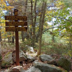
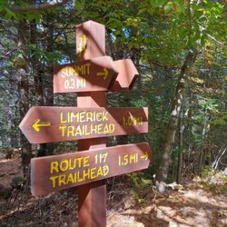
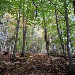
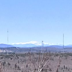
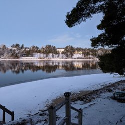
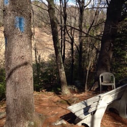
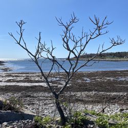
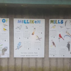
    Ossipee Hill Trail Photos

    You might also consider

    Recommended Reviews - Ossipee Hill Trail

    Your trust is our priority, so businesses can't pay to alter or remove their reviews. Learn more about reviews.
    Yelp app icon
    Browse more easily on the app
    Review Feed Illustration

    5 years ago

    Helpful 0
    Thanks 0
    Love this 1
    Oh no 0

    11 years ago

    Helpful 1
    Thanks 0
    Love this 0
    Oh no 0

    Verify this business for free

    People searched for Hiking 238 times last month within 15 miles of this business.

    Verify this business

    Sawyer Mountain Highlands

    Sawyer Mountain Highlands

    3.0(2 reviews)
    7.3 mi

    There are two trailheads to Sawyer Mountain Highlands: the Limington side which is a 3.6 mile round…read moretrip hike to the summit and back, or the Limerick side which is 2.4 miles. We opted for the latter; I'm not sure we really missed anything by not exploring the Limington side of things, truth be told, so don't worry too much about which you go with. Smith Trail picks up right in the parking lot on the Limerick side; the entire trail is extremely well marked with wooden plaques painted red and stamped with a yellow turtle, and brightly painted arrows when you need to take sharp turns. The combo of those two colors really pop regardless of season, so you should have no problem staying the course (there's also plenty of directional signs at intersections pointing which way is what and the distance to it). The first bit of Smith Trail is relatively steep so be sure to have good shoes, a walking stick, and knowledge that it's a serious work-out. We saw plenty of people turn back because they wanted a flat, easy walk in nature and not a hike. You don't need gear, but if you come in flip-flops and expect to not sweat then you've done yourself a disservice. That being said - it's always nice to be rewarded after putting in the effort... and Sawyer Mountain Highlands does NOT offer that. The view at the summit is underwhelming as its primarily obstructed by evergreens. Sure there are some spots through the trees you can see glimpses of across the valley below and mountains beyond, but mostly you're just really high up looking at nearby trees. We thought comparable hikes with far better summit views included Douglas Mountain in Sebago or Pleasant Mountain in Bridgton. The coolest bit of this particular summit is the sign marking where a whale oil light was used to navigate ships in Portland harbor ('cause you can see Sawyer from the ocean apparently). Leaving the summit, you can go back the way you came (Smith Trail) or you can opt to take the old Sawyer Mountain Road - personally, while I don't like doubling back and seeing the same things on my hikes, I regret taking Sawyer Mountain Road back to the parking lot - not sure if it was a former riverbed, but the entire thing was rocky and pebbly (goodbye articular cartilage around my patella, I'm sure I didn't need you). It also came out near someone's house at the end of Sawyer Mountain Road where large, growling, bark-screaming German shepherds at the edge of their chain were snapping at us (and hung on trees and fences there were loads of "stay out"/"private property" signs hung everywhere). Just a heads-up. All in all? I'd prefer to go to Libby & Son's nearby, eat a truckload of donuts, and walk their beautiful grounds which actually offers far more expansive, impressive views.

    I'm consistently impressed by the seemingly endless number of hiking trails in Maine. On a recent…read moreday off, and after some quick googling, we came across this trail and decided to try it out. There's a small parking area on 117 in Limington and you can hike up from the Limerick side of the mountain as well. The hike is pretty rocky, and steep in some parts, but evens out in spots for a very pleasant experience overall. I think it was 1.8 miles to the summit. There are a few small cemeteries and foundations of buildings that used to stand on the mountain. On a Sunday in November our trip was a pretty quiet one. We ran into one other couple and a geocacher on his way down who was nice enough to give us the basics of geocaching and point us in the right direction to find the box hidden on the hill, which made for some extra excitement when we reached the summit. The one downside to this hike was that whoever owns the neighboring property seemed to be really unhappy that the trails were open to the public. There were several unfriendly signs that indicated the neighbors were not fans of the Francis Small Heritage Trust that owns the trail. We didn't actually see anyone, and I'm pretty happy about that. This would be a great spot in nicer weather; it was too foggy for us to have much of a view but I bet it's a good one. Would be a great spot for a picnic.

    Photos
    Sawyer Mountain Highlands
    Sawyer Mountain Highlands
    Sawyer Mountain Highlands

    See all

    Silver Brook Trail - The Very Old Pine Tree.

    Silver Brook Trail

    5.0(1 review)
    12.3 mi

    You know those magical places in the world that catch you off guard? You weren't expecting it, or…read morelooking for it maybe, you just stumbled upon it and thought... "this place - however long I stay here, whether I'm just passing through or stop to sit and soak it in - will always sit in my heart." That's how I felt about the brook off Broadturn Farm Trail. Broadturn Farm is this big, beautiful organic farm that invites visitors for a self-guided tour of the farmstead and their fields. Just behind their outhouses, though, lies Silver Brook Trail from the Scarborough Land Trust. It's maybe just a mile loop through former woods (really it feels like you're walking a wide path cut through enormous brambles). There's nothing exciting about it, but it's charming mostly because: a) You could be walking through the geography of a dozen different fables... will you end up at Snow White's cottage, the Shire, Albion, FernGully, or back at Broadturn Farm? b) There's a sign for a "Very Old Pine Tree" (and if that doesn't make you smile, then you're dead inside). Veer off the path to visit her. What IS so special about the place is... once you go down the little hill behind the outhouses you can choose to go right to the path or left to the brook. Go left. You will find yourself at a bench overlooking what I'm positive actually does come straight out of a fairy tale: if you're going in the summer, think hundreds of shades of green, moss covered rocks with water tumbling down them, a babbling brook, streams of golden sun shining through the canopy of trees. It feels absolutely enchanted or otherwordly (and I imagine it's just as glorious in the autumn). It's like a shot of everything perfect about nature right into the soul. And that it's just hidden-in-plain-sight enough, makes it feel extaordinarily special.

    Photos
    Silver Brook Trail - Silver Brook Trail this way!

    Silver Brook Trail this way!

    Silver Brook Trail - Please visit it. It's lonely.

    Please visit it. It's lonely.

    Silver Brook Trail - FACT: babbling brooks online do not sound as good as the real thing.

    See all

    FACT: babbling brooks online do not sound as good as the real thing.

    Bauneg Beg Mountain Conservation Area - Top of the peak!

    Bauneg Beg Mountain Conservation Area

    4.5(2 reviews)
    14.0 mi

    Good reward at the top for a short hike. You can see pretty far with the views but nothing…read moreextraordinary, since the mountain is not very tall. The trail is very well marked, with trail markers every twenty feet or so. The walk is mostly wooded, so just take some time and enjoy the rustling of the trees. This would be a good trail to bring your dog on. Parking lot probably fits 10 to 15 cars. There were no bathrooms on site.

    After a long day of hiking various trails in the area, we decided to squeeze in one more right…read morebefore dusk and we're so glad we did because it ended up being our favorite. Just the drive to find the entrance to Bauneg Beg (which we did from Fox Farm Hill Rd) was stunning - sweeping views of wide open fields and meadows. Lovely. If you're coming to the mountain this way, there's a inconspicuous brown wooden plank sign before the small off-street gravel parking lot (we blew past it initially, and probably would again if we came bag so just go slow!). This conservation area is comprised of close to 90 acres of logging trails (a two mile network) through thick woodlands and rock formations, one such called Devil's Den made up of impressive and daunting looking boulders - hiking up the relatively steep rocky "path" constructed through here, though, brings you directly to the top of Middle Peak. Apparently Banueg Beg has three distinct peaks which can actually be seen from the ocean (and in the past they were used to help navigation to ME's coast, kinda cool right?). Unfortunately, the views from the top (apparently you can see Mt Washington and the Atlantic on a clear day) where we specifically were didn't quite offer what we were expecting as much of it is obstructed by the overgrowth of trees and vegetation. A bit of a bummer, but still worth the work-out! Instead of backtracking, we went down the mountain via the more accessible, gentle, all-levels trail through a pine grove (Ginny's Way). Bauneg Beg was just such an unexpected, beautiful network of trails through such a thick, tall deciduous forest that we were impressed. The signage on the paths themselves could be improved (some trees have multiple boards with arrows pointing in literally every direction making it VERY confusing; guess that's part of the adventure, though!), but this particular spot just had that untouched-by-man, trekking-through-the-raw-beauty-of-Maine-without-a-single-person-knowing-where-I-am-and-can't-bother-me-via-text feeling really reconnects a gal to nature and makes her want to create or write something beautiful, y'know?

    Photos
    Bauneg Beg Mountain Conservation Area - Someone's having fires here?!?

    Someone's having fires here?!?

    Bauneg Beg Mountain Conservation Area - Okay, it just became The Labyrinth.

    Okay, it just became The Labyrinth.

    Bauneg Beg Mountain Conservation Area

    See all

    Pine River Pond

    Pine River Pond

    5.0(1 review)
    14.6 mi

    I have missed this lake. My grandparents bought a cottage up here many years ago, and the whole…read morefamily would come during the summer. We would all be crammed into this cottage, spending time together and going on adventures like hiking Mt Chocorua, going out on the canoe on the lake, or just swimming here. I remember countless hours fishing with my dad, I think I can count on one hand how many times I actually caught anything. Or we would just lounge on the porch, or be inside reading. Maybe we would watch the news in the morning, or watch a VHS tape of a kids movie at night (no cable here, this is roughing it!) with everyone in the living room and kitchen. I remember times spent with my grandparents here. Grandma passed away several years ago, and June of this year (2020) Grandpa passed away. There was a flood of memories coming back, it was a couple of years since my last visit. I am glad I was finally able to bring my wife here to see both the cottage and the lake. We went out on the canoe but had to come back because of thunder rolling in. It was her first time in a canoe, 30 seconds in she capsized and fell in the water. I'm glad I wasn't already in the damn thing . With Pine River Pond being 5 miles long, there is so much to explore; the islands, sand bars, tributaries, coves, there is no shortage of things to explore. The weekend was my birthday, and it was nice staying with my family there. This is a beautiful lake. I can't speak for the fishing but if you have a boat there is plenty to explore.

    Photos
    Pine River Pond - Sunrise in December

    Sunrise in December

    Pine River Pond
    Pine River Pond

    See all

    Horton Woods - A few scenic pit stops are on the trail

    Horton Woods

    5.0(1 review)
    10.1 mi

    Saco Trails has done a great job with this area and we discovered another new trail on this latest…read morehike. The terrain is varied and you should be prepared with good hiking shoes or boots. You will be hiking up and down short hills and the path will be rocky with roots and covered in leaves. Also, you will be walking around a marsh and along Stackpole Creek so there are many areas that are wet and you will want to keep your feet dry. The trails are extremely well marked, however, I would recommend taking a picture of the trails at the trail head to review as you hike. While we have been here a few times, we had never followed the Blue Heron trail to the end and were surprised when it just stopped at a bench overlooking the river. Well guess what... that is what it currently does! We back tracked and ended up crossing over the bridge to join the Red Maple trail and loop around the hill (you will come to a spot where you can look across the river to the bench at the end of the Blue Heron trail). This is a great spot for birders!!! Some trails are also open to mountain biking. Dogs are supposed to be on leash, no longer than 4ft, but that does not mean you will not come across someone with an off leash dog walking these trails. There is a decent sized parking area at the trail head which is located off Rt 112. The trail does skirt along private property so be aware of where you are. They are also building a development and there is currently a construction trailer near the trail head. You can make this hike a short hike or a long one. This last hike we ended with a 4.68 mile hike. I really like this spot and recommend bug spray in the Summer and expect to find ticks for sure.

    Photos
    Horton Woods - Varied terrain

    Varied terrain

    Horton Woods - Birds abound in the marsh

    Birds abound in the marsh

    Horton Woods - Trails are well marked

    See all

    Trails are well marked

    Jagolinzer Preserve

    Jagolinzer Preserve

    5.0(4 reviews)
    14.0 mi

    Holy green guacamole, folks -- what an adorable hike for some recreational activity. Eight thumbs…read moreup from me. (SAYS THE OCTOPUS!!!) If you must know, Eugene: this loop's difficulty was easy-to-moderate. Moderate; only because there are a few steep inclines/declines & lots of exposed roots throughout. Otherwise, super charming trail -- at time of this post (8.24.25), there was a story book; 'The Wicked Big Toddlah' displayed along the trail 4 people 2 read. That was a fun touch that must have been added by someone who likes fun things. Saco River = the midway point -- and guess what?! -- there's a rope swing there!!! Splish-splash -- take a swing, miss thing! Cool lil' waterfall to observe, as well. FYI: it's in the distance & it comes up towards the end of the loop. You can access it, however, by moving your bod down a fairly steep woodland surface. (Be careful, Uncle Todd!) Lots of pine needles around, too -- but also, hello, it's the woods! Call me Ranger Rick -- but I really enjoyed this hiking loop. Fam said 'bravo ' too!

    Great time walking the preserve with my husband and dog. Don't be scared off by the "no…read moretrespassing" sign at the end of the road, like us. We saw that sign, despite Google maps telling us we arrived, and continued driving. We pulled off and decided to try again and sure enough, the parking lot and trail is JUST down the road slightly. Just past the no trespassing sign. The trail is extremely steep in 2 spots so I can't imagine visiting after it's freezing/icy/snow covered, unless you use snowshoes. Pretty view of the Saco River. Lots of parking.

    Photos
    Jagolinzer Preserve
    Jagolinzer Preserve
    Jagolinzer Preserve

    See all

    Ossipee Hill Trail - hiking - Updated May 2026

    Loading...
    Loading...
    Loading...