
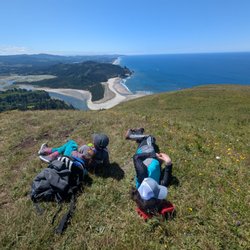
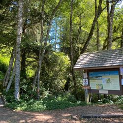
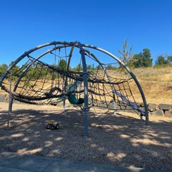
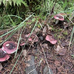
Harvey Creek Trail Photos


You might also consider
More like Harvey Creek Trail
Recommended Reviews - Harvey Creek Trail
Start your review...

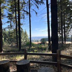
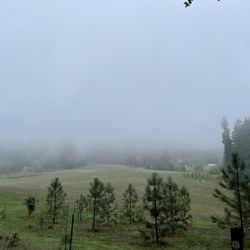
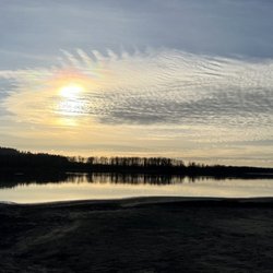
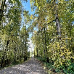
It's a great little trail to have a talk and take a walk. Not a lot of physical challenge. There are some spots that have a incline nothing that should be too difficult. You many options once inside. The trail keeps splitting and twisting. There good news is they all seem to end up in the relative same position at the top of the hill. The cemetery I would imagine used to have some good views. All the houses and development have made that less than available. Don't look for places to just chill or have a picnic at the top. Pretty sure the home owners have made all that go away. Still a good walk to think and or have a good conversation Enjoy read more


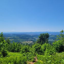
This trail is basically a hill climb and descent with two endpoints. I felt like Will Teasle looking for John Rambo in the woods on this hike, having to pause every so often to catch my breath. Coming from Orlando where an 8 mile hike will have 16 feet of elevation gain, this was a new challenge for sure. I'd do it again for exercise, but it wasn't very scenic or interesting. read more


This trail was personally recommended to me by a wine tasting associate from a winery on Worden Hill Road. It was a great place to take my two dogs and stretch their legs out & roam around. I have made it a tradition ever since!!! It is very low-key and rarely busy or crowded. A great place togo between wineries! read more


4 years ago
8 years ago
6 years ago
9 years ago
8 years ago
More info about Harvey Creek Trail
Dundee, OR 97115
Directions
Hours
Outdoor Amenities
Ask the Community - Harvey Creek Trail


Harvey Creek Trail - hiking - Updated July 2026
Best of Dundee
People found Harvey Creek Trail by searching for…
Trending Searches in Dundee, OR
Blueberry Picking near Harvey Creek Trail
Boat Tours near Harvey Creek Trail
Cliff Jumping near Harvey Creek Trail
Cruising Spots near Harvey Creek Trail
Day Trips near Harvey Creek Trail
Dog Friendly Things To Do near Harvey Creek Trail
Jet Ski Rental near Harvey Creek Trail
Kayak Rental near Harvey Creek Trail
Kids Activities Indoor near Harvey Creek Trail
Off Road Trails near Harvey Creek Trail
Outdoor Activities near Harvey Creek Trail
Peach Picking near Harvey Creek Trail
Places To Walk Around near Harvey Creek Trail
Public Shower near Harvey Creek Trail
River Swimming near Harvey Creek Trail
Rock Quarry near Harvey Creek Trail
Scenic Night View near Harvey Creek Trail
Scenic Overlook near Harvey Creek Trail
Surf Shop near Harvey Creek Trail
Swimming Holes near Harvey Creek Trail
Swimming Lakes near Harvey Creek Trail
Things To Do On A Rainy Day near Harvey Creek Trail
Tubing near Harvey Creek Trail
View Points near Harvey Creek Trail
Watch Sunset near Harvey Creek Trail
Browse Articles
Browse Nearby
BEST of Dundee, Oregon Coffee near Harvey Creek Trail
BEST of Dundee, Oregon Restaurants near Harvey Creek Trail
BEST of Dundee, Oregon Things to Do near Harvey Creek Trail
BEST of Dundee, Oregon Campgrounds near Harvey Creek Trail
BEST of Dundee, Oregon Parks near Harvey Creek Trail
BEST of Dundee, Oregon Walking Trails near Harvey Creek Trail
BEST of Dundee, Oregon Breakfast near Harvey Creek Trail
Browse Brands
Related Searches in Dundee, OR
Affordable Kayak Rental Services in Dundee, Oregon
Affordable Paddle Board Rental in Dundee, Oregon
Best Dog Hiking Trails Around Dundee, Oregon
Best Fishing Locations and Guides in Dundee, Oregon
Best Places for Horseback Riding in Dundee, Oregon
Best Sightseeing Experiences Available in Dundee, Oregon
Best Waterfalls and Swimming Holes in Dundee, Oregon
Discover Dog Friendly Trails to Explore in Dundee, Oregon
Discover Kid Friendly Hiking Trails in Dundee, Oregon
Discover Popular Bike Trails in Dundee, Oregon
Discover Scenic Mountain Bike Trails Near Dundee, Oregon
Discover Walking Parks in Dundee, Oregon Near You
Discover a Hiking Trail in Dundee, Oregon
Discover the Best Night Hike Trails in Dundee, Oregon
Dog-Friendly Hikes With Dogs in Dundee, Oregon
Enjoy Camping Adventures Around Dundee, Oregon
Enjoy Kayaking Adventures in Dundee, Oregon
Enjoy Off Leash Dog Hikes in Dundee, Oregon
Enjoy Tent Camping Spots Around Dundee, Oregon
Enjoy a Beautiful Waterfall Hike in Dundee, Oregon
Enjoy the Best Walking Path in Dundee, Oregon
Enjoy the Best Walking Trails in Dundee, Oregon
Experience Thrilling White Water Rafting in Dundee, Oregon
Explore Beautiful Parks and Green Spaces in Dundee, Oregon
Explore Easy Hikes Perfect for All in Dundee, Oregon
Explore Fun Activities to Do in Dundee, Oregon
Explore Popular Campgrounds Near Dundee, Oregon
Explore Top Dog Parks in Dundee, Oregon Near You
Explore the Best Beach Spots in Dundee, Oregon
Explore the Best Swimming Holes Around Dundee, Oregon
Family Friendly Hiking With Kids in Dundee, Oregon
Find Top-Rated Waterfalls in Dundee, Oregon Now
Find the Best Parks BBQ Grills in Dundee, Oregon
Find the Best Parks for Picnics in Dundee, Oregon
Hiking Trails With Waterfalls in Dundee, Oregon
Off Leash Dog Hiking Trails in Dundee, Oregon
Plan a Scenic Drive Route Near Dundee, Oregon
Popular Outdoor Activities to Try in Dundee, Oregon
Popular Picnic Spots to Visit in Dundee, Oregon
Popular Waterfall Hiking Trails in Dundee, Oregon
Safe River Swimming Areas in Dundee, Oregon
Safe and Fun Parks for Kids in Dundee, Oregon
Top Hiking Trails to Explore in Dundee, Oregon
Top Playgrounds for Kids to Enjoy in Dundee, Oregon
Top Running Trails to Explore in Dundee, Oregon
Top Swimming Lakes to Enjoy in Dundee, Oregon
Top Swimming Spots and Pools in Dundee, Oregon


