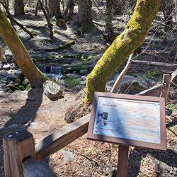
Half Dome View Photos


You might also consider
More like Half Dome View
Recommended Reviews - Half Dome View
Start your review...


5 years ago
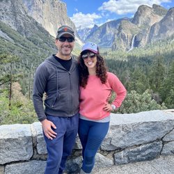
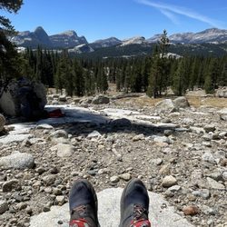
Getting there: If entering through the North side of the park, you will travel down the 120 which turns into Big Oak Flat Rd. You'll come around a bend and you will not only see the view, but you will see a small pull off with limited parking. (If you google Half Dome View it will come up) Experience: This is a great spot to pull off and not only enjoy the view for a bit, but take some nice pics of the valley. It almost doesn't seem real when you're there looking at it. Tips: - Don't go too fast or you could miss the turnout - If it's not too cold, stop and have a quick lunch here - There is no service until you get to the valley floor, so put in the directions while you have service read more


More info about Half Dome View
Foresta, CA 95389
Directions
Visit Website
https://www.nps.gov/yose/learn/index.htm
Hours
Outdoor Amenities


Why does Yelp recommend reviews?
Half Dome View - parks - Updated May 2026
Best of Foresta
People found Half Dome View by searching for…
Snow Park in Foresta, California
Things to Do in Foresta, California
Cliff Jumping in Foresta, California
Watch Sunset in Foresta, California
Free Snow Play in Foresta, California
Fishing Spots in Foresta, California
Hiking Trails With Waterfalls in Foresta, California
Redwood Trees in Foresta, California
Sunrise View in Foresta, California
Picnic Areas in Foresta, California
Off Road Trails in Foresta, California
River Swimming in Foresta, California
Sunset View in Foresta, California
Running Trails in Foresta, California
Scenic Views in Foresta, California
State Parks Camping in Foresta, California
Picnic Spots in Foresta, California
Walking Trails in Foresta, California
Parks With Pull Up Bars in Foresta, California
Scenic Drive in Foresta, California
Pokemon Go in Foresta, California
Browse Nearby
BEST of Foresta, California Things to Do near Half Dome View
BEST of Foresta, California Hiking near Half Dome View
BEST of Foresta, California Coffee near Half Dome View
BEST of Foresta, California Restaurants near Half Dome View
BEST of Foresta, California Breakfast near Half Dome View
BEST of Foresta, California Shopping near Half Dome View
BEST of Foresta, California Lodging near Half Dome View
Browse Brands
Browse Articles
People who viewed Half Dome View also viewed
Sentinel Dome & Taft Point
42 reviews
Lower Yosemite Falls
68 reviews
Yosemite Falls
190 reviews
Hetch Hetchy Reservoir
42 reviews
Cloud's Rest
55 reviews
Mist Trail
113 reviews
Half Dome Day Hike
299 reviews
Curry Village Recreation Center, Rafting and Ice Skating
20 reviews
Mariposa Arts Park
1 review
Jackson Road Trail
1 review