Cancel

    Open app

    Search

    Guale Preserve

    3.0 (1 review)

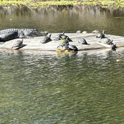
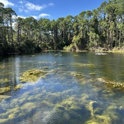
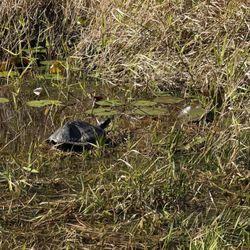
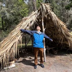
    Guale Preserve Photos

    Recommended Reviews - Guale Preserve

    Your trust is our priority, so businesses can't pay to alter or remove their reviews. Learn more about reviews.
    Yelp app icon
    Browse more easily on the app
    Review Feed Illustration
    Photo of Olivia H.
    0
    102
    18

    5 years ago

    Helpful 0
    Thanks 0
    Love this 0
    Oh no 0

    Verify this business for free

    People searched for Hiking 174 times last month within 15 miles of this business.

    Verify this business

    Cannon’s Point Preserve - Cannon point is full of history and nature! Bike or walk to the north end of the park and see the ruins located on the Hampton River!

    Cannon’s Point Preserve

    4.7(3 reviews)
    2.9 mi

    Awesome place but it's a hike if you go the whole route. If you get there too late they won't let…read moreyou start your hike. Bring a bike if you wanna get in and have time to really explore.

    Cannon's Point Preserve is one of the holdings of St. Simons Land Trust. It is a large preserve on…read morethe northern end of SSI. The main attraction here is to do the long hike to the ruins at the northernmost tip of the preserve. I was never given a clear answer about how many miles the hike is, I was just told it would probably take an hour each way to hike it, and they do not allow anyone access to attempt the hike past 1pm, to assure they've returned before close. You may bike it, something I wasn't told. That would've gone a lot faster and I'd have made it with my toddler! Next time. I did do a large portion of the trail, but I skipped the side trails in my attempt to reach the ruins. When I finally gave up, I did take a side path to a hammock of live oaks, and it was such a beautiful canopy! Like an arboreal cathedral! I posted a video of the birdsong here, OMG, it is crazy! Birds friggin' love this place! My dogs had fun exploring, but I don't think there was a lot of wildlife other than birds, because my dogs will usually get excited for anything and they didn't do that the whole walk. The bush here is so thick, I guess the fauna kept well hidden. This is a beautiful sanctuary, which is wonderful on the very built up island of SSI. Thank God for St Simons Trust!

    Photos
    Cannon’s Point Preserve - Cannon's Point Preserve

    Cannon's Point Preserve

    Cannon’s Point Preserve - Cannon's Point Preserve

    Cannon's Point Preserve

    Cannon’s Point Preserve - Cannon's Point Preserve

    See all

    Cannon's Point Preserve

    Jekyll Island Trail System - Jekyll Island Trail System

    Jekyll Island Trail System

    5.0(1 review)
    10.5 mi

    *********** I started this page for the JEKYLL ISLAND TRAIL SYSTEM, which is a thing, but Yelp then…read morechanged it to the Jekyll Island Campground, which is an entirely different thing that already has a different Yelp page elsewhere.******** I also put this under categories for hiking and biking but Yelp changed it to camping. Hiking and biking trails are NOT the same thing as a campground!!!! I hope Yelp can get its act together to acknowledge the trails on this island, which are a huge draw for visitors, and which have their own web presence as acknowledged by the Golden Isles tourism org, as well as the state parks system! JEKYLL ISLAND TRAIL SYSTEM So this review goes with the dozens of photos I posted of the trails all over the island, better known as the Jekyll Island Trail System. JI has over 25 miles of paved trails throughout the island. They also have dirt/sand trails, and gravel trails. Most trails are handicapped accessible, though I'd stick to the paved ones if exploring on wheels of any kind. It is very popular to circumnavigate the perimeter of the island, which can be done, nonstop, in under an hour on bike. But you can easily spend a day traveling this island by bike if you pause to take in all the sights. I would not call any of the trails difficult, neither for biking, nor for walking. The island is mostly flat, so virtually no inclines at all, and the paths are so well-maintained that you will never encounter overgrowth or mud or anything on the paved or boardwalk trails. From Corsair Beach Park, northward, one can ride their bike on the beach, including all over Driftwood Beach, which is arguably the main attraction of not only Jekyll Island, but all of the Golden Isles put together! Other worthy stops include the Historic District, St. Andrews Picnic Area, and Clam Creek Picnic Area. But those are just highlights. Bikes can't go on the southern beaches because it is a haven for sea turtle nests. However, you can chain your bike in the parking lot and walk these beaches, which are worth every second of detour. Beach Village is another fun stop, and the perimeter bike trail goes right through it. Beach Village houses Love Shack inside Jekyll Market, which is my top recommendation for a food stop! On the southern end of the island, there are a lot of inland trails, running through swamp, and under thick tree canopies, allowing you to really explore the innards of the island, and a lot of wildlife. At the northern end, between Clam Creek and Driftwood Beach, there is a trail through the swamp that has beautiful views in every direction, especially at sunset. More toward the center of the island, Tupelo Trail runs past Horton Pond, and Shell Rd. Trail navigates some of the best wildlife spotting areas on the island.

    Photos
    Jekyll Island Trail System - Jekyll Island Trail System

    Jekyll Island Trail System

    Jekyll Island Trail System - Jekyll Island Trail System

    Jekyll Island Trail System

    Jekyll Island Trail System - Jekyll Island Trail System

    See all

    Jekyll Island Trail System

    Cay Creek Wetlands Interpretive Center - Deck at the top of the tower.

    Cay Creek Wetlands Interpretive Center

    4.8(5 reviews)
    39.0 mi

    Cay Creek Wetlands Interpretive Center (CCWIC) is located in Midway, off exit 76 on I-95. According…read moreto one of the info boards, the site of CCWIC was bought by the City of Midway to provide its citizens, as well as visitors, a green space to enjoy and to learn about the unique environment in our coastal area. I'm always on the lookout for nature spaces to bring my kids, so when a friend had mentioned this place that she had heard, I, of course, immediately did some research and went to check it out this weekend with my kids. The unique thing about this space is that this is where you can see the wetlands transition to a salt water marsh. - Parking - Private lot. You'll clearly see a wooden sign from Charlie Butler Road and a metal gate that bears its name. It states on the website, open daily from 9 am to dusk, so plan accordingly. You'll drive straight down a short dirt path and will arrive at the parking area. - Admission - FREE, Baby! - History - The area used to be a plantation which, back then, used to be called Salter's Creek, owned by Raymond Cay. Rice and other food crops were grown on a smaller scale then. Pine trees were abundant in the area and eventually, with the booming paper industry, paper companies bought large pieces of pine lands, including Cay Creek. In 1996, the City of Midway bought the property. - Trail Description - There is only one path with no off shoot trails, about 0.7 miles round trip. An elevated boardwalk has been built the entire way. It's very well maintained, with built-in benches and trash cans with their own built-in nooks for your convenience throughout the trail. There is also a 15-ft tower about halfway through the trail that provides a great bird's eye view and great for bird watchers. When you get to the end of the trail, there is also a bigger deck with benches built in on either side and you can see the transition of the two types of water flow. Lots of birds and animals can be found here, but my kids and I probably scared them all away. Haha. - Heads Up - You will find modern and recent info boards in color, throughout the trail that talks about the different flora and fauna and how they have adapted to this environment. There are QR codes at the bottom of the boards that you can scan to read more about it, but I tried scanning the code on the first board and it came up as an error so I didn't bother scanning the others. Given the proximity of this trail to I-95, this would be a great place to stop and have a quick snack and to stretch your legs as there is a picnic table in the parking area. However, there are no bathrooms on site, so you might want to stop at the gas station down the road for that. This is such a great gift by the city of Midway and anyone passing through or live in the area, should take advantage. It was a great place for a small afternoon adventure and get some fresh air and teach my kids about the unique environmental conditions in this area. Get outside!

    What a cool little spot off the beaten path. In a short walk on their boardwalk we saw an indigo…read moresnake, an alligator, lots of birds and insects, crabs, and very interesting plants. Worth spending 30+ minutes on

    Photos
    Cay Creek Wetlands Interpretive Center - Garden at trail head.

    Garden at trail head.

    Cay Creek Wetlands Interpretive Center - Beautiful flower.

    Beautiful flower.

    Cay Creek Wetlands Interpretive Center - Flowers

    See all

    Flowers

    St Simons Land Trust - St. Simons Land Trust -- passport guide to all the different preserves

    St Simons Land Trust

    5.0(2 reviews)
    4.2 mi

    St. Simons Land Trust is the org trying to preserve as much land as possible on the heavily-built,…read moreSSI. Unlike the state park that is the entirety of Jekyll Island, St. Simons is densely populated, with relatively little greenspace. On a map, most is city grey. Luckily, the St. Simons Land Trust has claimed most of the northern end of the island, and it is a lush sanctuary for wildlife and vegetation. The site where St Simons Land Trust's offices sit, was going to be a Dollar Tree. I know in my tree-hugging heart that this is a better choice, but I do love my DT. That said, SSLT has various smaller properties around the island, some as small as a fraction of an acre. Whatever they can get their hands on, they'll grab, because greenspace is limited, especially on an island. They have information about every preserve or other land holding on the main page of their website, even the smallest ones, that are not developed into anything for the public to visit. They also divulge the funding sources for many of these acquisitions. The staff in the office is very friendly. I called a few times before visiting their properties. All are free, and leashed dogs are allowed at most. They recommended I stop by and pick up a "Passport" for my son, which is a cute little booklet highlighting the special flora and fauna unique to each of their properties, and kids can check stuff off as they go. It's free, and it's very well done, not only to use in the field, but to keep as a souvenir to take home. SSLT is doing great work, and I am excited to watch what they do with their acquisitions, and hope they are able to buy up as much of the remaining land as they can!

    This foundation has done amazing work on the island to preserve historic and wildlife spaces. We…read morebenefit by admiring these beautiful spaces with nature paths to explore. Scattered throughout the island are opportunities to go back in time and relish nature havens

    Photos
    St Simons Land Trust
    St Simons Land Trust - St Simons Land Trust 2023

    St Simons Land Trust 2023

    St Simons Land Trust - St. Simons Land Trust storefront

    See all

    St. Simons Land Trust storefront

    Fort Frederica National Monument

    Fort Frederica National Monument

    4.7(49 reviews)
    1.1 mi

    I never knew any of the history that we stumbled upon here!…read more First of all, the building is nicely done with great museum like displays and a cute gift shop. There was also an extremely knowledgeable person inside who gave us a ton of info about the history and the fort. We then ventured outside (bug spray may be a good idea here!) and looked at the various spots with info and the history of the butcher, baker, candlestick maker as well as the other jobs around the fort. The actual building ruins are interesting and picturesque by the water. You could easily spend a while here meandering and learning. 100% worth a visit if you are nearby!

    This afternoon, my mom and I went to go tour the Fort Federica national Monument on Saint Simons…read moreIsland. It is a free fort so you don't pay a parking fee or an entrance fee. They have a museum inside along with a small gift shop as well as the fort grounds that you can walk around and read the Historical information. To get on Saint Simons Island you don't have to pay an island fee. The lady at the desk, her name is Barbara. She was very nice and assisted me with purchasing my passport guide. A passport to the national parks has little areas where you can take the stamps from the different national parks and stamp in your booklet. The passport books includes national parks all over the country. In the gift shop, they have a regular passport, an expert passport and a junior guide for a junior Rangers. 10/10

    Photos
    Fort Frederica National Monument - Rise and shine, time for a macchiato venti hot

    Rise and shine, time for a macchiato venti hot

    Fort Frederica National Monument - Canon

    Canon

    Fort Frederica National Monument

    See all

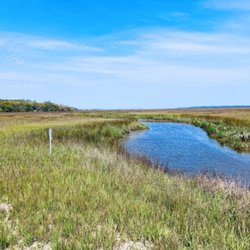
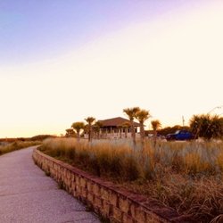
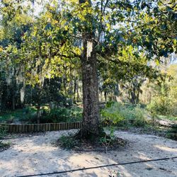
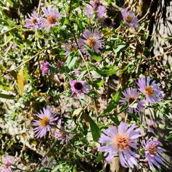
    Guale Preserve - hiking - Updated May 2026

    Loading...
    Loading...
    Loading...