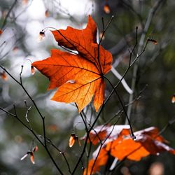
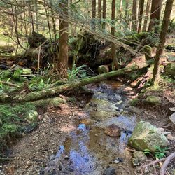
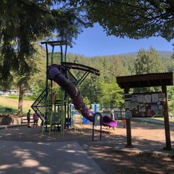
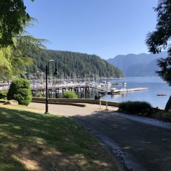
Grouse Grind Photos


More like Grouse Grind
Recommended Reviews - Grouse Grind
Start your review...

Reviews With Photos

This trail wise, it's very very intense workout. It's not normal hike. However I'm thanksful for this trail existence. I can come here by Transkink bus paying only $2.4 and do this hardcore exercise. I did alone because I wanted to keep my pace but please be aware that you need good preparation. I had thought the gondola charges only $10 but nowadays it's $20 and have to book by online. Show QR code at gondola gate and masks are mandatory.

HARDEST hike of my life! Online they say it's 1.55 miles (2.5 km)... Apple Watch determined that was a lie! A total of 1.9 miles straight UP :') elevation of 2500 ft (aka 2800 stairs/200 flights). Took me a total of 1 hr 13 mins. The site says average time is 2-2.5hr. But you can purchase an official timer to keep track of your time as well as compare yourself to others on the scoreboard. The fastest official times were about 30 mins. Savages. I'm so glad I bought the download sky ride trip down for C$20 pp! As you cannot hike down grouse grind! A sign of how difficult and dangerous this trail is. I didn't know there's an option to hike down another trail though (BCMC 3.1km less steep) for those of you who are inclined. My legs were shakey af halfway up! And I do not skip leg day. Sweating balls in 60*F. My bf had to take plenty of breaks! Super surprising since he runs a lot. Luckily there's cafes up top to replenish. Plenty of activities as well (grizzly bear exhibit, birds of prey talk, zip lining, disc golf, rope climbing). Even shops - one in particular w running gear and cute grouse grind swag. At the half mile mark (1/4 way marker) - there's a sign/warning that's the last place you're allowed to turn around. The hike gets steeper and narrower! Then some benches a little more up and at the 1/2 way marker (1 mile according to my watch). Cute sign at the top w the view .. slightly obscured by the sky ride. A good amount of ppl around noon on a weekday in June, but not overly crowded. But I unfortunately stood on the far side of the crowded sky ride and didn't get a good view on the way down :(. Overall a must do and wish I could do it more often as a super hard workout! Just be prepared! #12

So much harder than I thought it was going to be. I was expecting more of a trail but this thing was like one giant stairmaster. You pretty much climb straight up the mountain side. I tried to capture how steep it is on my camera but it was pretty impossible to do. At a quarter of the way up, there's a sing telling you to do a gut check to see if you can continue. I thought it was for theatrics but it really did get much steeper past the sign. The climb itself is beautiful even with the manmade stairs and railings. Once you get to the top, you can walk around and enjoy the view. It was really foggy the day we went up so not much for us. Also, be prepared to buy a sky ride ticket to get back down.

I weigh train twice a week and do intensive cardio 3-5 times a week (ie. HIIT, Crazy Asian Woman Dance Cardio, etc.) and the Grouse Grind was not as scary as the descript and some people have made it out to be. It's about 2 miles and 2800 feet, which is no small feat, but a well-marked and well-maintained trail. Steps ALL of the way, reinforced by logs, sometimes with helpful woooden hand rails or ropes. Steps may be very large (ie. I sometimes felt like a toddler trying to hoist myself up an adult-sized chair), but quite do-able. I went with a friend who hiked with the pace of a dead man walking to the electric chair. With a 30-minute break and constantly waiting up for her, we did the thing in 1 hour 44 minutes. We started mid-morning and there were a TON of people on the trail - mostly non-hikers ready for a challenge. Our hike up was like a tag team of going up, resting, letting the same group(s) of people pass us, then we pass them, etc. There is no GOING DOWN the trail, though we did see two sheepish-looking people do just that. It's not dangerous to go down per se, but with the number of people going up, it's better to keep the trail one way only. No bathroom facilities, though there were a few areas where you could get out of sight for a pee break. No rest areas (ie. Scenic picnic spots) anywhere along the trail, except for the base of a tree or a cut-down stump. It's not a pretty trail; the trail is all tree covered with exposure only at the top. The trail's sole purpose is to kick my flat Asian ass into oblivion. At the top, you must purchase a $15 gondola ride down to the parking lot (parking is about $6 or $8 for 3 hours paid at machines located in the lots). Flinging yourself off the mountain is also an option, though not recommended. There's also a cafe at the top which serves very healthy granola-y baked goods and drinks, most of which you will have no interest in, after coming within an inch of death hiking the Grouse Grind. The cafe has a nice outdoor patio from which you can take in the scenery before you, as you contemplate why you're still alive, when you cannot feel your extremities.

What a discovery! I appreciate the tremendous effort and engineering to build this trail. I love Grouse Grind Trail because it's steep enough one of the few steep enough trails to get my cardio up to maximum heart rate. To find your maximum heart rate subtract your age from 220 and that will be your maximum and to get cardio benefit try to get to at least 80% of your maximum. This is very easy to do on Grouse Grind Trail most Trails I hike I have to do Sprints up the Steep Parts just to get the cardio. Five stars for Grouse Grind Trail. I'll be back next time earlier to check out the exhibits up top.

Less than 2 miles? Psh. I've done ultramarathons before. No problem. WRONG. WRONG. WRONG. Longest 2 miles of my life. SO.MANY.STAIRS. Views were really pretty, but THOSE STAIRS. Bring (lug) food and have a mini-celebratory picnic at the top (you laugh now, but that's actually what we did). There's also a surprising amount of stuff to do/see at the top, so pay your parking meter accordingly!! The gondola down is $10 and has amazinggggg views, but they pack people in like sardines, which kind of sucks (and is kind of scary. Are you sure this thing can hold that much weight?!). Slightly depressing what took you 2 hours to climb only takes 4 minutes on a gondola, though. I did this the day after the Lululemon Half, so it's definitely doable. The hike surprisingly didn't even leave me sore the next day! If you're not in shape, best of luck to you.

Everybody knows, you ain't a Vancouverite unless you've done the world famous Grind. Parking is available in the various lots, but Lot D (on the R side as soon as you enter the park) is free. If you have never done this before, this is a must. With that said, come prepared. This is no leisurely walk. I cannot stress this enough, for the sake of safety. You can buy a pass that allows you to "beep in" at the beginning and end of the hike. Your name and time will then be displayed at the top of the screen. Besides the street cred gained, this is also a great time to see how many 60 year olds are faster than you. I'm serious. Nothing like realizing you're way slower than some who are twice your age. People are crazy here. As for the hike itself, here are some tips: 1) The hike is marked at the 1/4, 1/2, and 3/4 marks, which is great for setting your pace. The 1st 1/4 is the longest, in terms of both horizontal distance and time required. There are many times when you may think you'll die before reaching here. The good news though is that each segment gets progressively "shorter". 2) Even during the summer, the trail gets quite wet and muddy after the 3/4 mark. 3) Bring some insect repellent if you don't like being swarmed by tiny flies. This happens after the 3/4 mark as well. 4) Bring water. You will need it, guaranteed. 5) Unfortunately, riding the gondola down after is not free. Yes, you have to pay $10 to come down. You could technically walk back down the GG (I didn't tell you this), but this can't be too healthy for your knees. If you can finish the hike within 90 minutes, that is considered good for a tourist/visitor. For the locals, everyone talks about breaking the 1h mark. And for those who are insane, it's 30 minutes. Yes, people actually pull this off. It's ridiculous. I didn't tell you this, but if the fence is closed, you can bypass the entrance fence by looking for the "path" to the R of it. Go far enough up and the fence ends. Oops, did I say this out loud? With that said, don't be stupid and trap yourself on the mountain, since there will obviously be nobody to save you. If you survive this walk, not only do you get bragging rights, but you are treated to what is probably the best view of Vancouver from anywhere short of a plane.

If you want to do this hike and never exercise, turnaround and buy a lift ticket up because you will not make it. For those that exercise regularly, this hike will be challenging. You will break a sweat but will be rewarded with a sweet view at the top. FYI: lift ticket up $40. Lift down $10. If you hike up, you can't hike back down so be prepared to spend $10 on a ride down. Level of difficulty: 8.5/10

So you are wondering about the Grouse Grind*, how to improve your speed up the slope and maximise the experience. Well, here's a few tips now that I've conquered that little hill: 1. DON'T do the Grind hungover. Just don't do it. Don't! Take it from the man who did. It's super brutal. Worst. Decision. Ever! 2. DO take plenty of water. 2L and a Gatorade wasn't enough for me. 3. DON'T take a 20 pound backpack with you full of camera gear. 4. DO bring a couple of good friends, who will take turns with said backpack when it gets too heavy (just remember to buy them a beer at the top to say thanks!) 5. DON'T get the poutine at the top, it's probably worth another entire trip up the mountainside. 6. DO get a beer, you've earned it! (and beer doesn't contain calories --- not the kind you count anyways hehehe). 7. DON'T look at the orange markings on the rocks/trees indicating that you are a 1/4, 1/2 or 3/4 mile up the slope. 8. DO read the official signs marking the milestones, you'll find them about 200 metres beyond the fake ones... I know, whoever did that is a totally sadistic shit! 9. DON'T take long breaks, you'll convince yourself to turn around and go back down! 10. DO take short breaks, often. Especially when your heart rate hits 200!!! 11. DON'T bother walking back down the mountain, get a skyride ticket and taken the gondola (let those muscles rest) 12. DO visit the Grizzly enclosure before you leave. It's the closest you are going to get to 2 magnificent looking beasts! 13. DON'T make stupid bets with people suggesting you are going to shit all over their time (also don't post on FB bragging you are going to hammer those times, especially when you've been drinking beer and whiskey shots the night before). 14. DO use those times as a motivator to help you climb the hill. Even if the bets are cashless, bragging rights do reign supreme! * I did this in late 2011 (I think I am still recovering), but wrote the above entry the next day. I did the grind hung-way-over thinking it'd be a piece of cake. Idiot! I had with me a Canon EOS 450d with a battery grip; Canon EF 70-200mm f/2.8L IS II USM lens; Canon EF-S 17-55mm f/2.8 IS USM lens; plus snacks, a jumper and water/drinks --- The total pack weighed around 20 pounds. Super idiot! I was fit at the time, but that nearly did me in*

A mutual friend living in Vancouver described this trail as "endless" and "disgusting". "You should go if you're into that sort of thing." With that glowing endorsement, this was by far top on my list which probably speaks volume. I had originally planned on going a day after arriving, though the weather was near perfect so that I couldn't resist going after checking into my room. I took the 236 bus up which conveniently stopped at the base of the mountain. Folks were performing deep stretches and breathing exercises at the trailhead in preparation, a sign of things to come. When I started, I paced a hiker in front of me for a while before overtaking her. Naturally, another hiker came up from behind and steadily passed me. Intense concentration from everyone made the hike a fairly quiet one with occasional nods of empathy from those taking an extended break. Markers along the way tell you when you are 1/4, 1/2, and 3/4 of the way up along smaller fractional markers out of 40. Beyond the 1/4 marker, downhill hiking is no longer permitted, though I noticed a handful of hikers doing just that. In total, my time was 1:07. In between the sweating and the panting, lush forest trees and bright purple foxgloves made the experience a visual delight. Heading back down via gondola, I had a chance to talk with someone who has been doing the grind for years and still loves it. Next time I would try the BCMC to compare but consider me a fan. read more


2 years ago
THE BIG: Located in North Vancouver, past the capilano bridge. Plenty of parking in the paid lots and free street parking down the hill. THE BLACK AND WHITE: This is a grueling hike. Think stairmaster but for an hour. The first time my wife and I did it, we got 59 minutes. This second round, we beat our time. I channeled my inner billy goat and hiked it in 56 minutes. There is a scanner at the bottom of the hike and top of the hike that you can scan to get a more accurate reading of your hike. I recorded everything on my apple watch. The trail is beautiful, plenty of temperate rainforest to see and markers to show half way, 3/4 way and it gets brighter as you approach the top. THE FINAL BAMBOO: Overall, this is a very hard hike but the reward is worth it. Free to hike up and there is no way down except to buy a tram ticket that is around 20 CAD. read more


This trail wise, it's very very intense workout. It's not normal hike. However I'm thanksful for this trail existence. I can come here by Transkink bus paying only $2.4 and do this hardcore exercise. I did alone because I wanted to keep my pace but please be aware that you need good preparation. I had thought the gondola charges only $10 but nowadays it's $20 and have to book by online. Show QR code at gondola gate and masks are mandatory. read more


HARDEST hike of my life! Online they say it's 1.55 miles (2.5 km)... Apple Watch determined that was a lie! A total of 1.9 miles straight UP :') elevation of 2500 ft (aka 2800 stairs/200 flights). Took me a total of 1 hr 13 mins. The site says average time is 2-2.5hr. But you can purchase an official timer to keep track of your time as well as compare yourself to others on the scoreboard. The fastest official times were about 30 mins. Savages. I'm so glad I bought the download sky ride trip down for C$20 pp! As you cannot hike down grouse grind! A sign of how difficult and dangerous this trail is. I didn't know there's an option to hike down another trail though (BCMC 3.1km less steep) for those of you who are inclined. My legs were shakey af halfway up! And I do not skip leg day. Sweating balls in 60*F. My bf had to take plenty of breaks! Super surprising since he runs a lot. Luckily there's cafes up top to replenish. Plenty of activities as well (grizzly bear exhibit, birds of prey talk, zip lining, disc golf, rope climbing). Even shops - one in particular w running gear and cute grouse grind swag. At the half mile mark (1/4 way marker) - there's a sign/warning that's the last place you're allowed to turn around. The hike gets steeper and narrower! Then some benches a little more up and at the 1/2 way marker (1 mile according to my watch). Cute sign at the top w the view .. slightly obscured by the sky ride. A good amount of ppl around noon on a weekday in June, but not overly crowded. But I unfortunately stood on the far side of the crowded sky ride and didn't get a good view on the way down :(. Overall a must do and wish I could do it more often as a super hard workout! Just be prepared! #12 read more
So much harder than I thought it was going to be. I was expecting more of a trail but this thing was like one giant stairmaster. You pretty much climb straight up the mountain side. I tried to capture how steep it is on my camera but it was pretty impossible to do. At a quarter of the way up, there's a sing telling you to do a gut check to see if you can continue. I thought it was for theatrics but it really did get much steeper past the sign. The climb itself is beautiful even with the manmade stairs and railings. Once you get to the top, you can walk around and enjoy the view. It was really foggy the day we went up so not much for us. Also, be prepared to buy a sky ride ticket to get back down. read more


2 years ago
I weigh train twice a week and do intensive cardio 3-5 times a week (ie. HIIT, Crazy Asian Woman Dance Cardio, etc.) and the Grouse Grind was not as scary as the descript and some people have made it out to be. It's about 2 miles and 2800 feet, which is no small feat, but a well-marked and well-maintained trail. Steps ALL of the way, reinforced by logs, sometimes with helpful woooden hand rails or ropes. Steps may be very large (ie. I sometimes felt like a toddler trying to hoist myself up an adult-sized chair), but quite do-able. I went with a friend who hiked with the pace of a dead man walking to the electric chair. With a 30-minute break and constantly waiting up for her, we did the thing in 1 hour 44 minutes. We started mid-morning and there were a TON of people on the trail - mostly non-hikers ready for a challenge. Our hike up was like a tag team of going up, resting, letting the same group(s) of people pass us, then we pass them, etc. There is no GOING DOWN the trail, though we did see two sheepish-looking people do just that. It's not dangerous to go down per se, but with the number of people going up, it's better to keep the trail one way only. No bathroom facilities, though there were a few areas where you could get out of sight for a pee break. No rest areas (ie. Scenic picnic spots) anywhere along the trail, except for the base of a tree or a cut-down stump. It's not a pretty trail; the trail is all tree covered with exposure only at the top. The trail's sole purpose is to kick my flat Asian ass into oblivion. At the top, you must purchase a $15 gondola ride down to the parking lot (parking is about $6 or $8 for 3 hours paid at machines located in the lots). Flinging yourself off the mountain is also an option, though not recommended. There's also a cafe at the top which serves very healthy granola-y baked goods and drinks, most of which you will have no interest in, after coming within an inch of death hiking the Grouse Grind. The cafe has a nice outdoor patio from which you can take in the scenery before you, as you contemplate why you're still alive, when you cannot feel your extremities. read more


What a discovery! I appreciate the tremendous effort and engineering to build this trail. I love Grouse Grind Trail because it's steep enough one of the few steep enough trails to get my cardio up to maximum heart rate. To find your maximum heart rate subtract your age from 220 and that will be your maximum and to get cardio benefit try to get to at least 80% of your maximum. This is very easy to do on Grouse Grind Trail most Trails I hike I have to do Sprints up the Steep Parts just to get the cardio. Five stars for Grouse Grind Trail. I'll be back next time earlier to check out the exhibits up top. read more

8 years ago
5 years ago
Less than 2 miles? Psh. I've done ultramarathons before. No problem. WRONG. WRONG. WRONG. Longest 2 miles of my life. SO.MANY.STAIRS. Views were really pretty, but THOSE STAIRS. Bring (lug) food and have a mini-celebratory picnic at the top (you laugh now, but that's actually what we did). There's also a surprising amount of stuff to do/see at the top, so pay your parking meter accordingly!! The gondola down is $10 and has amazinggggg views, but they pack people in like sardines, which kind of sucks (and is kind of scary. Are you sure this thing can hold that much weight?!). Slightly depressing what took you 2 hours to climb only takes 4 minutes on a gondola, though. I did this the day after the Lululemon Half, so it's definitely doable. The hike surprisingly didn't even leave me sore the next day! If you're not in shape, best of luck to you. read more


Everybody knows, you ain't a Vancouverite unless you've done the world famous Grind. Parking is available in the various lots, but Lot D (on the R side as soon as you enter the park) is free. If you have never done this before, this is a must. With that said, come prepared. This is no leisurely walk. I cannot stress this enough, for the sake of safety. You can buy a pass that allows you to "beep in" at the beginning and end of the hike. Your name and time will then be displayed at the top of the screen. Besides the street cred gained, this is also a great time to see how many 60 year olds are faster than you. I'm serious. Nothing like realizing you're way slower than some who are twice your age. People are crazy here. As for the hike itself, here are some tips: 1) The hike is marked at the 1/4, 1/2, and 3/4 marks, which is great for setting your pace. The 1st 1/4 is the longest, in terms of both horizontal distance and time required. There are many times when you may think you'll die before reaching here. The good news though is that each segment gets progressively "shorter". 2) Even during the summer, the trail gets quite wet and muddy after the 3/4 mark. 3) Bring some insect repellent if you don't like being swarmed by tiny flies. This happens after the 3/4 mark as well. 4) Bring water. You will need it, guaranteed. 5) Unfortunately, riding the gondola down after is not free. Yes, you have to pay $10 to come down. You could technically walk back down the GG (I didn't tell you this), but this can't be too healthy for your knees. If you can finish the hike within 90 minutes, that is considered good for a tourist/visitor. For the locals, everyone talks about breaking the 1h mark. And for those who are insane, it's 30 minutes. Yes, people actually pull this off. It's ridiculous. I didn't tell you this, but if the fence is closed, you can bypass the entrance fence by looking for the "path" to the R of it. Go far enough up and the fence ends. Oops, did I say this out loud? With that said, don't be stupid and trap yourself on the mountain, since there will obviously be nobody to save you. If you survive this walk, not only do you get bragging rights, but you are treated to what is probably the best view of Vancouver from anywhere short of a plane. read more


7 years ago
If you want to do this hike and never exercise, turnaround and buy a lift ticket up because you will not make it. For those that exercise regularly, this hike will be challenging. You will break a sweat but will be rewarded with a sweet view at the top. FYI: lift ticket up $40. Lift down $10. If you hike up, you can't hike back down so be prepared to spend $10 on a ride down. Level of difficulty: 8.5/10 read more

4 years ago
So you are wondering about the Grouse Grind*, how to improve your speed up the slope and maximise the experience. Well, here's a few tips now that I've conquered that little hill: 1. DON'T do the Grind hungover. Just don't do it. Don't! Take it from the man who did. It's super brutal. Worst. Decision. Ever! 2. DO take plenty of water. 2L and a Gatorade wasn't enough for me. 3. DON'T take a 20 pound backpack with you full of camera gear. 4. DO bring a couple of good friends, who will take turns with said backpack when it gets too heavy (just remember to buy them a beer at the top to say thanks!) 5. DON'T get the poutine at the top, it's probably worth another entire trip up the mountainside. 6. DO get a beer, you've earned it! (and beer doesn't contain calories --- not the kind you count anyways hehehe). 7. DON'T look at the orange markings on the rocks/trees indicating that you are a 1/4, 1/2 or 3/4 mile up the slope. 8. DO read the official signs marking the milestones, you'll find them about 200 metres beyond the fake ones... I know, whoever did that is a totally sadistic shit! 9. DON'T take long breaks, you'll convince yourself to turn around and go back down! 10. DO take short breaks, often. Especially when your heart rate hits 200!!! 11. DON'T bother walking back down the mountain, get a skyride ticket and taken the gondola (let those muscles rest) 12. DO visit the Grizzly enclosure before you leave. It's the closest you are going to get to 2 magnificent looking beasts! 13. DON'T make stupid bets with people suggesting you are going to shit all over their time (also don't post on FB bragging you are going to hammer those times, especially when you've been drinking beer and whiskey shots the night before). 14. DO use those times as a motivator to help you climb the hill. Even if the bets are cashless, bragging rights do reign supreme! * I did this in late 2011 (I think I am still recovering), but wrote the above entry the next day. I did the grind hung-way-over thinking it'd be a piece of cake. Idiot! I had with me a Canon EOS 450d with a battery grip; Canon EF 70-200mm f/2.8L IS II USM lens; Canon EF-S 17-55mm f/2.8 IS USM lens; plus snacks, a jumper and water/drinks --- The total pack weighed around 20 pounds. Super idiot! I was fit at the time, but that nearly did me in* read more


10 years ago
This review is based on people who do marathons & CrossFit for your well being! When locals tell you it's a strenuous hike, you better believe it! But is the view at the top all worth it? YES!! It will make you forget what you just climbed. Maybe not, but seriously I could not be anymore grateful to have done this on a perfect weather & day. * Parking: They have a parking lot for a few hours & all day. We were lucky to arrive while someone was leaving & they were kind enough to give us their parking stub for the rest of the day. We tried to do the same when we left, but we were being honked at from drivers without patience. * Experience: Keep in mind, I did this with 3 other friends which 2 of us did a CrossFit workout early in the morning & had the SeaWheeze Lululemon half marathon the following day. I had come out of packet pick up & one of the Lululemon workers asked me what I had planned for the rest of the day. I said, "Grouse Grind!" Their jaw dropped. Literally tried scarying me while telling me that they do not recommend doing Grouse Grind especially if I have a half marathon to do the following day & it's my first time. I kept my humble mouth shut & just agreed with them. Held my breath without saying that I've done a full marathon & beyond before. The only person that knows your body is yourself! I almost tried convincing my friends to not do it, but when you've never been to Canada & this is the first time? I said F it, let's do it! Now for the climb.... this was a REAL strenuous 2,000+ steps, 2 point something kilometer distance staircase with your legs bent almost 90 degrees for some steps. There are tree trunks that count how the number out of 40 until you reach the top. I apologize if this may gross you out, but I admit that 1/4th of the way, I vomited once. It was a good one though because after that, I felt 10x better & was able to climb the rest! Did it make me think twice about giving up? Definitely not! When you're already up there, why turn back? It's not a race. Give me credit for finishing this because we did come across some people who weren't even half way up & gave up by coming back down. We also came across locals who sped through us like nothing. Our overall time? 2 sum hours. - View at the top: BEAUTIFUL! Worth the climb! We were lucky the weather was completely clear. - What to wear: Hiking shoes, no heavy backpacks, workout clothes, sunglasses, & cap - What to bring: Energy snacks, water, sunscreen, ca$h (They have a snack bar, food, & drinks at the very top, so you pretty much have a good prize after that climb.), small face towel or wipes (Please wipe down or bring deodorant. We came across people with some serious B.O.) - What's at the top? Souvenir shop, dining area, balcony, bathrooms, water fountains, & we even witnessed a wedding ceremony happening as well. - Gondola: Rode it on the way down! $10 per person & a quick ride down. - What's at the bottom? Another souvenir shop, Starbucks - Can you time yourself? Yes! I noticed some people had a card that they scanned before the first step & scanned right at the top. aaaand the last question.... WOULD I DO IT AGAIN?! YES! North Vancouver, Canada, you are beautiful & worth every sight! ps - I was NOT sore the next day after doing this. Again, you are the only person that knows what your own body is capable of! If you're not tremendously active, be prepared to be sore the following day & stretch! read more


I had looked up this hike prior to coming to Vancouver and was real excited to check it out! During our stay in Vancouver there was a lot of rain but who cares....we were doing this hike rain or shine! We started on the right side at first and then realized we were on the wrong trail....got over to the Grouse Mountain trail and never looked back. This trail has ZERO flat spots and ZERO declines....it's all an uphill hike. Very intense and not recommended for the faint of heart! Make sure you are dressed appropriately to do this too. Even in the cold it's not recommended to wear layers....might need them when you reach the top and stop moving though but not for the hike. Good luck if you decide to take on the grind! It's quite fun and rewarding!! read more


I've been to Vancouver several times before and visited all the touristy attractions, so a local flavor activity was next on my bucket list. I read about the Grouse Grind in a magazine that mentioned finishing this challenging uphill hike within 90 minutes is decent for out-of-towners, and is evidence of being in good physical shape. I wanted to test my cardio endurance so I accepted the challenge. Grouse Grind ended up being the most memorable event during my recent Vancouver trip! This hike reminded me of being on Stair Masters except doing it in mother nature. The other difference is that each step in the Grouse Grind is not evenly spaced apart. There were frequent switchbacks and not many areas of flat terrain during the hike. The experience of endless climbing was comparable to hiking the Great Wall of China, except the path here consisted of a man-constructed wood staircase. Mental toughness was just as important as physical endurance to complete the Grouse Grind. I had to force myself to keep going, or else I wouldn't be able to finish within 90 minutes. I watched numerous hikers 2 or 3 times my age climb pass me without resting, and that motivated me to not quit and continue with fewer breaks. The first 1/4 of the hike was easy, and the second 1/4 was most tough due to the increased spacing between steps. Fortunately, there were markers along the trail (measuring elevation gain in 1/40 increments and is generally accurate) to let you know how far you are from the finish line. The reward of making it to the summit for a view of Vancouver (overlooking North Van and Stanley Park) was amazing. My time of 85 minutes (1:25) was not remarkable at all, in fact well below the average time for men aged 70+ (1:06)! But I know with some more cardio and endurance training, I can do a lot better. My next goal is to complete it within 60 minutes. :) read more


10 years ago
Fantastic hike with straightforward 2800+ stairs brings you to the top of goose mountain with amazing view. As a hike lover, I absolutely enjoyed the hike - it's fun and challenging. Great hiking trail with forest accompany the whole way. The trail is well-maintained and marked. You can track the progress easily by checking the numbers on the trees (1-40/40 trees and big marks every 25% along the trail). The challenging part - I had to keep push myself to keep the 1hr pace until finish line! Here are the stats: 1-2hrs, 4km distance, 850m elevation (2800+stairs non-stop). Hike up and ride the lift down (only $10 one-way down). I would def come back next time I visit Vancouver! If you are up for the challenge, you can also download the goose mountain hike app to get on the score board! read more


15 years ago
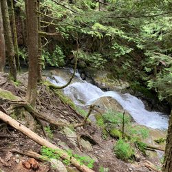
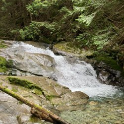
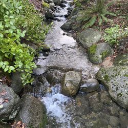
On a recent vacation to Vancouver, I decided that I wanted to do the Grouse Grind hike. My friend, who lives in Vancouver, had done it a few years ago, but couldn't really remember how easy(hard) the hike was. And the trail had apparently changed since then. So I kind of went into the hike only knowing that it was lots of steps. Sounds easy, right? We hiked the trail fairly early in the morning to avoid crowds. The trail is a mix of dirt, stones, and wooden stairs. Zigzagging up the mountain through the trees. Starting off I thought, I exercise regularly, this will be easy. After just a few minutes of hiking, my opinion quickly changed. By this point, after hardly any hiking, I was struggling to keep up with my friend. Curious about how far we had to go, we asked someone how close we were to the top. He smiled and said "you're not even half way there!" In fact we weren't even 1/4 of the way. Hearing that and being so tired was kind of demoralizing, but we just laughed and kept going. The trail has distance markers throughout, with big signs marking 1/4, 1/2, and 3/4s complete. As the trail went on, it seemed to get steeper and steeper, but that could have just been the effects of my tired legs on my mind. Step after step after step... this was much harder than I thought it would be. Near the top (3/4), the trail became wet and slippery. There was actually still snow at the top of the mountain, so maybe that's where the water was coming from. The trail also goes near a small waterfall. There were ropes along the path near the top to help with the climb. And maybe stop you from tumbling down the mountain. We finally reached the top, legs tired, sighs of relief, but with a feeling of accomplishment. It was definitely worth it for the view though. Although I guess if you just want the view, you can take the gondola up, but where is the fun in that? The trail is 1.8 miles long, starts at 900 feet, and reaches a height of 3700 feet. The trail's average time to complete is 1.5 hours. My friend and I did it in 1 hour and 11 minutes. Not a bad time (record time is 25 minutes!!?!!?), but I'm almost certain that we got beat by someone who couldn't have been more than 10 years old. The trail does seem to get crowded at times, but I really didn't have a problem with that. Some areas are really narrow so passing, or being passed, can be difficult. The only problem I had with Grouse Grind was that you have to pay to go back down. Hiking the trail down is not allowed, so you must take the Grouse Mountain Skyride (gondola). A ticket for the gondola is $10 dollars. Even though the hike was not easy, I'd definitely want to do it again to try and beat my time. read more


12 years ago
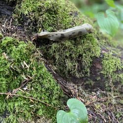
If all you're doing is walking around the block for your exercise, then shuffle on with ya bad self and keep a steppin'. This mountain will eat you up and spit you you out at the 10th step. Take heed to the tremendous effort that will be required when doing the Grind. If you have weak knees, don't do it! Now, if you're a cowboy or lassie, well giddy up and let's hit the rodeo! This is a bull of a mountain and totally worth the climb. The view from the 4,000ft summit is magnificent! The path is a mixture of rocks, tree trunks and mountainside rising like a ladder towards the sky. On a clear day you can see way down yonder into these United States! It's not that far really, but seriously the view of Vancouver Island, Washington State and the various surrounding provincial parks, truly show what affect the abundance of water has on this terrain. At under 2 miles the hike should take you approximately 2 hours. Depending on your health, endurance and speed of course. When you reach the 1st marker rejoice, but know that you're only 1/4 of the way there. HA! deadly. On your way up take time to see your ascent through the forest. Look behind you to see that you are nearly at the tree tips. Then in another moment you are above the trees, above the clouds and well above the city below. Listen to the water trickling beneath your feet, over the rocks and from the trees. See the moss, the ferns, the mushrooms, even the mist rolling through the forest like some scary scene in a movie. Once you see the chalet from the forest you have survived the rodeo! Take the ski lift down the mountain and look in awe at the mountain you just wrangled. read more


Having just moved to Canada, we were told climbing the Grind would be the determining factor whether we were truly Vancouverites. The initiation process began on a Saturday mourning* in September. On the sea bus over, our friends warned it would be no cake walk getting up the Grind. They said some people train weekly and that even star athletes and avid runners are challenged with the incline. That there's even a gigantic warning sign to ward off amateur hikers looking for a pleasant stroll through the trees. The Grind is not for the faint. About ten minutes in, after commenting how beautiful the forest trees and how cute the squirrels, we noticed our legs start to buckle underneath our bodies. I turned around and asked, "Does this ever stop?" An hour later I was drenched in sweat, my legs jello, and my water all gone. And I still had a 1/4 more to go! All in all, great feeling after your workout and definitely worth the trip. If you choose to take the Grind just keep remembering there is a wonderful beer and meal waiting for you at the top! *pun intended read more

What a tough climb!! I would say that the biggest hurdle is mental, as with any challenging physical feat. You really have to push yourself and/or go with someone who is positive and supportive. It is step after step after step, with some monkeying over rocks for a little ways as well. I found it to be quite crowded...and that was the most difficult part for me. I felt nervous as people approached me aggressively and wanted to pass without saying a word. Because the path is narrow, there isn't always a convenient place to stop on the side. The view at the top is magnificent and breath taking, which makes the challenging work out truly worth it for me. I also enjoyed the entertainment of the lumber jack show, bird show, grizzly bear habitat, riding the gondola, and of course, eating my first beaver tail. I would most definitely return...whether I will climb it again is to be determined! ;) I will leave with some humble words of advice: 1. Remember your manners--let people know when you would like to pass instead of hovering over them. The paths are narrow and Grouse Grind is only as dangerous as its guests' behavior. 2. Go at your own pace. 3. Revel in the feeling of accomplishment and pride when you reach the top! read more

I was in Vancouver for the past few days and I decided to take on the epic Grouse Grind hike my first day there. People say it's one of the most challenging hikes out there, so of course, I had to see for myself. There's a free public shuttle that runs from downtown to the base of Grouse Mountain, but the first bus comes at 9am, so I decided to just take the local buses so I could get a head start. I got to the base of the mountain at around 7am and there were already quite a few people hiking! You can definitely tell who the regulars are. They blew past the endless steps so effortlessly. Meanwhile, I was panting, sweating like a pig, and stopping for a break every 5 min (maybe even less). This is definitely a hike that you need to be in decent shape for. For me, this 2 hour stair master workout was the hardest hike I've ever experienced. I heard the record for getting the the top was 23 minutes. Whoever that guy was, he's crazy. I probably won't be hiking this trail again for a while, but it's nice to say that I survived the Grouse Grind! Once you get to the top, the views are phenomenal. On the day that I went, the sun broke through the clouds right as I was near the top. It was so beautiful! The last set of steps really looks like a staircase to heaven, with the light shining perfectly between the trees (or maybe just cause I was about to pass out). There are lots of activities on top of the mountain. I went to see the bear exhibit, and I did the zipline tour as well. I had a blast! It does cost $10 to take the SkyTrain back down to the base of the mountain, though, since they don't allow you to hike back down for safety reasons. If you buy a zipline tour, the SkyTrain ride is included. So basically, be prepared to spend a minimum of $10 for this hike, unless you want to be a rebel and hike back down the mountain at your own risk. If you're in Vancouver and are up for a hard but rewarding challenge, hike up Grouse! I assure you it will be an experience to remember. read more


10 years ago
Somehow I managed to do this in just under an hour and ten minutes without losing my will to live. But I was close. To say this is a strenuous hike is an understatement. Don't take that whole "2800 steps straight up" sentiment lightly. This is a staircase for all intents and purposes, but many steps are boulders and tree roots, and railings are hard to come by (but you cling to them like Grimm death when they do). It narrows in places, though there's plentiful many spots to pull off and stop to breathe/let the people (read: super humans) trail running this to pass. Was is strenuous? Holy heck. There were people I saw bail in the first 1/4 of the trail. Another, who passed me initially, was yacking close to the 1/2 way point. Others were in jeans and sandals. Word to the wise: don't take the Grind lightly. Just because some badass did it 16 times in a day doesn't mean it's going to be a cake walk. The whole trail wreaks of sweat and self doubt. You can see people in actual mental anguish throughout the hike. Another tip: Don't wear a full backpack! For one, you're only making it worse on yourself, and for two, it really hurts getting a backpack to the face when you decide to stop in the middle of the step and I've got forward momentum just behind you. I can imagine the view from the top would be epic, but it was foggy (and thus, comfortable temperature) on the morning I decided to make the climb. A masochist to the core, I was in this for the challenge, not the view. By the halfway mark, my internal Jimminy Cricket/therapist kept saying "Why do you keep punishing yourself?" Because, damn, did it feel good to get to the top. The gondola down (manditory) is $10, and parking was $6 for 3 hours (more than enough time for the average person to do the hike and get down, as the gondola ride is less than 5 minutes). There's a shop at the top with shirts emblazoned with "GRIND." to let outsiders know what a bad a-- you are, but with a minimum price tag of $25, I gave it a miss. I don't need a T-shirt to prove I got to the top. My knees will ache for days, and that's proof enough for me. Apologies for fuzzy pictures. I think my phone was covered in sweat by the first steep climb. read more


This is definitely an experience..... My advice for people doing it for the first time: 1. Bring a small backpack or a drawstring pouch for WATER, SMALL TOWEL, and a SNACK. (lol this sounds dumb but it might help give you a small energy boost on the way up) 2. Don't wear heavy clothing like sweaters, zip ups, baggy pants - I recently went on a cool day with light rain when I got to the top and I wore a tank and shorts and survived. It does get kind of cold at the top but your body will be sweating so much from the whole trek that you should be ok. Basically the less you carry the better. I sugges bringing a 500 mL water bottle but not your own HUGE plastic/aluminum water bottles - it's not worth carrying something heavy or bulky up the hike. Take small steps throughout the whole hike and you'll find it helps. Make sure you take mini breaks to give yourself and your legs time to get over the lactic acid build up. I definitely prefer to do the grind in colder/cloudy weather versus sunny. It's so much more difficult when you have the sun shining down on you and the heat adding to the exhaustion. If you do go in the cold and don't want your hands to freeze then gloves are a good option. The gondola ride down is $10 a person so make sure you bring cash/credit so you can get down. In my opinion a little pricey for a 5 minute ride down but it's a lot cheaper than a gym membership! read more


7 years ago
10 years ago
The BEST hike you will ever do in your entire life - not joking! This hike is super intense, it is at a constant steep incline for a solid one hour (if you are in extremly good shape you can maybe do it in 50 minutes?) It is a really well marked trail and you definitely wont be alone doing it. Bring some water, snacks and workout clothes, after all you will be climbing a little over 2,800 steep steps - excellent work out for your glutes. During the first 1/4 we felt good about ourselves but during the second 2/4 thoughts like "why in the world am i doing this?" kept popping into our heads. the last quarter of the climb was the steepest, or so it felt. Once we were up top all the hardwork was worth it. We sat at the restaurant at the top and enjoyed the view for a few minutes.To get down you need to take the gondola and it costs $10 per person. To get up is about $30 so you save yourself some money and get a good workout by climbing! read more


If you're in the mood to quite possibly kick your own ass (and who isn't really?) THIS is the place to go. It's the perfect place to 'get your fitness on'. Basically, you climb a whole schwack-load of stairs to the top of a mountain. The pay off? Burning muscles, a racing heartbeat, an amazing view, and a genuine sense of... 'I DID IT!!! HECK YEAH!!!!'. Here are a few tips for ya: * DO NOT let the fitness nerds make you feel bad when they run past you, or loudly announce how long it takes them to climb to the top of Grouse. Just do your thing :) * DO NOT throw your garbage on the side of the trail (for the love of GAD!!!). *DO NOT spit directly on the trail. There's nothing more disgusting than stomping over and over on other people's loogies. I mean, C'MON!!! * Try parking on the sides of the streets, just outside the paid parking lot. It's free and spots are constantly opening up, so you just need a bit of patience. * Bring lot's of water with you. Seriously. LOT'S. * Have $10 on hand to take the gondola back down the mountain ($10 is a tad bit steep if you ask me. No pun intended). And here's the one I learned the hard way... * DO NOT bring your dog with you. Turns out, dogs are not allowed on the trail, on the top of the mountain, and nope, not even on the gondola. I'm lucky the gondola attendant let me bring my little guy down with me. My bad. So be prepared to sweat my friend. As I like to say, 'You'll be sweating like a hooker in church'. Classy. read more

 - Hiking Near Me - North Vancouver, British Columbia")
7 years ago
Page 1 of 5
More info about Grouse Grind
Review Highlights - Grouse Grind


Why does Yelp recommend reviews?
13 reviews that are not currently recommended
The reviews below are not factored into the business's overall star rating.
7 years ago
14 years ago
11 years ago
14 years ago
7 years ago
7 years ago
13 years ago
15 years ago
13 years ago
12 years ago
10 years ago
14 years ago
Grouse Grind - hiking - Updated July 2026
People found Grouse Grind by searching for…
Beaches in North Vancouver, British Columbia
Night View in North Vancouver, British Columbia
Public Shower in North Vancouver, British Columbia
Scenic Drive in North Vancouver, British Columbia
Hiking Trails With Waterfalls in North Vancouver, British Columbia
Fishing in North Vancouver, British Columbia
Hot Springs in North Vancouver, British Columbia
Scenic Views in North Vancouver, British Columbia
Things to Do in North Vancouver, British Columbia
Tourist Attractions in North Vancouver, British Columbia
Stair Climbing in North Vancouver, British Columbia
Beautiful Views in North Vancouver, British Columbia
Stairs Workout in North Vancouver, British Columbia
Watch Sunset in North Vancouver, British Columbia
Abandoned Buildings in North Vancouver, British Columbia
Lookout Points in North Vancouver, British Columbia
Night Hiking in North Vancouver, British Columbia
Off Road Trails in North Vancouver, British Columbia
Monkey Bars in North Vancouver, British Columbia
Waterfalls and Swimming Holes in North Vancouver, British Columbia
Photo Spots in North Vancouver, British Columbia
Off Leash Dog Hikes in North Vancouver, British Columbia
Browse Articles
Browse Brands
Related Searches in North Vancouver, BC
Affordable Kayak Rental Services in North Vancouver, British Columbia
Best Fishing Locations and Guides in North Vancouver, British Columbia
Best Places for Horseback Riding in North Vancouver, British Columbia
Check Out Off Road Trails in North Vancouver, British Columbia
Discover Scenic Mountain Bike Trails Near North Vancouver, British Columbia
Discover Scenic Waterfall Spots in North Vancouver, British Columbia
Discover the Best Night Hike Trails in North Vancouver, British Columbia
Discover the Best Running Track in North Vancouver, British Columbia
Enjoy Camping Adventures Around North Vancouver, British Columbia
Enjoy Exciting Mountain Biking Adventures in North Vancouver, British Columbia
Enjoy Kayaking Adventures in North Vancouver, British Columbia
Enjoy Tent Camping Spots Around North Vancouver, British Columbia
Enjoy Water Activities and Fun in North Vancouver, British Columbia
Enjoy the Best Family Activities in North Vancouver, British Columbia
Enjoy the Best Picnic Spots and Ideas in North Vancouver, British Columbia
Enjoy the Best Walking Trails in North Vancouver, British Columbia
Exciting Cliff Jumping Spots in North Vancouver, British Columbia
Experience Thrilling White Water Rafting in North Vancouver, British Columbia
Explore Beautiful Parks and Green Spaces in North Vancouver, British Columbia
Explore Free Things to Do Around North Vancouver, British Columbia
Explore Fun Activities to Do in North Vancouver, British Columbia
Explore Nature Spots Around North Vancouver, British Columbia
Explore Popular Campgrounds Near North Vancouver, British Columbia
Explore Scenic Lakes to Visit in North Vancouver, British Columbia
Explore the Best Beach Spots in North Vancouver, British Columbia
Explore the Best Boating Spots in North Vancouver, British Columbia
Explore the Best Trail Options in North Vancouver, British Columbia
Find Beautiful Views in North Vancouver, British Columbia
Find Parks and Recreation Activities in North Vancouver, British Columbia
Find the Best Playgrounds to Visit in North Vancouver, British Columbia
Find the Best Scenic View Locations in North Vancouver, British Columbia
Great Places to Walk in North Vancouver, British Columbia
Hiking Trails With Waterfalls in North Vancouver, British Columbia
Plan a Scenic Drive Route Near North Vancouver, British Columbia
Popular Fishing Spots to Explore in North Vancouver, British Columbia
Popular Outdoor Activities to Try in North Vancouver, British Columbia
Popular Picnic Spots to Visit in North Vancouver, British Columbia
Popular Things to Do in North Vancouver, British Columbia
Popular Things to See in North Vancouver, British Columbia
Safe River Swimming Areas in North Vancouver, British Columbia
Safe and Fun Parks for Kids in North Vancouver, British Columbia
Top Climbing Spots and Gyms in North Vancouver, British Columbia
Top Places for Snorkeling in North Vancouver, British Columbia
Top Places to Visit in North Vancouver, British Columbia for Sightseeing
Top Playgrounds for Kids to Enjoy in North Vancouver, British Columbia
Top Running Trails to Explore in North Vancouver, British Columbia
Top Swimming Spots and Pools in North Vancouver, British Columbia
Top Things to Do With Kids in North Vancouver, British Columbia
Walk Dog Friendly Hiking Trails in North Vancouver, British Columbia
Walk the Best Paved Walking Trails in North Vancouver, British Columbia