Brother's Creek Loop Photos


More like Brother's Creek Loop
Recommended Reviews - Brother's Creek Loop
Start your review...

3 years ago


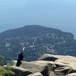
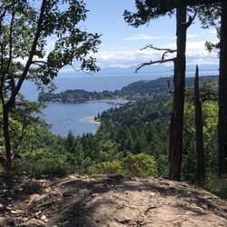
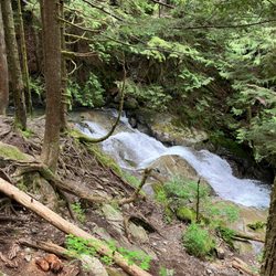
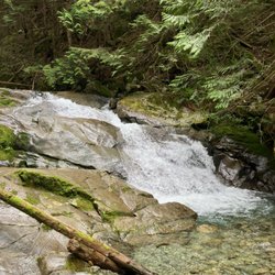
It was drizzling a little and with no sign of any breaks in the clouds as we headed up the trail. We seemed to have the park to ourselves for quite some time allowing us to enjoy the peacefulness that this perfect loop trail has to offer. Rich green ferns line the rocky trail through wooded areas and over old log foot bridges, muddy creeks and magnificent rushing cascades. Yes, this is one of those enchanted places that is best kept a local secret, and getting there is challenging enough to keep it that way. The loop trail is easy to moderate and I would recommend that proper hiking boots be warn. Some of the bridges are in need of repair but mostly it's an easy trail, with moderate elevation. read more
 - Hiking Near Me - British Properties, British Columbia")


11 years ago
14 years ago
More info about Brother's Creek Loop


Brother's Creek Loop - hiking - Updated July 2026
People found Brother's Creek Loop by searching for…
Hiking Trails With Waterfalls in British Properties, British Columbia
Playgrounds in British Properties, British Columbia
Fun Things to Do at Night in British Properties, British Columbia
Views in British Properties, British Columbia
Walking Trails in British Properties, British Columbia
Secret Spots in British Properties, British Columbia
Things to Do on a Rainy Day in British Properties, British Columbia
Night Walk in British Properties, British Columbia
Secluded Spots in British Properties, British Columbia
Scenic View in British Properties, British Columbia
Tourist Attractions in British Properties, British Columbia
Things to Do in British Properties, British Columbia
Places to Take Pictures in British Properties, British Columbia
Off Leash Dog Hikes in British Properties, British Columbia
Beautiful Views in British Properties, British Columbia
Waterfalls and Swimming Holes in British Properties, British Columbia
Night View in British Properties, British Columbia
Running Trails in British Properties, British Columbia
Photo Spots in British Properties, British Columbia
Parks in British Properties, British Columbia
Parks for Kids in British Properties, British Columbia
Night Hiking in British Properties, British Columbia