1. Garwin Falls

0

Wilton, NH

Cancel

Open app

Search

Garwin Falls

4.0 (1 review)

GARWIN FALLS · YELP ASSISTANT

Ask Yelp Assistant

Garwin Falls Photos

Recommended Reviews - Garwin Falls

Your trust is our priority, so businesses can't pay to alter or remove their reviews. Learn more about reviews.
Yelp app icon
Browse more easily on the app
Review Feed Illustration
Photo of Karen 2.
197
3216
3417

4 years ago

Helpful 0
Thanks 1
Love this 0
Oh no 0

Verify this business for free

People searched for Hiking 329 times last month within 15 miles of this business.

Verify this business

Table Rock Trail

Table Rock Trail

5.0(2 reviews)
39.7 mi

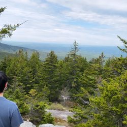
Anytime of the year is perfect for the rewarding view. Maybe a little tough during snow and mud…read moreseason, but still doable. Table Rock faces the Bellows Falls are from New Hampshire, just across the Connecticut River. We're in our 60s and needed to stop a few times on the way up, but it was never too steep or treacherous, just a long steady hike. You want bring good hiking shoes with serious treads. No fees. Dogs allowed.

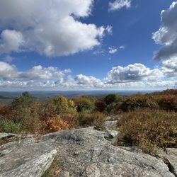
Phenomenal trail!! Definitely in my top 5 fave hikes - especially for the fall colors (my visit was…read morein early October)!! And it's a killer workout too! The view from the top is breathtaking- but not for the faint of heart - I have a fear of heights and it took me a while to work up the nerve to go sit on the edge lol! AllTrails has this trail labeled as "moderate" - but it was insanely muddy and very wet when I hiked it - took me ages and totally wore me out - so in those conditions I'd call it moderate-hard. And also with the rock scrambling at the top - it can be quite difficult. Very steep and especially narrow at the top - can be dangerous if you're not careful. I did a total of 2 miles round trip - it's an out and back trail. In those 2 miles, my tracker showed an 800 foot elevation gain so it's definitely a butt burner. And along the trail there are numerous areas of rock scrambling (some are very steep) and stream crossings during the wet season - get ready to be covered in mud lol! You will definitely need decent hiking shoes - and poles would've been so helpful I think! There were quite a few other hikers around. The trails are very well marked with colorful tree badges - but in some spots between the markers, I needed my trail map bc the ground was covered in leaves and mud and it wasn't as obvious. Once you get to the top of Table Rock, the stunning view will absolutely take your breath away! It's a sweeping vista of the entire forest area with the lake and resort below to the left and the long stretch of road through the park to the right - perfect for taking in all the colorful autumn splendor!! The top is a long, very narrow and flat tableau. It seems pretty stable - but has extremely steep (and deadly!) drop offs either side and no safety rails or fencing or anything so be aware. Drones aren't allowed in the park (according to the State Park website) but someone was flying one and buzzing us closely at the top which made it very distracting and scary unfortunately. Dogs are allowed - there were many on the trail and at the top. Parking is a small dirt lot pull out on the side of the road at the trailhead - Google maps took me right to it (just put in Table Rock Trailhead). It's located in Dixville Notch State Park (you can see my review of that for more detailed info). The park doesn't have bathrooms that I could find. And I think it's free. I didn't see any fee areas and their website doesn't list it as a fee area.

Photos
Table Rock Trail
Table Rock Trail - Another stream crossings along the trail

Another stream crossings along the trail

Table Rock Trail - Gorgeous fall colors all along the trail (early October)!

See all

Gorgeous fall colors all along the trail (early October)!

Garwin Falls - hiking - Updated November 2026

Loading...
Loading...
Loading...