1. Purgatory Brook and Falls

0

Hillsborough, NH

Cancel

Open app

Search

Purgatory Brook and Falls

3.1 (14 reviews)

Purgatory Brook and Falls Photos

Recommended Reviews - Purgatory Brook and Falls

Your trust is our priority, so businesses can't pay to alter or remove their reviews. Learn more about reviews.
Yelp app icon
Browse more easily on the app
Review Feed Illustration

Reviews With Photos

Robert F.

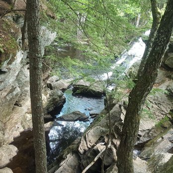
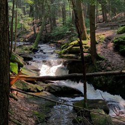
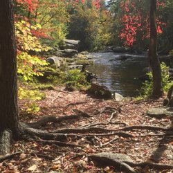
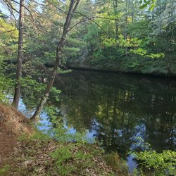
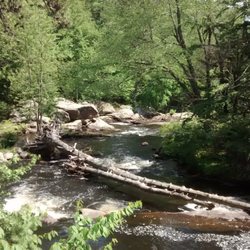
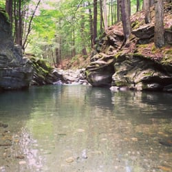
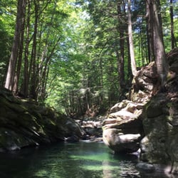
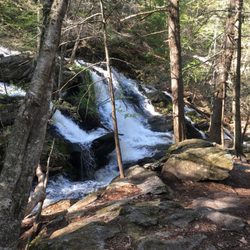
Purgatory Brook is an almost six mile long river, in southern New Hampshire, lying between the towns of Lyndeborough and Mont Vernon. A series of hiking trails cut through and along it, and as one hikes south, one passes three waterfalls, named Upper Falls, Middle Falls and Lower Falls. The northern falls were a tourist destination in the late 19th and early 20th century, when the area was home to a number of hotels which served people from the greater Boston area. The upper falls and middle can be reached from Lyndeborough. One has to drive to the end of Purgatory Falls Road, and park at the end of the dirt road. The views from the upper falls are fantastic!
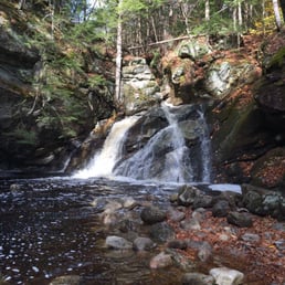
The first waterfall.
Chilly P.

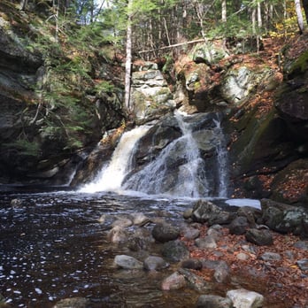
So I totally came here off season when the leaves have completely fallen off the trees which was quite eerie but beautiful. Google Maps brought me to the correct "parking" area for Upper Falls but my friend and I had no idea we could park there; the sign was so small. Please, whoever manages the trails, update the signs because it's so hard to spot! We ended up driving in circles until realizing it was the correct area. The trail is a bit confusing. You can easily walk the wrong direction, if you are not constantly keeping an eye out for the markers. My favorite part about this hike is the multiple waterfalls; small but beautiful. I know people can swim in the river but it looked quite dirty. We didn't hike the entire way to the Lower Falls. The hike from the beginning to the last waterfall is about 45 mins, so about 1 and a half hours round trip for us. Easy but challenging when maneuvering up and down to see each waterfall. Purgatory Falls was an okay hike. I'm from Massachusetts, so driving here again wouldn't be worth it. The experience was underwhelming. It makes sense for locals though. They REALLY need to update the signs that mark the parking area; bigger and brighter!

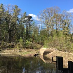
this is what a "waterfall" looks like at Purgatory Falls. How atrocious!

See all

6 months ago

This is a beautiful and easy hike. Impressive water flow in April. Went on a Saturday and it wasn't crowded at all.

Helpful 0
Thanks 0
Love this 0
Oh no 0

1 year ago

Helpful 0
Thanks 0
Love this 0
Oh no 0

7 years ago

Helpful 3
Thanks 0
Love this 0
Oh no 0
Photo of Robert F.
12
74
114

14 years ago

Helpful 4
Thanks 0
Love this 1
Oh no 1

7 years ago

Helpful 0
Thanks 0
Love this 0
Oh no 0

11 years ago

Helpful 4
Thanks 0
Love this 2
Oh no 0
Photo of Hayley L.
226
16
12

10 years ago

Helpful 0
Thanks 0
Love this 1
Oh no 0

6 years ago

Helpful 0
Thanks 0
Love this 0
Oh no 0

9 years ago

Helpful 1
Thanks 0
Love this 0
Oh no 0
Photo of Tom L.
0
43
0

12 years ago

Helpful 1
Thanks 0
Love this 0
Oh no 0

8 years ago

Helpful 2
Thanks 0
Love this 0
Oh no 1
Photo of Lisa L.
11
133
0

12 years ago

Helpful 3
Thanks 0
Love this 2
Oh no 0

9 years ago

Helpful 0
Thanks 0
Love this 0
Oh no 0

12 years ago

Helpful 1
Thanks 0
Love this 0
Oh no 0

Ask the Community - Purgatory Brook and Falls

Verify this business for free

People searched for Hiking 423 times last month within 15 miles of this business.

Verify this business

Mount Kearsarge

Mount Kearsarge

4.7(3 reviews)
31.6 mi

Beautiful hike up in the White Mountains of NH that leads you to the summit of a fire tower with…read morebeautiful vistas of the range up at the top. The hike will take someone a few hours, give or take the same few hours based on your hiking experience, pace preference, desire to stop, snack, take in the sights and explore. Get ready for a nice time out in nature when you start the trail. Parking is scarce, you'll likely just park on the side of the road (it's free though) and hope you don't get sideswiped as you start the hike. There's some definite elevation, but it's not super steep or overwhelming like some of the more challenging peaks in NH (Mt Washington for instance!). In the winter, be sure to have snow shoes and spikes. This hike is unique in the firetower at the top which you can access! Everyone I met on the trail was super COVID conscious and put masks on as I passed, which was so appreciated as well. If you're staying in the beautiful town of North Conway, this hike is only a few minutes away - so be sure to check it out! At the top, you'll see views of the tallest peak of the northeast (Mt Washington) on a clear day! I wish this trail was more of a loop, but the out and back was nice too!

Four bucks pays for the ride up then a great hike awaits you. Took the easier of the two trails…read more(stay to the right.) Make it to the top for a view that makes everyday life seem ridiculous. Bugs weren't terrible so you could probably get away with some lemon/lavender oil. Enjoy!

Photos
Mount Kearsarge
Mount Kearsarge
Mount Kearsarge

See all

Table Rock Trail

Table Rock Trail

5.0(2 reviews)
41.0 mi

Anytime of the year is perfect for the rewarding view. Maybe a little tough during snow and mud…read moreseason, but still doable. Table Rock faces the Bellows Falls are from New Hampshire, just across the Connecticut River. We're in our 60s and needed to stop a few times on the way up, but it was never too steep or treacherous, just a long steady hike. You want bring good hiking shoes with serious treads. No fees. Dogs allowed.

Phenomenal trail!! Definitely in my top 5 fave hikes - especially for the fall colors (my visit was…read morein early October)!! And it's a killer workout too! The view from the top is breathtaking- but not for the faint of heart - I have a fear of heights and it took me a while to work up the nerve to go sit on the edge lol! AllTrails has this trail labeled as "moderate" - but it was insanely muddy and very wet when I hiked it - took me ages and totally wore me out - so in those conditions I'd call it moderate-hard. And also with the rock scrambling at the top - it can be quite difficult. Very steep and especially narrow at the top - can be dangerous if you're not careful. I did a total of 2 miles round trip - it's an out and back trail. In those 2 miles, my tracker showed an 800 foot elevation gain so it's definitely a butt burner. And along the trail there are numerous areas of rock scrambling (some are very steep) and stream crossings during the wet season - get ready to be covered in mud lol! You will definitely need decent hiking shoes - and poles would've been so helpful I think! There were quite a few other hikers around. The trails are very well marked with colorful tree badges - but in some spots between the markers, I needed my trail map bc the ground was covered in leaves and mud and it wasn't as obvious. Once you get to the top of Table Rock, the stunning view will absolutely take your breath away! It's a sweeping vista of the entire forest area with the lake and resort below to the left and the long stretch of road through the park to the right - perfect for taking in all the colorful autumn splendor!! The top is a long, very narrow and flat tableau. It seems pretty stable - but has extremely steep (and deadly!) drop offs either side and no safety rails or fencing or anything so be aware. Drones aren't allowed in the park (according to the State Park website) but someone was flying one and buzzing us closely at the top which made it very distracting and scary unfortunately. Dogs are allowed - there were many on the trail and at the top. Parking is a small dirt lot pull out on the side of the road at the trailhead - Google maps took me right to it (just put in Table Rock Trailhead). It's located in Dixville Notch State Park (you can see my review of that for more detailed info). The park doesn't have bathrooms that I could find. And I think it's free. I didn't see any fee areas and their website doesn't list it as a fee area.

Photos
Table Rock Trail
Table Rock Trail - Another stream crossings along the trail

Another stream crossings along the trail

Table Rock Trail - Gorgeous fall colors all along the trail (early October)!

See all

Gorgeous fall colors all along the trail (early October)!

Clark Lookout Trail - Tree restoration

Clark Lookout Trail

5.0(2 reviews)
39.0 mi

The Kearsarge/Lake Sunapee area is post-card beautiful, and residents and visitors enjoy the active…read morelifestyle and the plethora of things to do. One of the many four-season things available is hiking. And a gem in the hiking category is the Davis Hill and Clark Lookout Trail. The first thing is that almost anyone can negotiate the trail. It is only 0.7 miles long out and back in its totality. But still, visitors should plan an hour. That's because the Clark Lookout Trail provides a spectacular, I mean, write home to mom kind of beautiful, view of Lake Sunapee and Mount Sunapee. A camera or a good quality smartphone is a must, as the views here are amazing. The Clark Lookout property cuts through a neighborhood of million-dollar homes and was made available to the residents through the generosity of Sydney L. Crook and Mary D. Haddad, who donated land and funding to the town of New London for conservation and recreation use. The trail is managed by the New London Conservation Commission. Much of the land and its conservation easements are held by the area's prime land conservation organization, the Ausbon Sargent Land Preservation Trust. For a family traveling on the Interstate that wishes to have a nice break, this spot is optimum. It is also a must for anyone visiting for the first time, as you will fall in love with the area on the spot. The trail is also amazingly dog friendly (on a leash) and poopy bag dispensers are available indifferent places. The Clark Lookout Trail starts on Rt 103-A, across from the Park and Ride lot near Exit 12 on Rte. 89. From that point, the trail climbs only 100 feet. From the Conservation Commission's description, "heading up the trail, the first point of interest is the trail kiosk, which has information about the history of the trail and includes a bulletin board where notices and information are posted. Near it is the libary box, where hikkers can borrow or lend books when they visit. Turn left at the kiosk to continue up the trail. Further on is the four corner road intersection (turn right) which is the last turn before proceeding to the lookout summit". Once on top, a majestic view of Lake Sunapee, Lake Sunapee and the surrounding area greets the visitor. During the Covid-19 pandemic, Clark Lookout is one of these places where you can see the beauty of nature and feel optimistic again.

The views at the top of this short walk are amazing. It's a relaxing walk from the trailhead and…read moreonly .8 miles round trip. Great photo opportunities and it's a good place to walk your dog. There is small chestnut tree restoration farm along the way as well as a stone wall that lines the trail. Well worth a visit to see the beautiful vista at the end of this short and easy trail.

Photos
Clark Lookout Trail - Vista of Sunapee Lake

Vista of Sunapee Lake

Clark Lookout Trail - Vista

Vista

Clark Lookout Trail - Lookout at top of trail

See all

Lookout at top of trail

Pillsbury State Park - View from our quiet camp site

Pillsbury State Park

4.6(16 reviews)
31.7 mi

This place is exactly what my boyfriend and I were looking for! We were kind of looking around last…read moreminute and came across this state park. We have a small dog, so the pet friendly part was a big plus! I desperately wanted to go camping this past weekend because we didn't get a chance to go as much this summer as intended. It was about a 2 hour drive from home so it was a nice little road trip. I would have to recommend getting everything you need food and camp site wise before you reach the grounds. We had to leave a couple times for firewood ($3 bundles of dry wood that burns great, about a 20 minute drive from camp though, but half the price.) We stayed at site #18 at the end of the horse shoe. Although there are other campsites close by in that loop, I still felt like we had adequate privacy and for majority of the time were not disturbed by noise from other campers. This park seems to be a good one night stop for other campers heading farther up north. There are a lot of families, but there are also a lot of couples, and groups of twenty something's out to have a good time. Basically, whatever reason you are looking to go camping, this place will accommodate you well. I could see where the bathrooms were at the top of the hill from our campsite, so night time trips to and from were easy and I felt safe. The bathrooms are also very well kept for just a toilet and a urinal. There are plenty of hiking trails, and some people even spotted a Moose as well as some young Bears. The women that work the registration office were very helpful and pleasant, and let us know where we could find anything we needed. We actually stayed while there was a blood moon and we didn't even know it! It was crazy beautiful and so close it felt like we could reach out and touch it. Overall, great find and we already are talking about next year :)

We love this small, scenic campground! Very quiet beautiful water. Great trails for hiking. Will be…read moreback this year.

Photos
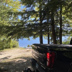
Pillsbury State Park - This campground is quiet and peaceful. We had a site right by the water ( the water is right behind me , but this was our set up.

This campground is quiet and peaceful. We had a site right by the water ( the water is right behind me , but this was our set up.

Pillsbury State Park - Enjoying campsite #10 by the water!

Enjoying campsite #10 by the water!

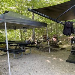
Pillsbury State Park - Our campsite #18. We had a 20x10 tent, and our car on site, and still had plenty of room to move around and be comfortable.

See all

Our campsite #18. We had a 20x10 tent, and our car on site, and still had plenty of room to move around and be comfortable.

Purgatory Brook and Falls - hiking - Updated November 2026

Loading...
Loading...
Loading...