
Friendship Garden Photos


You might also consider


More like Friendship Garden
Recommended Reviews - Friendship Garden
Start your review...


Reviews With Photos
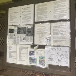

Friendship Garden is a pretty short family friendly 0.8 mile hike. There is another part of the hike that is considered challenging, we attempted it but it was pretty steep with a rope to aid you but it started to drizzle so we decided to turn back from the ridge trail. Parking is alongside the road near the entrance. Several cars parked, good thing we found an empty spot to parallel park in. There is a board of the history and a map you could take along the way(didn't read the map, not sure if it only showed Friendship Garden or the ridge trail as well). The view is pretty of the ocean. There is a bench at the end of the trail to sit down and look out from the view.


Hiking in Kaneohe, O'ahu, Hawaii... Friendship Garden is a Historical Landmark established in 1927. It is not on the Registry, but it's still important... Because the people who maintain the trails are dedicated and awesome! My friend and I have never been on this trail before. There are several splits and switchbacks, so, stay together! We had different goals. My friend wanted a cardio workout, so, she went at a faster pace. I was taking my time with photos and plant identification. I really liked the views of Kaneohe Bay, the bamboo grove, the different types of paths, etc. About four groups of people (a couple of groups had little children) and a cute doggie crossed paths with me. They were all pleasant and cheerful! We went relatively early at 10am. We easily found street parking. My friend and I will return again because I didn't see "the bench" with a plaque, the gazebo, nor the stone pagoda. Uhg! For sure, I will find them next time! Note: I'm glad that we went in late September when it wasn't muddy. The inclines would be spooky if they were slippery!


45-219 Kokokahi Place, Kaneohe Easy....quiet....few hikers....pretty flowers and foliage and fabulous views of the water. My kind of hike. The trail meandered slowly up and you have the choice of doing the more challenging trail....or not. It involved more uphill climbing and there were ropes to help. Otherwise the trail is a vine covered walk upwards. Loose rocks make it a little slippery. Start of the hike is almost at the top of Kokokahi. Park on the side of the road and don't block the road for residents. Panoramic views of kaneohe bay Kailua.

Fun easy hike that comes with a challenge if you can handle it lol. A great beginners hike, however it can has a tougher route on the way to the lookout (Fantasitc view of Kāneʻohe Bay all the way to Kuaola and Mokoliʻi)where their is a ridge route. It can get a bit rough with California grass but itʻs a great fun route if you take on the challenge as it has a unstoppable view of Kāneʻohe! Looking forward to the next hike/run!


The Friendship Garden and the Ridge trail combination is a wonderful morning hike on the Windward side of the island. First of all if going with a group best to carpool very limited parking on a very tight street in residential area. The Friendship Garden section has placards identifying plants and trees, Man made steps and rated easy. Very pretty lush area with large plants growing intermixed with trees and bamboo. For a more challenging hike continue on the ridge trail. Be prepared with plenty of water, poles, hiking boots and crampons especially for coming back down. Maybe slippery after a rain. There are a number of ropes to aid hikes on these steeper areas. The pay back for the climb is all the amazing views of the Bay, mountains and mine along the way. Highly recommend giving it a try.


Great spot for photos in a residential area. There's some parking along the path. To be honest I only went up the first few steps of this trail for some photos and didn't actually do the hike! Lol. I'm sure it is a fairly easy hike throughout the trail tho. But for me - I'm lucky that the first few steps was sufficient for my needs lol. This path is also dog friendly. I did see another dog that came shortly after us.


A hidden gem in Kāne'ohe. It's located in a residential neighborhood so parking can be limited. The Main trail is a short easy hike that goes in a loop. Kid & pet friendly. Many beautiful plants & flowers to admire along the way. My friends and I decided to hike up to the lookout. There are ropes to assist going up/down the steep parts of the trail. A bit challenging but well worth it.


A quick and easy hike located in Kaneohe. This hike is perfect for families as its a switchback trail that gets you to the top view points in about 30mins or less, depending on how fast you go. It is a maintained trail and there a rail maps as well provided at the beginning of the trail. Please be mindful that this trail is located within a neighborhood, so please be respectful for the residents there. Parking is a little tricky, there a two spaces in front of the trail, street parking is available, but be sure to not have your car parked on the paved road, you can get ticketed. The trail itself is shaded, so no need to worry about that hot sun. There are numerous plants there that is labeled throughout the hike so you know what types of plants they are. There is a fork in the trail either one you take leads you to the viewpoint and also takes you back to the beginning. The view itself is beautiful and relaxing. There is a bench at the top, you get the view of Kaneohe bay as well as partial view of the Ko'olaus. Overall this hike is an easy one and nice stroll.


Nice and easy hike to do that is kid and dog friendly. I would recommend taking a map or a picture of it at the beginning if it's your first time since it can get confusing if you don't know the trail. We went around the large loop up to the ridge lookout, and then back to the small loop to exit. The view at the ridge lookout is really nice, you can see Kaneohe bay and if you decide to go to the top of the lookout you can see kailua too. The ridge look out does get pretty steep if you decide to go up, but their are ropes that you can use to go up and down. We were fortunate to get a parking stall right at the entrance and there are warnings that when you park your tires must be off the road to avoid tickets. We were able to finish the hike within an hour.


One of my new favorite hikes! (Shaded, not too long, just enough of ups and downs, with great views) There are two loops on this walk, slight incline along the side of the mountain and you basically zigzag upwards. Perfect if it hasn't rained and not muddy. If it rained (like today) then the ground is a tad sleek and easy to slip. Quite a few graceful slips/slides today . You can finish the small and bigger loop in about an hour. We made it to the clear look out area in under an hour and we decided to continue on past the loop onto the ridge. This is where it gets a tad harder as there were multiple inclines with ropes to pull on as you get up. But definitely doable since once you past those it's a pretty flat walk until the next incline. Lots of greenery and trees so there's ample shade! We finally made it to the top of ridge after about another hour from the chair lookout point. And we continued onward in hopes of making it to the quarry. Getting to the ridge was probably the hardest as there was a spot where there were 4 steep inclines with ropes one after another. But once you get past that you will be at the top. And you just keep walking towards wherever you want to end up. We made it to the quarry and turned around. If you continued you would have made it to the veteran cemetery. I would suggest going even w spikes if it just rained, we definitely slipped a few times today as it rained before we got there. There are fauna labels as you walk upwards towards the top that tells you the type of plant you are seeing. I would come back to do this again :)


Limited parking but the views are amazing. Be careful not to slip if the trail is wet or there is loose gravel. The ridge trail is a little harder and overgrown in parts but the view is amazing!
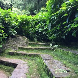

Short, easy hike on the windward side that is fairly unknown to many, even locals like myself. As everyone has already pointed out, parking is the biggest challenge when it comes to this hike. Be sure to check the Friendship Garden's website for instructions on where to park. Respect the residents who live in this area. The trail is short and clearly marked so you won't have trouble reaching the lookout, even if you don't follow the map (like how i did). Great for novice hikers and kids too. Dogs are welcomed ON LEASH. The panoramic view of Kaneohe from the lookout is amazing. Stop for a moment, put down your camera/cell phone, and just take it all in.


Such a cute and moderately easy hike filled with various plants and greenery! Definitely kid and animal friendly. However, please be mindful of where to park as it is deep within a residential area (not to mention, there's multiple turns and highs and lows). One important thing to note--GRAB A MAP. Friendship garden trail is a loop that shouldn't elevate you so quickly. If you find yourself going above the trees, congratulations, you have off trailed and are now on your way to Onewa Hills or Kapa'a Quarry hike. This is not a bad thing--but it can get tiresome, and a little hefty quick. If you choose to keep going this route, make sure you hydrate, go when it is not rainy so as to be able to climb up without fear of slipping, and go on until you see the Aztec looking quarry.

4 days ago
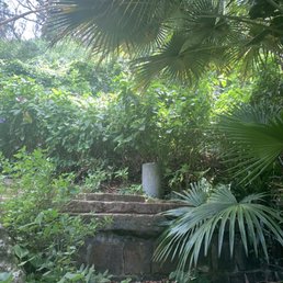
This is a beautiful hidden gem that I came across all because I got stuck on H3 when I intended to drive home on H one. I'm so happy for where my mistake took me. The drive to get here is a very narrow driveway to a dead end through residential areas. Be very careful of cars coming out of their driveway and or those driving down the hill. There is so much lush greenery on these paths. Be prepared for some steep, climbs and elevation. It is clear that the path has been made, but becomes narrow and/or can be quite slippery at some parts. I was so ill prepared for a hike, but didn't want to miss out on the chance so I can vouch that careful steps in slide Sandals is doable. This is also recommended even if you have a young child ages 8+. As long as they are not prone to run off and are able to watch carefully where they are stepping It will be a wonderful family experience. I definitely hope to come back again because I only had time to go about halfway before turning around. Be also mindful that there are people who walk this path with their dog, sometimes not on the leash so be careful not to startle and fall off the side of the incline. read more


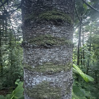

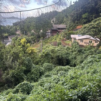


Friendship Garden has 72 reviews as of 1/17/2025 and I was wondering why. I think the name explains it. It's a short, garden trail inside a neighborhood rather than a real hike. As I was walking this trail, my brain is telling me this is a mini Aiea loop trail with great view of the Windward side of Oahu. Parking is a challenge. The location is inside, one way, Kokokahi Place neighborhood so there's only street parking. We were lucky to find spacious area to park. The view here is great considering we only hike up 20-30 minutes. Total trip length was 2 miles. That was little disappointing because I like to get most out of my hikes. I feel like I got ripped off on this hike with little sweat. As for intensity, you do have to climb up but lots of ropes to help you. Luckily it was a dry day so no mud. This trail is quite narrow so it may not be kid friendly. Also, if you're on the taller side, watch out for branches. This is not State trail so it seems like it's not kept up regularly. read more


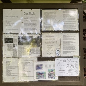
If you need an escape from daily life to catch a breath and rekindle friendships, then the Friendship Garden is the perfect place. This is a very short hike that loops around, so you shouldn't be running into anyone on the narrow pathway. Start right, like driving! There's nothing steep, treacherous, or difficult. The Friendship Garden is very well maintained. Maps and information are provided at the beginning. At the top, you'll find beautiful views Kaneohe Bay. There's also a pathway that leads to another hike that's clearly more difficult and not apart of the Friendship Garden. Warning signs posted! The only difficult thing might be finding this place because it's quite hidden, deep in a residential area. It's located on Kokokahi Pl, which you can reach from Kaneohe Bay Dr. Just drive all the way up, and it'll be to your left. You can only park along the side of the road. Make sure to leave enough space, and also be mindful of the signs! No parking from 6-11AM on Wednesdays and Saturdays, which is probably trash pick up days. Overall, a really nice, easy hike with well maintained pathways. It might be a journey to get there, but it's worth it. Bring friends and make new friends! read more




3 years ago
Friendship Garden is a pretty short family friendly 0.8 mile hike. There is another part of the hike that is considered challenging, we attempted it but it was pretty steep with a rope to aid you but it started to drizzle so we decided to turn back from the ridge trail. Parking is alongside the road near the entrance. Several cars parked, good thing we found an empty spot to parallel park in. There is a board of the history and a map you could take along the way(didn't read the map, not sure if it only showed Friendship Garden or the ridge trail as well). The view is pretty of the ocean. There is a bench at the end of the trail to sit down and look out from the view. read more


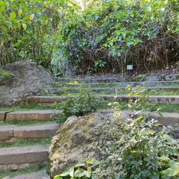
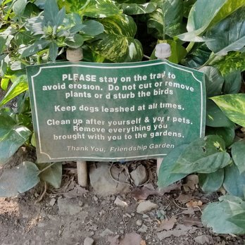
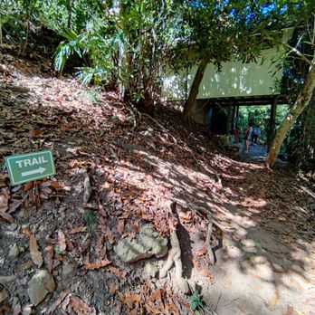
Hiking in Kaneohe, O'ahu, Hawaii... Friendship Garden is a Historical Landmark established in 1927. It is not on the Registry, but it's still important... Because the people who maintain the trails are dedicated and awesome! My friend and I have never been on this trail before. There are several splits and switchbacks, so, stay together! We had different goals. My friend wanted a cardio workout, so, she went at a faster pace. I was taking my time with photos and plant identification. I really liked the views of Kaneohe Bay, the bamboo grove, the different types of paths, etc. About four groups of people (a couple of groups had little children) and a cute doggie crossed paths with me. They were all pleasant and cheerful! We went relatively early at 10am. We easily found street parking. My friend and I will return again because I didn't see "the bench" with a plaque, the gazebo, nor the stone pagoda. Uhg! For sure, I will find them next time! Note: I'm glad that we went in late September when it wasn't muddy. The inclines would be spooky if they were slippery! read more




3 years ago
45-219 Kokokahi Place, Kaneohe Easy....quiet....few hikers....pretty flowers and foliage and fabulous views of the water. My kind of hike. The trail meandered slowly up and you have the choice of doing the more challenging trail....or not. It involved more uphill climbing and there were ropes to help. Otherwise the trail is a vine covered walk upwards. Loose rocks make it a little slippery. Start of the hike is almost at the top of Kokokahi. Park on the side of the road and don't block the road for residents. Panoramic views of kaneohe bay Kailua. read more


1 year ago
Fun easy hike that comes with a challenge if you can handle it lol. A great beginners hike, however it can has a tougher route on the way to the lookout (Fantasitc view of Kāneʻohe Bay all the way to Kuaola and Mokoliʻi)where their is a ridge route. It can get a bit rough with California grass but itʻs a great fun route if you take on the challenge as it has a unstoppable view of Kāneʻohe! Looking forward to the next hike/run! read more


The Friendship Garden and the Ridge trail combination is a wonderful morning hike on the Windward side of the island. First of all if going with a group best to carpool very limited parking on a very tight street in residential area. The Friendship Garden section has placards identifying plants and trees, Man made steps and rated easy. Very pretty lush area with large plants growing intermixed with trees and bamboo. For a more challenging hike continue on the ridge trail. Be prepared with plenty of water, poles, hiking boots and crampons especially for coming back down. Maybe slippery after a rain. There are a number of ropes to aid hikes on these steeper areas. The pay back for the climb is all the amazing views of the Bay, mountains and mine along the way. Highly recommend giving it a try. read more


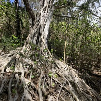


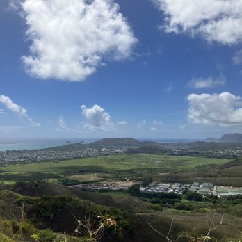

Great spot for photos in a residential area. There's some parking along the path. To be honest I only went up the first few steps of this trail for some photos and didn't actually do the hike! Lol. I'm sure it is a fairly easy hike throughout the trail tho. But for me - I'm lucky that the first few steps was sufficient for my needs lol. This path is also dog friendly. I did see another dog that came shortly after us. read more


3 years ago
A hidden gem in Kāne'ohe. It's located in a residential neighborhood so parking can be limited. The Main trail is a short easy hike that goes in a loop. Kid & pet friendly. Many beautiful plants & flowers to admire along the way. My friends and I decided to hike up to the lookout. There are ropes to assist going up/down the steep parts of the trail. A bit challenging but well worth it. read more


A quick and easy hike located in Kaneohe. This hike is perfect for families as its a switchback trail that gets you to the top view points in about 30mins or less, depending on how fast you go. It is a maintained trail and there a rail maps as well provided at the beginning of the trail. Please be mindful that this trail is located within a neighborhood, so please be respectful for the residents there. Parking is a little tricky, there a two spaces in front of the trail, street parking is available, but be sure to not have your car parked on the paved road, you can get ticketed. The trail itself is shaded, so no need to worry about that hot sun. There are numerous plants there that is labeled throughout the hike so you know what types of plants they are. There is a fork in the trail either one you take leads you to the viewpoint and also takes you back to the beginning. The view itself is beautiful and relaxing. There is a bench at the top, you get the view of Kaneohe bay as well as partial view of the Ko'olaus. Overall this hike is an easy one and nice stroll. read more


Nice and easy hike to do that is kid and dog friendly. I would recommend taking a map or a picture of it at the beginning if it's your first time since it can get confusing if you don't know the trail. We went around the large loop up to the ridge lookout, and then back to the small loop to exit. The view at the ridge lookout is really nice, you can see Kaneohe bay and if you decide to go to the top of the lookout you can see kailua too. The ridge look out does get pretty steep if you decide to go up, but their are ropes that you can use to go up and down. We were fortunate to get a parking stall right at the entrance and there are warnings that when you park your tires must be off the road to avoid tickets. We were able to finish the hike within an hour. read more


One of my new favorite hikes! (Shaded, not too long, just enough of ups and downs, with great views) There are two loops on this walk, slight incline along the side of the mountain and you basically zigzag upwards. Perfect if it hasn't rained and not muddy. If it rained (like today) then the ground is a tad sleek and easy to slip. Quite a few graceful slips/slides today . You can finish the small and bigger loop in about an hour. We made it to the clear look out area in under an hour and we decided to continue on past the loop onto the ridge. This is where it gets a tad harder as there were multiple inclines with ropes to pull on as you get up. But definitely doable since once you past those it's a pretty flat walk until the next incline. Lots of greenery and trees so there's ample shade! We finally made it to the top of ridge after about another hour from the chair lookout point. And we continued onward in hopes of making it to the quarry. Getting to the ridge was probably the hardest as there was a spot where there were 4 steep inclines with ropes one after another. But once you get past that you will be at the top. And you just keep walking towards wherever you want to end up. We made it to the quarry and turned around. If you continued you would have made it to the veteran cemetery. I would suggest going even w spikes if it just rained, we definitely slipped a few times today as it rained before we got there. There are fauna labels as you walk upwards towards the top that tells you the type of plant you are seeing. I would come back to do this again :) read more


3 years ago
Limited parking but the views are amazing. Be careful not to slip if the trail is wet or there is loose gravel. The ridge trail is a little harder and overgrown in parts but the view is amazing! read more

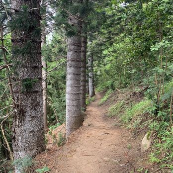

Short, easy hike on the windward side that is fairly unknown to many, even locals like myself. As everyone has already pointed out, parking is the biggest challenge when it comes to this hike. Be sure to check the Friendship Garden's website for instructions on where to park. Respect the residents who live in this area. The trail is short and clearly marked so you won't have trouble reaching the lookout, even if you don't follow the map (like how i did). Great for novice hikers and kids too. Dogs are welcomed ON LEASH. The panoramic view of Kaneohe from the lookout is amazing. Stop for a moment, put down your camera/cell phone, and just take it all in. read more
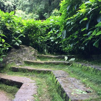


Such a cute and moderately easy hike filled with various plants and greenery! Definitely kid and animal friendly. However, please be mindful of where to park as it is deep within a residential area (not to mention, there's multiple turns and highs and lows). One important thing to note--GRAB A MAP. Friendship garden trail is a loop that shouldn't elevate you so quickly. If you find yourself going above the trees, congratulations, you have off trailed and are now on your way to Onewa Hills or Kapa'a Quarry hike. This is not a bad thing--but it can get tiresome, and a little hefty quick. If you choose to keep going this route, make sure you hydrate, go when it is not rainy so as to be able to climb up without fear of slipping, and go on until you see the Aztec looking quarry. read more


We lucked out with parking as a party with two cars was leaving. A very pleasant walk with pretty views. There are some steep switchbacks, but we were able to do it in slippers. Not sure it's one that I'd drive across island again to do, but if I lived in the area I'd enjoy the serenity. read more
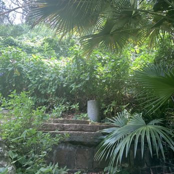


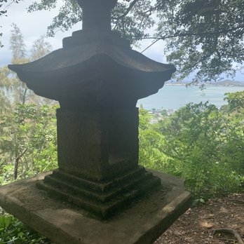


This is a great little hike in my neighborhood. Luckily I am able to walk to the trailhead. If you drive here be prepared for very limited parking, basically two spots. It is a short hike, about a half mile loop, and there is lots of vegetation and shade along the way. At the top be sure and take a left to catch the view. And what a view it is!! From the top you can follow the same path down or go down the loop you hadn't previously traveled. At the top you can also take a right at the top and follow the trail to get views of the quarry and beyond. I've done this once, more or less lost our way and ended up on a much longer and rigeous path than we'd intended. Let's call it an adventure!! Have fun! Take only pictures, leave only footprints and malama the aina! read more

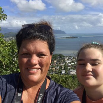


The Friendship Garden is located in Kokokahi Place. This is a residential area, so just keep driving up. Parking is limited, goodluck! You have to look carefully while you're driving up; the signs are hidden with leaves and grass. Sign 1: http://www.yelp.com/biz_photos/friendship-garden-kaneohe#UZzs9cNC1eQA0ZbevRBm6w Sign 2: http://www.yelp.com/biz_photos/friendship-garden-kaneohe#vMbC_BgCht148KoGCGhU2A The Friendship Garden was really nice to go through and the smell was wonderful. You can smell the eucalyptus plants through the whole place. There was also fresh guava. The path is very clean and well-maintained. Another thing that I thought cool about this garden was how they had signs indicating what the different plants were. I thought that was cool to learn about the nature we were surrounded by. Overall: This is an easy hike. Great for kids and pets. I recommend to bring mosquito repellent. read more

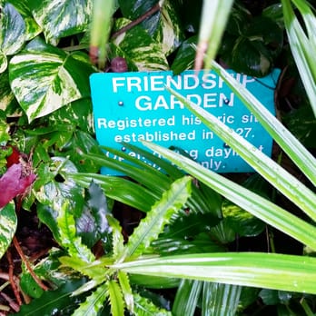


The friendship garden is located on along the loop of Kokokahi place. As you pass by it, you will see a small green sign with friendship garden on it. Now the parking is little diffcult because it is located in a residential area. You just to need to look for an empty spot on the street that is off the road. My bf was lucky enough to find a spot not too far away from the garden. It is an easy hike with a few inclines. The hike should take about 1 hr. We wanted to check out the hike to Oneawa hills, but seeing how steep the incline was in the beginning of the trail and the enormous amount of big red ants, we turned back, slowly descending down the hill, making sure we don't lose our footing and slip. There too many loose rocks on the trail that is made it easy to slip and fall. The lookout at the top of the higher trail wasn't too bad, but I wished the trees weren't blocking the way to take a scenic photo. Surprising there was no one hiking the trail so we had the whole place to ourselves. Quiet and peaceful hike :) The weather was sunny and little overcast. Heat was super muggy. Most of the trail is shaded by the trees. So not completely in the sun the entire hike. There is a cute teahouse on the lower trail. read more


5 years ago
If you blink you will miss it! It is a hidden gem in a neighborhood up in the hills and unfortunately parking is not easy to find in a very narrow street. Nevertheless, it is a nice woodsy uphill hike which is nice because lots of shade, not many people on the trail, there is a small Japanese garden and then if you make it to the top you will see the most beautiful views of Kaneohe Bay. I recommend this hike! read more


Mistaken trail. Note to first timers: If you end up chest high in itchy tall grass... you're not in the garden. You're on the ridge. Others have mentioned this being an easy hike and safe to bring a baby, that's true if you stay off the ridge. The ridge trail (****sorry no photos****) is littered with ropes and steep inclines that prey on the balance of those klutzy and out of shape. You might have an involuntary trust fall/slip moment on this hike, I hope you take a friend. Everything is at your own risk. The trail is well maintained. I recommend checking your interest to continue every 10 minutes or half a mile. There was maps a beginning of trail, but not a guarantee. Parking is limited and it is in a residential area. Be respectful, don't double park and don't litter. read more


8 years ago

4 years ago

9 years ago
I have wanted to hike the Friendship Garden Trail ever since I moved to Kailua three years ago. Not only was it nearby, but the view from various photos displayed online was magnificent. It just so happened that the topic of hiking had come up when I had gone to lunch with my Big (sister) who had asked what I wanted to do before I returned back to the work grind. Rewind to two nights ago when I receive a text from my Big asking what I was doing on Friday. When I said nothing, she said we should hike, and that's how we ended up going to the Friendship Garden Trail. For those visiting for the first time, you will need to pay close attention to Google Maps because you can easily miss the entrance (it's covered in shrubbery which is how we missed it the first time around). However, even if you back track, you'll be able to find it. The hike itself is not a difficult one, though I should warn you that if you lift like I do (and by lift, I mean lift cheeseburgers into my mouth lol), this is definitely a hike that will make you get your cardio in. Not to mention that if you're trying to get to the top, always go for the routes that go up because while there's little trail signs at the beginning of the path to help guide you, they quickly disappear and you're on your own. If you're not careful, you can easily get lost or end up looping around in a circle to where you started. The view at the top, however, is worthwhile and I highly encourage going to the right once you're done with the Sandbar view since there's actually a little cave (?) in the back that some viewers have posted pictures of. I would definitely recommend this hike because as its title suggests, you can't help but bond with those that you're hiking with due to the secludedness and somewhat complex twists and turns of the path. read more


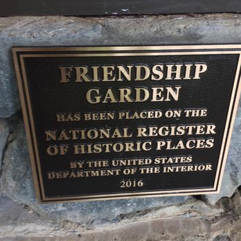


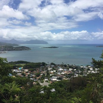


This was a fun little hike. It's nice and easy. Just a small loop only takes an hour to complete, thats with stopping at the small lookout that over looks Kaneohe. I thought that view was amazing to look at. On the trail it's mostly covered by the trees and surrounding plants, there's small placards telling you what type of plants they are. Bring mosquitoe repellent if you're worried about being bitten. It also gets pretty hot walking the trail, just because not a lot of breeze makes it through, so you might want to put the jacket aside until you get to the lookout or leave it in the car altogether, I didn't bring one. Only downfall watch where you step, many people and their pets do this trail, so there was some droppings along the way. Overall, I enjoyed this hike and would definitely do it again with my son in tow. read more




9 years ago
Beautiful little neighborhood gem. Parking is an issue so plan to carpool if you're going with a group. It's a historic site so please respect it. We went with a 3 year old and a 6 year old. The 3 year old made it halfway and had to be carried the rest. The 6 year old made it all the way up and had to be carried down. I might have taken everyone too far- The "top" was loosely packed dirt/clay and required ropes to maintain traction. The view at the top was worth the short but steep hike! Definitely don't wear slippers. But good traction sneakers are fine! read more



Friendship Garden...with an inviting name like that how can you pass it up? Well, it's easy to pass because the entrance is located on a narrow residential street. I must've passed it 5 times and cursed out my GPS because she kept saying it was on my right when it's actually on the left. I was about to give up when I finally saw the trail head and a tiny stone carved with "Friendship Garden." There are only 6 parking spots for the hike--2 100feet before the entrance, 2 directly in front of the hike entrance, and 2 100 feet after the entrance. Don't bring your wide Soccer Mom van or giant monster truck because the parking spots are narrow and any vehicles in the road will get ticketed or towed. Friendship Garden is an short easy hike of only .6miles but with amazing views of Kane'ohe Bay. We did the upper and lower trail and had snack at the view point with 5 kids in less than 1.5hrs. My friend's 3yo walked the whole thing and on the way out my 8yo stated it was too short and wanted to do it again. The trail is well shaded full of thick foliage so we expected mosquitos that many other Yelpers complained about and thick mud especially because it was raining off and on when we went. But it was our lucky day! The trees provided great coverage from the rain and our group of 8 didn't get a single mosquitos bite! This is a great hike for tourists who didn't pack hiking shoes, beginners, baby wearers, and families! My friend's 4yo with a broken arm was able to easily do this hike. Avid hikers may want to cross this one off their list. BUT if you make your way to the lookout point, you can make a left turn as you're heading back to the main trail; there is a treacherous trail complete with ropes to climb up that leads to Onewa Hills Hike. We didn't do that hike since we had 5 kids with us but I know some people who have inadvertently went that way. Trek on! read more







The Friendship Garden is maintained by a non-profit organization and admission is FREE. There are two separate loop trails to hike - an upper loop and a lower loop (see their website for a trail map). The longer upper loop trail is only a one mile hike, but it came with 227 feet of elevation gain. We parked the car at 295 feet and the highest elevation we got to was 522 feet. My family has gone here twice now - once to do the lower loop and once to do the upper loop. It's not a very well known or popular spot, so we only saw a couple of other people on the trail each time we went. The views of Kaneohe Bay are spectacular. I will post some of my photos here, but there are also several photos on the Friendship Garden website. If you are a geocacher, there are a couple of geocaches along the trail. Terrain: The trail is mostly hard-packed dirt, so it's probably pretty muddy after rain, and it probably doesn't dry very quickly under the shade of the trees. Parking: The website has a map showing how to get to the park. There is only enough room for two cars to park along the side of the street in front of the park entrance, so if you have a large group, you might want to arrange to carpool or drop people off and come back to get them (as suggested on their website). Facilities: None. No bathrooms nor water fountains of any sort. What to bring: Water, snack, camera, and bug spray. The trail is mostly shady under the trees, so you can get by here without sun screen, but I do recommend bug spray. read more




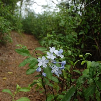
I finished the lower trail today. It's a very very very short walk in the Garden, yet very peaceful and serene! I found the tea house (a small hut with two benches), a view of Kaneohe Bay can be seen from the bench. I had my breakfast there and had some time to just sit and reflect and enjoy my peaceful surroundings. I'll go back next time and do the upper trail with a couple of friends. read more




12 years ago
A hidden gem. Not a lot of parking in the area, but I went on a weekday and didn't have any trouble. Easy path with a lot of shade. Lots of beautiful plants and a couple of really nice views of the ocean. If you're looking for something a little bit more strenuous, Friendship Garden connects to a great hike called Oneawa Hills, which I accidentally (and happily) stumbled upon. read more


12 years ago
Such a short, fun, easy hike. It's really like a walk in the park with a little of an inclination. For the most part, the hike is quite shady. But, you don't get much wind till you get to the first lookout so be prepared to work up a sweat. I did get a few bites on the trail so bring mosquito repellent if you want. There's also alternate trails if you want more of a challenge. If you do decide to continue on, be prepared for a little more inclination than before and maybe the need to use your hands to get up some of the steep parts that have loose rocks. The view is the same but just higher, which I thought was worth going the extra distance for. I'll be back for sure to do the entire trail :) read more


13 years ago
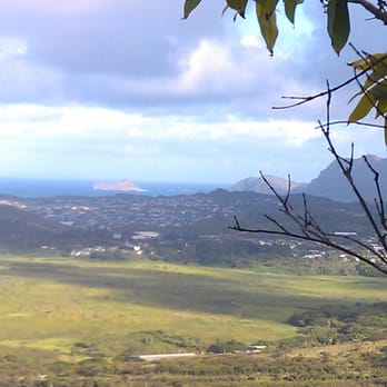
What a cute hike! Well maintained and nice views. Good for young children. Very easy to do but if you want more of a challenge... just keep going up the mountain... it can be a much longer hike if you want it to be! Two girls found a geocache while we were up there. The only downside is the parking... I think many will not venture here if there's no parking. Road is narrow too. Those who live in the area must frequent often though - would be a nice place to walk weekly. Liked being in the bamboo forest area. The entire family walked it in slippers...so that indicates to you how pretty friendly the path is...But we're a hiking family too. read more




11 years ago
Being someone that loves easy hikes, I really enjoyed this one. The hike is pretty difficult to find while you're driving up the road. I recommend looking for the stairs or if other cars are parked nearby it. I told my boyfriend I wanted to try this hike because it looked "prettier" than other hikes we've been on and it definitely was. There was a lot of greenery to admire on the hike and a lot of them had names of what kind of plant they were. I felt like I got a pretty good workout as well, there were slight inclines in places. The path is pretty narrow and there are drop offs everywhere so be careful if bringing young children or pets (or if you're just clumsy like me :P). The normal standard trail goes in a loop and there is a dead end area where you can admire the sights. However, if you want more of a workout, there is an extended trail to see the sights from a higher distance. Be prepared though. I feel like the hike went from 0 to 100 real quick. It gets a lot steeper. There were some ropes put in to help you out, but they're pretty thin and not that sturdy. We met one of the trail maintenance people along the trail and even he admitted that it gets pretty steep. He wondered how we heard about this hike, so I'm going to assume that they don't get many visitors everyday, especially ones that try to go further. He also told us that there is another extension to the trail that goes down into a valley and back up, but he doesn't recommend it that much because you could get lost pretty easily. So for you adventurers and more advanced hikers out there, beware and be safe. We opted to head back down and call it a day. Overall, I'm glad we gave this place a try. read more


10 years ago
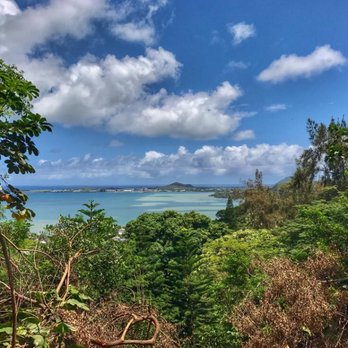
This place is absolutely gorgeous! The views are stunning and the trails are well-maintained. Based on reviews I read, I thought there would be one easy 15-minute trail (so I wore sandals), but there are actually two main trails; an upper and lower trail. While both trails are fairly easy, the upper trail in particular is not recommended for individuals who have difficulty walking up hills or are concerned about narrow paths. I also recommend definitely wearing active shoes/tennis shoes because the lower trail is a bit muddy and you'll need the grip for the upper trail. As previous reviewers said, parking is very limited. There are two spaces right beside the entrance and then two spaces on the residential street. Overall, the park is well maintained and there's a stand that has brochures with maps on it. read more

Page 1 of 2
More info about Friendship Garden
45-219 Kokokahi Pl
Kaneohe, HI 96744
Directions
Visit Website
http://friendshipgarden.org
Hours
Indoor Amenities
Outdoor Amenities
Friendship Garden Reviews in Other Languages
Ask the Community - Friendship Garden
Is this hike baby friendly, if I have my child strapped in baby carrier?
Review Highlights - Friendship Garden
You might also consider


















Why does Yelp recommend reviews?
1 review that is not currently recommended
The reviews below are not factored into the business's overall star rating.

9 years ago
Friendship Garden - hiking - Updated October 2026
Best of Kaneohe
People found Friendship Garden by searching for…
Trending Searches in Kaneohe, HI
Apple Orchards near Friendship Garden
Apple Picking near Friendship Garden
Bird Sanctuary near Friendship Garden
Corn Maze near Friendship Garden
Costume Store near Friendship Garden
Craft Fairs near Friendship Garden
Dog Friendly Trails near Friendship Garden
Dog Parks near Friendship Garden
Hair Stylists near Friendship Garden
Halloween Events near Friendship Garden
Haunted Houses near Friendship Garden
Hiking Trails near Friendship Garden
Lookout Points near Friendship Garden
Men's Clothing near Friendship Garden
Off Road Trails near Friendship Garden
Photo Spots near Friendship Garden
Pick Your Own Farms near Friendship Garden
Places To Take Pictures near Friendship Garden
Places To Walk Around near Friendship Garden
Pumpkin Patches near Friendship Garden
Rock Quarry near Friendship Garden
Scenic Night View near Friendship Garden
Scenic Overlook near Friendship Garden
Shoe Stores near Friendship Garden
State Parks near Friendship Garden
Sunrise View near Friendship Garden
Browse Articles
Browse Nearby
BEST of Kaneohe, Hawaii Coffee near Friendship Garden
BEST of Kaneohe, Hawaii Restaurants near Friendship Garden
BEST of Kaneohe, Hawaii Things to Do near Friendship Garden
BEST of Kaneohe, Hawaii Breakfast near Friendship Garden
BEST of Kaneohe, Hawaii Walking Trails near Friendship Garden
BEST of Kaneohe, Hawaii Parks near Friendship Garden
BEST of Kaneohe, Hawaii Campgrounds near Friendship Garden
Browse Brands
Related Searches in Kaneohe, HI
Best Dog Hiking Trails Around Kaneohe, Hawaii
Best Fishing Locations and Guides in Kaneohe, Hawaii
Best Nature Trails for Hiking in Kaneohe, Hawaii
Best Places for Horseback Riding in Kaneohe, Hawaii
Best Sightseeing Experiences Available in Kaneohe, Hawaii
Best Waterfalls and Swimming Holes in Kaneohe, Hawaii
Discover Dog Friendly Trails to Explore in Kaneohe, Hawaii
Discover Easy Hiking Trails Near Kaneohe, Hawaii
Discover Kid Friendly Hiking Trails in Kaneohe, Hawaii
Discover Popular Bike Trails in Kaneohe, Hawaii
Discover Scenic Mountain Bike Trails Near Kaneohe, Hawaii
Discover Top Nature Parks to Visit in Kaneohe, Hawaii
Discover Walking Parks in Kaneohe, Hawaii Near You
Discover a Hiking Trail in Kaneohe, Hawaii
Discover the Best Night Hike Trails in Kaneohe, Hawaii
Dog-Friendly Hikes With Dogs in Kaneohe, Hawaii
Enjoy Camping Adventures Around Kaneohe, Hawaii
Enjoy Kayaking Adventures in Kaneohe, Hawaii
Enjoy Off Leash Dog Hikes in Kaneohe, Hawaii
Enjoy Tent Camping Spots Around Kaneohe, Hawaii
Enjoy a Beautiful Waterfall Hike in Kaneohe, Hawaii
Enjoy the Best Walking Path in Kaneohe, Hawaii
Enjoy the Best Walking Trails in Kaneohe, Hawaii
Explore Easy Hikes Perfect for All in Kaneohe, Hawaii
Explore Fun Activities to Do in Kaneohe, Hawaii
Explore Popular Campgrounds Near Kaneohe, Hawaii
Explore Popular State Park Destinations in Kaneohe, Hawaii
Explore Top Dog Parks in Kaneohe, Hawaii Near You
Explore the Best Beach Spots in Kaneohe, Hawaii
Family Friendly Hiking With Kids in Kaneohe, Hawaii
Find Cozy Camping Cabins in Kaneohe, Hawaii
Find Popular Ziplining Spots Around Kaneohe, Hawaii
Find Top Dog Friendly Parks to Visit in Kaneohe, Hawaii
Find Top-Rated Waterfalls in Kaneohe, Hawaii Now
Find the Best Parks for Picnics in Kaneohe, Hawaii
Hiking Trails With Waterfalls in Kaneohe, Hawaii
Off Leash Dog Hiking Trails in Kaneohe, Hawaii
Picnic Areas With BBQ Pits Available in Kaneohe, Hawaii
Popular Outdoor Activities to Try in Kaneohe, Hawaii
Popular Picnic Spots to Visit in Kaneohe, Hawaii
Popular Waterfall Hiking Trails in Kaneohe, Hawaii
Safe and Fun Parks for Kids in Kaneohe, Hawaii
Top Hiking Trails to Explore in Kaneohe, Hawaii
Top Playgrounds for Kids to Enjoy in Kaneohe, Hawaii
Top Running Trails to Explore in Kaneohe, Hawaii
Top Swimming Spots and Pools in Kaneohe, Hawaii
Top Things to Do With Kids in Kaneohe, Hawaii
Top-Rated Camping Sites in Kaneohe, Hawaii


