Fish Canyon Narrows Photos


You might also consider
More like Fish Canyon Narrows
Recommended Reviews - Fish Canyon Narrows
Start your review...

Reviews With Photos
")
Now that I actually found the right trail, I can say this is a hike everyone should come out for. It's GORGEOUS and you feel a million miles out of the city. After the February rains, there was so much water that crossing all of the creeks became a bit of a drag (I must have taken on and off my hiking boots more than a dozen times), but I wouldn't have traded it for anything. It was awesome to see so much water! I did 7 miles round trip (a little further than the abandoned camp site) and am looking forward to pushing past that on my next visit, possibly with hiking sandals so I can avoid taking off and putting on my boots so often, which added a lot of wasted time. To find the narrows, you go past the bridge and past the first left immediately after that bridge (even though it seems like that is a path...it isn't). The next left is where you want to be, following the creek on what is a dirt, rock and sometimes old washed out road trail. It's maybe a half to full football field length from the end of the bridge.

This review is for an out and back hike to Redrock Mountain, a little known hike in the area. It is about 11 miles roundtrip with 3,220' elevation gain/loss. The first 3 or so miles of the hike are set in a wooded area, are quite easy and mostly flat. It is the last couple of miles that have most of the elevation. The trail is wide to start but becomes single file toward the end. There is some rock scrambling, but overall it is minimal. The views are beautiful from the peak and along way. parking - free

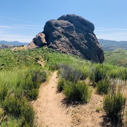
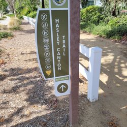
Voted as the #1 hiking spot by LA Magazine in 2009, Fish Canyon Narrows, not to be confused with Fish Canyon Falls located in the City of Duarte, is located in the Sierra Pelona Mountains just north of Santa Clarita and Castaic. It's a 10.5-mile, round-trip, hike that takes you through a Zion National Park-like narrow canyon trail flanked by towering mountain walls. The canyon walls can get as narrow as 15 feet in certain spots. It also has old abandoned campgrounds, was once an old mining prospect, and is a prehistoric Chumash Indian site. The trail follows a Forest Service Road that continues one mile west of the abandoned Cienaga Campground. Start the hike from the gated road at the eastern end of Templin Highway, 4 miles from the I-5 exit. You will encounter a locked gate which will be the start of the hike. I have read that you used to be able to drive from Templin Hwy all the way to Cienaga Campground but in 2002 a flood washed out a large portion of the road and this resulted in the closure of the campground and the road. After about 0.6 miles you will come to a bridge that crosses Castaic Creek. The asphalt road will then become a dirt service road. Hang a left and make your way into the canyon. Along the way you will encounter sections of the concrete road and you will also walk past tall rock walls and some shallow streams. Most of the hike is flat without much elevation gain. It kinda reminded me of the Bridge to Nowhere hike. After 2 miles you will eventually come across the abandoned Cienaga campground. There are abandoned restrooms and markers where the sites used to be. After you pass the campground the trail changes from a dirt road to a foot path up to Pianobox Prospect. At the 4 mile mark you will encounter the old mining prospect known as Pianobox. It got its name from the miners who decided to haul a piano up there for some entertainment. You will see an opening on the side of the mountain that was the entrance to the mine. A little farther up the canyon is the location of Fish Canyon Narrows. I did not find out until after I did some research on the area that the Forest Supervisor had issued a Powerhouse Fire Closure Order which means that you're not allowed to hike in the area. Apparently, you can get a pretty expensive ticket it you get caught. When I went there were no signs indicating the closure. Fortunately, it is only in effect until Dec 31st, 2014. Additionally, bears, mountain lions, bobcats, coyotes and foxes live in the area. I also read a recent article where forest rangers relocated three black bears into Cienaga Campground. So encountering potentially hostile wildlife is always a possibility so be careful.

We used Fish Canyon to reach Redrock Mountain Bench on an eleven mile, roundtrip, out-and-back hike. It was an easy beginning through Fish Canyon, but a mean end to reach the Bench. Fish Canyon wasn't much, but the Bench had a nice view (see pic). The trailhead starts at the closed road and no trespassing signs at the end of Templin Highway. Walk down the closed highway (not the road to the lake), across a one-lane bridge, and then go left (again, not straight to the lake) into Fish Canyon for an easy hike up the river. The path is virtually flat where some parts are a dirt service road while other sections are paved like a freeway. The paving impedes the natural beauty of the river and canyon. I saw a turtle in the river (sorry, no pic) and there were face-swarming bugs near the river in the afternoon. After 3-miles of coasting, we reached the bathrooms at the campground and turned left to head north along a smaller river. The route was still easy hiking, but slightly overgrown. After a mile, turn left to cross the stream. This location is marked by a rusted post, a red rock alcove, and a campfire under an oak tree. Turn back if the trail turns into a tight slot canyon. Here's where the mean part begins as the steep trail leaves the river to reach the ridgeline. The trail showed signs of other hikers/bikers, but we were the only ones on the trail on a Saturday. The path was overgrown and plan on getting poked by plants that drew blood a half-dozen times. The trail was not enjoyable. After 1.2 miles, there is a junction when the trail no longer faces the canyon. Turn right. This final leg to the Redrock Mountain Bench showed no signs of activity except the recently disturbed snake holes. I guess there are very few people willing to try this hard-to-follow trail that goes up 800 feet in 0.3 miles. There is "supposed" to be a trail along the ridgeline that continues to Redrock Mountain, but we didn't want to bushwhack through the extra 0.7 miles. Also, the rocks aren't very red - more of an orange-tinged nougat.

An excellent hike. It has narrows as the name would suggest and it winds back quite a ways. I recommend staying out of the sketchy bathrooms at the abandoned camp ground. Every 1/2 mile or so the terrain changes so one minute you feel like you're in Main, the next in Utah, and some parts even feel like a tropical rain forest. This is a cool hike, you'd should check it out.

The hike to Fish Canyon Narrows, named the #1 Intense Hike by Los Angeles Magazine, blew my mind. Accompanying two twenty-something botanists on a native plant field survey, I knew nothing about this trail prior to our trip. I wasn't prepared for the stunning beauty and challenging hiking conditions in early June 2023. An incredible adventure but not for the faint of heart! Parking: Follow Templin Highway to the east to a locked gate. You will be in the Angeles National Forest; an Adventure Pass is required to park in this location. The Trail: It's probably best to go with someone who's been here before (I was lucky in this regard.) Otherwise, make sure you map out directions ahead of time because there are virtually no trail signs to guide you. It's not too steep; the challenge is more finding the trail and the unique condition it's in at the moment. Due to the recent winter and spring storms, much of the trail is in shambles, with fallen trees and landslides and debris in your path. Then, there are the river crossings (or creek crossings, in less rainy years.) This can be treacherous; the water was at least shin-high in some places, not to mention the slippery algae, the rapid current, and obstacles under the water. We ended our hike after dark; a flashlight and/or headlamp highly recommended. Safety: There is no cell phone service in this location. A personal safety beacon is highly recommended, plus letting folks know where you are going and when you are expected to return. Take a first aid kit, enough water, food, and everything needed for a wilderness expedition. Wildlife: Bear have been reported here. Snakes are around; one of my hiking companions spotted a non-venemous snake in the dark and actually picked it up. I would *not* recommend touching any wildlife unless you are a trained biologist! Be alert. Scenery: The narrows are spectacular. There are springs, ferns, flowers, and the high canyon walls above you once you arrive at the canyon. This is one of the most beautiful destination hikes in Southern California and I feel lucky to have been able to visit. Free admission (but again, parking requires an Adventure Pass.) Highly recommended but be prepared! read more


OUR PATH: Go LEFT twice at the first and second forks-in-the-road. This trail allowed us to walk as far and as long as we wanted. Ryan, Duke (great hike for a dog) and I trekked four hours through the canyon and up the mountains. This is a desolate trail, which is what we enjoy. We only passed a group of three other hikers. Along the was we crossed creeks, brushed through a forrest-like area and climbed (I really mean "walked") up a mountain with a moderate incline. It was a nice cool day in January, and the trail offered several shady areas. The next time we go, we'll go RIGHT at the first fork to explore the trail near the lake. read more


11 years ago
WHAT?!?!? A TUNNEL IN THE 20 FEET ABOVE IN THE MIDDLE OF NOWHERE?!?!? BACKGROUND: Here, amid the arid-looking mountains north of Castaic Lake, Castaic Creek flows the better part of the year through a sinuous gorge flanked by picturesque sandstone outcrops. The creek is perfect for wading - shallow, slow-moving, and warmed by the sun. Fish Canyon Narrows: In the trenchlike confines of middle Fish Canyon, aridity and moisture stand side by side, separated by a matter of a few yards. Mountain mahogany, manzanita and other drought-resistant shrubs cling to the walls, while a shallow stream gurgles merrily past a line of oaks, sycamores, willows, and cottonwoods. It is almost as if a little slice of the Pacific Northwest was transplanted to Southern California. The Stats Distance: ~11 miles Elevation Gain: 1100 ft. Trail conditions: a bit of asphalt, fire road, single track trail, some rock hopping; out and back. ESSENTIALS: At least 3 liters of water Know your limits Hiking boots that can withstand water, ice, and snow Layered Clothing Gloves High protein food/snacks Electrolytes Camera Hat (optional) Sunscreen Trek/ski poles OUR ROUTE: Me and The Crew set out this hike by going through a locked gate and heading down an asphalt road to a fire road till we reached the narrows, about four miles from the cars. Oh boy! There is a big difference between these narrows and the narrows in Paria Canyon. The condition of Fish Canyon is filled with dwarf leafless trees and scrubs and the water that runs through it, trickles over slippery rocks. The narrows are so grand, there is very little warmth from the sun coming in, so layer up, it does get quite chilly. Our final destination and lunch spot was at Rogers Trail Camp. Amazingly, what seemed to be in the heart of nowhere, there were well preserved picnic tables and a flame ring, not to mention a hand saw, and a couple other gardening tools. In addition, on that point is a short tunnel bored into the rock about 20 feet upwards. After lunch several of us headed to the burrow. Not sure what the purpose of a tunnel in the middle of nowhere, 20 feet up from the ground serves, but a couple of us climbed up to check it out. There was a can of turpentine in the tunnel and a few other items. So very odd. Once we satisfied our curiosity, we packed up and out, back the same way we came in, following the trickling no more than a foot of water and with this drought, easily avoidable. DISCLAIMER: Hiking is not something that can be taken lightly. It can be life-threatening as you see and hear on the news, people die or get lost all time. Please, if you are going to hike, never go alone and prepare for the worst, hope for the best. Remember when going for a hike, no matter how short you think it may be, always be prepared. Carry at least two liters of water for every five miles (more if the weather is warm), protein bar, nuts, and electrolytes. Wear sturdy lug sole shoes and protective clothing. Some areas the weather can change quicker than a fireman can put on his gear. It is also very important, always always always let a family member or friend know where you are going and when you expect to be back. Lastly, have fun when you hike it up. Review 49 Yelp 100+ Challenge 2015 read more


9 years ago
Now that I actually found the right trail, I can say this is a hike everyone should come out for. It's GORGEOUS and you feel a million miles out of the city. After the February rains, there was so much water that crossing all of the creeks became a bit of a drag (I must have taken on and off my hiking boots more than a dozen times), but I wouldn't have traded it for anything. It was awesome to see so much water! I did 7 miles round trip (a little further than the abandoned camp site) and am looking forward to pushing past that on my next visit, possibly with hiking sandals so I can avoid taking off and putting on my boots so often, which added a lot of wasted time. To find the narrows, you go past the bridge and past the first left immediately after that bridge (even though it seems like that is a path...it isn't). The next left is where you want to be, following the creek on what is a dirt, rock and sometimes old washed out road trail. It's maybe a half to full football field length from the end of the bridge. read more
 - Hiking Near Me - Castaic, California")
 - Hiking Near Me - Castaic, California")
 - Hiking Near Me - Castaic, California")


9 years ago
This review is for an out and back hike to Redrock Mountain, a little known hike in the area. It is about 11 miles roundtrip with 3,220' elevation gain/loss. The first 3 or so miles of the hike are set in a wooded area, are quite easy and mostly flat. It is the last couple of miles that have most of the elevation. The trail is wide to start but becomes single file toward the end. There is some rock scrambling, but overall it is minimal. The views are beautiful from the peak and along way. parking - free read more


Voted as the #1 hiking spot by LA Magazine in 2009, Fish Canyon Narrows, not to be confused with Fish Canyon Falls located in the City of Duarte, is located in the Sierra Pelona Mountains just north of Santa Clarita and Castaic. It's a 10.5-mile, round-trip, hike that takes you through a Zion National Park-like narrow canyon trail flanked by towering mountain walls. The canyon walls can get as narrow as 15 feet in certain spots. It also has old abandoned campgrounds, was once an old mining prospect, and is a prehistoric Chumash Indian site. The trail follows a Forest Service Road that continues one mile west of the abandoned Cienaga Campground. Start the hike from the gated road at the eastern end of Templin Highway, 4 miles from the I-5 exit. You will encounter a locked gate which will be the start of the hike. I have read that you used to be able to drive from Templin Hwy all the way to Cienaga Campground but in 2002 a flood washed out a large portion of the road and this resulted in the closure of the campground and the road. After about 0.6 miles you will come to a bridge that crosses Castaic Creek. The asphalt road will then become a dirt service road. Hang a left and make your way into the canyon. Along the way you will encounter sections of the concrete road and you will also walk past tall rock walls and some shallow streams. Most of the hike is flat without much elevation gain. It kinda reminded me of the Bridge to Nowhere hike. After 2 miles you will eventually come across the abandoned Cienaga campground. There are abandoned restrooms and markers where the sites used to be. After you pass the campground the trail changes from a dirt road to a foot path up to Pianobox Prospect. At the 4 mile mark you will encounter the old mining prospect known as Pianobox. It got its name from the miners who decided to haul a piano up there for some entertainment. You will see an opening on the side of the mountain that was the entrance to the mine. A little farther up the canyon is the location of Fish Canyon Narrows. I did not find out until after I did some research on the area that the Forest Supervisor had issued a Powerhouse Fire Closure Order which means that you're not allowed to hike in the area. Apparently, you can get a pretty expensive ticket it you get caught. When I went there were no signs indicating the closure. Fortunately, it is only in effect until Dec 31st, 2014. Additionally, bears, mountain lions, bobcats, coyotes and foxes live in the area. I also read a recent article where forest rangers relocated three black bears into Cienaga Campground. So encountering potentially hostile wildlife is always a possibility so be careful. read more


10 years ago
We used Fish Canyon to reach Redrock Mountain Bench on an eleven mile, roundtrip, out-and-back hike. It was an easy beginning through Fish Canyon, but a mean end to reach the Bench. Fish Canyon wasn't much, but the Bench had a nice view (see pic). The trailhead starts at the closed road and no trespassing signs at the end of Templin Highway. Walk down the closed highway (not the road to the lake), across a one-lane bridge, and then go left (again, not straight to the lake) into Fish Canyon for an easy hike up the river. The path is virtually flat where some parts are a dirt service road while other sections are paved like a freeway. The paving impedes the natural beauty of the river and canyon. I saw a turtle in the river (sorry, no pic) and there were face-swarming bugs near the river in the afternoon. After 3-miles of coasting, we reached the bathrooms at the campground and turned left to head north along a smaller river. The route was still easy hiking, but slightly overgrown. After a mile, turn left to cross the stream. This location is marked by a rusted post, a red rock alcove, and a campfire under an oak tree. Turn back if the trail turns into a tight slot canyon. Here's where the mean part begins as the steep trail leaves the river to reach the ridgeline. The trail showed signs of other hikers/bikers, but we were the only ones on the trail on a Saturday. The path was overgrown and plan on getting poked by plants that drew blood a half-dozen times. The trail was not enjoyable. After 1.2 miles, there is a junction when the trail no longer faces the canyon. Turn right. This final leg to the Redrock Mountain Bench showed no signs of activity except the recently disturbed snake holes. I guess there are very few people willing to try this hard-to-follow trail that goes up 800 feet in 0.3 miles. There is "supposed" to be a trail along the ridgeline that continues to Redrock Mountain, but we didn't want to bushwhack through the extra 0.7 miles. Also, the rocks aren't very red - more of an orange-tinged nougat. read more


9 years ago
An excellent hike. It has narrows as the name would suggest and it winds back quite a ways. I recommend staying out of the sketchy bathrooms at the abandoned camp ground. Every 1/2 mile or so the terrain changes so one minute you feel like you're in Main, the next in Utah, and some parts even feel like a tropical rain forest. This is a cool hike, you'd should check it out. read more


10 years ago
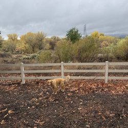
I didn't hike the entire trail but after reading the other reviews I will come back and so it. I was tired but still wanted to get a hike in. We hiked about 5 miles with our Yorkie and had a great day. We ran across no other people which is nice. Easy to find and easy to park. I will be back to go farther on the trail. read more


More info about Fish Canyon Narrows
37773 Templin Hwy
Castaic, CA 91384
Directions
Hours
Outdoor Amenities
Ask the Community - Fish Canyon Narrows
You might also consider


Fish Canyon Narrows - hiking - Updated July 2026
Best of Castaic
People found Fish Canyon Narrows by searching for…
Fishing Spots in Castaic, California
Fishing in Castaic, California
Campgrounds in Castaic, California
Hiking Trails in Castaic, California
Things to Do in Castaic, California
Picnic Areas in Castaic, California
Flower Fields in Castaic, California
Fishing Lake in Castaic, California
Waterfall Hike in Castaic, California
Camping Sites in Castaic, California
Dog Friendly Hiking Trails in Castaic, California
Easy Hikes in Castaic, California
Off Road Trails in Castaic, California
Beautiful Views in Castaic, California
Walking Trails in Castaic, California
National Parks in Castaic, California
Picnic Spots in Castaic, California
Gold Panning in Castaic, California
Swimming Lakes in Castaic, California
Running Trails in Castaic, California
Trending Searches in Castaic, CA
Browse Articles
Browse Nearby
Browse Brands
Related Searches in Castaic, CA
Affordable Kayak Rental Services in Castaic, California
Best Fishing Locations and Guides in Castaic, California
Best Places for Horseback Riding in Castaic, California
Best Waterfalls and Swimming Holes in Castaic, California
Check Out Off Road Trails in Castaic, California
Discover Dog Friendly Trails to Explore in Castaic, California
Discover Scenic Bike Paths in Castaic, California
Discover Scenic Mountain Bike Trails Near Castaic, California
Discover Scenic Waterfall Spots in Castaic, California
Discover Top Nature Parks to Visit in Castaic, California
Discover a Hiking Trail in Castaic, California
Discover the Best Night Hike Trails in Castaic, California
Discover the Best Running Track in Castaic, California
Dog-Friendly Hikes With Dogs in Castaic, California
Enjoy Camping Adventures Around Castaic, California
Enjoy Kayaking Adventures in Castaic, California
Enjoy Tent Camping Spots Around Castaic, California
Enjoy a Beautiful Waterfall Hike in Castaic, California
Enjoy the Best Picnic Spots and Ideas in Castaic, California
Enjoy the Best Walking Path in Castaic, California
Enjoy the Best Walking Trails in Castaic, California
Exciting Cliff Jumping Spots in Castaic, California
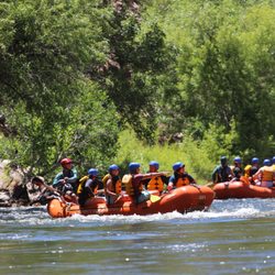
Experience Thrilling White Water Rafting in Castaic, California
Explore Beautiful Parks and Green Spaces in Castaic, California
Explore Easy Hikes Perfect for All in Castaic, California
Explore Fun Activities to Do in Castaic, California
Explore Popular Campgrounds Near Castaic, California
Explore Top Dog Parks in Castaic, California Near You
Explore Top Water Parks in Castaic, California Today
Explore the Best Beach Spots in Castaic, California
Explore the Best Boating Spots in Castaic, California
Family Friendly Hiking With Kids in Castaic, California
Find Beautiful Views in Castaic, California
Find the Best Playgrounds to Visit in Castaic, California
Find the Best Scenic View Locations in Castaic, California
Hiking Trails With Waterfalls in Castaic, California
Off Leash Dog Hiking Trails in Castaic, California
Plan a Scenic Drive Route Near Castaic, California
Popular Fishing Spots to Explore in Castaic, California
Popular Outdoor Activities to Try in Castaic, California
Popular Picnic Spots to Visit in Castaic, California
Safe River Swimming Areas in Castaic, California
Safe and Fun Parks for Kids in Castaic, California
Top Climbing Spots and Gyms in Castaic, California
Top Paddleboarding Activities in Castaic, California
Top Places for Snorkeling in Castaic, California
Top Playgrounds for Kids to Enjoy in Castaic, California
Top Running Trails to Explore in Castaic, California
People who viewed Fish Canyon Narrows also viewed
Plum Canyon Fire Road
4 reviews
Pico Canyon
2 reviews
Wildwood Canyon Open Space
3 reviews
Vasquez Rocks Natural Area Park
318 reviews
Whitney Canyon Park
66 reviews
Castaic Rock Trail
1 review
Indian Canyon
5 reviews
Whitaker Peak Lookout
2 reviews
Placerita Canyon Nature Center
140 reviews
Jupiter Mountain Loop
1 review