Emory Peak Photos


More like Emory Peak
Recommended Reviews - Emory Peak
Start your review...

6 months ago
The hike to Emory peak is iconic and stunning. You get an amazing view of the window along the trail, and from the top you can see all the way out to the south rim - it's like you really can see forever. The hike is fairly moderate up until you get to the scramble at the very end, which really does require using your whole body - arms and legs. The climb up really isn't all that bad, but coming down was a little bit tricky, even if just because it's easy to forget the path down and there's only one or two feasible options for a normal sized human. That said - I would recommend making the climb to the very top. It's a narrow area, just a few boulders wide - I'd guess that 15 people or fewer can actually fit up there at one time, and that would be standing close to one another. Overall: if you're going to do one long hike in big bend, I would say this should be it. You can do the whole thing round trip within 4ish hours if you walk fast, or take your time and spend longer. But seriously, you cannot beat the views. read more


Good hike. A bit strenuous, but worth it. But, if I had to choose between the South Rim, and Emory Peak, I would go for the South Rim. It's longer, not quite as strenuous, and more scenically diverse. Seeing the Rio Grand, from the South Rim, was amazing, but this is the Emory Peak page. If the South Rim had it's own Yelp page, I would go 5 stars! Once you get to the top, you are rewarded with a pretty good view, and cell phone coverage. At least we had it on two different networks. So get that selfies stick out, and watch your step. If you are aggressive, fast, and start early, you could probably do Emory and South Rim in the same day. Heading to the South Rim takes you to the path for Emory Peak, but it will add several hours. We did not start terribly early, so we just did a quick out and back, from the Chisos Basin Campground ( https://www.yelp.com/biz/chisos-basin-campground-big-bend-national-park ), which is where we were camping. Bottom line: If your pressed for time, I would skip it. Since we did South Rim, I would rather have seen more of the park, but hiking to the tallest spot in the park was pretty cool! PS. Review is a bit late. We were in early March, 2018. read more


Emory Peak is the highest and most beautiful Point in all of Big Bend. If you don't believe me look at the pictures I have posted. Emory Peak is located in Big Bend National Park and boasts the highest Peak of all the mountains. Yet, it is very accessible via a fairly well maintained trail. Our group of 8 (aged late 30's to mid 50's all outdoorsy types) were challenged yet capable of the hike up the mountain. No climbing material is needed as there are hand holds and foot grips - just be sure and wear ankle supporting hiking boots. We started at 9AM and reached the top by 12:30PM for a picnic with amazing jaw dropping panoramic views and absolutely surreal picture taking opportunities. The top of the mountain has lots of solar panels that I have no idea what they are for?? and you can see Mexico from the top. I need to write up a will requesting my ashes be scattered here so my soul can live forever amongst the flora and fauna of Emory Peak. Oh, and beware the signs warning of Black Bears and Mountain Lions! read more


More info about Emory Peak
Ask the Community - Emory Peak


Emory Peak - hiking - Updated May 2026
Best of Big Bend National Park
People found Emory Peak by searching for…
Hiking Trails in Big Bend National Park, Texas
Campgrounds in Big Bend National Park, Texas
Things to Do in Big Bend National Park, Texas
Visitor Centers in Big Bend National Park, Texas
Tent Camping in Big Bend National Park, Texas
Off Road Trails in Big Bend National Park, Texas
Places to Take Pictures in Big Bend National Park, Texas
Watch Sunset in Big Bend National Park, Texas
Sunrise View in Big Bend National Park, Texas
Stargazing in Big Bend National Park, Texas
Camping Sites in Big Bend National Park, Texas
Canyoneering in Big Bend National Park, Texas
Caves in Big Bend National Park, Texas
Sunset View in Big Bend National Park, Texas
New Businesses in Big Bend National Park, Texas
Walking Trails in Big Bend National Park, Texas
Picnic in Big Bend National Park, Texas
Photo Spots in Big Bend National Park, Texas
Scenic Views in Big Bend National Park, Texas
Dinosaur Park in Big Bend National Park, Texas
Swimming in Big Bend National Park, Texas
Reviews in Big Bend National Park, Texas
Browse Nearby
BEST of Big Bend National Park, Texas Things to Do near Emory Peak
BEST of Big Bend National Park, Texas Restaurants near Emory Peak
BEST of Big Bend National Park, Texas Coffee near Emory Peak
BEST of Big Bend National Park, Texas Shopping near Emory Peak
BEST of Big Bend National Park, Texas Parks near Emory Peak
BEST of Big Bend National Park, Texas Campgrounds near Emory Peak
BEST of Big Bend National Park, Texas Breakfast near Emory Peak
BEST of Big Bend National Park, Texas Visitor Centers near Emory Peak
BEST of Big Bend National Park, Texas Hotels near Emory Peak
Browse Brands
Browse Articles
People who viewed Emory Peak also viewed
Big Bend National Park
155 reviews
Lost Mines Trail
5 reviews
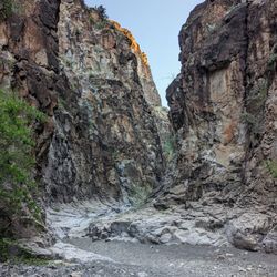
Santa Elena Canyon
2 reviews
Big Bend Boating and Hiking Company
67 reviews
Lajitas Zip-Line
10 reviews
Lajitas Stables
70 reviews
Lajitas Resort Trail Rides
3 reviews
Big Bend & Lajitas Stables
5 reviews
Big Bend Stables
4 reviews
Lajitas Equestrian Center
6 reviews