Cancel

Open app

Search

Cypress Creek Natural Area

4.3 (7 reviews)

Cypress Creek Natural Area Photos

You might also consider

Recommended Reviews - Cypress Creek Natural Area

Your trust is our priority, so businesses can't pay to alter or remove their reviews. Learn more about reviews.
Yelp app icon
Browse more easily on the app
Review Feed Illustration

Reviews With Photos

A boardwalk
Bob S.

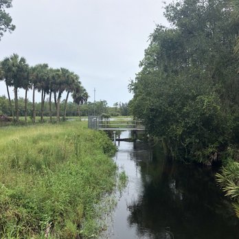
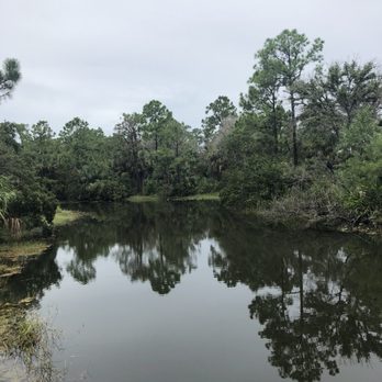
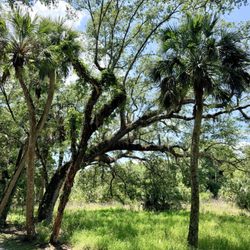
Old Florida, real Florida, the jungle. Yup work your way to the north side of Indiantown find a trail and go. You can park at Riverbend and pick up the Ocean to Lake trail in the north east corner, orange blazes and head into the jungle. The trail is well blazed, well maintained and beautiful. I came across 2 pieces of garbage that i carried out, i love that people respect nature snd for the most part leave it as found. The trail winds through hammocks, some open grassy areas, fringes the lox. Its beautiful. Its an up and back trail, i didnt see a loop trail on this day anyway. Get out enjoy the wonderful jungle.

Really busy on New Year's Day
Kori M.

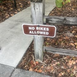
Stopped here to eat lunch on my way to Miami. It's very pretty and quiet with a decent sized parking lot. I was super bummed to see that dogs are not allowed. I saw a lot of people with bikes and hiking gear. Hopefully I'll be able to stop again in the future when I don't have my 2 dogs with me.

See all

Photo of Ariel W.
4398
5931
104193

8 years ago

Helpful 5
Thanks 0
Love this 4
Oh no 0

4 years ago

Helpful 5
Thanks 0
Love this 1
Oh no 0

5 years ago

Helpful 0
Thanks 0
Love this 1
Oh no 0

7 years ago

Helpful 2
Thanks 0
Love this 0
Oh no 0

7 years ago

Helpful 1
Thanks 0
Love this 0
Oh no 0

5 years ago

Helpful 0
Thanks 0
Love this 0
Oh no 0

7 years ago

Helpful 1
Thanks 0
Love this 1
Oh no 0

Ask the Community - Cypress Creek Natural Area

You might also consider

Verify this business for free

People searched for Hiking 565 times last month within 15 miles of this business.

Verify this business

Jupiter Ridge Natural Area - Path to the beach

Jupiter Ridge Natural Area

4.4(9 reviews)
7.2 mi

I've been wanting to visit this ERM park ever since visiting its neighbor, Juno Dunes Natural Area…read more The last time I tried to visit, the very small parking lot was full. From the road, this park looks to be all scrub, but like the other park, it contains multiple habitats inside. The first paved walk leads to a very nice pavilion overlooking the River. The view was peaceful and beautiful. Trying to access the unpaved trails, however, proved problematic. We turned onto the red path, only to find that the marker stakes had most of the red faded away and were difficult to find. At one point there is a huge fork in the path with no direction on which way to go. The end of the trail is practically non existent, with no clear path, but it does return us to the park entrance. I insisted on trying to get to Ski Beach- whatever that was! It looked about a 1/3 the way of the yellow trail. The path was very sandy, and difficult to walk on for that reason, and it seemed to take forever! When we finally found Ski Beach, we found another Park kiosk, a garbage can, and a tiny path down to... a beach! and the Intracoastal. We watched fish swim by, and lots of boats go by. This could be a nice place to wade or further explore, if you lugged all of your things here. ERM, would have loved finding a bench here, so we had someplace to take our shoes on and off. We did not continue down the yellow trail due to being exhausted, but I would like to do this again. The landscape was nice- just difficult to walk in due to the white sand. We saw a cactus in bloom, a snake, and a TON of lichen. Lichen everywhere! It really looked like little fairy landscapes to me. I think I finally identified Florida rosemary too! Kudo to ERM for the map/brochures. My kids pore over every aspect of it while we walk, trying to find all the natural items pictured, excitedly matching the pictures to plants. Thank you!

Jupiter Ridge is located south of the Jupiter inlet. It is part of the Great Florida Bird and…read moreWildlife Trail. This natural area is made up of 274 acres of scrub that contain five native Florida ecosystems: scrub, scrubby flatwoods, mesic flatwoods, depression marsh and mangrove swamp, It is one of the few places you can go in Jupiter to see how Florida looked before it was developed. Thirty one plant species live here as well as threatened and endangered species like the large-flowered rosemary, the Florida scrub-jay; and the gopher tortoise. Jupiter Ridge is owned by the state Conservation and Recreation Lands project which is managed by Palm beach County. This natural area has the longest shoreline along the Atlantic Intracoastal Waterway of any other natural area in Palm Beach County. There is also 7,600 feet of water frontage along the Intracoastal Waterway along the Loxahatchee River/Lake Worth Creek Aquatic Preserve. There are three hiking trails, the paved Little Blue Heron Trail, (0.2 miles), the sand Scrub Lizard Trail (1.7 miles). and the sand Pawpaw Trail (0.6 miles). The sand trails really give your legs a work out and there is no shade so the sun can be brutal. The natural area has canoe and kayak access from Ski Beach and you may be able to spot manatees. There is also an observation platform on the Little Blue heron Trail that overlooks Old Lake Worth Creek. Jupiter Ridge Natural Area is open to the public, sunrise to sunset, seven days a week.
Photos
Jupiter Ridge Natural Area - First part of trail

First part of trail

Jupiter Ridge Natural Area - Red trail

Red trail

Jupiter Ridge Natural Area - Lichen everywhere

See all

Lichen everywhere

Limestone Creek Natural Area - Trail entrance

Limestone Creek Natural Area

4.0(4 reviews)
3.5 mi

I finally ventured further down the path in this park and was greatly pleased! On my first trip…read morehere, I stopped after reaching the first 'river' pavilion, because the path forward looked more like a side street than a park path, as it is wide enough for a car. But this time I kept going and found another river lookout, this one with a boardwalk that actually went out over the River. After that, the path went into another part of woods. It meandered along until we reached a tiny boardwalk bridge over a slightly marshy area and then found we had reached the very end of the park, where it intersected with a main road near the highway. Once again, we had the park all to ourselves, which was a treat. These days, with so little rain, so many plants looked brown and lifeless. We saw a gopher tortoise and a black snake.

This is a very nice hike through the northeast portion of the Everglades. You start off from the…read moreparking lot on the Bracken Fern Nature Trail which is paved and wheelchair accessible. It is flanked on either side by slash pine which provides shade. There are also sections of scrubby flatwoods and bracken fern. The length of this trail is 1/4 mile. When the pavement ends the trail turns to the left and becomes the Gallberry Hiking Trail which parallels a canal. Mangroves grow along the waters edge and there is a lookout pavilion and a fishing pier. If you come during the winter you might be able to catch sight of manatees in the C-18 canal. This part of the trail backs a neighborhood and you can enter from the street to join the trail here. The final portion of the trail veers of through a denser forest before transitioning into scrubby flatwoods. You cross over a bridge that goes over a small stream that once fed into the Loxahatchee River. The trail ends at the Island Way Road. If you walk the trail and back to the parking lot you will have traveled 1.2 miles. I didn't see any wildlife on this trip but I still enjoyed my hike. It was mostly shaded which I appreciated and the three distinct parts of the trail made the hike interesting. I plan to come back during the colder months to see if I can spot a manatee.

Photos
Limestone Creek Natural Area - Uneven pavement

Uneven pavement

Limestone Creek Natural Area - Closeup of another turtle

Closeup of another turtle

Limestone Creek Natural Area

See all

Jonathan Dickinson State Park - River Store Goods!

Jonathan Dickinson State Park

4.1(118 reviews)
6.9 mi

Every time we come to this Park we are just so delighted. The trails are in great condition. The…read morestaff is always helpful friendly and respectful. It is an hour drive for us but we find it so worth while. The food concession is a tremendous value and the food is great. They have bikes, kayaks and a river tour. Or you can pay the $6.00 per car and pack a lunch for one of the best values for a family. Great place to spend a day.

Cool park! We drive by often and it's always something we've wanted to stop and check out. I had no…read moreidea this park is so huge! You could drive for 30 minutes and still not see everything! We stopped by on a weekday and the park was pretty and relaxing. Not too many people on the couple of trails we did. The observation tower is closed but they still have a nice boardwalk up to that area that makes for a great walk! It's pretty highly elevated for Florida - kind of impressive in person! Entry is $6 per car, and the lady provided a map and recommended her favorite trail. We checked that trail out as well (the white trail), but the height of the observation tower trail was really the star! We decided to drive around after doing both trails, and we saw their campgrounds. So surprising at how busy this place was! It seemed there was hardly an empty spot! Must be a happening place to camp! We'd definitely return for more adventures, as this is a cool park!

Photos
Jonathan Dickinson State Park - Camp Food :: Pan-Seared Asian Style Wings!

Camp Food :: Pan-Seared Asian Style Wings!

Jonathan Dickinson State Park - Another outstanding weekend of training for Camino de Santiago. Love this park so much.

Another outstanding weekend of training for Camino de Santiago. Love this park so much.

Jonathan Dickinson State Park - The long boardwalk to the tower

See all

The long boardwalk to the tower

Loxahatchee Slough Natural Area

Loxahatchee Slough Natural Area

5.0(1 review)
7.2 mi

The Loxahatchee Slough is a 10,391 acre Natural Area that was acquired by Palm Beach in 1996. An…read moreadditional 2,190 acres were purchased in between 2000 and 2007. The County also leases 257 acres from the South Florida Water Management District and 3 acres from the Florida Fish and Wildlife Conservation Commission. Loxahatchee Slough is actually three separate tracts, the largest of which sits north of PGA Boulevard. There are two access points to the main trail. One is the Bluegill Trail at Sandhill Crane Access Park where there is water, parking and restrooms, and the other is the Pantano Trail from River Bend Park along Indiantown Road. According to the county's Environmental Resources Management Department, Loxahatchee Sloughis the largest and most biologically diverse natural area managed by Palm Beach County. This preserve contains the historic headwaters of the Loxahatchee Wild and Scenic River and has nine native Florida ecosystems: mesic flatwoods, wet flatwoods, mesic hammock, hydric hammock, wet prairie, depression marsh, slough marsh, strand swamp, and dome swamp. This area attracts many birds. Ninety three different species of birds have been recorded here including limpkins, white ibis, fish crows, common grackles, rock pigeons, red wing blackbirds, American robins, and cedar waxwings. There are also hundreds of plant and animal species. Some of the plants that have been seen are the pineland daisy, jack-in-the-pulpit, Florida tassel flower, fringed yellow star grass, southeastern primrose willow, swamp forest beaks edge, bull tongue arrowhead, fire flag, red mulberry, and swamp bay. Animals found here include the Florida apple snail, handsome Florida grasshopper, gray-green club tail, red ear sunfish, little grass frog, striped mud turtle, wood duck, Florida sandhill crane, bobolink, and Sherman's fox squirrel. Many of the plants and animals found here are endangered or threatened. Through the years this area has been negatively impacted by over drainage, agricultural use, and invasion of non native plant species. Extensive restoration has been done to remove removal invasive non native plants, fill in the drainage ditches and shell mining pits, and replace the culverts leading to the C-18 Canal. This natural area is part of the Northeast Everglades Natural Area. Palm Beach County manages the site with the assistance of the City of Palm Beach Gardens. The Florida Trail Association maintains the 4.5-mile segment of the Ocean to Lake Trail that passes through this area. This area can be biked, hiked, paddled, or traversed by horseback.

Photos
Loxahatchee Slough Natural Area

See all

Cypress Creek Natural Area - hiking - Updated May 2026

Loading...
Loading...
Loading...