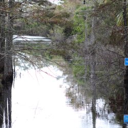
1. Bluegill Trail

0

Palm Beach Gardens, FL

Cancel

Open app

Search

Bluegill Trail

5.0 (1 review)

Bluegill Trail Photos

You might also consider

Recommended Reviews - Bluegill Trail

Your trust is our priority, so businesses can't pay to alter or remove their reviews. Learn more about reviews.
Yelp app icon
Browse more easily on the app
Review Feed Illustration
Photo of Ariel W.
4021
6184
108280

7 years ago

Helpful 81
Thanks 2
Love this 72
Oh no 0

You might also consider
Verify this business for free

People searched for Hiking 305 times last month within 15 miles of this business.

Verify this business

Apoxee Wilderness Trail - White-tailed deer family

Apoxee Wilderness Trail

4.6(15 reviews)
8.6 mi

What I love about living in the SW area of Greater West Palm Beach is the abundance of parks and…read morewilderness areas that you can enjoy. The Apoxee Trail is one of the "wilderness urban areas", which I find amazing: when visiting these areas (and big parks) you would think you are far away from civilization, when in fact you don't have to drive for hours to enjoy some open, green and wild places! I knew of this trail for many years because I used to drive by the entrance in my daily commutes to work, but only recently we finally visited it. This trail is "wild" from the very start: there is only a small street bringing you to the entrance and back to Jog Rd, and no parking lot - you will have to park on the side of the street, and depending on the time and the day, you may find it challenging to find a free spot. The park however is so big that it will rarely be crowded! At the entrance of the Apoxee Trail there is also a ¼ mile paved trail, which we checked out before continuing our walk into the park. This trail is very easy and all in the wood's shade. The trail runs on wetlands through boardwalks and natural surfaces in the woods: such surfaces are of course not even, so watch out for roots and stones when walking. It is an extremely peaceful walk where you'll make several stops for wildlife observation (bring your binoculars!), as well for letting through people on bikes. At the end of the Apoxee Trail you can either go back the same way, or continue your walk/ride on the outer loop (called Owahee Trail) before reconnecting with the second part of the Apoxee Trail. If you do this whole trail you will walk over 4 miles. Just so you know, the loop is all under the sun and has a stream on one side. We saw a huge alligator on the opposite side, which means... they could have been on our side too! We encountered a couple of families with kids running and playing very close to the stream, and I don't think that's a great idea... As for every other wilderness area, you will also need to pay extra attention to your surroundings during the alligator's mating season (we usually just avoid going to those areas in that period). The Trail is open every day from sunrise to sunset, but may be closed for flooding after heavy or constant rainfalls. There are portable toilets at the entrance but no access to water, so make sure you go in properly prepared. We will certainly go back to this trail other times!

This trail area is a great spot to enjoy some nature right outside the city. All the pictures in…read morethis review were taken on a single 2-3 hour hike one morning/afternoon but on the Owahee canal trail, not Apoxee. I live right behind this trail, walking distance from my apartment (a rarity in this part of WPB) so I care about it quite a bit. There are certainly plenty of improvements that could be made. If you're not walking the Owahee canal trails on the outskirts, and trying to walk the actual Apoxee trail, it's almost always too flooded by rainfall to make it very far. There has been word of more elevated boardwalks for the trail, but no progress has been visible for a while. Still a great place for a nature hike in WPB.

Photos
Apoxee Wilderness Trail - Mushrooms

Mushrooms

Apoxee Wilderness Trail - Great Blue Heron

Great Blue Heron

Apoxee Wilderness Trail - Alligator

See all

Alligator

Juno Dunes Natural Area

Juno Dunes Natural Area

4.6(9 reviews)
7.3 mi

This review is for the West Tract. I have driven by this natural area for decades and never once…read moreeven driven into the parking lot. From the roadside, it just looks like endless scrub, but I am happy to report that not only is it far more than 'just scrub,' it is full of surprises! Check out my photo at the bottom of the review of the map closeup; I outline the path I took in pink. For one, I can't believe how big this natural area is. Not only do I want to return to do the same path but go farther, I want to do all the paths, including the ones across Donald Ross Road that are not very accessible. There are only a handful of parking spots for this park, but the spots are decently far from US1, which is nice. We started off on a paved path that became a boardwalk, which ended at a little pavilion with 2 benches. After that, the path was just pure white sand. Not beach sand, not hard packed sand, but scrub sand that is not flat in any way (there is no way a stroller or walker could cross this). My kids Crocs came off right then, but they loved being barefoot in the park! Luckily it was a cool day, so the lack of shade was fine. Eventually, the sand turned to more of a dirt and grass path as we moved into a shadier area with taller trees. We turned right to follow the sign that said 'Boat Dock.' We wandered and meandered and eventually we could see peeks of the Intracoastal on our left and mangroves on our right. I was so thrilled to finally stumble onto a beautiful view of marsh water with a wooden lookout tower! Apparently the boat dock is also a canoe/kayak entrance to explore this marsh area. Bucket list! Anytime I stumble upon a water body, I am happy. Beyond the tower, the path headed straight towards the Intracoastal, which we could see a glimpse of from the stairs. but we had to head back at that point. We did see some moths and butterflies but otherwise no other animal life, but we also passed more people than we usually do on trails. The walk was lovely, if a little tougher due to all that sand. Looking forward to returning to cover all the trails.

Beautiful nature trail near the beach. It leads off to an over look not much of an overlook to…read moreGrassy to see anything. Another part of the trail leads to the beach pretty cool. No way to get lost in there and it's not long at all to do the whole thing. Lots of signs around to inform you about the trees and nature. Parking it free in this lot and there was lot of it.

Photos
Juno Dunes Natural Area
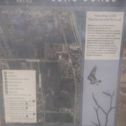
Juno Dunes Natural Area - Information map

See all

Information map

Sandhill Crane Access Park - Sandhill Crane Access Park, Palm Beach Gardens

Sandhill Crane Access Park

4.8(5 reviews)
0.8 mi

I arrived here just as a biking group arrived. They told me that the ride out and back along the…read moreBluegill Trail was beautiful and refreshing. They looked sweaty. I opted not to unpack my own bike and take the ride, instead climbing the flight of stairs to the observation deck to enjoy the view. The 1.5 acre park was officially renamed in 2012 to the Karen T. Marcus Sandhill Crane Access Park. Commissioner Marcus championed environmental preservation during her nearly three decades in office. The park includes a decent sized parking lot and a building with public restrooms. Be on the lookout for wildlife. [Review 468 of 2025 - 2111 in Florida - 24030 overall]

Sandhill Crane Access Park started off as a gravel parking lot owned by Florida Power & Light. FPL…read morehad to give the land to the city as a concession having their Ryder substation east of the property approved. FPL removed the invasive plants and provided drainage and landscaping. Palm Beach Gardens spent $550,000, including $200,000 from Florida Department of Environmental Protection on improvements. In 2006, the city opened it as a park that serves as a point of entrance to the Bluegill Trail that runs along the C-18 Canal. The trail allows hikers, equestrian riders, and bikers to travel the North Everglades Natural Area. To Riverbend Park in Jupiter. In November 2012 the 1.5 acre Sandhill Crane Access Park was renamed Karen T. Marcus Sandhill Crane Access Park to honor commissioner Karen Marcus. Marcus was first elected to the Palm Beach commission in 1984. The park was named in her honor because the commission felt he helped control the development in northern Palm Beach to keep it from becoming overcrowded. In addition to the trail, the park has restrooms, an observation deck, fishing pier, picnic tables and a boat launch onto the C-18 Canal. Sadly I did not see any of my beloved sandhill cranes this trip although there were other birds willing to show off. Whether you are horse back riding, hiking, boating, or just stopping to enjoy nature, this park will allow you to access the best that Florida's Mother Nature has to offer.

Photos
Sandhill Crane Access Park - Sandhill Crane Access Park, Palm Beach Gardens

Sandhill Crane Access Park, Palm Beach Gardens

Sandhill Crane Access Park - Sandhill Crane Access Park, Palm Beach Gardens

Sandhill Crane Access Park, Palm Beach Gardens

Sandhill Crane Access Park - Sandhill Crane Access Park, Palm Beach Gardens

See all

Sandhill Crane Access Park, Palm Beach Gardens

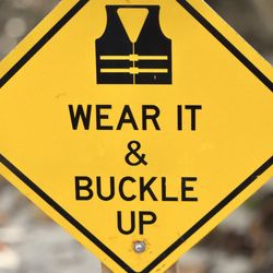
John D. MacArthur Beach State Park - Safety First. Wear It & Buckle Up.

John D. MacArthur Beach State Park

4.4(113 reviews)
8.1 mi

The water was very nice and clear, enjoyed the beach. We rode our bikes over the long boardwalk…read morethat crosses over the intracoastal, we were hoping for more bike trails but there was not much as far as bike riding trails. The boardwalk is pretty long if crossing over carrying a lot of stuff on a hot day that may not be too enjoyable for some. It's also pretty bumpy on a bike. But the beach was great and it's a great scenic boardwalk.

John D. MacArthur Beach State Park seemed like such a hidden gem from everything I had read and…read moreseen online. I loved that it offers so many activities in one place--kayaking, paddleboarding, the beach, picnic areas, a gift shop, and educational exhibits--all at very reasonable prices. Parking was only $5, and the kayak and paddleboard rentals were affordable too. Unfortunately, I happened to visit on a day with an extremely low tide. Paddleboard rentals were suspended, but kayak rentals were still available. The staff did warn us about the low tide and advised us to stay near the edges to avoid getting stuck. However, as someone new to kayaking, I didn't realize just how much the tide would impact the experience. For a large portion of our trip, the water was so shallow that our kayaks constantly got stuck. We had to repeatedly get out and drag them through the water. At times, the water wasn't even ankle deep. I completely understand that the staff can't control the tides, but I honestly wish kayak rentals had also been paused that day because the conditions made it difficult to really enjoy the experience. By the time we finished kayaking, we were exhausted and felt pretty gross from walking through the murky water, so we ended up skipping the beach altogether. Outside of that, the park itself looked lovely. There was a nice picnic area, a cute gift shop, and they even had a rescued sea turtle with a volunteer sharing information about sea turtle conservation, which was a really nice touch. There also appeared to be several educational exhibits throughout the park, although they happened to be closed during our visit. One downside was a pretty unpleasant smell near the gift shop, but I'm guessing that may have also been related to the unusually low tide. Despite my experience, I haven't written the park off. The photos I've seen online make it look absolutely beautiful, and I think we were just unlucky with the timing. I'd definitely consider coming back on a day with higher water levels to give it another chance. It sounds like a great park overall--I just recommend checking the tide conditions before planning to kayak or paddleboard so you can enjoy it at its best.

Photos
John D. MacArthur Beach State Park - Just saying...

Just saying...

John D. MacArthur Beach State Park - Kayaking on a sunny Monday in January

Kayaking on a sunny Monday in January

John D. MacArthur Beach State Park - Canoeing on a sunny Monday in January

See all

Canoeing on a sunny Monday in January

Jonathan Dickinson State Park - River Store Goods!

Jonathan Dickinson State Park

4.1(118 reviews)
11.4 mi

Camping over Labor Day weekend was such a great time at the state park! We spent the weekend doing…read morevarious things at the camp as well as in Jupiter area! I highly suggest hiking up to the top of Hobe Mountain Tower! The view is beautiful and it's only a 10 min walk from the parking lot! Another favorite from the weekend was fishing from the dock at the end of river camp! We caught puffer fish, garr, and stripped mojarra (may be spelled wrong lol)! It was a good time but be careful not to touch the puffer fish because they're poisonous!! The next highlight was walking the trails in the park! The Kitching Creek Nature Trail - Overlook is closed as of right now so the hike is pretty much the same the whole way. It's about a 1.5 mile walk. We camped at the River Campground, with 52 sites, is 4 miles from the park entrance, near the Loxahatchee River. That is where we fished in the evenings and mornings! I would say that close to all 52 sites were full for Labor Day, but it didn't seem crowded at all! The bathhouses held two showers and 3 bathrooms-quite clean as well! I would recommend stopping in if you get the chance! Plus super close to beautiful beaches!

Cool park! We drive by often and it's always something we've wanted to stop and check out. I had no…read moreidea this park is so huge! You could drive for 30 minutes and still not see everything! We stopped by on a weekday and the park was pretty and relaxing. Not too many people on the couple of trails we did. The observation tower is closed but they still have a nice boardwalk up to that area that makes for a great walk! It's pretty highly elevated for Florida - kind of impressive in person! Entry is $6 per car, and the lady provided a map and recommended her favorite trail. We checked that trail out as well (the white trail), but the height of the observation tower trail was really the star! We decided to drive around after doing both trails, and we saw their campgrounds. So surprising at how busy this place was! It seemed there was hardly an empty spot! Must be a happening place to camp! We'd definitely return for more adventures, as this is a cool park!

Photos
Jonathan Dickinson State Park - Camp Food :: Pan-Seared Asian Style Wings!

Camp Food :: Pan-Seared Asian Style Wings!

Jonathan Dickinson State Park - Another outstanding weekend of training for Camino de Santiago. Love this park so much.

Another outstanding weekend of training for Camino de Santiago. Love this park so much.

Jonathan Dickinson State Park - The long boardwalk to the tower

See all

The long boardwalk to the tower

Loxahatchee Slough Natural Area

Loxahatchee Slough Natural Area

5.0(1 review)
0.8 mi

The Loxahatchee Slough is a 10,391 acre Natural Area that was acquired by Palm Beach in 1996. An…read moreadditional 2,190 acres were purchased in between 2000 and 2007. The County also leases 257 acres from the South Florida Water Management District and 3 acres from the Florida Fish and Wildlife Conservation Commission. Loxahatchee Slough is actually three separate tracts, the largest of which sits north of PGA Boulevard. There are two access points to the main trail. One is the Bluegill Trail at Sandhill Crane Access Park where there is water, parking and restrooms, and the other is the Pantano Trail from River Bend Park along Indiantown Road. According to the county's Environmental Resources Management Department, Loxahatchee Sloughis the largest and most biologically diverse natural area managed by Palm Beach County. This preserve contains the historic headwaters of the Loxahatchee Wild and Scenic River and has nine native Florida ecosystems: mesic flatwoods, wet flatwoods, mesic hammock, hydric hammock, wet prairie, depression marsh, slough marsh, strand swamp, and dome swamp. This area attracts many birds. Ninety three different species of birds have been recorded here including limpkins, white ibis, fish crows, common grackles, rock pigeons, red wing blackbirds, American robins, and cedar waxwings. There are also hundreds of plant and animal species. Some of the plants that have been seen are the pineland daisy, jack-in-the-pulpit, Florida tassel flower, fringed yellow star grass, southeastern primrose willow, swamp forest beaks edge, bull tongue arrowhead, fire flag, red mulberry, and swamp bay. Animals found here include the Florida apple snail, handsome Florida grasshopper, gray-green club tail, red ear sunfish, little grass frog, striped mud turtle, wood duck, Florida sandhill crane, bobolink, and Sherman's fox squirrel. Many of the plants and animals found here are endangered or threatened. Through the years this area has been negatively impacted by over drainage, agricultural use, and invasion of non native plant species. Extensive restoration has been done to remove removal invasive non native plants, fill in the drainage ditches and shell mining pits, and replace the culverts leading to the C-18 Canal. This natural area is part of the Northeast Everglades Natural Area. Palm Beach County manages the site with the assistance of the City of Palm Beach Gardens. The Florida Trail Association maintains the 4.5-mile segment of the Ocean to Lake Trail that passes through this area. This area can be biked, hiked, paddled, or traversed by horseback.

Photos
Loxahatchee Slough Natural Area

See all

Bluegill Trail - hiking - Updated November 2026

Loading...
Loading...
Loading...