Cox Pinnacle Photos


You might also consider
More like Cox Pinnacle
Recommended Reviews - Cox Pinnacle
Start your review...

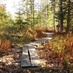
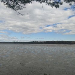
Beautiful walk this morning. Fresh snow meant I had the trail all to myself. Peaceful. Gorgeous. The only tracks were those I made. I need to come back in the summer and fall but I appreciated the winter solitude! read more


More info about Cox Pinnacle
295 Hacker Rd
Brunswick, ME 04011
Directions
Hours
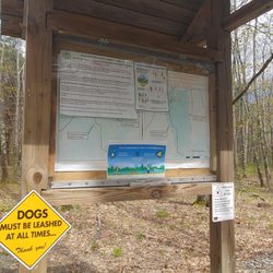
Outdoor Amenities


Cox Pinnacle - hiking - Updated July 2026
Best of Brunswick
People found Cox Pinnacle by searching for…
Things to Do in Brunswick, Maine
Hiking Trails With Waterfalls in Brunswick, Maine
Walking Trails in Brunswick, Maine
Waterfalls in Brunswick, Maine
Swimming Holes in Brunswick, Maine
Hiking With Kids in Brunswick, Maine
Off Leash Dog Hikes in Brunswick, Maine
Running Trails in Brunswick, Maine
Fun Things to Do With Kids in Brunswick, Maine
Jogging Trails in Brunswick, Maine
Places to Swim in Brunswick, Maine
Public Beaches in Brunswick, Maine
Walking Path in Brunswick, Maine
Playgrounds in Brunswick, Maine
Off Road Trails in Brunswick, Maine
Bike Paths in Brunswick, Maine
Things to Do at Night in Brunswick, Maine
Lakes & Ponds in Brunswick, Maine
Watch Sunset in Brunswick, Maine
Browse Articles
Browse Nearby
Browse Brands
Trending Searches in Brunswick, ME
Cliff Jumping in Brunswick, ME
Dog Friendly Trails in Brunswick, ME
Fishing Spots in Brunswick, ME
Jet Ski Rental in Brunswick, ME
Off Road Trails in Brunswick, ME
Outdoor Activities in Brunswick, ME
Pool Day Pass in Brunswick, ME
Public Shower in Brunswick, ME
River Swimming in Brunswick, ME
Running Trails in Brunswick, ME
Scenic Night View in Brunswick, ME
Scenic Overlook in Brunswick, ME
Secluded Spots in Brunswick, ME
Strawberry Picking in Brunswick, ME
Swimming Holes in Brunswick, ME
People who viewed Cox Pinnacle also viewed
Talking Brook Public Land
1 review
Black Brook Preserve
4 reviews
Whiskeag Trail
1 review
Long Reach Preserve
1 review
Fuller Farm
4 reviews
Presumpscot River Preserve
3 reviews
North Deering
Androscoggin Riverwalk
4 reviews
Back Cove Trail
33 reviews
West Bayside
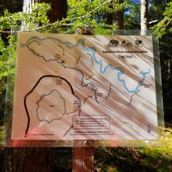
Cathance River Nature Reserve Trails
4 reviews
Cliff Trail
9 reviews