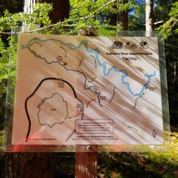
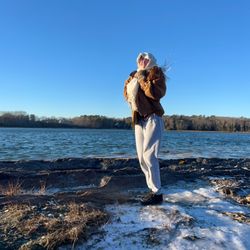
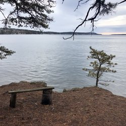
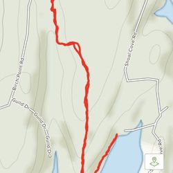
Whiskeag Trail Photos


You might also consider
More like Whiskeag Trail
Recommended Reviews - Whiskeag Trail
Start your review...

6 years ago
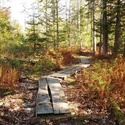
This was such a lovely hike while on a quick visit to Bath, en route to Bar Harbor. Foliage beautiful and so many picturesque spots with the water. It was hunting season, so we had to make a pit stop to get our orange protective gear, but the trail was very well marked and was a great day. We didn't have the time to go the entire length but picked a turnaround spot about 3.5 miles in. read more


More info about Whiskeag Trail
Whiskeag Trl
Bath, ME 04530
Directions
Hours
Outdoor Amenities


Whiskeag Trail - hiking - Updated June 2026
Best of Bath
People found Whiskeag Trail by searching for…
Trending Searches in Bath, ME
Bait And Tackle Shop near Whiskeag Trail
Boat Rental near Whiskeag Trail
Cliff Jumping near Whiskeag Trail
Dog Friendly Trails near Whiskeag Trail
Fishing Spots near Whiskeag Trail
Jet Ski Rental near Whiskeag Trail
Kayak Rental near Whiskeag Trail
Lakes & Ponds near Whiskeag Trail
Off Road Trails near Whiskeag Trail
Outdoor Activities near Whiskeag Trail
Pick Your Own Farms near Whiskeag Trail
Public Shower near Whiskeag Trail
Scenic Drive near Whiskeag Trail
Scenic Night View near Whiskeag Trail
Secluded Spots near Whiskeag Trail
Soccer Store near Whiskeag Trail
Splash Pad near Whiskeag Trail
Strawberry Picking near Whiskeag Trail
Sunrise View near Whiskeag Trail
Swimming Holes near Whiskeag Trail
Swimming Lakes near Whiskeag Trail
Swimming Pools near Whiskeag Trail
Watch Sunset near Whiskeag Trail
Browse Articles
Browse Nearby
BEST of Bath, Maine Restaurants near Whiskeag Trail
BEST of Bath, Maine Parks near Whiskeag Trail
BEST of Bath, Maine Photo Spots near Whiskeag Trail
BEST of Bath, Maine Coffee near Whiskeag Trail
BEST of Bath, Maine Things to Do near Whiskeag Trail
BEST of Bath, Maine Hot Springs near Whiskeag Trail
BEST of Bath, Maine Breakfast near Whiskeag Trail
Browse Brands
Related Searches in Bath, ME
Affordable Kayak Rental Services in Bath, Maine
Best Fishing Locations and Guides in Bath, Maine
Best Places for Horseback Riding in Bath, Maine
Best Places for Stunning Views in Bath, Maine
Check Out Off Road Trails in Bath, Maine
Discover Dog Friendly Trails to Explore in Bath, Maine
Discover Public Beaches to Visit in Bath, Maine
Discover Scenic Waterfall Spots in Bath, Maine
Discover a Hiking Trail in Bath, Maine
Discover the Best Night Hike Trails in Bath, Maine
Dog-Friendly Hikes With Dogs in Bath, Maine
Enjoy Camping Adventures Around Bath, Maine
Enjoy Exciting Mountain Biking Adventures in Bath, Maine
Enjoy Kayaking Adventures in Bath, Maine
Enjoy Tent Camping Spots Around Bath, Maine
Enjoy Water Activities and Fun in Bath, Maine
Enjoy a Beautiful Waterfall Hike in Bath, Maine
Enjoy the Best Walking Trails in Bath, Maine
Exciting Cliff Jumping Spots in Bath, Maine
Experience Thrilling White Water Rafting in Bath, Maine
Explore Beautiful Parks and Green Spaces in Bath, Maine
Explore Bike Rentals Throughout Bath, Maine
Explore Easy Hikes Perfect for All in Bath, Maine
Explore Fun Activities to Do in Bath, Maine
Explore Popular Campgrounds Near Bath, Maine
Explore Popular Scenic Overlook Points in Bath, Maine
Explore the Best Beach Spots in Bath, Maine
Explore the Best Swimming Holes Around Bath, Maine
Explore the Best Trail Options in Bath, Maine
Family Friendly Hiking With Kids in Bath, Maine
Find Beautiful Views in Bath, Maine
Find Popular Ziplining Spots Around Bath, Maine
Find the Best Scenic View Locations in Bath, Maine
Hiking Trails With Waterfalls in Bath, Maine
Off Leash Dog Hiking Trails in Bath, Maine
Plan a Scenic Drive Route Near Bath, Maine
Popular Fishing Spots to Explore in Bath, Maine
Popular Outdoor Activities to Try in Bath, Maine
Popular Picnic Spots to Visit in Bath, Maine
Popular Things to Do in Bath, Maine
Popular Things to See in Bath, Maine
Safe River Swimming Areas in Bath, Maine
Safe and Fun Parks for Kids in Bath, Maine
Top Paddleboarding Activities in Bath, Maine
Top Places for Snorkeling in Bath, Maine
Top Running Trails to Explore in Bath, Maine
Top Swimming Lakes to Enjoy in Bath, Maine
Top Swimming Spots and Pools in Bath, Maine