Androscoggin Riverwalk Photos


You might also consider
More like Androscoggin Riverwalk
Recommended Reviews - Androscoggin Riverwalk
Start your review...

4 years ago
The bridge slightly sways more then swings. It is a pretty sight to see. The walking trail however wasn't as impressive as I thought it would be. I probably won't come back again even though it was nice to see the location for a short time. read more


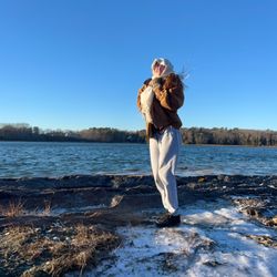
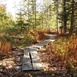
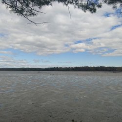
This cute little walking path meanders next to the Androscoggin river and over the Swinging bridge. I love walking this when looking for a short peaceful walk. I can go down to the mini beach to see the ducks, walk over the swinging bridge, grab a coffee from one of the local cafes on Maine street or Union street, and even lengthen my walk onto the Androscoggin Pedestrian and Bike Path to make for a 9 mile plus walk round trip if I want. Be aware though,there are three roads to cross to get to the other pathway, all have crosswalks, one which has a flashing light for pedestrians. Taken from their website: When completed, the Androscoggin Brunswick-Topsham Riverwalk will be a year-round, in-town walking loop, 1.25 miles long. Fully-accessible paths, including sidewalks in the more urban portions of the route, will link the Frank J. Wood ("Green") Bridge to the historic Androscoggin Swinging Bridge along the Androscoggin River in both Brunswick and Topsham. Benches will be installed along the route, particularly at sites that provide spectacular views of the Androscoggin River and the neighborhoods adjacent to the river. There will be directional signage along the route and informational signage at points of natural, historic or other significance. As necessary, existing sidewalks will be extended or improved. New safety buffers will protect pedestrians and cyclists from vehicles in the more high-traffic sections of the Riverwalk. The Riverwalk is being implemented in phases. Initial components included the restoration of the Swinging Bridge and creating of a new pedestrian walkway on the Frank J. Wood Bridge as well as an extension to the Summer Street sidewalk in Topsham. In October 2012, the Mill Road section through the woods in Topsham was completed, linking the Swinging Bridge to the Summer Street sidewalk. Future phases include improvements along the busy Mill Street Route One connector in Brunswick and the Fort Andross area in Brunswick as well as a riverfront park at the Priority Business Center in Topsham. read more


More info about Androscoggin Riverwalk


Androscoggin Riverwalk - hiking - Updated July 2026
Best of Topsham
People found Androscoggin Riverwalk by searching for…
Things to Do in Topsham, Maine
Hiking Trails With Waterfalls in Topsham, Maine
Scenic Overlook in Topsham, Maine
Walking Trails in Topsham, Maine
Beautiful Views in Topsham, Maine
Lookout Points in Topsham, Maine
Parks for Kids in Topsham, Maine
Kids Friendly Beaches in Topsham, Maine
Secret Spots in Topsham, Maine
Natural Hot Springs in Topsham, Maine
Scenic Views in Topsham, Maine
Off Leash Dog Hikes in Topsham, Maine
Fun Things to Do at Night in Topsham, Maine
Dog Friendly Trails in Topsham, Maine
Trending Searches in Topsham, ME
Boat Rental near Androscoggin Riverwalk
Cliff Jumping near Androscoggin Riverwalk
Day Trips near Androscoggin Riverwalk
Dog Friendly Trails near Androscoggin Riverwalk
Fireworks near Androscoggin Riverwalk
Jet Ski Rental near Androscoggin Riverwalk
Kayak Rental near Androscoggin Riverwalk
Lakes & Ponds near Androscoggin Riverwalk
Outdoor Activities near Androscoggin Riverwalk
Parks For Picnics near Androscoggin Riverwalk
Public Pools near Androscoggin Riverwalk
Public Shower near Androscoggin Riverwalk
River Swimming near Androscoggin Riverwalk
River Tubing near Androscoggin Riverwalk
Rock Quarry near Androscoggin Riverwalk
Scenic Night View near Androscoggin Riverwalk
Scenic Overlook near Androscoggin Riverwalk
Secluded Spots near Androscoggin Riverwalk
Soccer Store near Androscoggin Riverwalk
Splash Pad near Androscoggin Riverwalk
Strawberry Picking near Androscoggin Riverwalk
Sunrise View near Androscoggin Riverwalk
Swimming Holes near Androscoggin Riverwalk
Swimming Lakes near Androscoggin Riverwalk
Watch Sunset near Androscoggin Riverwalk
Browse Articles
Browse Nearby
BEST of Topsham, Maine Parks near Androscoggin Riverwalk
BEST of Topsham, Maine Restaurants near Androscoggin Riverwalk
BEST of Topsham, Maine Coffee near Androscoggin Riverwalk
BEST of Topsham, Maine Things to Do near Androscoggin Riverwalk
BEST of Topsham, Maine Waterfalls near Androscoggin Riverwalk
BEST of Topsham, Maine Campgrounds near Androscoggin Riverwalk
BEST of Topsham, Maine Breakfast near Androscoggin Riverwalk
BEST of Topsham, Maine Sledding near Androscoggin Riverwalk
BEST of Topsham, Maine Snow Tubing near Androscoggin Riverwalk
Browse Brands
Related Searches in Topsham, ME
Affordable Kayak Rental Services in Topsham, Maine
Best Fishing Locations and Guides in Topsham, Maine
Best Places for Horseback Riding in Topsham, Maine
Best Places for Stunning Views in Topsham, Maine
Check Out Off Road Trails in Topsham, Maine
Discover Dog Friendly Trails to Explore in Topsham, Maine
Discover Public Beaches to Visit in Topsham, Maine
Discover Scenic Waterfall Spots in Topsham, Maine
Discover a Hiking Trail in Topsham, Maine
Discover the Best Night Hike Trails in Topsham, Maine
Discover the Best Running Track in Topsham, Maine
Enjoy Camping Adventures Around Topsham, Maine
Enjoy Exciting Mountain Biking Adventures in Topsham, Maine
Enjoy Kayaking Adventures in Topsham, Maine
Enjoy Tent Camping Spots Around Topsham, Maine
Enjoy a Beautiful Waterfall Hike in Topsham, Maine
Enjoy the Best Walking Trails in Topsham, Maine
Exciting Cliff Jumping Spots in Topsham, Maine
Explore Beautiful Parks and Green Spaces in Topsham, Maine
Explore Bike Rentals Throughout Topsham, Maine
Explore Easy Hikes Perfect for All in Topsham, Maine
Explore Fun Activities to Do in Topsham, Maine
Explore Popular Campgrounds Near Topsham, Maine
Explore Popular Scenic Overlook Points in Topsham, Maine
Explore the Best Beach Spots in Topsham, Maine
Explore the Best Swimming Holes Around Topsham, Maine
Explore the Best Trail Options in Topsham, Maine
Family Friendly Hiking With Kids in Topsham, Maine
Find Beautiful Views in Topsham, Maine
Find Popular Ziplining Spots Around Topsham, Maine
Find the Best Parks for Picnics in Topsham, Maine
Find the Best Playgrounds to Visit in Topsham, Maine
Find the Best Scenic View Locations in Topsham, Maine
Hiking Trails With Waterfalls in Topsham, Maine
Off Leash Dog Hiking Trails in Topsham, Maine
Plan a Scenic Drive Route Near Topsham, Maine
Popular Fishing Spots to Explore in Topsham, Maine
Popular Outdoor Activities to Try in Topsham, Maine
Popular Picnic Spots to Visit in Topsham, Maine
Popular Things to Do in Topsham, Maine
Popular Things to See in Topsham, Maine
Safe and Fun Parks for Kids in Topsham, Maine
Top Climbing Spots and Gyms in Topsham, Maine
Top Paddleboarding Activities in Topsham, Maine
Top Places for Snorkeling in Topsham, Maine
Top Running Trails to Explore in Topsham, Maine
Top Swimming Lakes to Enjoy in Topsham, Maine
Top Swimming Spots and Pools in Topsham, Maine
People who viewed Androscoggin Riverwalk also viewed
Jewell Falls
13 reviews
Nasons Corner
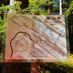
Giant's Stairs Trail
35 reviews
Eastern Promenade
84 reviews
East End
Fort Sumner Park
6 reviews
East End
Western Promenade
10 reviews
West End
Wilbur Preserve
2 reviews
Intervale Preserve
1 review
Bijhouwer Forest
2 reviews
Widgeon Cove Trail
2 reviews
Captain Alfred Skolfield Nature Preserve
2 reviews