Coventry Greenway Photos


You might also consider
More like Coventry Greenway
Recommended Reviews - Coventry Greenway
Start your review...

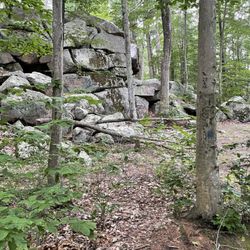
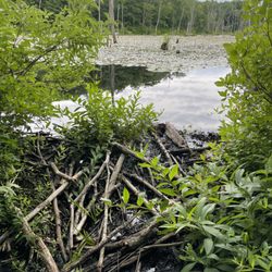
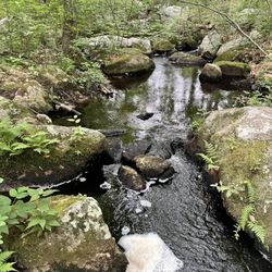
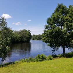
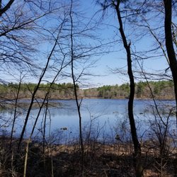
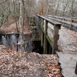
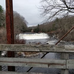
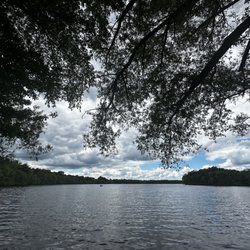
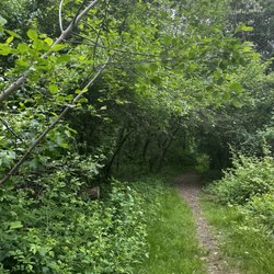
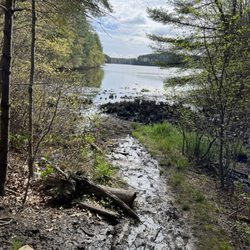
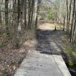
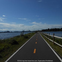
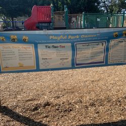
Parking to access this section of the trail is on Brenda Drive, right next to the Coventry Library. Room for about twenty vehicles or so, there is additional parking, plus an EV charge station available in the library parking lot just across the road. A childrens playground is on the front lawn of the library (full sun) and picnic tables are in the shade by the trailhead. Trash bins are also available here. Facilities are available in the library vestibule during business hours. A short, paved trail from the parking lot leads to the main trail. The reservoir will be to your right where you can fish or swim. The trail to the right is very shady in summer with trailside horse paths and ends before the CT state line in the village of Summit. (Horse trailer parking is on Pine Haven.) The path turns to a dirt tract in the woods at Summit and picks up in CT as a cleared dirt trail. Turning left leads to downtown West Warwick and is more sunny and urban. Pedestrians walk on the left, cyclists ride on the right, facing pedestrians. Bicycles yield to pedestrians. Pets must be on leash and animal waste must be removed and disposed of in a waste bin. Trail is paved throughout RI with connections into PVD if you'd like to go that far, where part of the trail is surface roads. Parking area has some shaded spots in summer. There are many rural road crossings on trail and part of the trail is close to Flat River road. Easy and convenient location for accessing a nice, rural section of trail. read more
 - Mountain Biking Near Me - Coventry, Rhode Island")


More info about Coventry Greenway
1672 Flat River Rd
Coventry, RI 02816
Directions
Hours
Outdoor Amenities
You might also consider


Coventry Greenway - mountainbiking - Updated July 2026
Best of Coventry
People found Coventry Greenway by searching for…
Things to Do in Coventry, Rhode Island
Playgrounds in Coventry, Rhode Island
Fishing in Coventry, Rhode Island
Walking Trails in Coventry, Rhode Island
Picnic Areas in Coventry, Rhode Island
Hiking Trails in Coventry, Rhode Island
Bike Paths in Coventry, Rhode Island
Bikes in Coventry, Rhode Island
Dog Friendly Trails in Coventry, Rhode Island
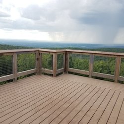
Scenic View in Coventry, Rhode Island
View Points in Coventry, Rhode Island
Picnic Tables in Coventry, Rhode Island
Picnic Spots in Coventry, Rhode Island
Waterfall Hike in Coventry, Rhode Island
Trail in Coventry, Rhode Island
Fishing Spots in Coventry, Rhode Island
Off Road Trails in Coventry, Rhode Island
Night Hike in Coventry, Rhode Island
Waterfalls in Coventry, Rhode Island
Things to See in Coventry, Rhode Island
Bicycles in Coventry, Rhode Island
Stroller Friendly Hikes in Coventry, Rhode Island
Browse Articles
Browse Nearby
BEST of Coventry, Rhode Island Coffee near Coventry Greenway
BEST of Coventry, Rhode Island Restaurants near Coventry Greenway
BEST of Coventry, Rhode Island Things to Do near Coventry Greenway
BEST of Coventry, Rhode Island Playgrounds near Coventry Greenway
BEST of Coventry, Rhode Island Breakfast near Coventry Greenway
BEST of Coventry, Rhode Island Botanical Gardens near Coventry Greenway
Browse Brands
Trending Searches in Coventry, RI
Black Owned Nail Salons near Coventry Greenway
Boat Rental near Coventry Greenway
Day Trips near Coventry Greenway
Dog Friendly Trails near Coventry Greenway
Fishing Spots near Coventry Greenway
Jet Ski Rental near Coventry Greenway
Kayak Rental near Coventry Greenway
Mountain Biking near Coventry Greenway
Off Road Trails near Coventry Greenway
Outdoor Activities near Coventry Greenway
Picnic Spots near Coventry Greenway
Pool Day Pass near Coventry Greenway
Public Pools near Coventry Greenway
River Swimming near Coventry Greenway
Scenic Overlook near Coventry Greenway
Soccer Store near Coventry Greenway
Splash Pad near Coventry Greenway
Star Gazing near Coventry Greenway
Strawberry Picking near Coventry Greenway
Swimming Holes near Coventry Greenway
Swimming Lakes near Coventry Greenway
Watch Sunset near Coventry Greenway
People who viewed Coventry Greenway also viewed
Trestle Trail
1 review
Calf Pasture Point Recreation
1 review
Maxwell Mays Wildlife Refuge
13 reviews
Manchester Street Park
2 reviews
Allen's Pond Wildlife Sanctuary
7 reviews
River Point Park
3 reviews
Mawney Pine Preserve
1 review
Washington Secondary Bike Path
5 reviews
Quequechan River Rail Trail
1 review
Fort Barton
19 reviews