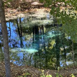
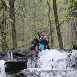
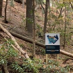
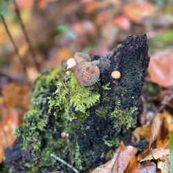
Cohutta Overlook Photos


More like Cohutta Overlook
Recommended Reviews - Cohutta Overlook
Start your review...

2 years ago


7 years ago
12 years ago
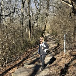
April 4, 2014, Tony and I was driving the back roads of Georgia on our way to Helen, GA to visit the Bavarian Village. We passed Fort Mountain State Park, which we love by the way. We visited there a few weeks back, but this time ON TO HELEN....on down the road towards Elijay, Ga I noticed a sign "COHUTTA OVERLOOK"...I said...BRAKE..side trip.. My husband is used to this..that is why I travel the back roads so I can find interesting sites, old homes and buildings and overlooks...I do this quite regularly...Glad I am the driver. I also Brake for Yard Sales...lol I drove out the side road and parked along the narrow ONE WAY road..and we started to climb up the side of the small mountain via a trail and some stairs...its a nice little HEART POUNDING hike..but once you are at the top...oh WOW !!! the View is AWESOME...STUNNING..the adjectives keep going on, on and on...You have to take the 10-15 minutes out of your schedule to check out this great vista. I loved it. I took several photos ( of course ) And AGAIN..I can't say it enough....FREE FREE FREE !!!! read more


More info about Cohutta Overlook


Cohutta Overlook - hiking - Updated May 2026
Best of Chatsworth
People found Cohutta Overlook by searching for…
Things to Do in Chatsworth, Georgia
Beautiful Views in Chatsworth, Georgia
Star Gazing in Chatsworth, Georgia
Hiking Trails in Chatsworth, Georgia
Scenic Views in Chatsworth, Georgia
Lookout Points in Chatsworth, Georgia
Scenic Overlook in Chatsworth, Georgia
Secret Spots in Chatsworth, Georgia
Places to Take Pictures in Chatsworth, Georgia
Walking Trails in Chatsworth, Georgia
Fun Things to Do at Night in Chatsworth, Georgia
Photo Spots in Chatsworth, Georgia
View Points in Chatsworth, Georgia
Things to Do on a Rainy Day in Chatsworth, Georgia
Natural Hot Springs in Chatsworth, Georgia
Waterfalls in Chatsworth, Georgia
Running Trails in Chatsworth, Georgia
Night View in Chatsworth, Georgia
Easy Hikes in Chatsworth, Georgia
State Park in Chatsworth, Georgia
Trending Searches in Chatsworth, GA
Baseball Fields near Cohutta Overlook
Botanical Gardens near Cohutta Overlook
Bounce House Rentals near Cohutta Overlook
Campgrounds near Cohutta Overlook
Flower Fields near Cohutta Overlook
Lakes & Ponds near Cohutta Overlook
Mens Suits near Cohutta Overlook
Mexican Catering near Cohutta Overlook
Nurseries & Gardening near Cohutta Overlook
Outdoor Furniture Stores near Cohutta Overlook
Party Equipment Rentals near Cohutta Overlook
Pedicure near Cohutta Overlook
Photo Spots near Cohutta Overlook
Pick Your Own Farms near Cohutta Overlook
Picnic Areas near Cohutta Overlook
Places To Take Pictures near Cohutta Overlook
River Swimming near Cohutta Overlook
Rv Rental near Cohutta Overlook
Strawberry Picking near Cohutta Overlook
Browse Articles
Browse Nearby
Browse Brands
Related Searches in Chatsworth, GA
Affordable Kayak Rental Services in Chatsworth, Georgia
Best Fishing Locations and Guides in Chatsworth, Georgia
Best Fun Things to Do in Chatsworth, Georgia
Best Lookout Points to Visit in Chatsworth, Georgia
Best Places for Horseback Riding in Chatsworth, Georgia
Best Places for Stunning Views in Chatsworth, Georgia
Best Spots for Star Gazing in Chatsworth, Georgia
Best Waterfalls and Swimming Holes in Chatsworth, Georgia
Check Out Off Road Trails in Chatsworth, Georgia
Discover Dog Friendly Trails to Explore in Chatsworth, Georgia
Discover Popular Photo Spots in Chatsworth, Georgia
Discover a Hiking Trail in Chatsworth, Georgia
Discover the Best Night Hike Trails in Chatsworth, Georgia
Discover the Best Running Track in Chatsworth, Georgia
Enjoy the Best Tubing Experiences in Chatsworth, Georgia
Enjoy the Best Walking Trails in Chatsworth, Georgia
Explore Beautiful Botanical Gardens in Chatsworth, Georgia
Explore Beautiful Parks and Green Spaces in Chatsworth, Georgia
Explore Easy Hikes Perfect for All in Chatsworth, Georgia
Explore Popular Campgrounds Near Chatsworth, Georgia
Explore Popular RV Parks Around Chatsworth, Georgia
Explore Scenic Lakes to Visit in Chatsworth, Georgia
Explore Top Dog Parks in Chatsworth, Georgia Near You
Explore Top Water Parks in Chatsworth, Georgia Today
Explore the Best Boating Spots in Chatsworth, Georgia
Explore the Best Swimming Holes Around Chatsworth, Georgia
Family Friendly Hiking With Kids in Chatsworth, Georgia
Find Beautiful Views in Chatsworth, Georgia
Find Fun Things to Do With Kids in Chatsworth, Georgia
Find Popular Ziplining Spots Around Chatsworth, Georgia
Find Top Skate Parks in Chatsworth, Georgia for All Skill Levels
Find the Best Playgrounds to Visit in Chatsworth, Georgia
Find the Best Swimming Pools in Chatsworth, Georgia Today
Great Places to Swim in Chatsworth, Georgia
Hiking Trails With Waterfalls in Chatsworth, Georgia
Locate Tennis Courts Around Chatsworth, Georgia
Off Leash Dog Hiking Trails in Chatsworth, Georgia
Perfect Spots to Watch Sunset in Chatsworth, Georgia
Popular Fishing Spots to Explore in Chatsworth, Georgia
Popular Kids Activities in Chatsworth, Georgia
Popular Picnic Spots to Visit in Chatsworth, Georgia
Popular Places to Take Pictures in Chatsworth, Georgia
Popular Things to Do in Chatsworth, Georgia
Relax at Natural Hot Springs Near Chatsworth, Georgia
Safe River Swimming Areas in Chatsworth, Georgia
Top Climbing Spots and Gyms in Chatsworth, Georgia
Top Running Trails to Explore in Chatsworth, Georgia
Top Swimming Lakes to Enjoy in Chatsworth, Georgia
People who viewed Cohutta Overlook also viewed
Fall Branch Falls
34 reviews
Sea Creek Falls
1 review
Fort Mountain State Park
53 reviews
Chattahoochre National Forest
2 reviews
Tocca River Swinging Bridge
2 reviews
Amicalola Falls State Park and Lodge
118 reviews
Harrison Park
2 reviews
Toccoa Valley Campgrounds
31 reviews
Dalton Parks and Recreation Department.
3 reviews
Lee Newton Park
1 review