Harrison Park Photos


More like Harrison Park
Recommended Reviews - Harrison Park
Start your review...

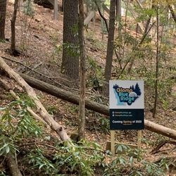
2 years ago


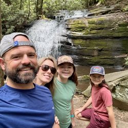
7 years ago
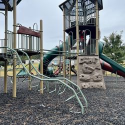
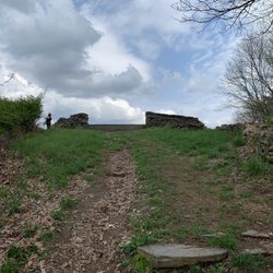
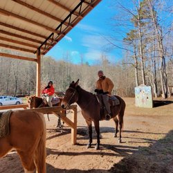
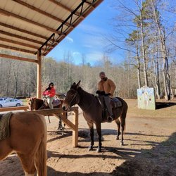
A nice flat walking path. It's graveled and has some shade. This would be a good place to walk or take dogs, but there are no swing sets or bathrooms other than porta- potties. The loop is about a mile at its longest. read more

More info about Harrison Park
75 McCutchen St
Ellijay, GA 30540
Directions
Hours
Outdoor Amenities


Harrison Park - parks - Updated July 2026
Best of Ellijay
People found Harrison Park by searching for…
Things to Do in Ellijay, Georgia
Places to Take Pictures in Ellijay, Georgia
Playgrounds in Ellijay, Georgia
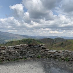
Scenic Views in Ellijay, Georgia
Walking Trails in Ellijay, Georgia
Scenic Drive in Ellijay, Georgia
Photo Spots in Ellijay, Georgia
Picnic Spots in Ellijay, Georgia
Things to Do at Night in Ellijay, Georgia
Hiking Trails in Ellijay, Georgia
Flower Fields in Ellijay, Georgia
Dog Swimming in Ellijay, Georgia
Beautiful Views in Ellijay, Georgia
Attractions in Ellijay, Georgia
Dog Friendly Trails in Ellijay, Georgia
Picnic Parks in Ellijay, Georgia
Swimming Holes in Ellijay, Georgia
Picnic Tables in Ellijay, Georgia
State Parks in Ellijay, Georgia
Secluded Spots in Ellijay, Georgia
Running Trails in Ellijay, Georgia
Trending Searches in Ellijay, GA
Black Owned Nail Salons near Harrison Park
Boat Rental near Harrison Park
Cliff Jumping near Harrison Park
Dog Friendly Beaches near Harrison Park
Dog Swimming near Harrison Park
Fishing Spots near Harrison Park
Jet Ski Rental near Harrison Park
Kayak Rental near Harrison Park
Paddle Boat Rentals near Harrison Park
Places To Walk Around near Harrison Park
Public Pools near Harrison Park
River Swimming near Harrison Park
Soccer Store near Harrison Park
Strawberry Picking near Harrison Park
Swimming Holes near Harrison Park
Swimming Lakes near Harrison Park
Browse Articles
Browse Nearby
BEST of Ellijay, Georgia Playgrounds near Harrison Park
BEST of Ellijay, Georgia Restaurants near Harrison Park
BEST of Ellijay, Georgia Coffee near Harrison Park
BEST of Ellijay, Georgia Things to Do near Harrison Park
BEST of Ellijay, Georgia Breakfast near Harrison Park
BEST of Ellijay, Georgia Picnic Areas near Harrison Park
BEST of Ellijay, Georgia Campgrounds near Harrison Park
Browse Brands
Related Searches in Ellijay, GA
Best Parks for Parties and Events in Ellijay, Georgia
Best Water Parks for Kids in Ellijay, Georgia
Check Out Great Playgrounds in Ellijay, Georgia
Discover Baseball Fields Around Ellijay, Georgia
Discover Dog Friendly Trails to Explore in Ellijay, Georgia
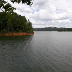
Discover Lakes & Ponds to Explore in Ellijay, Georgia
Discover Popular Bike Trails in Ellijay, Georgia
Discover Public Beaches to Visit in Ellijay, Georgia
Discover Soccer Fields in Ellijay, Georgia Near You
Discover Top Nature Parks to Visit in Ellijay, Georgia
Discover the Best Beaches in Ellijay, Georgia
Enjoy Hiking Adventures in Ellijay, Georgia
Enjoy the Best Picnic Spots and Ideas in Ellijay, Georgia
Enjoy the Best Walking Trails in Ellijay, Georgia
Explore Easy Hikes Perfect for All in Ellijay, Georgia
Explore Family-Friendly Zoos and Wildlife in Ellijay, Georgia
Explore Free Picnic Areas Around Ellijay, Georgia
Explore Fun Activities to Do in Ellijay, Georgia
Explore Parks With Pull Up Bars in Ellijay, Georgia
Explore Picnic Parks Near Ellijay, Georgia
Explore Popular Campgrounds Near Ellijay, Georgia
Explore Popular Picnic Areas Around Ellijay, Georgia
Explore Popular RV Parks Around Ellijay, Georgia
Explore Scenic Lakes to Visit in Ellijay, Georgia
Explore Top Dog Parks in Ellijay, Georgia Near You
Explore Top Trampoline Parks in Ellijay, Georgia
Explore Top Water Parks in Ellijay, Georgia Today
Explore the Best Swimming Holes Around Ellijay, Georgia
Find Great Places to Feed Ducks in Ellijay, Georgia
Find Top Dog Friendly Parks to Visit in Ellijay, Georgia
Find Top Skate Parks in Ellijay, Georgia for All Skill Levels
Find Top-Rated Petting Zoos Near Ellijay, Georgia
Find a Park With BBQ Pits in Ellijay, Georgia
Find the Best Parks BBQ Grills in Ellijay, Georgia
Find the Best Parks for Picnics in Ellijay, Georgia
Find the Best Playgrounds to Visit in Ellijay, Georgia
Have Fun at a Splash Pad in Ellijay, Georgia
Locate Tennis Courts Around Ellijay, Georgia
Must-See Tourist Attractions Around Ellijay, Georgia
Picnic Areas With BBQ Pits Available in Ellijay, Georgia
Popular Picnic Spots to Visit in Ellijay, Georgia
Safe and Fun Parks for Kids in Ellijay, Georgia
Top Amusement Parks to Visit in Ellijay, Georgia
Top Hiking Trails to Explore in Ellijay, Georgia
Top Playgrounds for Kids to Enjoy in Ellijay, Georgia
Top Running Trails to Explore in Ellijay, Georgia
Top Swimming Lakes to Enjoy in Ellijay, Georgia
Top-Rated Camping Sites in Ellijay, Georgia
People who viewed Harrison Park also viewed
Lee Newton Park
1 review
Mulberry Gap - Adventure Basecamp
30 reviews
$
Cohutta Overlook
3 reviews
Woodring Branch Campground
4 reviews
Aska Mining Company
15 reviews
Tocca River Swinging Bridge
2 reviews
Gilmer County River Park
1 review
Hooves and Feathers Petting Farm
2 reviews
Rich Mountain Wildlife Management Area
1 review
Lakeshore Park
1 review