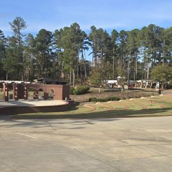
Calhoun Falls State Park Photos


More like Calhoun Falls State Park
Recommended Reviews - Calhoun Falls State Park
Start your review...

Reviews With Photos

I really don't have anything bad to say about this campground. My family and I drove from Florida to stay here for New Years, it was definitely worth the drive. All of the camp sites are very well maintained, you have a beautiful view of the lake from everywhere in the campground. They have parks for kids, basketball and tennis courts if I remember correctly and a swimming area which was closed when we went because it was so cold. The staff there was very helpful and super nice, we'll definitely be back soon. The only downfalls I had personally is the bathrooms are in need of a major face lift and there are no boating rentals to rent when you're there. It would have been nice to take a pontoon boat or something out to explore. But other than that everything was pretty perfect.


2 years ago


3 years ago
6 years ago
I really don't have anything bad to say about this campground. My family and I drove from Florida to stay here for New Years, it was definitely worth the drive. All of the camp sites are very well maintained, you have a beautiful view of the lake from everywhere in the campground. They have parks for kids, basketball and tennis courts if I remember correctly and a swimming area which was closed when we went because it was so cold. The staff there was very helpful and super nice, we'll definitely be back soon. The only downfalls I had personally is the bathrooms are in need of a major face lift and there are no boating rentals to rent when you're there. It would have been nice to take a pontoon boat or something out to explore. But other than that everything was pretty perfect. read more


6 years ago
5 years ago
We enjoy camping at this state park as well as spending time at the day use area. There are updates that need to be done for sure but overall, we enjoy making wonderful memories here! read more
14 years ago
Beautiful! Great area, minus the bugs but that's everywhere you camp. The store was always helpful and the rangers were always considerate and helpful. The lake felt great and it was a great place to just go relax for a few day or even a week! read more


More info about Calhoun Falls State Park
Ask the Community - Calhoun Falls State Park


Calhoun Falls State Park - parks - Updated July 2026
Best of Calhoun Falls
People found Calhoun Falls State Park by searching for…
Campgrounds in Calhoun Falls, South Carolina
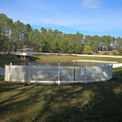
Lakes in Calhoun Falls, South Carolina
Things to Do in Calhoun Falls, South Carolina
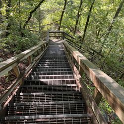
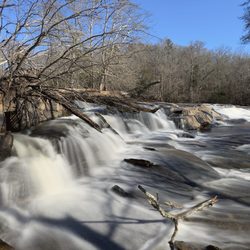
Hiking Trails With Waterfalls in Calhoun Falls, South Carolina
Fishing in Calhoun Falls, South Carolina
Basketball Courts in Calhoun Falls, South Carolina
Watch Sunset in Calhoun Falls, South Carolina
Sunset View in Calhoun Falls, South Carolina
Waterfalls in Calhoun Falls, South Carolina
Scenic View in Calhoun Falls, South Carolina
Picnic Areas in Calhoun Falls, South Carolina
Swimming Lakes in Calhoun Falls, South Carolina
Tennis in Calhoun Falls, South Carolina
Parks for Picnics in Calhoun Falls, South Carolina
Fishing Spots in Calhoun Falls, South Carolina
Fishing Lake in Calhoun Falls, South Carolina
Playgrounds in Calhoun Falls, South Carolina
Parks for Kids in Calhoun Falls, South Carolina
Scenic Overlook in Calhoun Falls, South Carolina
Places to Swim in Calhoun Falls, South Carolina
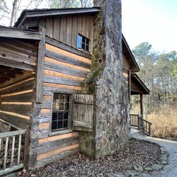
Camping Sites in Calhoun Falls, South Carolina
Walking Trails in Calhoun Falls, South Carolina
Trending Searches in Calhoun Falls, SC
Browse Articles
Browse Brands
Related Searches in Calhoun Falls, SC
Best Fishing Locations and Guides in Calhoun Falls, South Carolina
Best Parks for Parties and Events in Calhoun Falls, South Carolina
Best Places for Horseback Riding in Calhoun Falls, South Carolina
Best Water Parks for Kids in Calhoun Falls, South Carolina
Check Out Great Playgrounds in Calhoun Falls, South Carolina
Discover Baseball Fields Around Calhoun Falls, South Carolina
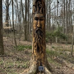
Discover Popular Photo Spots in Calhoun Falls, South Carolina
Discover Soccer Fields in Calhoun Falls, South Carolina Near You
Discover Top Nature Parks to Visit in Calhoun Falls, South Carolina
Discover the Best Beaches in Calhoun Falls, South Carolina
Enjoy Hiking Adventures in Calhoun Falls, South Carolina
Enjoy the Best Picnic Spots and Ideas in Calhoun Falls, South Carolina
Enjoy the Best Walking Trails in Calhoun Falls, South Carolina
Explore Beautiful Botanical Gardens in Calhoun Falls, South Carolina
Explore Free Picnic Areas Around Calhoun Falls, South Carolina
Explore Parks With Pull Up Bars in Calhoun Falls, South Carolina
Explore Picnic Parks Near Calhoun Falls, South Carolina
Explore Popular Campgrounds Near Calhoun Falls, South Carolina
Explore Popular Picnic Areas Around Calhoun Falls, South Carolina
Explore Popular View Points Around Calhoun Falls, South Carolina
Explore Scenic Lakes to Visit in Calhoun Falls, South Carolina
Explore Secret Spots Worth Visiting in Calhoun Falls, South Carolina
Explore Summer Camps for All Ages in Calhoun Falls, South Carolina
Explore Top Dog Parks in Calhoun Falls, South Carolina Near You
Explore Top Gyms in Calhoun Falls, South Carolina Now
Explore Top Water Parks in Calhoun Falls, South Carolina Today
Explore Venues & Event Spaces in Calhoun Falls, South Carolina
Explore the Best Boating Spots in Calhoun Falls, South Carolina
Find Great Places to Feed Ducks in Calhoun Falls, South Carolina
Find Parks and Recreation Activities in Calhoun Falls, South Carolina
Find Top Dog Friendly Parks to Visit in Calhoun Falls, South Carolina
Find Top-Rated Waterfalls in Calhoun Falls, South Carolina Now
Find the Best Parks BBQ Grills in Calhoun Falls, South Carolina
Find the Best Parks for Picnics in Calhoun Falls, South Carolina
Find the Best Playgrounds to Visit in Calhoun Falls, South Carolina
Find the Best Swimming Pools in Calhoun Falls, South Carolina Today
Have Fun at a Splash Pad in Calhoun Falls, South Carolina
Hiking Trails With Waterfalls in Calhoun Falls, South Carolina
Picnic Areas With BBQ Pits Available in Calhoun Falls, South Carolina
Popular Kids Activities in Calhoun Falls, South Carolina
Popular Picnic Spots to Visit in Calhoun Falls, South Carolina
Popular Places to Take Pictures in Calhoun Falls, South Carolina
Popular Things to Do in Calhoun Falls, South Carolina
Safe and Fun Parks for Kids in Calhoun Falls, South Carolina
See Top Fireworks Events in Calhoun Falls, South Carolina
Top Hiking Trails to Explore in Calhoun Falls, South Carolina
Top-Rated Boat Rental Services in Calhoun Falls, South Carolina