Cancel

    Open app

    Search

    Bull Point Trail

    4.2 (5 reviews)

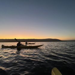
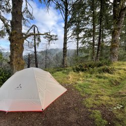
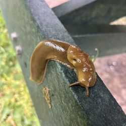
    Bull Point Trail Photos

    You might also consider

    More like Bull Point Trail

    Recommended Reviews - Bull Point Trail

    Your trust is our priority, so businesses can't pay to alter or remove their reviews. Learn more about reviews.
    Yelp app icon
    Browse more easily on the app
    Review Feed Illustration

    5 months ago

    Helpful 0
    Thanks 0
    Love this 0
    Oh no 0

    6 years ago

    Helpful 40
    Thanks 0
    Love this 41
    Oh no 0

    5 years ago

    Helpful 2
    Thanks 0
    Love this 0
    Oh no 0

    8 years ago

    Helpful 27
    Thanks 1
    Love this 25
    Oh no 1

    6 years ago

    Helpful 2
    Thanks 0
    Love this 1
    Oh no 0

    Ask the Community - Bull Point Trail

    You might also consider

    Verify this business for free

    People searched for Hiking 277 times last month within 15 miles of this business.

    Verify this business

    Tomales Bay Trail

    Tomales Bay Trail

    3.6(7 reviews)
    7.9 mi

    Half these reviews are of the wrong place. There's the Tomales Bay Trail and the Tomales Point…read moreTrail which sound very similar so it's easy to get them mixed up but they are completely different places. The Tomales Point Trail is much farther out and the hike is in view of the ocean and features Tule Elk. That place is: https://www.yelp.com/biz/tomales-point-trail-tule-elk-preserve-inverness?osq=tomales+trail The Tomales Bay Trail is right outside of Point Reyes Station off the Shoreline freeway. The trail is about 2.5 miles and takes a little over an hour. Since it's so close to Point Reyes Station it's nice to go here if you are looking for a shorter hike and not wanting to go all the way out to the seashore or do a long Bear Valley trail. The trail is easy passing by two lagoons or ponds and views of the Inverness mountain in the background. Lots of wildflowers in the spring! Lots of birds, not always in eyesight but I could hear them everywhere. I kept seeing a black bird with a bright red markings, not sure what type of bird this is but it was pretty. There is no shade, most of the time this isn't an issue since Point Reyes is naturally cool or foggy but on a sunny day this can really creep up on you.

    For years now I've driven by the Tomales Bay Trailhead and been consistent in remarking that "I…read morewant to hike that". I finally did, and when I'd almost fully back-tracked to my car I said "Well, done that. Don't need to do that again". I got home and told my son I'd hiked this nothing-burger trail. At first he didn't know which trail I was talking about then he was struck with a sudden recognition. "You're right" he said, "that's a nothing-burger". There's nothing wrong with his trail aside from there not being much to it. Parking at the trailhead is easy and free in a small lot. After going through numerous gates designed, I believe, to keep the cows in, hikers are presented with attractive views of Tomales Bay and the surrounding wetlands. The trail is neither challenging, steep, nor long but if you want to make it as long as possible head out to the end of the peninsula. Reach the end of that and return the way you came and you'll log a bit under 3.5 miles total. There's no looping here so backtracking is your sole option. Dogs aren't permitted though nobody appears to be checking. If you've also been driving by this trailhead for a long time know that crossing it off your own bucket list won't eat up too much of your day so you might as well. Pretty, easy, and short make this a worthy place to work off a few calories before heading further north for, perhaps, that platter of Hog Island oysters that's got you on this road in the first place.

    Photos
    Tomales Bay Trail - 9/2024

    9/2024

    Tomales Bay Trail - 9/2024

    9/2024

    Tomales Bay Trail - 9/2024

    See all

    9/2024

    Estero Trail - Bush lupine

    Estero Trail

    4.7(15 reviews)
    3.6 mi

    I can hear this past Saturday around 11:20 am with 3 other friends and it took about 4 hours to do…read more10 miles. There's some incline but nothing crazy. I forgot the trail name but it led to a beach which was very secluded and nice. There weren't many people hiking but a ton of mosquitoes. Don't forget to wear repellent. No fee for parking.

    I love coming out here because it's more remote with lots of wildflowers, birds, and cattle grazing…read moreon the hills. The parking lot to the trail has bathrooms and a picnic bench. I'd recommend using both before the hike as there are no bathrooms on the trail nor a good place to sit for lunch along the way. For the first mile the trail is shaded and goes through a forest area until it hits a bridge at the estuary. From there it's open with views of the water and hills but no shade. Point Reyes is foggy most of the time even if it's sweltering in the rest of Marin but definitely bring layers and a hat because if you get a rare hot day this trail would be a lot more difficult with the absence of shade. It fluctuated in elevation, which was nice, but this made it more of a moderate as opposed to easy hike. There were a couple of ponds where birds would congregate so it's a great place for birder, I don't know all the kinds I saw but definitely some herons and California Quails. I also saw some elk grazing in the hills. At about 2.5 miles the trail forks and you can take the Sunset Trail or Drakes Head. The Sunset is a little shorter and at the end there's a bench to sit and look out. Altogether about 8 miles 3.5-4.5 hrs. depending on stops.

    Photos
    Estero Trail - Bush lupine

    Bush lupine

    Estero Trail - Wildflowers

    Wildflowers

    Estero Trail

    See all

    Chimney Rock - Point Reyes National Seashore - Sunset from the parking lot

    Chimney Rock - Point Reyes National Seashore

    4.7(32 reviews)
    9.2 mi

    "Where is the best place to get 360 degree views of the ocean?" Someone asked me this question last…read moreweek while I was hiking out at Tomales Point, and I've decided that the answer is Chimney Rock. (I mean, technically, the answer is actually 'from a boat in the middle of the ocean,' but I'm pretty sure they meant like, 300 degree views.) Chimney Rock is a thin straight of land that peeps out into the ocean. Or, in more technical terms, according to the NPS website, it is "the Eastern spur of the Point Reyes headlands." If you think of Point Reyes as being shaped like a double-headed wrench, the lighthouse and Chimney Rock are on the same side of the wrench, but they are the tips that oppose each other. Each one juts out into the ocean on its own. Of course, you could also get great, nearly all-around views at the lighthouse, but this requires hiking down 313 stairs. As opposed to the lighthouse, Chimney Rock is a much easier hike. In fact, this hike would have been a breeze, if not for the actual breeze, which was blowing at about 45mph. (Point Reyes is the second windiest point on the West Coast. If you are not able to maintain a very strong stance against the wind, then consider a different hike.) The hike was less than a mile each way. There were not very many wildflowers, but in some ways, this is actually an advantage over Tomales Point, because it allows for better unobstructed views. There are a lot of social trails at Chimney Rock. NPS has posted signs in front of these trails that say, "Unauthorized trail, hazardous cliffs. Please stay on authorized trails." I stayed on the authorized trails, not just because I'm a goody-two-shoes as a hiker, but because, as a California native, I understand cliff geology, and the very real risks associated with it. You may be thinking, "This cliff isn't really going to crumble and drop me into the ocean," but actually, this can and does happen all the time. (In fact, this actually happened to a member of my cohort at UC Santa Barbara.) A side hike can take you down to the Historic Life Saving Station. There is not a sign that says "this way to the life saving station," but you will know which trail it is because it is *not* marked with an unauthorized trail sign. (I have not yet taken that side hike, but it looks interesting.)

    Yelp has the wrong map location for this spot. A nice hike and we were close and personal with a…read morecoyote during our hike. We just kept still and it walked on by. Pretty cool! The easy walk itself is fairly short out and back with a mandatory turnaround at the end of the trail. Make sure you venture to the right toward the beginning to get that awesome sheer cliff ocean view. And be careful because that little 20 foot desire comes with some wind. Many folks miss this feature of the hike. Lots of flowers during springtime.

    Photos
    Chimney Rock - Point Reyes National Seashore - Chimney Rock

    Chimney Rock

    Chimney Rock - Point Reyes National Seashore - Chimney Rock

    Chimney Rock

    Chimney Rock - Point Reyes National Seashore - One of the cliff views

    See all

    One of the cliff views

    Laguna Trailhead

    Laguna Trailhead

    4.3(3 reviews)
    6.7 mi

    Fun easy around 2 mile trail to the beach or coast camp from the environmental center and parking…read morelot. Very small parking lot of about 10 or less spaces. Fills up by late afternoon. Friendly hikers pass and very used trail as it leads to camp coast. Good trail for the kids. Trail clearly marked and well kept. Did NOT spot any poison ivy along the trail. Not sure if the trail itself is dog friendly, however the beach head is no dogs allowed. Loved that it leads to a long walkable beach. It is not advisable to swim as there is no lifeguard and Nor-California is known for its strong undercurrents. But plenty of things to explore and see. Camp grounds have vault toilets and are cleaned regularly by the park service. Pack in and pack it out.

    Awesome little hike - mostly flat but great peekaboo views of the bay along with panoramic views,…read moreand tons of wildlife! From Townsend's warblers to big elk, there was a lot to see the day we were out here. Finding this trailhead can be difficult as there are no signs anywhere in the park - why?!?! There is no cell phone reception in the park so if you have a car GPS you'll need to route yourself to the hostel within the park grounds. It is the only way to find this trailhead! The start of this hike is just past the hostel and on the right. This hike is easy and can be done by old and young alike. There are a few little dips and hills but nothing that would make you short of breath. Being by the water there is a nice breeze and you'll probably only be warm when you have complete sun exposure. Make sure to layer up as when there is no sun it is brr cold!

    Photos
    Laguna Trailhead - Townsend's warbler

    Townsend's warbler

    Laguna Trailhead
    Laguna Trailhead - Hostel near trailhead

    See all

    Hostel near trailhead

    Wildcat Camp

    Wildcat Camp

    4.4(24 reviews)
    9.2 mi

    Fog is burning off. He fires up the Jetboil…read more She probes him: "Say, What is this little rat-tail thing you've got going on?" He has a short braided thing of hair hanging off the back of his head, like he's a Padawan apprentice or something. "What, this?" he laughs. "Party in the back?" In a thicket by the creek, they sip coffee. Song of the thrush ascends. Seems to spiral to heaven upward like a shell. They gaze through a seven foot tall cow parsnip at the sky. The umbels are bobbing galaxies in a vast universe. Ever expanding. Wielding a magic wand, she identifies the plant: "Heracleum maximum!" It has gigantic leaves. Each one is connected to a thick, hollow, densely-haired stem. She steers the huge leaves on their thick stems in her slender arms. Swipes away the poison oak. "Found a path to the creek," she says cheerily. Clear water riffles and splits around a shoal. It's sandy with willows and cattails. There is a great blue heron in the reeds. The heron saunters forward deceptively, like a starlet at the Croisette, then recoils its long neck and strikes. "Bill stab!" he exclaims. He purses his mouth, throws his arm up and makes a fist. Taking a beat, she observes the scene, and says wryly "Sick, huge fan. What a bird." The impaled fish writhes on the heron's spear in the sun, scales glinting. It has met its immutable fate. They sit on a bank dotted with Cyperaceae. Lady beetles fly about. They turn and face each other. "F#$%#g sh*# show that was..." he moans. "What do you mean? We shucked a thousand shells. You have to respect your aunt's stamina, it's a Vibe!" she says, grinning. The moment is fleeting. The song and the chirping and the thrum of insects in the morning heat. They kill the coffee. It's time to pack up their tent and go. "Check out time!" she says. "Pack it up!"

    Beautiful campground and hike in, I took coast trail from bear valley and it was 8 miles... trail…read morewas very secluded after bear valley fire road... magical forest and garden surrounds the campgrounds. Camped at 2ab and it was ok, it was not very private and near the bathroom/water spigot so I felt like it was more people interaction than I cared for but that was what was available! The beach was a great place to relax after my hiking days and I loved it. I was there 3 days mid week in June and it was 75 one day and foggy/wet 60 degrees the other days, recommend rain fly for tents, and exploring the singletrack trails , they are so beautiful, full of wildlife

    Photos
    Wildcat Camp
    Wildcat Camp
    Wildcat Camp - Morning visitors

    See all

    Morning visitors

    Glen Camp - Site 9

    Glen Camp

    4.4(12 reviews)
    9.2 mi

    AWESOME. Hiked a 5…read moremile night hike to arrive around 3am with 7 people. We had two sites and it was great. Clean bathrooms, and running water which we purified and cleaned. This place is tucked deep away and its really nice. We hiked in from the south and then used bear valley trail to leave towards the coast.

    Point Reyes national seashore is a day hikers and beachcombers paradise, with nearly all of its…read morescenic treasures accessible from a drive-in trailhead or beach parking area. If you have the time and money, you can B&B it in style at Osprey Peak and enjoy oysters and wine at Saltwater in Inverness while hiking during the day. But there's more to Point Reyes than meets the eye. There's also the wilderness. The wilderness? The Phillip Burton Wilderness, actually. And wilderness areas are special - the most protected areas within the National Parks and National Forests in the US with the strictest rules regarding land use and recreation. You traverse the wilderness area on many hikes, but there are only 4 places (and about 50 sites) where you can overnight. Of the four, Glen Camp is to my mind the most secluded and therefore also the most "wildernessy" of the bunch. Wildcat and Coast camps are beach sites, extremely pretty but very popular and rather unprotected from the elements. Sky is closest to the road and the Bear Valley visitor center, which makes it good for folks w/ kids or tons of gear. It has sheltering trees but isn't as deep into the woods as Glen and further away from some of the scenic wonders: the lakes and Alamere falls and wildflower-covered ridges. And of the sites in Glen Camp, 005 and 006 are the most secluded, located up a hillside and under gorgeous tree canopies. Importantly, the toilets and water pump are out of sight up here, so you'll feel more in the woods than on the flat (and dusty) section below. It's not as OutThere! as Montana's Bob Marshall wilderness, but it's secluded and fun and full of forest sounds and sensations, which is all you really need, unless grizzly scat, snowmelt, and sage grouse are what you're after. http://www.yelp.com/biz_photos/glen-camp-point-reyes-station?select=gqO8uxAcbaNpw1BH3_iNUw#gqO8uxAcbaNpw1BH3_iNUw http://www.yelp.com/biz_photos/glen-camp-point-reyes-station?select=gqO8uxAcbaNpw1BH3_iNUw#6DTO7sDytgZWZjrpbpt7nA http://www.yelp.com/biz_photos/glen-camp-point-reyes-station?select=gqO8uxAcbaNpw1BH3_iNUw#uMfDaekmvtCXFMjYAVjC2w http://www.yelp.com/biz_photos/glen-camp-point-reyes-station?select=gqO8uxAcbaNpw1BH3_iNUw#QaLBtYeVRcDzAtHqIX28Vg From Glen Camp, you are perfectly positioned for a half-day loop hike to Wildcat Beach and back, using part of the epically scenic Lakes trail and getting a full-on forest meets the sea experience: the best Point Reyes wilderness experience you'll find. Lots of microclimates and intimate as well as expansive views. http://www.yelp.com/biz_photos/glen-camp-point-reyes-station?select=gqO8uxAcbaNpw1BH3_iNUw#5IMcDlW-oQ6fTTb218z6zw http://www.yelp.com/biz_photos/glen-camp-point-reyes-station?select=gqO8uxAcbaNpw1BH3_iNUw#MzaY0PU4X300QfK9T1R4UA http://www.yelp.com/biz_photos/glen-camp-point-reyes-station?select=gqO8uxAcbaNpw1BH3_iNUw#KkiBU7OVZQN1q6kJ3vwjNg http://www.yelp.com/biz_photos/glen-camp-point-reyes-station?select=gqO8uxAcbaNpw1BH3_iNUw#jHDmbp8uydgCTnq3_utLEw http://www.yelp.com/biz_photos/glen-camp-point-reyes-station?select=gqO8uxAcbaNpw1BH3_iNUw#j8kxoOJliLa9mpv5BkbRyA http://www.yelp.com/biz_photos/glen-camp-point-reyes-station?select=gqO8uxAcbaNpw1BH3_iNUw#aqfLOMz8P0RTFPZH7DVmYw Remember that you'll be one of 50-100 people around, probably less, once the evening sets in. Because you can't camp anywhere but the four designated spaces. And Glen gets fewer reservation requests than Wildcat or Coast. On the return to Bear Valley, don't take the shortest route to your car. Instead, set out on the Coast Trail to Arch Rock, then return to Bear Valley. You'll be rewarded with wonderful coastal views and - if you get an early start - you'll have the trails to yourself. Solitude is part of what Point Reyes' wilderness experience is all about. Glen Camp gives you a convenient base from which to explore the inner recesses during times of the day when the masses are still asleep or on the road. That's what makes it so special.

    Photos
    Glen Camp
    Glen Camp - Site 005.

    Site 005.

    Glen Camp - June wildflowers in the Point Reyes wilderness.

    See all

    June wildflowers in the Point Reyes wilderness.

    Jewell Trail - Huge boulder near Jewell Trail.

    Jewell Trail

    5.0(1 review)
    12.3 mi

    ACCESSING JEWELL TRAIL. On two occasions in February 2021, I hiked the loop trail consisting of…read moreBolinas Ridge Trail, Jewell Trail, and Cross Marin Trail. My hike was in the counterclockwise direction around this loop trail. The final stretch of this loop hike requires hiking within the narrow space between the Francis Drake Blvd. and a steep downhill slope covered with trees and with lichens called "old man's beard." Jewell Trail has two trailheads. One is located on Bolinas Ridge Trail and the other is on Cross Marin Trail. The trailhead for Bolinas Ridge Trail is next to Francis Drake Blvd., one mile east of Olema. The trailhead on Cross Marin Trail, is situated one mile to the northwest of the Camp Taylor campground. Regarding the Bolinas Ridge trailhead a mile east of Olema, typically between five and ten automobiles are parked here. They're parked on the south shoulder of Francis Drake Blvd., but additional parking places are available on a wide dirt shoulder, across the street and 50 feet to the west. The segment of Bolinas Ridge Trail leading to the Jewell Trail Trailhead provides scenery of amazing beauty. The photographs in the following list describe, by way of pictures, everything that I could possibly describe with words about Bolinas Ridge Trail and Jewell Trail: (1) Photo of wooden maze that allows passage of people, but prevents cows from passing through. The body of the cow is not flexible in the same way that snakes are flexible. If cows were flexible, they could be taught to dance the hula. But cows are unable to do hula dancing. Because cows are not flexible, they cannot pass through the wooden maze. (2) On the left side of Bolinas Ridge Trail, you can see a cluster of trees sitting on a hillock, with a row of stones embedded in the hillock. This hillock occurs about 100 feet down a grassy slope. (3) Same cluster of trees sitting on a hillock, where photo shows a tree coated with "Old Man's Beard" lichens. (4) To the right of Bolinas Ridge Trail is a deep valley. The boulder at the far left has lichen clinging to it. (5) On the right side of Bolinas Ridge Trail is a tall boulder with a stone shelf on it. On this stone shelf, I posed my mountain goat. While taking this photograph, a man and woman, in their 20's, were hiking by. I turned to them and said, "Don't worry, my permit for keeping the mountain goat is all paid up." They responded with a flurry of laughs. (6) Same boulder, with both Strawberry Shortcake and the goat. (7) Photo of deep valley to left of Bolinas Ridge Trail. Jewell Trail is just beyond this valley. (8) Photo of the sign at the trailhead for Jewell Trail. Two men were approaching, riding their mountain bikes. I was impressed by their ability to ride up the steep hill and I said, "You are certainly strong and powerful, but I know you are vulnerable to KRYPTONITE." They understood my joke and laughed. (9) After a minute of hiking down Jewell Trail there's a huge boulder to the right. Photo of the goat, California quail, and northern flicker sitting on this boulder. (10) Further down Jewell Trail, view looking uphill at the beautiful upper part of the valley. (11) Same location by Jewell Trail, with view looking downhill. Francis Drake Blvd. can be seen in the distance. (12) Further down Jewell Trail, the forest begins. Goat and Strawberry Shortcake stand near a zig-zag in the trail. (13) Further on down, the trail enters a shady area, covered with a tunnel of trees. I arranged a fallen white-colored branch, possibly from a birch tree, so that it would show up in the photograph. (14) Photo of a mossy tree covered with a few tiny ferns, located next to Jewell Trail. LICHENS. In many areas of your hike, you will find lichens hanging from trees and lichens growing on rocks. The kind of lichen that hangs from trees is "old man's beard," also called beard lichens of the genus Usnea. Photographs of beard lichens are available from, "pointreyesnature dot com/alamea-trail" and also from Kundsen and Carlberg (2005). Other kinds of lichen at Bolinas Ridge include Rimularia insularis and Rinodina falvosoralifera. Colorful lichens that grow on rocks include, Xanthoria elegans, Rhizoplaca melanopthalma, and Saxicolous lichens. REFERENCES. ( 1 ) K. Knudsen and T. Carlberg (2005) Bulletin of the California Lichen Society. Vol. 12, No. 2, page 36. ( 2 ) Tom Carlberg (2012) Bulletin of the California Lichen Society. Vol. 19. See, page 27. ( 3 ) Larry St. Clair (1999) Bulletin of the California Lichen Society. Vol. 6, No. 2. ( 4 ) Kocourkova (2012) A Checklist of the Lichenicolous Biota of California Opuscula Philolichenum. 11:64-103. ( 5 ) Lichens, surprising pioneering organisms (2019) Encyclopedia of the Environment. ( 6 ) Article by Sheela McLean, available from: "methownet dot com/grist/features/lichens.html

    Photos
    Jewell Trail - Goat and Strawberry Shortcake on huge boulder next to Bolinas Ridge Trail.  Trailhead to Jewell Trail is only about 20 minutes ahead.

    Goat and Strawberry Shortcake on huge boulder next to Bolinas Ridge Trail. Trailhead to Jewell Trail is only about 20 minutes ahead.

    Jewell Trail - Near the bottom of Jewell Trail, the trail enters a dark forested area.

    Near the bottom of Jewell Trail, the trail enters a dark forested area.

    Jewell Trail - Mountain goat perching on huge boulder next to Bolinas Ridge Trail.  Here, we are about half-way to the trailhead for Jewell Trail.

    See all

    Mountain goat perching on huge boulder next to Bolinas Ridge Trail. Here, we are about half-way to the trailhead for Jewell Trail.

    Bull Point Trail - hiking - Updated May 2026

    Loading...
    Loading...
    Loading...