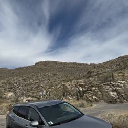
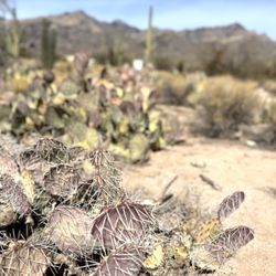
Mount Lemmon and the Catalina Highway, AZ. Early Dec, 2025. Mount Lemmon, the highest peak…read more(9,175') in the Santa Catalina Mountains near Tucson, is managed by the U.S. Department of Agriculture, Forest Service as part of the Coronado National Forest. (Fun Fact: Mt. Lemmon is named after Sara Plummer Lemmon, an amateur botanist and the first white woman to climb to the summit in 1881. It is one of the few peaks in the U.S. named after a woman).
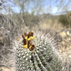
Our objective was to drive the Catalina Highway Scenic Drive (27 miles) to the Mount Lemmon summit. This is the only paved road that leads to the upper reaches of the Santa Catalina Range, and is one of the most scenic highways in the southwest. Because the road starts in the lower Sonoran vegetative life zone and climbs to high forests, it offers the biological equivalent of driving from the deserts of Mexico to the forests of Canada in only 27 miles. Before proceeding on the drive, we downloaded a free app entitled "Mt. Lemmon Science Tour" by the University of Arizona, which provided excellent commentary on the Sky islands, rocks, life zones, water, forest, and fire, that was well-synced with our drive up the mountain as it evolved.
This is a windy, slow drive with the posted speed limit of 35 MPH or less on most sections. Plus, you're sharing the road with bicyclists riding in both directions. The road is paved, and is well-designed with frequent pull-offs and stops that allow for vista views or just to take a rest.
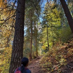
A few of our favorite and recommended stops include: *Babad Do'ag for its excellent vistas of the desert environment and saguaros. *Gordon Hirabayashi Campground (and Historical Recreation Area). I've reviewed this separately on Yelp. *The Palisades Visitor Center, with family-friendly exhibits, brochures and general information, and a small gift shop. *Windy Point Vista, for sweeping views. *High-elevation picnic areas at Box Elder, Alder, Loma Linda, or Inspiration Rock. *Mt. Lemmon Ski Valley, where there is a restaurant and ski lift rides ($). We were disappointed that the entrance road to Rose Canyon Lake was closed on the day that we visited.
This is a Forest Service fee area. A day-use pass is $8 per vehicle, and can be purchased on-line or at the Palisades Visitors Center on-route. We didn't have time to hike on the day that we visited but there are miles and miles of trails of varying length and difficulty. While there are restrooms with pit toilets at multiple sites, but there is no potable water nor service stations.
I've posted a handout about the area that I picked up at the Visitors Center. Only Spanish-language brochures were available.