Androscoggin Riverlands State Park Photos


You might also consider
More like Androscoggin Riverlands State Park
Recommended Reviews - Androscoggin Riverlands State Park
Start your review...

10 years ago
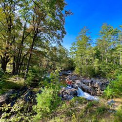
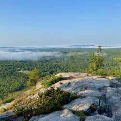
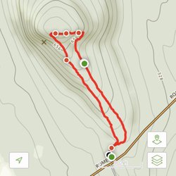
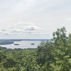
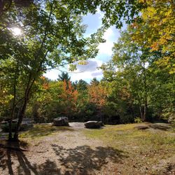
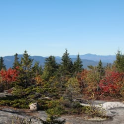
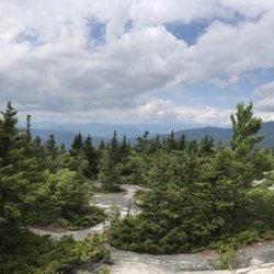
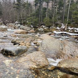
Maine Trip #1 "Something will have gone out of us as a people if we ever let the remaining wilderness be destroyed ... We simply need that wild country available to us, even if we never do more than drive to its edge and look in." ― Wallace Stegner, The Sound of Mountain Water Androscoggin Riverlands State Park (ARSP) first came to my attention while in Maine visiting my family. I had never heard of it before, and when I did some research, I found out why. ARSP opened six years ago, but hardly anyone was using this amazing park. A year ago, they put up more trail signs in order to encourage people to visit, in the hopes that they won't be so nervous about getting lost in the 2,700 acres, 12 miles of river frontage, and 22 miles of trails. History: The Androscoggin River is the 3rd largest river in Maine, and it begins in the mountains of New Hampshire. The Native Americans camped and fished for at least 9,000 years, and they gave the river its name--meaning "plenty of fish." Thanks to riverfront industries, the Androscoggin River became one of the ten most polluted rivers in the country back in the 1960s, but thankfully, the Clean Water Act in 1972 helped water quality improved tremendously. Amenities: * Toilet (outhouse--these things are probably way better than portable toilets. Open-air and wood building makes for no odor. * Large, dirt parking lot * No fee * ATV riding * Canoeing * Cross-country skiing * Fishing * Hiking (trails) * Horseback riding * Hunting (except Sundays) * Kayaking (two water landings) * Off-road biking * Picnicking * Snowmobiling * Snowshoeing * Watchable wildlife * Carry In-Carry Out * Pets welcome (on a leash at all times) * 8 old foundations show the community that existed here before 1927 I had a wonderful time hiking the Homestead Trail. It has several different terrain and lots to see. Unfortunately, I didn't know exactly how far the trail would go, so I turned around. (I now have a trail map and will post it.) At one point, I did lose cell signal so be prepared for that. Make sure you bring bug spray! I didn't see a single soul while I was on my hike, which is wonderful for me. I love the solitude and the "wilderness" at ARSP. I think you will too. read more


More info about Androscoggin Riverlands State Park


Androscoggin Riverlands State Park - hiking - Updated July 2026
Best of Turner
People found Androscoggin Riverlands State Park by searching for…
People who viewed Androscoggin Riverlands State Park also viewed
Vaughan Woods
12 reviews
Bri-Mar Trail
1 review
Vassalboro Town Forest Trail
1 review
Shepard’s Farm Family Preserve
1 review
Papermill Trail
2 reviews
David Rancourt River Preserve
1 review
Annie Sturgis Sanctuary
1 review
Jones-Bonney Turner Village Park
1 review
Range Ponds State Park
12 reviews
Hacker's Hill Preserve
1 review