Cancel

    Open app

    Search

    柏架山道

    Mount Parker Road

    5.0 (2 reviews)
    Open Open 24 hours

    柏架山道 Photos

    Recommended Reviews - 柏架山道

    Your trust is our priority, so businesses can't pay to alter or remove their reviews. Learn more about reviews.
    Yelp app icon
    Browse more easily on the app
    Review Feed Illustration
    Photo of Ace C.
    74
    26
    8

    8 years ago

    Helpful 1
    Thanks 0
    Love this 1
    Oh no 0

    柏架山道 Reviews in Other Languages

    Verify this business for free

    Get access to customer & competitor insights.

    Verify this business

    大潭篤水塘

    大潭篤水塘

    4.9(7 reviews)
    3.0 kmStanley, Hong Kong Island

    I always say that one of the most amazing things of Hong Kong is the fact that, in 10 minutes cab…read moreride, you are in the middle of nature. How many cities can say that? And how cool is that? In most other big cities, you may need to get on a train, pay a high fare and travel for a couple of hours. It also means you need to plan. That's not the case in Hong Kong and whether you are a hiker or not, you can still enjoy beautiful landscapes and retreat for a few hours. Feeling like an easy Sunday hike? One of your options is Tai Tam Tuk Reservoirs, located at the Tai Tam Country Park, in the East side of Hong Kong Island. That's what three of us did early on a Saturday morning a few weeks ago. We only walked for about an hour, contemplating the nature and chatting. It is a very easy hike, flat and signaled all the way, mostly sheltered by trees so there is plenty of shadow. We went through the main stone bridges, of similar design but different heights and dating back to the 20s. They are all English style building classified as I Grade heritage. And so is the huge dam, that you can see from afar. What impressed me more was the bright turquoise water, and the contrast with the greenery and the intense blue of the sky, which created such an inspiring view! If you are in need of a deep breath of pure air outside of the city, but not feeling like hiking up the hills, get on a cab and head to Tai Tam, you'll feel alive again.
    Tai Tam Tuk Reservoir is part of the Tai Tam group of reservoirs which were erected from the late…read more1880s into the early 1910s when Hong Kong's demand for water constantly outstripped supply. Tai Tam Tuk is the biggest one of out the group and probably the one seen by most people as they make their way to Stanley, when they pass by the precariously narrow dam road that lines one side of the reservoir. This is truly one of Hong Kong's scene of natural beauty where within 20 minutes from bustling Central you can get to somewhere that's basically been untouched since the beginning of time. One of the favourite routes to take in all this would be to take a hike from Parkview (which is at the top of the hill) and walk down past the smaller reservoirs up top and then onto this main body of water where it joins back with the main road. One of the attractive features of this route would again be the masonry of the buildings here, being built at that time it had a very heavy British influence and much like parts of Hong Kong; you would at times think whether you really are on the edge of the South China sea or somewhere Somerset. This is also a particularly popular path as the route is mainly downhill hence making it easier for families and it takes around 2 hours in total. Locals and tourists alike- I will be willing to bet my money that you won't be disappointed.

    Photos
    大潭篤水塘
    大潭篤水塘
    大潭篤水塘

    See all

    衛奕信徑第二段 - The view is worth the pain.

    衛奕信徑第二段

    5.0(1 review)
    2.2 kmTai Tam, Hong Kong Island

    My sister and I got up early one morning to walk up to Mount Butler with a friend, following Wilson…read moreTrail Stage 2. We wanted to see the sunrise from there. So when I say early I mean really early (4am!!). We had already prepared food and drinks the previous night and just needed to get dressed and hail a cab. At 4.45 we were at Parkview and facing the big brown sign. The hiking had started! It was still dark and walking in the middle of the forest at that time was a mix of excitement and a little fear. We got lost for a second and had to come back. A few minutes later we were at the peak of Jardine's Lookout, seriously amazing views and time for a quick break, pictures and a snack. On one side we could see the city, waking up. On the other side we could already gaze at Tai Tam Park. A historical fact for you about Jardine's Lookout: it's named after William Jardine a ship surgeon considered responsible for the start of the First Opium War. After that we went down for a while leaving the quarry on our left and hiking up the trail again to Mount Butler. This is when it started to pour like crazy and it didn't stop until we finished the hike, lucky us. Mount Butler is a 371 meters mountain peak, ranking 21st of the hills in Hong Kong. From there we decided it was time for breakfast and we were absolutely soaked so walked down to Quarry Bay. There is a lovely sheltered space with benches where we opened our plastic boxes and shared a few snacks. The sun was finally shining and we felt extremely happy with our adventure as we had a look at the great snaps taken from uphill.

    Photos
    衛奕信徑第二段

    See all

    寶雲道

    寶雲道

    4.0(1 review)
    4.6 kmThe Peak, Hong Kong Island

    Roads in Hong Kong can be pretty hairy for runners, especially with the F1 style taxi and minibus…read moredriving. If you are into your fitness, you would be wise to go to the Bowen Road Fitness Trail. It's a 4km long "running" track, and I mean that in the most basic a sense, i.e. it's a strip of pavement, which is partially closed off to traffic. Technically, cars are allowed on a lot of it, but these are obviously servicing the 2-3 houses down there, so seeing cars is pretty rare. The running track is nice and flat, and offers great views across HK island. It's actually quite amazing how far along you go. Even though it's only 4km, you pretty much go from Central though to Happy Valley. The views looking out to the Hopewell Centre as you pass Wan Chai are particularly striking at night. The track "officially" starts (or ends) at the junction of Magazine Gap Road and Bowen Road,and goes all the way through to Stubbs Road, where the HK Adventist Hospital is. Along the track are a few drop out areas with fitness equipment, like pull up bars and the like. There are also a couple of public toilets on the way. Despite being a city trail, it is surprisingly country-like. There is plenty of flora and fauna to see. I have heard of reports of snakes, but the only thing that has bitten me is the blasted mozzies - grrrr! At night, there are patches which are poorly lit, so it can get a bit freaky - especially when you see the trees rustling! Don't be worried, like most of HK it is very safe. You won't get hoodies here shanking you for your Nokia. If you do get scared, just run a bit faster to the next lit patch.

    Photos
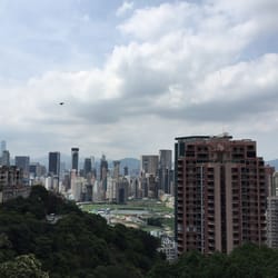
    寶雲道 - View of the Happy Valley Racecourse from Bowen.

    View of the Happy Valley Racecourse from Bowen.

    寶雲道
    寶雲道

    See all

    柏架山道 - hiking - Updated August 2026

    Loading...
    Loading...
    Loading...