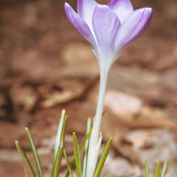
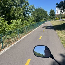
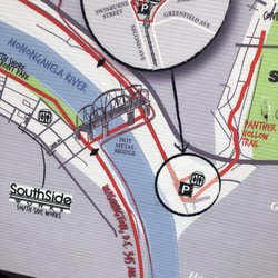
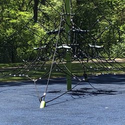
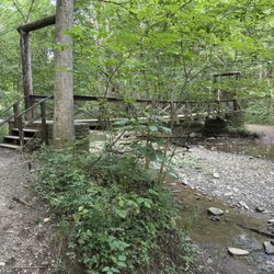
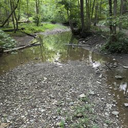
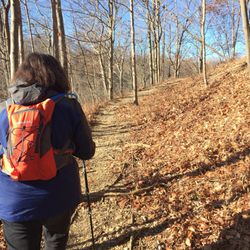
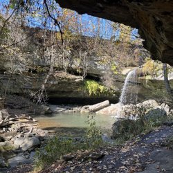
Young River Trail Photos


More like Young River Trail
Recommended Reviews - Young River Trail
Start your review...

7 months ago
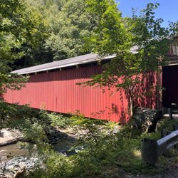
Great place to go hiking or biking there is parking. You will get nice views of the river and the bridges would recommend. read more


More info about Young River Trail
McKeesport, PA 15132
Directions
Hours
Outdoor Amenities


Young River Trail - hiking - Updated July 2026
Best of McKeesport
People found Young River Trail by searching for…
Things to Do in McKeesport, PA
Walking Trails in McKeesport, PA
Beautiful Views in McKeesport, PA
Running Trails in McKeesport, PA
Off Leash Dog Hikes in McKeesport, PA
Places to Take Pictures in McKeesport, PA
Fishing Spots in McKeesport, PA
Places to Visit in McKeesport, PA
Public Swimming Pools in McKeesport, PA
River Swimming in McKeesport, PA
Picnic Areas in McKeesport, PA
Dog Friendly Beaches in McKeesport, PA
Things to Do at Night in McKeesport, PA
Places to Walk in McKeesport, PA
Trending Searches in McKeesport, PA
Black Owned Nail Salons near Young River Trail
Boat Rental near Young River Trail
Cliff Jumping near Young River Trail
Day Trips near Young River Trail
Dog Friendly Trails near Young River Trail
Jet Ski Rental near Young River Trail
Kayak Rental near Young River Trail
Lakes & Ponds near Young River Trail
Off Road Trails near Young River Trail
Outdoor Activities near Young River Trail
Picnic Spots near Young River Trail
Places To Swim near Young River Trail
Pool Day Pass near Young River Trail
Public Pools near Young River Trail
Public Shower near Young River Trail
River Swimming near Young River Trail
River Tubing near Young River Trail
Rock Quarry near Young River Trail
Running Trails near Young River Trail
Scenic Night View near Young River Trail
Scenic Overlook near Young River Trail
Soccer Store near Young River Trail
Splash Pad near Young River Trail
Sunrise View near Young River Trail
Swimming Holes near Young River Trail
Swimming Lakes near Young River Trail
Watch Sunset near Young River Trail
Browse Articles
Browse Nearby
BEST of McKeesport, Pennsylvania Restaurants near Young River Trail
BEST of McKeesport, Pennsylvania Things to Do near Young River Trail
BEST of McKeesport, Pennsylvania Coffee near Young River Trail
BEST of McKeesport, Pennsylvania Parks near Young River Trail
BEST of McKeesport, Pennsylvania Breakfast near Young River Trail
BEST of McKeesport, Pennsylvania Lakes near Young River Trail
BEST of McKeesport, Pennsylvania Taxis near Young River Trail
Browse Brands
Related Searches in McKeesport, PA
Affordable Kayak Rental Services in McKeesport, Pennsylvania
Best Fishing Locations and Guides in McKeesport, Pennsylvania
Best Places for Horseback Riding in McKeesport, Pennsylvania
Best Sledding Spots and Fun in McKeesport, Pennsylvania
Best Spots for Star Gazing in McKeesport, Pennsylvania
Check Out Off Road Trails in McKeesport, Pennsylvania
Discover Dog Friendly Trails to Explore in McKeesport, Pennsylvania
Discover Popular Photo Spots in McKeesport, Pennsylvania
Discover Scenic Mountain Bike Trails Near McKeesport, Pennsylvania
Discover a Hiking Trail in McKeesport, Pennsylvania
Discover the Best Night Hike Trails in McKeesport, Pennsylvania
Discover the Best Running Track in McKeesport, Pennsylvania
Dog-Friendly Hikes With Dogs in McKeesport, Pennsylvania
Enjoy Camping Adventures Around McKeesport, Pennsylvania
Enjoy River Tubing Adventures in McKeesport, Pennsylvania
Enjoy Scenic Night View Experiences in McKeesport, Pennsylvania
Enjoy Tent Camping Spots Around McKeesport, Pennsylvania
Enjoy the Best Tubing Experiences in McKeesport, Pennsylvania
Enjoy the Best Walking Trails in McKeesport, Pennsylvania
Exciting Cliff Jumping Spots in McKeesport, Pennsylvania
Explore Beautiful Parks and Green Spaces in McKeesport, Pennsylvania
Explore Bike Rentals Throughout McKeesport, Pennsylvania
Explore Easy Hikes Perfect for All in McKeesport, Pennsylvania
Explore Free Things to Do Around McKeesport, Pennsylvania
Explore Fun Activities to Do in McKeesport, Pennsylvania
Explore Popular Campgrounds Near McKeesport, Pennsylvania
Explore Scenic Lakes to Visit in McKeesport, Pennsylvania
Explore Top Dog Parks in McKeesport, Pennsylvania Near You
Explore Top Water Parks in McKeesport, Pennsylvania Today
Explore the Best Beach Spots in McKeesport, Pennsylvania
Explore the Best Boating Spots in McKeesport, Pennsylvania
Explore the Best Swimming Holes Around McKeesport, Pennsylvania
Family Friendly Hiking With Kids in McKeesport, Pennsylvania
Find Beautiful Views in McKeesport, Pennsylvania
Find Fun Kids Activities Outdoor in McKeesport, Pennsylvania
Find Parks and Recreation Activities in McKeesport, Pennsylvania
Find Top Dog Swimming Spots in McKeesport, Pennsylvania
Find the Best Parks for Picnics in McKeesport, Pennsylvania
Find the Best Playgrounds to Visit in McKeesport, Pennsylvania
Hiking Trails With Waterfalls in McKeesport, Pennsylvania
Off Leash Dog Hiking Trails in McKeesport, Pennsylvania
Perfect Spots to Watch Sunset in McKeesport, Pennsylvania
Popular Fishing Spots to Explore in McKeesport, Pennsylvania
Popular Picnic Spots to Visit in McKeesport, Pennsylvania
Popular Things to Do in McKeesport, Pennsylvania
Top Climbing Spots and Gyms in McKeesport, Pennsylvania
Top Paddleboarding Activities in McKeesport, Pennsylvania
Top Running Trails to Explore in McKeesport, Pennsylvania