Cancel

Open app

Search

Yellow Creek State Park

3.2 (5 reviews)

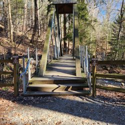
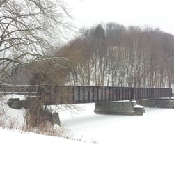
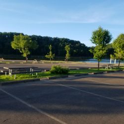
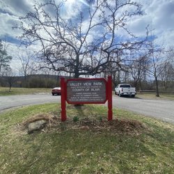
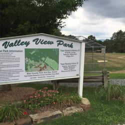
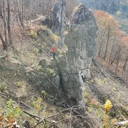
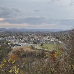
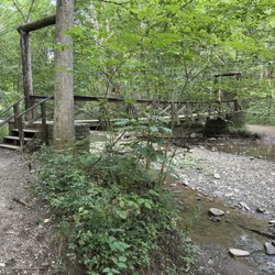
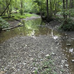
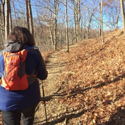
Yellow Creek State Park Photos

More like Yellow Creek State Park

Recommended Reviews - Yellow Creek State Park

Your trust is our priority, so businesses can't pay to alter or remove their reviews. Learn more about reviews.
Yelp app icon
Browse more easily on the app
Review Feed Illustration
Photo of Joshua R.
633
57
30

5 years ago

Helpful 1
Thanks 0
Love this 0
Oh no 0

5 years ago

Helpful 1
Thanks 0
Love this 0
Oh no 0

9 years ago

Helpful 0
Thanks 0
Love this 0
Oh no 0

8 years ago

Helpful 1
Thanks 0
Love this 0
Oh no 0

9 years ago

Helpful 0
Thanks 0
Love this 0
Oh no 0

Verify this business for free

Get access to customer & competitor insights.

Verify this business

Stackhouse Park - Took a mt bike ride through the park

Stackhouse Park

4.3(3 reviews)
17.6 mi

Great place to go for a walk or hike in the local area! I didn't know about this park until I saw…read moreit on the Johnstown bucketlist. We started at the main trailhead on Luzerne Street, next to the Westmont Municipal Building. "Luzerne" is the main trail and is a relatively easy hike, but keep in mind if you start at this trailhead it is mostly downhill, so be prepared for an uphill trek on your way back! They have maps and info at the entrance, helpful if you're unfamiliar with the area. We saw a ton of deer on our walk (end of May), and there were plenty of options to veer off onto different trails. There were also several pavilions we encountered which would have been nice for picnicking (however are currently closed due to COVID). We'll be back next season!

Stackhouse park is a beautiful 277 acre expansion of pure nature. It has over 7 miles of biking and…read morehiking trails. And filled with fun events year round. I am blessed because the park begins in my backyard so i have the pleasure of enjoying it everyday! Daily you can see hundreds of people enjoying the trails by foot or by bike. And also a fantastic place to walk your pooch if you have one. They have a long flowing peaceful creek that runs down the center with several bridge crossings for easy access. Many events take place year round. One Of my faves is called Shakespeare in the park.in which a talented acting group performs one of Willie's famous plays. Take a blanket and a bottle of wine and it makes for the perfect adult evening. They also have many public picnics with barbecues and bands which is fun for the whole family. The winter is no stranger to fun in the park as it is great for sled riding or toboggans!!!! A great natural monument for the city of Johnstown!!

Photos
Stackhouse Park - Park Map

Park Map

Stackhouse Park - Park Entrance

Park Entrance

Stackhouse Park - Beautiful spring popping out

See all

Beautiful spring popping out

Laurel Highlands Hiking Trail - Rte. 271 trailhead during 2017 LHHT Ultra marathon.

Laurel Highlands Hiking Trail

4.7(3 reviews)
10.5 mi

I spent 3.5 days and 3 nights on this trail this past memorial day weekend, my first venture back…read moreinto the backpacking world. This trail begins in Ohiopyle or Johnstown and ends whichever way you choose. If I were to try to pack the entire length I would start at the North end in Johnstown and hike South, to ease up the ankle pain and knee pain :) That comes with packing 20lbs + pack weight and hiking 18-19 miles in one day. Throw in the elevation gain and you will see what I mean. I hiked the South end starting in Ohiopyle and going out to about 26 miles over my time there, then I turned around and came back over two days. Things to note for overnight campers: You can call ranger station at trailhead to make your camping reservation, by credit card it is 4$ a night. Water: there is non drinking water at each campsite, bring a water filter or boil that water as it is not tested. I filtered stream water the whole time and it was fine. Ohiopyle about 6 miles in has the nicest camping ground with access to a large stream, but not all the sites have that. You might want to filter water for night hiking into camp. To save hiking a mile extra back out to get some as I had to do. Firewood, there are fire pits in the shelters if you want to skip the tent but bring something to lock your food up, mice are common in the shelters. I slept in a tent kept my back in the tent with me. There are portapotty type johns at the campsites. Weather: if you check local forecast plan on temps on the trail and at camp at night being around 10 degrees colder because of the elevation change, and storms. Bring rain gear if you're out for more than a day hike! Now for the trail, it is blazed yellow on the trees hard to get lost but a map would have been nice to have. However no maps available in Ohiopyle you have to pay for one at the Laurel State Park office. I did not do that would rather buy a hiking book with the trail in it at a later time. In most places its wide very rocky, lot of tree roots its murder on the soles of your feet, wear boots or stiff soled shoes if hiking for more than one day. Poles could come in handy, I don't use hiking poles but I got caught in little thunderstorm and had to grab a forest walking stick. Some places it looked like they barely blazed a trail at all it was very narrow hard to hike on. Hike with caution. Beautiful river runs stream runs, skyline views, and rock formations. In the first 26 miles views are at mile 6 ish and 24ish, rocks b between 15-20. Lots of birds, and small wildlife I only saw one deer. There is a shooting range at mile 25, just outside the park you will hear lots of gunshots. I would not recommend taking a break or relax day at the Grindle ridge campground out there as I did. Also the campgrounds that have broken water pumps currently are Grindle Ridge and Route 653 shelters campground. This is a lovely hiking trail but steep, be prepared for a challenge in the beginning. Happy Trails!

How can you not LOVE the LHHT? Its a trail I've frequented quite often in the last 15 years, and…read morehope to explore the entire 70 miles. This picture was taken during the Laurel Highlands Ultra race in June 2017. This race can be run as a relay or individually. They also sponsor a 50k race, which is approx. 30 of the 70 miles. There are many trail heads and shelter areas. The trail is great for day hikes, as well as multiple overnight stays. There are also many ambitious people who hike the entire thing. Its always fun to pass fellow hikers on the trail. Trail stories are always fun to hear, and there are people from all over that you'll meet. Running the trail is quite a challenge, as there's drastic elevation changes at some points and many technical areas. I suggest if you've never run the trail, and expect to run the race, you must do at least 1-2 runs on the trail.

Photos
Laurel Highlands Hiking Trail - Rte. 271 trailhead during LHHT Ultra marathon 2017

Rte. 271 trailhead during LHHT Ultra marathon 2017

Laurel Highlands Hiking Trail - Finish for 2017 LHHT Ultra Marathon, Rte. 56, Seward, PA

Finish for 2017 LHHT Ultra Marathon, Rte. 56, Seward, PA

Laurel Highlands Hiking Trail

See all

Yellow Creek State Park - hiking - Updated May 2026

Loading...
Loading...
Loading...