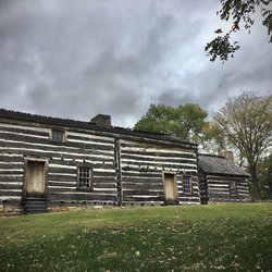
Weldon Spring Conservation Area Photos


You might also consider

More like Weldon Spring Conservation Area
Recommended Reviews - Weldon Spring Conservation Area
Start your review...


Reviews With Photos


This is my second time hiking here. The hike was enjoyable. When we went here, it was right after the rain so the trail itself was muddy. However, I still enjoyed this hike a lot. Parking is plenty in the trail gravel parking area. Phone reception here was not great though. I took a picture of a map I assume someone post at the board near the entrance of the hike. This hike is moderately intense so be prepared by bringing plenty of water.


Took the family to the sun flower fields to get some pictures and took in all the beautiful scenery. Love that there are easy to navigate signs when you drive into park on how to locate the sun flowers fields. Also a huge plus that it's a very short drive down the road to fields compared to other local seasonal sun flower fields that can have you driving down multiple long gravels roads before getting there. Be prepared to be around bees but you have to remember they are there for the flowers and will leave you alone if you leave them alone!


There are 2 main trails here: Lewis and Clark. Lewis Trail is 8.2 miles and is my favorite this far. More secluded, deep into the forest with nature connections were happening. Beautiful views of the Missouri River from high bluffs. Fairytale forest trees and woodland creature rustling about the leaves. This trail is less traveled so be prepared to knock down and/or have to fight your way through some massive spider web work. The Clark Trail is 5.3 miles and has some decent inclines and beautiful viewpoints too. There are benches/rest points along this trail. A couple of steep inclines to beware of if you're mobility challenged or other health issues. However, I've seen plenty of golden agers out with their canes and walking sticks, making it happen. You'll get a proper workout on either trail. I did the Clark trail in 1 hour 10min with a brisk walk, sprinkled with a prance here and there. Lewis Trail - done in 2hrs 6min with a walk/jog combo. No bicycles are allowed on this trail, which I love. The Yelp address on this listing will NOT take you to these trails. Enter Weldon Spring Lewis and Clark trail in your Apple map, and it'll lead you in the right direction. It's such a beautiful, peaceful slice of nature.


Was in the Weldon Spring Conservation Area working a military dental event. The space was peaceful, it was clean & people clearly have respect for the grounds!


Great walking / biking trails lined with wildflowers. A beautiful place to take a walk in Weldon Spring. There is a lake and spot to stop for a break at a table overlooking the lake. This connects to the Busch Greenway network and the Katy Trail.


I really enjoyed hiking here. There are two trails to choose from. I chose the Clark Trail which is a little over 5 miles. The Lewis Trail is a little over 8 miles. The trail is well marked and well traveled. The first leg of the trail is relatively easy. This section takes you to the first overlook of the Missouri River; a very scenic spot. The rest of the trail has multiple sections of steeper uphill journeys with some rocks and roots to deal with. I would consider these areas moderately difficult. This is definitely one of the best trails in St. Charles County.


4 months ago

1 year ago
(AUGUST 2025) I'd never seen the sunflower fields that my friends post about with their children and families until recently. It almost seemed unbelievable some of the imagery stemming from these 7,000 acres of natural beauty and outdoor recreation in the heart of scenic Missouri wine county. Once you are off highway 40, it's 50-55mph WINE-dy back roads to get there. Once you get into the turn in, it's a graveled road with a trailhead to the Katy Trail. Do not even think about having a clean car upon entering this place. It will get dirty and dusty. There are also (surprisingly) random humans running in the middle of the narrow driveway leading up to the sunflower field and ending at a boat ramp. I never understood why people never stick to one side of the road while on foot amongst VEHICLES. I find my friend and we exit our vehicles to begin our mini photoshoot in the sunflower fields. I felt like Candy(wo)man as the bees tended to the sunflowers while I freaked out thinking they'd sting me with my bright yellow shirt on and black skirt. It was so blissful to see sooo many beautiful BIG butterflies fly around us. The caterpillars were on like every leaf just hanging out like the Caterpillar from Alice in Wonderland. It was nature at its finest. Sunflowers for as far as the eye can see. The sounds of bees (and flies) buzzing about. I tried to relax, and we got a few non-frantic pictures of me. I will wear pants next time and try to relax more. I was invading THEIR space, not the opposite. read more


4 years ago
4/23/23: Updated this page to accurately reflect the reviews and location. WSCA is a Missouri Department of Conservation property left largely in a natural state. Consisting of two interlocking trails, the Lewis and Clark trails can be hiked separately for shorter walks or combined for an 8-mile trek. The trails are moderately strenuous, so good health and physical conditioning are recommended. Both trails descend into deep ravines and ascend to high ridges. Rocks, roots, and ruts make some sections treacherous. If you walk the Clark Trail counter clockwise you'll reach the high bluffs overlooking the Missouri River about 1-1/2 miles--or 30-40 minutes in. It's quite a view and worth the trek. read more


This is my second time hiking here. The hike was enjoyable. When we went here, it was right after the rain so the trail itself was muddy. However, I still enjoyed this hike a lot. Parking is plenty in the trail gravel parking area. Phone reception here was not great though. I took a picture of a map I assume someone post at the board near the entrance of the hike. This hike is moderately intense so be prepared by bringing plenty of water. read more


Took the family to the sun flower fields to get some pictures and took in all the beautiful scenery. Love that there are easy to navigate signs when you drive into park on how to locate the sun flowers fields. Also a huge plus that it's a very short drive down the road to fields compared to other local seasonal sun flower fields that can have you driving down multiple long gravels roads before getting there. Be prepared to be around bees but you have to remember they are there for the flowers and will leave you alone if you leave them alone! read more

There are 2 main trails here: Lewis and Clark. Lewis Trail is 8.2 miles and is my favorite this far. More secluded, deep into the forest with nature connections were happening. Beautiful views of the Missouri River from high bluffs. Fairytale forest trees and woodland creature rustling about the leaves. This trail is less traveled so be prepared to knock down and/or have to fight your way through some massive spider web work. The Clark Trail is 5.3 miles and has some decent inclines and beautiful viewpoints too. There are benches/rest points along this trail. A couple of steep inclines to beware of if you're mobility challenged or other health issues. However, I've seen plenty of golden agers out with their canes and walking sticks, making it happen. You'll get a proper workout on either trail. I did the Clark trail in 1 hour 10min with a brisk walk, sprinkled with a prance here and there. Lewis Trail - done in 2hrs 6min with a walk/jog combo. No bicycles are allowed on this trail, which I love. The Yelp address on this listing will NOT take you to these trails. Enter Weldon Spring Lewis and Clark trail in your Apple map, and it'll lead you in the right direction. It's such a beautiful, peaceful slice of nature. read more


Great walking / biking trails lined with wildflowers. A beautiful place to take a walk in Weldon Spring. There is a lake and spot to stop for a break at a table overlooking the lake. This connects to the Busch Greenway network and the Katy Trail. read more

I really enjoyed hiking here. There are two trails to choose from. I chose the Clark Trail which is a little over 5 miles. The Lewis Trail is a little over 8 miles. The trail is well marked and well traveled. The first leg of the trail is relatively easy. This section takes you to the first overlook of the Missouri River; a very scenic spot. The rest of the trail has multiple sections of steeper uphill journeys with some rocks and roots to deal with. I would consider these areas moderately difficult. This is definitely one of the best trails in St. Charles County. read more


3 years ago


8 years ago


Great trail system right across the river from the Chesterfield Valley. Good trails for every skill level even nice long ones like the Lewis trail. Great scenic overlooks of the Missouri river from the bluffs. Plenty of deer and wildlife to view and fairly well marked trails. We will be back to hike these in the spring and fall as well. read more


11 years ago
More info about Weldon Spring Conservation Area
6990 S Highway 94
St. Charles, MO 63304
Directions
(636) 441-4554
Call Now
Hours
Outdoor Amenities