1. Virginia Creeper Trail

0

Damascus, VA

Cancel

Open app

Search

Virginia Creeper Trail

5.0 (1 review)
Open • 8:00 am - 6:00 pm

Virginia Creeper Trail Photos

Recommended Reviews - Virginia Creeper Trail

Your trust is our priority, so businesses can't pay to alter or remove their reviews. Learn more about reviews.
Yelp app icon
Browse more easily on the app
Review Feed Illustration

1 month ago

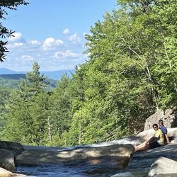
There are lots of beautiful vistas on this awesome trail. I cannot wait to experience the trail again.

Helpful 0
Thanks 0
Love this 0
Oh no 0

Verify this business for free

People searched for Hiking 130 times last month within 15 miles of this business.

Verify this business

Devil's Bathtub & Waterfall - Safety rope is handy for sure-footedness. All hikers, young & old, were using it.

Devil's Bathtub & Waterfall

4.8(9 reviews)
49.6 mi

Please, more than anything, allow yourself an appropriate amount of time to enjoy the beauty of…read morethis area and the wonderful hike. I chose this location as a surprise for my date to celebrate her birthday and we couldn't have been happier with our trip. Being in December it was almost a necessity to have perfect weather and we did. The trail is moderately difficult but the 10 crossings of the brook definitely challenge a novice hiker. We had 50 degrees and the sunshine highlighted the scenery beautifully. The serenity cant even begin to be described; maybe its the area, maybe its the time of year, but we didn't hear a bird or see so much as a squirrel until the last 30 minutes of the trip. The good part of going in December was not having to worry about snakes (see other reviews) however the one person we saw during our 5 hours of hiking says the water is cold even in summer so enjoying a dip in December was out of the question. Highly recommend bringing a walking stick to help balance crossing the water and MUST HAVE waterproof boots that go over your ankles, I recommend a minimum of 6" waterproof hikers but 8" or more if you go when there has been rain.

Great Hike. We had lots of run on this trail and reaching the Devils Bathtub…read moreTake the plunge and jump in it play in the water.

Photos
Devil's Bathtub & Waterfall - This is the lower bathtub. The main waterfall most seen in photos is just mere minutes beyond this.

This is the lower bathtub. The main waterfall most seen in photos is just mere minutes beyond this.

Devil's Bathtub & Waterfall - Many beautiful spots along the way.

Many beautiful spots along the way.

Devil's Bathtub & Waterfall - The Devils Bathtub

See all

The Devils Bathtub

Virginia Creeper Trail

Virginia Creeper Trail

4.8(45 reviews)
11.7 mi

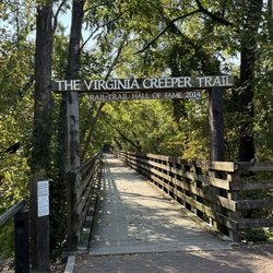
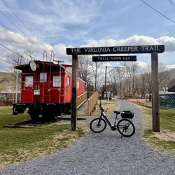
April, 2025. We visited Abington, Virginia quite a few years ago. After discovering the Virginia…read moreCreeper Trail at that time, we promised that we'd return "someday" to bike at least part of the trail. This trail is a nationally-acclaimed Rails-to-Trails that extends for 34 miles and over 47 trestle bridges. While best known as a biking trail, it's actually a multi-use trail with bikers, walkers, stroller pushers, runners, equestrians, and more, especially near the access points. In the past, the trail started near Whitetop, went about 18 miles to the center point near Damascus, and ended in the charming town of Abingdon (or vice versa). Unfortunately, Damascus was hard hit by Hurricane Helene, and 18 trestle bridges were destroyed as well as many portions of the trail so the Whitetop to Damascus portion of the trail is currently closed. The 18-mile stretch from Damascus to Abington IS open. While there are bike rental companies, as well as shuttle services to take you to the trail's start, we brought our own bikes. We decided to ride the 8.5 mile segment from Abingdon (elevation: 2,020' to Alvarado Station (the old train stop at 1,750') and back. This "lower" section is considered a relatively easy to moderate stretch through rolling farmland and forests and over beautiful trestle bridges. As mentioned, our turning point was Alvarado Station, where we enjoyed our picnic lunch on a bench river-side. The stop also had drinks and snacks available for sale, a water refill station, restrooms, and a big, friendly dog eyeing our lunches! The trail is wide in most areas, and is very well-maintained. There are multiple access points with parking lots, information kiosks, regular mileage markers, benches, photo ops, and some restrooms. In a relatively recent development, e-bikes are now allowed on the trail. With its restaurants, breweries, shops, local theater, and more, make some extra time to visit Abingdon!


Love riding the Virginia Creeper Trail. Most people ride it from Whitetop Mountain down to…read moreDamascus, but it's just as enjoyable riding the section from Abingdon to Damascus, and back. Both routes offer beautiful scenery and make for a great ride. ‍

Photos
Virginia Creeper Trail - Wildflowers

Wildflowers

Virginia Creeper Trail

See all

Elk Knob State Park - Hiking trail

Elk Knob State Park

4.4(10 reviews)
21.1 mi

What a little gem! This is a great day trip if you live in Charlotte and want to experience some…read morecooler temperatures. There is ample parking, and the main trail (Summit Trail) is very do-able. We saw plenty of seniors, small dogs, and children making this hike. There is an overlook only a mile in, and it's pretty impressive. You could stop and turn around there, and not be disappointed. The top overlook is gorgeous too and is only 1.9 miles to the top. The majority of the path is gravel, but there are some larger step stone rocks. The trail is not wheelchair friendly. There are picnic tables and restrooms in the park, and they even have a visitor center with gift shop. This was a popular trail with lots of App State students, and it was clean. They have other, shorter trails but the Summit trail was the main attraction.

DO NOT VISIT THIS PARK IN A RV or LARGE VEHICLE! We came from Boone which from our Google map said…read more23 minutes or 5 miles. The road to park is very steep in sections and has two (2) hairpin turns not designed for large heavy vehicles. When we got to the state park, at what felt like the top of the mountain, the only thing we saw were a dozen or so new picnic tables surrounded by a field of leafless trees ~ mid April. Very disappointed to say the least. IMPORTANT: On the way back down to Boone our brakes started to fail at about an .08 of the way down and we had the pull over and let them cool down for 45 minutes to let them stop smoking. This was a very scary experience and a poor decision to visit. Absolutely would not recommend this experience in any car or in an RV!!! Hope this helps someone.

Photos
Elk Knob State Park - Outdoor art

Outdoor art

Elk Knob State Park
Elk Knob State Park

See all

Julian Price Lake Park - Instagram: @telephonesmoothie

Julian Price Lake Park

4.7(24 reviews)
33.7 mi

This is one of the few if not the only lake on the blue ridge parkway! If I'm not mistaken the…read morelinville area is the only other water area. We stayed several weeks back during a holiday weekend (towards the end) all camp spots on the app were booked or closed due to dead trees and storms. We drove in and found a spot on the water side.. I'm impressed with these camping areas friendly folks and quiet!!!! Unbelievably quiet! Than once I realized you can walk around the WHOLE lake!! How cool is that! Just an awesome place! And we live here!!! I've drove by. I've drove through. I've dropped the kids for events here. But I've never experienced the park myself! I'm now hooked! You can be there and not really understand that there quite possibly is 1000's of people around you.. not really noticeable.. pretty awesome.. there's places to go and not far from you where there will be nobody! It's quite amazing!! I like to feel alone and this place works!!! Campsites are perfectly private and spaced as such! Love this place!

On our way to the top for leaf peeping, we stopped here for a bit and enjoyed the scenery. Located…read moreat milepost 297 of the Blue Ridge Parkway, the part encompasses over 4200 acres of rolling mountainous terrain that include campgrounds, hiking trails, picnic sites and Price Lake. The highlight is the Tanawha Trail that runs 13.5 miles and includes Grandfather Mountain. There are canoes available for rental and the lake is stocked with fish. This time of year with the leaves turning, it was a beautiful spot and we enjoyed our time here. Five stars. [Review 15917 overall - 3132 in North Carolina - 1422 of 2021.]

Photos
Julian Price Lake Park - A throwback to October 2016 in the park near Boone NC

A throwback to October 2016 in the park near Boone NC

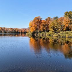
Julian Price Lake Park - Tranquil Lake - Good place to relax.- Fall is beautiful

Tranquil Lake - Good place to relax.- Fall is beautiful

Julian Price Lake Park - Creek

See all

Creek

Upper Creek Falls

Upper Creek Falls

5.0(3 reviews)
46.6 mi

Loved it!! Beautiful falls and swim hole. I can't wait to be back. Water shoes for when you get…read moredown to the water hole are recommended. It's a nice hike with lots of roots in the way so you need to be careful. But definitely worth it!

It is my absolute pleasure to introduce UPPER CREEK FALLS to Yelp!…read more If you are a hiker and lover of waterfalls, then you just might want to spend an entire weekend in the Newland, NC area. The mountains surrounding this area are a treasure trove of sights and sound for your soul to behold. Amongst them is the highly popular Upper Creek Falls. Now let me be honest, you're gonna burn some calories on this trail so don't let the short 1.5 miles round trip distance fool you! There is SIGNIFICANT elevation gain that will surely bring a little heavy breathing to your lips and sweat to your brow. However, the payoff is tremendous. **** The creek consists of multiple waterfalls, cascades and swimming holes, but the largest waterfall requires venturing to one of the lowest points on the trail to fully view. It will require detouring off the main yellow blazed trail and mountain-goating it down a steep side trail, then back up to the main trail before continuing the loop back to the parking area. According to ALLTRAILS, the loop starts at an elevation of around 3,215 feet and drops as low as 2,790 feet for a gain of approx. 425 feet in 3/4's of a mile. My personal trail tracker logged 436 feet of gain. The lowest point of the trail leads to a wonderfully exposed area of stone that almost acts as a raceway for the creek. The topography is such that you can walk on an island of stone that splits the creek in two for a short distant before rejoining and continuing its descent. I can only imagine how many more waterfalls are below this point as the creek continues its slide down the mountain another 460 feet over the following mile according to topography maps. *** FEATURES 1) There are two trailheads, but each links to the other. The trailhead on the left side of the parking area behind the information board leads first to the top of the main waterfall before crossing the creek and descending towards the base. You can get some terrifying pics on the dry stone near the crest, but don't drift too close to the edge! 2) Once you cross the creek, look to the left to spot a faint trail leading back up the mountain. Follow it and you will be rewarded with a gorgeous 15 foot waterfall. Here locals us the fall as a slide, complete with a rope to help you get back up to the top of this ultra-smooth cascade. 3) There is a fairly deep pool of water here and opposite of the climbing rope is a tire swing to launch into the pool. 4) Continue down the trail until you see side trails leading to the base of the largest waterfall. WARNING: The side trail is steep, but worth it to view the larger fall in its entirety. 5) As you continue down the trail it will once again cross the creek. This crossing is most likely tricky in high water and probably not advisable. It was only at average flow when I visited and I still got my feet wet doing my best jump. It is here you will discover another small pool of water and a large area to camp out on the stone outcrop. Even though this is the lowest point on the trail, it is actually an overlook of the mountains below. Very open and majestic. 6) Once across the lowest creek crossing, the trail switchbacks up the mountain OR you can find the shortcut trail that goes straight up the center! But fair warning, it's a leg burner! This portion of the loop will return to the parking lot on the opposite side of the upper creek trail. In total I logged 1.5 miles after visiting the sliding falls, main falls and lower raceway/overlook. *** FINAL THOUGHTS Upper Creek Falls in my opinion is 5+ stars despite its difficulty because of the multiple points of interest along the loop. I HIGHLY RECOMMEND this waterfall to avid hikers! While I personally would have thought it to be too much for kids and elderly... we saw SEVERAL older couples in the area above the main falls as well as a school bus load of 6 to 12-year-olds trekking along the lower falls trail well ahead of their parents. There was also a very large family of about 20 members (all age ranges) picnicking at the lower overlook, so I guess its safe to say its doable for all ages and skill levels. If you have any energy left, to the northeast are: - Grandfather Mountain - Big Lost Cove Cliffs - Harper Creek Falls - Gragg Prong Falls - Huntfish Falls And to the southwest are: - Linville Falls & Linville Caverns ENJOY! 2021 / 116

Photos
Upper Creek Falls
Upper Creek Falls
Upper Creek Falls

See all

Virginia Creeper Trail - hiking - Updated October 2026

Loading...
Loading...
Loading...