1. Veteran's Park

0

Dawsonville, GA

Cancel

Open app

Search

Veteran's Park

4.7 (3 reviews)

Veteran's Park Photos

You might also consider

Recommended Reviews - Veteran's Park

Your trust is our priority, so businesses can't pay to alter or remove their reviews. Learn more about reviews.
Yelp app icon
Browse more easily on the app
Review Feed Illustration

5 years ago

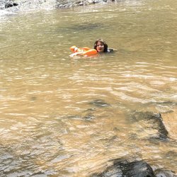
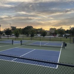
Pool, trail, volleyball, basketball, tennis, field, and senior center. Nice place! Highly recommend

Helpful 0
Thanks 0
Love this 0
Oh no 0

14 years ago

Helpful 0
Thanks 0
Love this 0
Oh no 0
Photo of T A.
0
9
0

12 years ago

Pretty good park and swimming pool. There is a little kid pool as well as a regular pool with deep end and diving board.

Helpful 0
Thanks 0
Love this 0
Oh no 0

You might also consider

Verify this business for free

People searched for Parks 388 times last month within 15 miles of this business.

Verify this business

Dawson Forest - Ram Rd

Dawson Forest

4.7(3 reviews)
6.2 mi

Want to hike in an-out-of-the-way area? Cool. Want to hike in an out-of-the-way area that also used…read moreto be a Cold War nuclear research facility that still contains relic structures of when it operated? If so, Dawson Forest is your place. Dawson Forest is a huge tract of forested land operated by the Georgia Forestry people but owned by the City of Atlanta, bisected by the Etowah River and located just southwest of Dawsonville. It's open to the public for hiking, horse riding and bicycles, although there are some calendar/time restrictions because it's also a hunting area. Get there by taking Dawson Forest Rd from Highway 9 just north of Silver City. At the time of this review, the Yelp map marker is wrong. I submitted a correction but Yelp is not very good with that. Wait, owned by the City of Atlanta? Yep. Apparently they bought the land as a possible site for a second major airport from Lockheed - which used it for the site of the Georgia Nuclear Aircraft Laboratory - but found it was unsuitable. It's been owned by the city since the early 1970's and is maintained as an experimental forest for the use of Georgians. Wait, what!? A nuclear aircraft laboratory!? Yep. The US Air Force commissioned Lockheed to explore the feasibility of powering bombers with nuclear reactors. It didn't pan out, but only after quite a bit of effort. The site contained a nuclear reactor, a hot cell test facility, support buildings and a really bizarre test facility whereby a reactor was elevated by cables between four towers to test ... well, I'm not sure what. But in the process, they managed to kill off all the wildlife in the area. It was quite an operation. You can still find numerous structures on the site including two fenced off areas that contain the hot cell facility and the reactor. I prowled around the hot cell building fence but didn't go to the reactor area. In case you're contemplating mischief, they're pretty serious about the fences. You don't want to go in there. More photos and videos are available on the GNAL Facebook page (everyone has a FB page, even derelict nuclear sites): https://www.facebook.com/Dawson-Forest-GNAL-154640534555862/ Air Force video: https://www.youtube.com/watch?v=BXd9JSJbrsU Other than the odd relic nuke structure and the ghosts of millions of murdered critters, you'll find miles of hiking trails (or horse trails, if that's your thing). The trails are accessed either from the main visitor information area (which is just a large board with the usual information set among weirdly out-of-place concrete pads and sidewalks) or from trail heads off the numerous unpaved roads that interlace the site. Most of the roads are quite passable by passenger cars, but some require high clearance and 4WD. At one point as I travelled to the northern half of the forest, I had to cross Shoal Creek. I suppose you could do it in your Honda Civic, but I put my Nissan Pathfinder into 4WD-Low to cross. One note on the roads - you can access (or egress) Dawson Forest from the north but it requires passing through a couple of miles of Georgia Wilderness area and there are signs that pronounce it highly illegal for any citizen to trespass without possessing one of two permits (hunting/fishing license or something else). Neither of which I had and I drove on anyway. I'm a rebel. A second note on roads - there is a trail map available at the visitor info area that along with all the colored trails shows the roads in the Forest, and the names aren't necessarily what shows on Google Maps. Trailmap: https://www.yelp.com/biz_photos/dawson-forest-dawsonville?select=_MLh00vz2UpkgKfehZ0xag The main entrance road, for example, is shown as Reactor Rd while Google says it's Dawson Forest Rd. I believe Reactor Rd is the historical name. It makes a bigger difference when it comes to Clark Rd. Google says that road is a continuation of Dawson Forest Rd to the river, while the map has Clark as a dirt road going off to the west from Reactor Rd. I didn't do a lot of hiking - this was mainly a recon mission. But from where I did walk, there appears to be a lot of signage indicating the trails - blue, yellow, purple, etc. I think the trails fairly well marked, although as I was on the blue trail near the Etowah River (at the end of Reactor Rd), I noticed the blue tree markings abruptly ended. Not sure what was going on there. Horse trails are easier to follow, because, well ... horses. I can't believe I didn't know about this place before. Over the past three years or so (before I became obsessed with golf), I've made an effort to visit all the Atlanta regional hiking spots and I totally missed Dawson Forest. If you look on Google Maps, you'll see a very large and prominent green square denoting the Forest. Not sure how I missed that. I'm a big fan of wildlife and wilderness areas open to the public, and Dawson Forest is no exception. The history of the place adds interest. 5 stars

This review is for the Edge of the World hiking trail and park. It is in the Dawson forest as well…read more Parking is minimal (cars were parked on the main highway as well). Beautiful scenery and a boardwalk that runs next to the Amicalola Creek river. Flowers grow along the sides of the river, and there are benches along the way to sit and take it all in or enjoy a picnic. Boating/wading in the water/tubing are also options but there are big rocks jutting in the middle of the river near the boardwalk. Trails lead up and into the woods from the boardwalk...definitely my favorite part! It is a blue marked trail that runs a loop just under 3 miles. It's marked all along the way, and goes inland enough that you can enjoy the peace and quietude, along with changing landscape on a well paved dirt path that goes up and down. It's a good workout...I would call it an easy-to-moderate hike due to the hills and dirt path. Suggest downloading the All Trails app or finding a map so you have a reference during the hike, as it it quite windy and connects with the red/pink trail as well. There are signs for park fees but we didn't have to pay/there was nobody manning it and there was no gate (perhaps due to COVID or the holiday weekend?). Also a pretty drive from the city to

Photos
Dawson Forest - Etowah river near blue trail

Etowah river near blue trail

Dawson Forest - Georgia Nuclear Aircraft Laboratory hot cell facility near visitor info area (fenced off).

Georgia Nuclear Aircraft Laboratory hot cell facility near visitor info area (fenced off).

Dawson Forest - Trail signs on Reservoir Rd

See all

Trail signs on Reservoir Rd

Yahoola Creek Park

Yahoola Creek Park

4.6(12 reviews)
9.7 mi

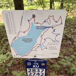
You can find Yahoola Creek Park at 464 Mechanicsville Rd Dahlonega, GA 30533 - this is on the…read moredownward east slope from downtown Dahlonega and about a mile from campus. You could probably walk it but the elevation change might be extreme for those that aren't fit. There's parking at the main trail entrance and a small parking pull-off west on Mechanicsville Dr. I had no issues parking at the main lot which also has public restrooms. I traveled to Dahlonega for a wedding held at Wolf Mountain Vineyards and decided to leave early and get my bearings (also check in at the local IHG/Holiday Inn Express and get cleaned up). This hike was right up my ally - close to the Hotel, about 3 miles and not too strenuous. It's mapped as: Yahoola Creek Reservoir Trail" - facing the main parking lot it's North - to the left side with the restrooms to the South side. It's marked on maps as the "red trail" at 3.1 miles. The trail starts with a gravel path until you get around the low areas then climbs upward under a leafy canopy moving clockwise around the lake. You get the typical elevation changes as you move through small hollars, then a ridgeline (you can see the lake through the trees) continuing around until you get to the mouth of the creek (lowest point) - there's a swing that probably gave you a great view before all the Kudzu took over. Moving around you get back to another low area where you can get down to the water for a view, before coming onto the dam (you walk across it) and back to the parking area. There's an optional blue trail that adds 1.7 miles that I would have taken if I had more time. In all, quite a lovely hike with only a couple of elevation points that some might find strenuous but no hard rocks/boulders to overcome. Those in Dahlonega are very lucky to have this resource - I'll be exploring the other trails the next time I'm in the area.

Fantastic fun outside with lots of space to run and be free. Fun playgrounds and splash pad during…read morethe summer or just play in the creek. One of our favorite spots!

Photos
Yahoola Creek Park
Yahoola Creek Park
Yahoola Creek Park

See all

Rock Creek Park and Recreation

Rock Creek Park and Recreation

4.7(3 reviews)
5.0 mi

As a resident of Dawson county, I was excited to learn that my grandson's U10 All Star baseball…read moreteam played a weekend championship series at Rock Creek Park. I was so impressed to see the condition of the fields. Grass behind the home plate and in the infield was perfectly precision cut. Bathrooms were impeccably cleaned throughout the day and we arrived at 7:30 am until 6:30 in evening. The concession stands were well equipped with hot dogs, pork plates and an offering of candies as snacks at reasonable-prices, so proud of these facilities. I'd even go as far as saying best facilities I've ever seen in the baseball circuit.

This very tiny gym gets 5 stars from me because it costs $25 for your ENTIRE FAMILY to join for SIX…read moreMONTHS. No contract and no monthly payments. It is super small- 2 treadmills, an elliptical, a few weight machines, a mat, and a yoga ball. I've never had to wait to use anything. Sometimes I have seen a couple of other people in there. The hours are good too. They have a TV. This cost does not include the classes that are sometimes offered. I have taken yoga classes with two different instructors and those have both been really great. My sister attends boot camp and it is also an amazing workout. The classes are usually cheaper if you pay for the whole month in advance. I think they run on Tuesday and Wednesday nights. So, they don't offer classes like LA Fitness or anything with a rotation of constant classes based on varying interests. I think they also offer other classes though. They have a great trail, and at the front of the park- like, it's hard to know it is even attached- their is a pavilion and a place to put in a kayak. Me and the mister have painted in the little pavilion. You don't have to pay to use the front part/boat launch, or the outside trail- just the weight room and classes. Also has a play area.

Gibbs Gardens - Japanese Maples

Gibbs Gardens

4.2(178 reviews)
11.4 mi

Visited today on a spectacular spring day (happened to be Earth Day.) The sky was so blue, the…read morebirds were singing, and the gardens were bursting with color. My favorite part of the gardens is the Japanese garden with its countless deep red Japanese maples, reflecting pools, shaded benches for contemplating the gardens' beauty. It's a beautiful place to take a stroll and have lunch in the shaded outdoor dining area next to the sandwich shed. Sandwiches are delicious, prepared by the fabulous Home Restaurant in the area. Make a day of it! Bring your book, have some lunch, and walk the gardens for a peaceful day out in nature.

There are plenty of parking spaces, you will see guides to lead your car to available spot…read more Currently tulips are off from its peak season, you can still see some, daffodils are in full bloom, also the azaleas are poised to burst forth at any moment. With weak or no cellular signal or Wi-Fi available within the gardens, visitors can pay full attention on admiring the beauty of nature. The gardens occupies total of 376 acres, featuring over 250 acres of landscaped gardens divided into several distinct sections: the Japanese Gardens, the Monet Waterlily Gardens, the Daffodil Gardens, and the Manor Gardens. The Japanese Gardens occupy a central position within the estate, covering 40 acres and featuring streams, ponds, miniature islands, small bridges, and Japanese maples. As one strolls through this section, one can deeply contemplate the core tenets of Japanese aesthetics: *Mono no aware* (物の哀れ the pathos of things), *Wabi-sabi* (侘寂 Wabi-austere beauty and sabi -rustic patina or beauty in aging), and *Yūgen* (幽玄 profound and mysterious grace and subtleness rather than obvious beauty. mystery). *Mono no aware* is certainly palpable here; the seasonal colors are vivid, yet most of the tulips have already faded. However, visitors do not see the withered blooms, as they are swiftly cleared away. This practice is, in fact, an authentic element of Japanese aesthetics--one that does not seek to deliberately pander to visitors. After all, imperfection and impermanence inevitably evoke a sense of melancholy, which lies at the very heart of Japanese aesthetic philosophy. As for *Wabi-sabi* and *Yūgen*, they are subtly woven into every detail of the landscape, inseparable from the whole. I could sense the garden's inherent simplicity and minimalism--its use of "negative space" and evocative atmosphere--such as the circular stone steps leading into the lake, only to come to an abrupt stop. Is it perhaps an example of the essence of sudden enlightenment found in Buddhist philosophy? Throughout the gardens, various Japanese-style shrines and stone lanterns are scattered everywhere, exuding that distinct aura of ethereal elegance and profound tranquility characteristic of traditional Japanese gardens. The floral plantings are meticulously designed to rotate with the changing seasons: spring brings a display of tulips and daffodils; summer features water lilies--specifically in the "Monet Water Lily Garden," which boasts 140 varieties of lilies and a replica of Monet's bridge; and autumn offers a vibrant tapestry of colorful foliage alongside sweeping fields of Sulfur Cosmos wildflowers. I visited the Butchart Gardens in Victoria over 30 years ago--a truly stunning garden that, at the time, was awash with tulips. In terms of sheer size, Gibbs Gardens is more than six times larger than Butchart Gardens.

Photos
Gibbs Gardens - Mountain laurel. Indigenous to the lowlands of the Smokey  and Blue Ridge mountains.

Mountain laurel. Indigenous to the lowlands of the Smokey and Blue Ridge mountains.

Gibbs Gardens - Japanese Garden

Japanese Garden

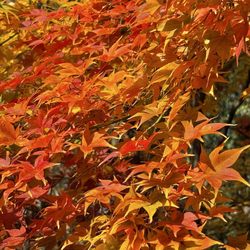
Gibbs Gardens - Red Japanese Maple

See all

Red Japanese Maple

Veteran's Park - parks - Updated October 2026

Loading...
Loading...
Loading...