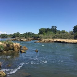
This hiking trail is located within Cache Creek Regional Park which offers hiking, camping, and…read morerafting. Their website has great information in regards to the above activities, including parking and directions to trailheads: http://www.yolocounty.org/general-government/general-government-departments/parks/parks-information/cache-creek-regional-park.
It's a beautiful trek, albeit challenging. The views at the peak are magnificent.
BLUE RIDGE TRAIL TO FISKE PEAK:
DIRECTIONS: From Woodland CA, take Route 16 West (Main St). Cache Creek Regional Park is on Route 16, approximately 40 miles from Woodland. After passing the casino, it's about 15 miles to the park's Lower Day Use Park Site. There will be a small sign on your left and you will see the parking area (bathrooms available). From there, take the dirt road on your left down to the bridge. Cross over the bridge and go left. Shortly, on the right side, you'll see the trail marker.
BASIC INFO: The Blue Ridge Trail to Fiske Peak is 8 miles, out and back. About 4 hours to complete. It's a pretty steep climb with a total of 2100+ ft. elevation gain. The way up was almost entirely uphill. The hike is listed as moderate but I'd say it's a pretty challenging moderate. I did not know this at the time but after doing some research later, I learned that the trail continues as a 16-mile loop.
TIPS:
- Access. Since you have to walk across a bridge to get to the trailhead, you are at the mercy of water levels. I saw a review or two on AllTrails where someone said that the bridge was underwater and they couldn't get across. Not sure if there is anywhere you can obtain updates. FYI: We came on April 1st and the weather was perfect.
- Register. Apparently, there is a register up at Fiske Peak but I did not learn about it until later. Make sure to sign it!
- Sunblock. Bring it and use it. There were multiple areas in open sun and my boyfriend got burned.
- Walking stick. Could be helpful because you've got such an incline/decline here. My boyfriend has a knee issue and the way down was particularly brutal for him.
- Water. Bring as much as you can. Between the exertion and sun, you will need a lot.
- Bring snacks/lunch. It'll take a lot out of you.
- BUGSPRAY. Bring it or use it beforehand. Lots of bugs on this trail. Also, saw a woman who warned us about ticks because her dog had a ton on him.
- WILDLIFE. This is mountain lion territory. I didn't see any warning signs but at the peak, I saw a lot of scat. Fresh and old (the desiccated, hairy stuff). We followed the path at the peak for a bit (not knowing about the loop initially) and walked right into a large swarm of insects. We got really nervous because it was very close to the poop and if I know cats, I know they like to go to the bathroom after a meal. So we thought, bugs = carcass. Either way, our cue to turn back. I was pretty paranoid the whole time because in 4 hours, we only encountered 2 other hikers. This was probably because it was Easter, haha. Saw a few small caves which seemed like perfect cat real estate. The entire walk back, I kept jingling keys and clapping. You also have a lot of large rocks on the path. Make sure to look before you step to avoid rattlesnakes.
Good luck!