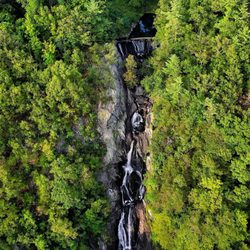
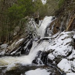
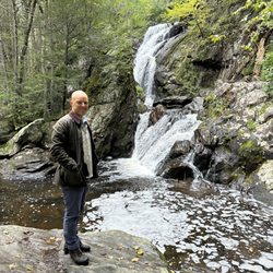
Umpachene Falls Photos


More like Umpachene Falls
Recommended Reviews - Umpachene Falls
Start your review...


Reviews With Photos


We had so much fun exploring here on a hot and humid day in the Berkshires. We did get a little lost trying to find it but it was worth the trouble. It had been a very rainy July so the water was plentiful. It was very refreshing. We had a lovely picnic warming ourselves on the rocks. Very grateful to have found this gem in the Berkshires.


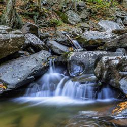
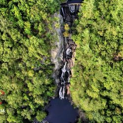
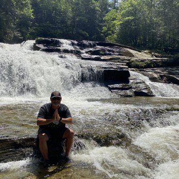
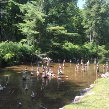
We got directions from two different people, neither of which brought us to the falls, but we finally figured it out and it was so worth getting lost to get here. (Turn where the "Bridge Closed" sign is, park, walk over the one-lane bridge, take a right just passed the end of the bridge, and walk towards the right to the town park. Since you can't see it, follow the sounds of the Falls in the back corner) It is part of a 5-acre New Marlborough town park that has swings, a calm stretch of river, and picnic tables. But the best part is to the multi-leveled, rushing Umpachene Falls. There, on the rockfaces, we sat, cooled off, lay back and watched the birds flying overhead, and just reveled in this hard-to-find gem of nature. Bring a picnic, if you like, as we did. Maybe a bathing suit or water shoes.


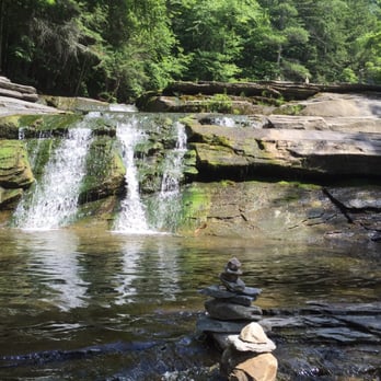
Certainly one of nature's wonders, simply a beautiful place with several trails along side the river which brings you to a number of different rock formations each with it's own water fall. I highly recommend Umpachene Falls, it truly is a beautiful reminder of the outdoor splendors we have been given to enjoy. Don't miss walking below the falls along the river toward the bridge and watch the peaceful meandering of the water providing ample opportunity to reflect, meditate or pray as this is a special spot.
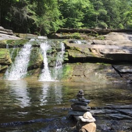

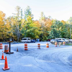
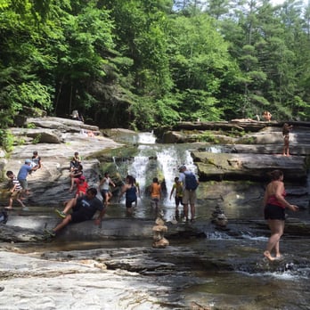
I am amazed that only Lee and I have reviewed this absolute gem. While it is accessible and stunning all year, on a hot day there is not a better place to cool off and just take in all the falls have to offer. You can stay down stream in a nice chest deep wading area or walk up the falls on flat rocks that have either a trickle or a surge of water depending on the amount of recent rain or lack of it. Sometimes, as happened today, there may be a puppy or a dog or two frolicking in the water, having just the time of their lives. The rocks that are covered by water can be extremely slippery, take caution. I'm at the age where a fall could do serious harm to my health, so I often bring a pair of Keens or Crocks. You can sit under the actual falls and let the water cascade over your head. Really a gem. There are many ways to reach Umpachene Falls. A local map provides the exact streets to get you there... Going to the left after you pass the Mill River General Store on your left allows you to enter the falls from a parking lot. Going right just means that you have to step over a long time concrete barrier and not be in an official lot. There are routes from Sheffield, Great Barrington near Guido's and also past Butternut on Lake Burl Road. At times you will be on roads that seem closed or say " Bridge Down". No matter how you approach them, planning a trip to these easy to access and spectacular family friendly falls should be a part of every local persons summer. Enjoy ( or message me for any questions)


27 days ago

Ahhhh.. Umpachene - how do I bottle you and bring you home? Delightful 18 minute ride from where we were staying in Sheffield. Suggest loading GPS or navigation app before losing signal in the mountains. Of note, and quite a surprise after a score of years closed, the bridge on Umpachene Falls Road has been rebuilt and is open. Yesterday, the falls were rushing abs bracingly cold! While I didn't fully submerge or hide behind the water curtain, I sat in the flow and was transfixed and refreshed for an hour. Remains a Berkshire treasure! read more



2 years ago

5 years ago
We had so much fun exploring here on a hot and humid day in the Berkshires. We did get a little lost trying to find it but it was worth the trouble. It had been a very rainy July so the water was plentiful. It was very refreshing. We had a lovely picnic warming ourselves on the rocks. Very grateful to have found this gem in the Berkshires. read more


We got directions from two different people, neither of which brought us to the falls, but we finally figured it out and it was so worth getting lost to get here. (Turn where the "Bridge Closed" sign is, park, walk over the one-lane bridge, take a right just passed the end of the bridge, and walk towards the right to the town park. Since you can't see it, follow the sounds of the Falls in the back corner) It is part of a 5-acre New Marlborough town park that has swings, a calm stretch of river, and picnic tables. But the best part is to the multi-leveled, rushing Umpachene Falls. There, on the rockfaces, we sat, cooled off, lay back and watched the birds flying overhead, and just reveled in this hard-to-find gem of nature. Bring a picnic, if you like, as we did. Maybe a bathing suit or water shoes. read more



4 years ago

4 years ago

Certainly one of nature's wonders, simply a beautiful place with several trails along side the river which brings you to a number of different rock formations each with it's own water fall. I highly recommend Umpachene Falls, it truly is a beautiful reminder of the outdoor splendors we have been given to enjoy. Don't miss walking below the falls along the river toward the bridge and watch the peaceful meandering of the water providing ample opportunity to reflect, meditate or pray as this is a special spot. read more


I am amazed that only Lee and I have reviewed this absolute gem. While it is accessible and stunning all year, on a hot day there is not a better place to cool off and just take in all the falls have to offer. You can stay down stream in a nice chest deep wading area or walk up the falls on flat rocks that have either a trickle or a surge of water depending on the amount of recent rain or lack of it. Sometimes, as happened today, there may be a puppy or a dog or two frolicking in the water, having just the time of their lives. The rocks that are covered by water can be extremely slippery, take caution. I'm at the age where a fall could do serious harm to my health, so I often bring a pair of Keens or Crocks. You can sit under the actual falls and let the water cascade over your head. Really a gem. There are many ways to reach Umpachene Falls. A local map provides the exact streets to get you there... Going to the left after you pass the Mill River General Store on your left allows you to enter the falls from a parking lot. Going right just means that you have to step over a long time concrete barrier and not be in an official lot. There are routes from Sheffield, Great Barrington near Guido's and also past Butternut on Lake Burl Road. At times you will be on roads that seem closed or say " Bridge Down". No matter how you approach them, planning a trip to these easy to access and spectacular family friendly falls should be a part of every local persons summer. Enjoy ( or message me for any questions) read more



8 years ago

7 years ago
This is by far the best place ever... well besides the beach!! It is so peaceful and tranquil listening to the water cascading down! There are so many places to just relax, take a dip in the oh so clear water! I even bring my float and float around in the pool part at bottom of falls! I love it! I don't have enough words to say how awesome this place is, just go and you will see what I'm talking about! read more


9 years ago
More info about Umpachene Falls
Umpachene Falls Rd
New Marlborough, MA 01230
Directions
Hours
Outdoor Amenities