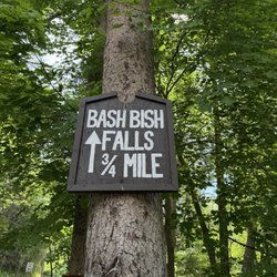
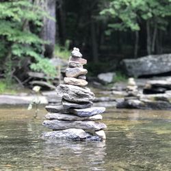
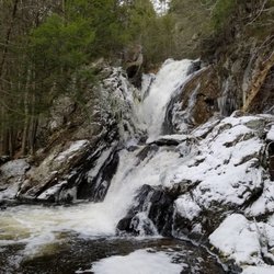
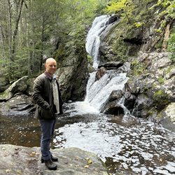
Monument Mountain Photos


You might also consider
More like Monument Mountain
Recommended Reviews - Monument Mountain
Start your review...

Reviews With Photos

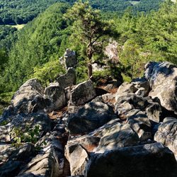
I love this hike as you can do a loop in less then two hours and that included stopping to enjoy the AMAZING views at the top. They have yellow, blue, and red trails and they can be a bit hard to see -- so you have to look at the tree markings so you don't take the wrong path to nowhere. Must be an East Coast thing -- they don't have these on the West Coast. A bit rocky here and there so I'd say you have to do some scrambling on the way up and down. Lots of rocks on the top but you'll be rewarded with stunning views -- go in the Fall for the leaves. Trails were pretty wide as we went during Covid -- so people mostly were masked up. Dog friendly too --they really love it! During the week we were there, there was a $5.00 fee via machine to park in the lot. Not sure if you can avoid this though.

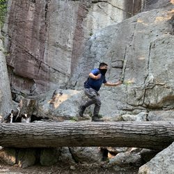
Let's just put it all out there: I don't hike, I've never hiked, I don't know the first thing about hiking. So if I can do it, can't be bad right? Right! Monument Mountain was a great intro to hiking 101! Thank goodness for fellow yelpers who wrote about this spot, otherwise I don't think we would've found out about it. We were in the area and wanted to enjoy the beautiful weather and these trails did not disappoint. The ranger on duty that day was eager to help and walked up to pretty much anyone who approaches the map to make sure their well acquainted and equipped with a map and an environmentally friendly bug repellent. There are 3 main trails 2 which lead you up and down the mountain. Hickey Trail is a bit of a steep ascent which gets you to Squawk Peak Trail relatively quickly so you can get to the breathtaking views! Luckily we started with Hickey which sets you up for a relatively smooth descent down Indian Monument Trail in your way back. We skipped over Devil's Pulpit for time purposes but we enjoyed the panoramic views of the Berkshires along Squaw Peak Trail. We spent a total of an hr and change on the trail but you can definitely extend your route. Keep in mind there is a $5 "parking" fee for the entire day unless you're a member. Small price to pay for a well manicured and well marked trail.

Like a walk in the park- then you will love Monument Mountain! Today was my 6th ascent and I still love it as much as my 1st. Please note that there is now a 5 dollar fee to park, credit/debit card only (like a muni meter only solar powered). As always, I take the Hickey Trail up to the summit. Hickey is the shortest route but the steepest- my fitness regimen allowed me to climb non-stop and just a little bit winded. The route takes you past a gorgeous rock cropping that I someday would like to scrabble up. Recent rain runoff provided interesting focal points of small waterfalls. The summit at Squaw Peak allows for 360 degree panoramic views of the surrounding mountains to all sides. The large rocks provide seating for rest and reflection. After a break, off to the Devil's Pulpit, striking rock formation reached by climbing large rock stepping stones. I looped back on the Indian Monument Trail to Inscription Rock and back down Hickey! Trails are well marked, meticulously kept. I marveled at how pristine everything was, not a bit of trash or signs of human trespass, until near the descent someone left a coffee cup on a log -really!!!!! BTW- dogs seem to love it as much as their owners.

The pay parking was the most disappointing part of this experience. I was there for a very quick power hike to squa peak and back with only an hour to spare. There are no hourly options for parking at the kiosk. Just a flat $5.00 fee "for the day". I'm all for supporting these trails and parking maintenance but there should be options. I noticed a couple was also put off by this paying kiosk fee and parked just a bit up the road where there is a pull off and they cut over to the trail from there.

Beautiful trails and an amazing view from the top. We arrived around 11AM on a fall Saturday and there were only a few spots left in the parking area. There is a $6 fee for parking, and the machine takes credit cards. We hiked up to the summit on the Blue trail which connected to the red trail. Trails were clearly marked and not too difficult. We even found a few geocaches along the way. Be sure to take the short spur trail to Devil's Pulpit for a spectacular view. Even though the parking lot was nearly full, there are enough trails to that we never felt crowded. It took us about 2 hours total for our climb up and down the mountain, with some time spent enjoying the view from the summit. read more


6 years ago
3 years ago
I love this hike as you can do a loop in less then two hours and that included stopping to enjoy the AMAZING views at the top. They have yellow, blue, and red trails and they can be a bit hard to see -- so you have to look at the tree markings so you don't take the wrong path to nowhere. Must be an East Coast thing -- they don't have these on the West Coast. A bit rocky here and there so I'd say you have to do some scrambling on the way up and down. Lots of rocks on the top but you'll be rewarded with stunning views -- go in the Fall for the leaves. Trails were pretty wide as we went during Covid -- so people mostly were masked up. Dog friendly too --they really love it! During the week we were there, there was a $5.00 fee via machine to park in the lot. Not sure if you can avoid this though. read more


7 years ago
Let's just put it all out there: I don't hike, I've never hiked, I don't know the first thing about hiking. So if I can do it, can't be bad right? Right! Monument Mountain was a great intro to hiking 101! Thank goodness for fellow yelpers who wrote about this spot, otherwise I don't think we would've found out about it. We were in the area and wanted to enjoy the beautiful weather and these trails did not disappoint. The ranger on duty that day was eager to help and walked up to pretty much anyone who approaches the map to make sure their well acquainted and equipped with a map and an environmentally friendly bug repellent. There are 3 main trails 2 which lead you up and down the mountain. Hickey Trail is a bit of a steep ascent which gets you to Squawk Peak Trail relatively quickly so you can get to the breathtaking views! Luckily we started with Hickey which sets you up for a relatively smooth descent down Indian Monument Trail in your way back. We skipped over Devil's Pulpit for time purposes but we enjoyed the panoramic views of the Berkshires along Squaw Peak Trail. We spent a total of an hr and change on the trail but you can definitely extend your route. Keep in mind there is a $5 "parking" fee for the entire day unless you're a member. Small price to pay for a well manicured and well marked trail. read more


Like a walk in the park- then you will love Monument Mountain! Today was my 6th ascent and I still love it as much as my 1st. Please note that there is now a 5 dollar fee to park, credit/debit card only (like a muni meter only solar powered). As always, I take the Hickey Trail up to the summit. Hickey is the shortest route but the steepest- my fitness regimen allowed me to climb non-stop and just a little bit winded. The route takes you past a gorgeous rock cropping that I someday would like to scrabble up. Recent rain runoff provided interesting focal points of small waterfalls. The summit at Squaw Peak allows for 360 degree panoramic views of the surrounding mountains to all sides. The large rocks provide seating for rest and reflection. After a break, off to the Devil's Pulpit, striking rock formation reached by climbing large rock stepping stones. I looped back on the Indian Monument Trail to Inscription Rock and back down Hickey! Trails are well marked, meticulously kept. I marveled at how pristine everything was, not a bit of trash or signs of human trespass, until near the descent someone left a coffee cup on a log -really!!!!! BTW- dogs seem to love it as much as their owners. read more


6 years ago
6 years ago
8 years ago
9 years ago
10 years ago
13 years ago
13 years ago
11 years ago
8 years ago
10 years ago
The pay parking was the most disappointing part of this experience. I was there for a very quick power hike to squa peak and back with only an hour to spare. There are no hourly options for parking at the kiosk. Just a flat $5.00 fee "for the day". I'm all for supporting these trails and parking maintenance but there should be options. I noticed a couple was also put off by this paying kiosk fee and parked just a bit up the road where there is a pull off and they cut over to the trail from there. read more

12 years ago
A group of friends and I did this hike while visiting the Berkshires and really enjoyed it! It is essentially a big loop with a "leisurely" route and "more strenuous" route. We spent 2.5 hours here and took our time to enjoy the nature and views and many breaks. The view at the top is nice but I really enjoyed just walking through the beautiful trees and being in the mountain air. The Devils pulpit is also a "place of attraction" on the hike which is a nice view of a pretty cool rock structure. We also enjoyed the view at Devils pulpit a little better than the view at the top. This was a very enjoyable hike and one of the highlights during our weekend here. read more


18 years ago
10 years ago
11 years ago
10 years ago
10 years ago
14 years ago
More info about Monument Mountain
Route 7 And 102
Great Barrington, MA 01230
Directions
Hours
Outdoor Amenities
Ask the Community - Monument Mountain
Review Highlights - Monument Mountain


Monument Mountain - hiking - Updated July 2026
Best of Great Barrington
People found Monument Mountain by searching for…
Things to Do in Great Barrington, Massachusetts
Hiking Trails With Waterfalls in Great Barrington, Massachusetts
Rock Climbing in Great Barrington, Massachusetts
Scenic Drive in Great Barrington, Massachusetts
Parks in Great Barrington, Massachusetts
Scenic Overlook in Great Barrington, Massachusetts
Scenic View in Great Barrington, Massachusetts
Attractions in Great Barrington, Massachusetts
Easy Hikes in Great Barrington, Massachusetts
Off Road Trails in Great Barrington, Massachusetts
Dog Friendly Parks in Great Barrington, Massachusetts
Walking Trails in Great Barrington, Massachusetts
Picnic Areas in Great Barrington, Massachusetts
Dog Friendly Hiking Trails in Great Barrington, Massachusetts
Beautiful Views in Great Barrington, Massachusetts
Waterfalls in Great Barrington, Massachusetts
Off Leash Dog Hikes in Great Barrington, Massachusetts
Lookout Points in Great Barrington, Massachusetts
View Points in Great Barrington, Massachusetts
Hikes With Dogs in Great Barrington, Massachusetts
Caves in Great Barrington, Massachusetts
Picnic Spots in Great Barrington, Massachusetts
Trending Searches in Great Barrington, MA
Black Owned Nail Salons in Great Barrington, MA
Boat Rental in Great Barrington, MA
Cliff Jumping in Great Barrington, MA
Day Trips in Great Barrington, MA
Jet Ski Rental in Great Barrington, MA
Kayak Rental in Great Barrington, MA
Lakes & Ponds in Great Barrington, MA
Off Road Trails in Great Barrington, MA
Outdoor Activities in Great Barrington, MA
Places To Swim in Great Barrington, MA
Pool Day Pass in Great Barrington, MA
Public Pools in Great Barrington, MA
Public Shower in Great Barrington, MA
River Swimming in Great Barrington, MA
River Tubing in Great Barrington, MA
Rock Quarry in Great Barrington, MA
Scenic Night View in Great Barrington, MA
Scenic Overlook in Great Barrington, MA
Secluded Spots in Great Barrington, MA
Soccer Store in Great Barrington, MA
Splash Pad in Great Barrington, MA
Swimming Holes in Great Barrington, MA
Swimming Lakes in Great Barrington, MA
Watch Sunset in Great Barrington, MA
Browse Articles
Browse Nearby
BEST of Great Barrington, Massachusetts Restaurants near Monument Mountain
BEST of Great Barrington, Massachusetts Things to Do near Monument Mountain
BEST of Great Barrington, Massachusetts Coffee near Monument Mountain
BEST of Great Barrington, Massachusetts Breakfast near Monument Mountain
BEST of Great Barrington, Massachusetts Shopping near Monument Mountain
Browse Brands
Related Searches in Great Barrington, MA
Affordable Kayak Rental Services in Great Barrington, Massachusetts
Best Fishing Locations and Guides in Great Barrington, Massachusetts
Best Lookout Points to Visit in Great Barrington, Massachusetts
Best Places for Horseback Riding in Great Barrington, Massachusetts
Best Sledding Spots and Fun in Great Barrington, Massachusetts
Best Spots for Star Gazing in Great Barrington, Massachusetts
Best Waterfalls and Swimming Holes in Great Barrington, Massachusetts
Check Out Off Road Trails in Great Barrington, Massachusetts
Discover Dog Friendly Trails to Explore in Great Barrington, Massachusetts
Discover Popular Photo Spots in Great Barrington, Massachusetts
Discover Top Boat Tours in Great Barrington, Massachusetts for All Ages
Discover a Hiking Trail in Great Barrington, Massachusetts
Discover the Best Night Hike Trails in Great Barrington, Massachusetts
Discover the Best Running Track in Great Barrington, Massachusetts
Dog-Friendly Hikes With Dogs in Great Barrington, Massachusetts
Enjoy Camping Adventures Around Great Barrington, Massachusetts
Enjoy Exciting Mountain Biking Adventures in Great Barrington, Massachusetts
Enjoy Kayaking Adventures in Great Barrington, Massachusetts
Enjoy Tent Camping Spots Around Great Barrington, Massachusetts
Enjoy a Beautiful Waterfall Hike in Great Barrington, Massachusetts
Enjoy the Best Tubing Experiences in Great Barrington, Massachusetts
Enjoy the Best Walking Trails in Great Barrington, Massachusetts
Exciting Cliff Jumping Spots in Great Barrington, Massachusetts
Experience Thrilling White Water Rafting in Great Barrington, Massachusetts
Explore Beautiful Parks and Green Spaces in Great Barrington, Massachusetts
Explore Bike Rentals Throughout Great Barrington, Massachusetts
Explore Easy Hikes Perfect for All in Great Barrington, Massachusetts
Explore Fun Activities to Do in Great Barrington, Massachusetts
Explore Popular Campgrounds Near Great Barrington, Massachusetts
Explore Popular Scenic Overlook Points in Great Barrington, Massachusetts
Explore Scenic Lakes to Visit in Great Barrington, Massachusetts
Explore the Best Boating Spots in Great Barrington, Massachusetts
Explore the Best Swimming Holes Around Great Barrington, Massachusetts
Family Friendly Hiking With Kids in Great Barrington, Massachusetts
Find Beautiful Views in Great Barrington, Massachusetts
Find Popular Ziplining Spots Around Great Barrington, Massachusetts
Find the Best Parks for Picnics in Great Barrington, Massachusetts
Find the Best Scenic View Locations in Great Barrington, Massachusetts
Hiking Trails With Waterfalls in Great Barrington, Massachusetts
Off Leash Dog Hiking Trails in Great Barrington, Massachusetts
Plan a Scenic Drive Route Near Great Barrington, Massachusetts
Popular Picnic Spots to Visit in Great Barrington, Massachusetts
Popular Things to Do in Great Barrington, Massachusetts
Top Climbing Spots and Gyms in Great Barrington, Massachusetts
Top Fishing Charter Experiences in Great Barrington, Massachusetts
Top Paddleboarding Activities in Great Barrington, Massachusetts
Top Running Trails to Explore in Great Barrington, Massachusetts
Top Swimming Lakes to Enjoy in Great Barrington, Massachusetts
Top Swimming Spots and Pools in Great Barrington, Massachusetts
Walk Dog Friendly Hiking Trails in Great Barrington, Massachusetts